What to see in the Orenburg region
Five attractions claim to be the main symbols of the region: two vast nature reserves, the largest river in the region, the unusual Camel rock and the Luna landscape park.
Orenburg Reserve
- Coordinates on the map: 51.085556, 57.686944.
The largest reserve in the Orenburg region covers an area of more than 38,000 hectares. The idea of creating a natural reserve appeared in the 20s of the last century, but it was realized only in 1989.
Scientists who advocated the organization of the reserve pursued a single goal - to preserve the unique steppe landscapes of the Volga region, the Cis-Ural region, the South of the Ural Mountains and the Trans-Ural region. In 2015, the area of the protected zone almost doubled.
The structure of the reserve is also unique: it consists of five separate sections scattered throughout the region. The smallest area - “Talovskaya Steppe” - is located in the extreme western point of the region, on the border of the Pervomaisky district and the Samara region.
The largest – “Pre-Ural Steppe” – took place in the center, in the Belyavsky and Akbulaksky districts. Nearby, a few kilometers from each other, are located the “Burtinskaya steppe” and the “Aytuarskaya steppe”. The last section, “Ashchisay Steppe,” is located near the eastern border.
90% of the entire protected area is occupied by steppes, where 1,350 plant species grow, including endangered species and endemics. The fauna is also diverse; the protected lands are inhabited by steppe harrier, steppe marmot, badger, black grouse, small gopher, long-eared hedgehog, elk, roe deer and many other species of mammals and birds.
In 2015, scientists released a group of Przewalski's horses onto one of the sites. The Orenburg Nature Reserve is of interest not only to biologists, but also to historians, as priceless archaeological monuments of Sarmatian culture have been found here.
Reserve "Shaitan-Tau"
- GPS coordinates: 51.649115, 57.399937.
A small reserve in the Kuvandyk district was formed quite recently - in 2014. The young reserve included the Shaitanau ridge and surrounding lands, the total area of the protected territory is more than 6,700 hectares.
The perfectly preserved oak forest-steppe is home to hundreds of animal species, many of which are listed in the Red Book of Russia. The beautiful Sakmara River flows through the reserve, into which dozens of smaller rivers and streams flow.
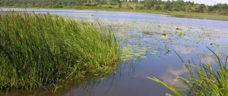
Ural River
- Coordinates: 51.732988, 55.641325.
The Ural is a waterway connecting Russia and Kazakhstan. In terms of length, it is second only to two European rivers - the Volga and Danube. The river received its modern name in 1775; previously it was called Yaik, which means “wide”. It is easy to guess that the Urals originate in the Ural Mountains, and specifically on the Uraltau ridge in the Republic of Bashkortostan.
Wriggling like a huge shiny snake, the river “crawls” into the Chelyabinsk region, then penetrates the Orenburg region, crosses it from east to southwest, flows into Kazakhstan and flows into the Caspian Sea. The Urals are rich in fish; sturgeon, carp, pike perch, stellate sturgeon, catfish, and perch live in its waters.
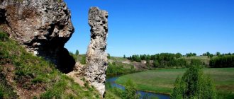
Rock Camel
- Coordinates: 51.380297, 61.384880.
An unusual landmark on the banks of the Ashesu River, on the eastern border of the region, has become one of the most recognizable symbols of the region. The small rock bears a striking resemblance to a lying camel.
Nature itself created an amazing sculpture from two quartzite blocks: one looks like a body with a hump, the second looks like a long neck and head with a protruding nose. The height of the stone beast is 14 meters; tourists love to climb onto its high back. The colorful figure appeared on the flag and coat of arms of the Svetlinsky district.
Landscape Park "Luna"
- Coordinates: 53.067433, 54.541393.
In the Sharlyk district of the Orenburg region, near the banks of the Dema River, in the tiny settlement of Luna there is a landscape park of the same name, which many tourists call the most heavenly corner of the Orenburg region.
On the territory of this attraction you can find beautiful sculptures that look like they came out of a fairy tale, a picturesque pond with the opportunity to sail on it on a catamaran or boat, and a colorful cafe where the food is very tasty.
There is also a real open-air zoo here - it consists mainly of deer walking around the territory, which you can even pet, and swans gracefully swimming in the lake, complementing the harmonious composition of the place.
Monuments, historical buildings and structures
Orenburg.
The Orenburg Down Shawl Gallery is the only place in the world where you can plunge into the history of the appearance of the world-famous Orenburg Down Shawls.
The first gallery, in which, along with a large collection of exclusive products made from goat down, the very history of the origin and existence of the Orenburg down trade is presented to visitors. It can rightfully be considered the hallmark of the down knitting craft of the Orenburg region, where “the miracle of the Orenburg land - the Orenburg down scarf” . The Orenburg down scarf is an artistic phenomenon in the history of folk art not only in the Orenburg region, but throughout Russia. It contains originality, perfection of workmanship, traditional crafts and original artistic technologies, which were identified and preserved by female wisdom and ingenuity. Orenburg downy scarf is a brand of the Orenburg region. Also in the gallery is the largest down scarf in Russia.
Memorial museum-apartment of Yuri and Valentina Gagarin.
The apartment museum of Yuri and Valentina Gagarin is located on the street. Chicherina, 35a. The museum was founded in 2001 and is located in the house in which Valentina Goryacheva (married Gagarin) lived with her parents, and where Yuri and Valentina’s wedding took place in 1957. Here, on the second floor of a former merchant mansion, and then a communal apartment, Yuri and Valentina often met. Their wedding took place here in November 1957. For the first months, the young Gagarin family lived in this apartment. And later, when the family settled in Star City, Valentina and Yuri Gagarin and their children came here. This museum is a branch of the Museum of the History of the City of Orenburg.
Memorial museum-guardhouse of Taras Shevchenko.
The exhibition, which is constantly updated, contains about 200 items from the funds of the Orenburg History Museum.
Memorial items include: a canvas embroidered by Elena Varfolomeevna Kovtun, the great-granddaughter of T. Shevchenko on the side of her brother Mikita; collections of works by the great Kobzar, donated by delegations from Kyiv.
In one of the rooms of the museum, the furnishings of a 19th-century guardhouse are reproduced: a guardhouse and a cell, which is also a memorial cell, since, according to archival data, Taras Grigorievich Shevchenko was imprisoned in it from April 27 to May 12, 1850.
The museum has an exhibition telling about the repressions of the twentieth century, which presents authentic items confiscated from those convicted under Article 58 (Criminal Code of the RSFSR. Special part. Chapter 1. State crimes. Counter-revolutionary crimes), archival documents, copies of personal files of the repressed.
House of Memory.
The House of Memory is located on Pobeda Avenue and, according to the authors’ plans, is a continuation of the “Eternal Flame” memorial. Architect S.E. Smirnov designed the building in the form of a chapel.
The House of Memory has become a place to perpetuate the names of Orenburg residents. Citizens buried in the city from 1900 to the present are entered into a computer database. Some of the names can be found in tabletop albums located in the central hall of the museum, covering the period from 1924 to 1955.
Here, on marble plaques, the names of internationalist soldiers who died in Afghanistan are imprinted; police officers who died in the line of duty in Orenburg; our fellow countrymen-liquidators of the accident at the Chernobyl nuclear power plant, as well as Orenburg residents who gave their lives while serving in the Caucasus.
Space Museum.
The Museum of Cosmonautics was created in 1961 as the Museum of History and Military Glory of the Orenburg Higher Military Aviation Red Banner Pilot School named after. I.S. Polbina on the basis of the order of the USSR Minister of Defense on the creation of rooms of military glory and museums at military units. By 1971, the museum had 3 full exhibition halls. In 1986, the museum began to be rebuilt and on August 10, 1991 it was reopened in its modern form, in which it remains today.
On the street, in front of the facade of the building, there is a monument dedicated to the graduates of the school - Heroes of the Soviet Union and the MiG-15 bis aircraft, on which Yu.A. Gagarin flew as a cadet. This aircraft is a cultural monument of federal significance.
Exhibition complex "Salute, Victory!"
For the 60th anniversary of Victory in the Great Patriotic War, the exhibition complex “Salute, Victory!” was created in the city of Orenburg. open air. The scientific and artistic project of the complex was developed by the Orenburg Governor's Museum of History and Local Lore (authors N.A. Eremina, N.M. Plyasheshnik). The museum exhibition presents more than 60 samples of weapons, military, agricultural, automotive and railway equipment, and industrial equipment.
Military equipment is presented in all its diversity: aircraft, tanks, artillery pieces - 19 units of authentic military-historical monuments from the period of the Great Patriotic War. The collection of military equipment is located in the park on an area of about four hectares in sectors dedicated to the most important events and battles: the Moscow, Stalingrad, Kursk battles, the crossing of the Dnieper and Victory. The combat paths of 15 divisions formed on Orenburg soil from residents of the region’s cities and villages are traced like a red thread throughout the entire exhibition.
Architectural complex "Caravanserai".
Caravanserai is a unique architectural monument that reflects the stylistic and national characteristics of the Orenburg region of the first half of the 19th century. As in the 19th century, today the Caravanserai is the most important architectural dominant of the historical center of the city.
The author of the project was the outstanding Russian architect Alexander Pavlovich Bryullov. In his projects, along with the techniques of the classical school, motifs of other architectural styles appear, mainly European - Romanesque, Gothic, Renaissance. Only once in his biography A.P. Bryullov turned to the heritage of oriental architecture, completing the Caravanserai project at the request of the Orenburg governor V.A. Perovsky. The general management of the construction was entrusted to Lieutenant Colonel Sharon, and the construction work was supervised by lieutenant engineer Senkov.
Construction of the Caravanserai took place during 1837-1846.
Memorial museum-apartment of Yuri and Valentina Gagarin.
The apartment museum of Yuri and Valentina Gagarin is located on the street. Chicherina, 35a. The museum was founded in 2001 and is located in the house in which Valentina Goryacheva (married Gagarin) lived with her parents, and where Yuri and Valentina’s wedding took place in 1957. Here, on the second floor of a former merchant mansion, and then a communal apartment, Yuri and Valentina often met. Their wedding took place here in November 1957. For the first months, the young Gagarin family lived in this apartment. And later, when the family settled in Star City, Valentina and Yuri Gagarin and their children came here. This museum is a branch of the Museum of the History of the City of Orenburg.
Cultural complex "National Village".
The Orenburg region has historically been formed as a multinational and multi-confessional region, comfortable for living, visiting and traveling of various ethnic groups. Today, more than 126 nationalities live in the Orenburg region. This specificity of the Orenburg region, as a multinational region, safe for tourism and recreation, continues to this day. A striking example of this is the “National Village” cultural complex. It is a kind of open-air park museum, which consists of ten national and cultural associations (Russian, Tatar, Kazakh, Ukrainian, Bashkir, Mordovian, German, Chuvash, Belarusian and Armenian). In all ten farmsteads there are museums of history, culture and life, libraries with literature in the native language, cafes or restaurants of national cuisine, newspaper editorial offices in native languages, offices of national cultural centers. On their territory there are exhibitions and ethnographic objects reflecting the life and culture of ethnic communities.
Monument to the Orenburg Cossacks.
The grand opening of the monument to the Orenburg Cossacks in Orenburg took place in December 2008. This is the second such monument in Russia. The monument was erected in honor of the outstanding services of the Cossacks in protecting the borders of the fatherland and the Orenburg region in the Forshtadt microdistrict at the intersection of Chkalov and Stepan Razin streets, near St. Nicholas Cathedral. The first stone of the future monument was laid after long debates in the Apple Orchard near St. Nicholas Cathedral. This place was not chosen by chance - it was in Forstadt that the Orenburg Cossacks lived. In the 18th and 19th centuries there was a square where the Cossacks held their events: marches, horse races. Nearby is the St. Nicholas Cathedral, and the Cossacks have always been Orthodox. In addition, the location for the monument was chosen so that it could be clearly visible from the adjacent streets.
The author of the monument is Moscow sculptor Alexey Nikolaev. The figure of the horseman was cast in one of the capital's workshops. The project was constantly refined and adjusted. As a result, the monument looks the way the Cossacks imagined, who controlled the process of creating the monument and even traveled to Moscow several times.
Monument to A. Pushkin and V. Dahl in Orenburg
The monument “Pushkin, Dal” was opened in mid-August 1998 for the anniversary of the regional center and for the celebration of the 200th anniversary of A.S. Pushkin. The author of the sculpture is a native of the city, Honored Artist of Russia, sculptor Nadezhda Gavrilovna Petina, and the architect is Stanislav Evgenievich Smirnov.
The theme of the monument is closely connected with the history of our region, the stay of A.S. Pushkin and V.I. Dahl in the Orenburg region. Monument depicting the poet and lexicographer walking along a city street. Pushkin and Dahl are engaged in conversation, their poses are lively and spiritual.
House-museum of L. and M. Rostropovich
In a house on Ziminskaya Street, M. L. Rostropovich lived with his evacuated family - his parents and sister Veronica - for two war years - from 1941 to 1943. It is in them that the exhibition is now located.
The house belonged to his godmother, Elena Adolfovna Lontkevich, a graduate of the Sorbonne, a teacher of foreign languages, a bright, extraordinary personality who took an active part in the musical life of the city.
It was she who introduced the future Rostropovich couple at her home, and in 1922 the city registry office registered the marriage of the Maestro’s father and mother, Leopold Vitoldovich and Sofia Nikolaevna.
The wartime environment was recreated using documents, photographs and furniture from the Lontkevich family. There are no authentic items of the Rostropovich Family in the museum.
The Orenburg roots of the great musician are unusually deep. After all, the origins of professional musical education in the Orenburg region were the Maestro’s grandfather and grandmother - the Fedotovs Nikolai Alexandrovich and Olga Sergeevna. The rich musical traditions laid down by the Fedotov-Rostropovich dynasty are strong in Orenburg to this day.
Rostropovich learned the basics of composition from the composer Mikhail Chulaki, who was evacuated to Orenburg during the war. In 1943, due to the illness and then death of his father, the young Rostropovich had to take over his teaching and concert activities. Therefore, Mstislav’s development as a person and musician took place in Orenburg.
The Maestro recalled this: “My life began in Orenburg, he sheltered me, warmed me and made me a Human.”
Monument to Alexander Zass (Russian Samson)
The authors of the monument are People's Artist of Russia sculptor Alexander Rukavishnikov and Orenburg architect Nikolai Chudin-Alexandrin.
Alexander Ivanovich Zass, a world-famous athlete of the 20th century, one of the strongest athletes on the planet of his time, first performed in the arena of the Andrzhievsky Circus in Orenburg in 1908. During the First World War, in 1914, he was captured by the Austrians. He remained in Europe, took the stage name “Samson” and went down in history as “The Strongest Man on Earth.” Since 1924 he lived permanently in England.
The composition of the sculpture embodies the athlete performing his crowning act - tying a steel rod in an ornate pattern. The monument is made of bronze, the total height is about 3 m. The sculpture, 1.7 m high and weighing 1.7 tons, is installed on a massive pedestal 1 m high, lined with marble. The inscription is engraved on the pedestal: “Zass Alexander Ivanovich (Samson), 1888 – 1962.”
Buguruslansky district.
Museum-reserve of the writer S.T. Aksakova.
The estate where the great Russian writer S.T. spent his childhood, part of his youth and adult years. Aksakov. The Aksakovs are one of the oldest noble families, which originates from the Varangians. And the village of Aksakovo is one of the oldest in the Orenburg region. Aksakovo is located in a picturesque place, 35 kilometers from the city of Buguruslan, not far from the Bugulma-Buzuluk highway.
Currently, on the territory of the writer’s family estate there is a museum named after him, the house, outbuildings, and outbuildings have been restored, alleys, a spring and a pond have been equipped. The museum regularly hosts excursions, theatrical performances, exhibitions of artists, meetings with writers and poets.
Oktyabrsky district
Kargaly copper mines
The Kargaly copper mines are a unique monument that is of genuine interest to archaeologists around the world, an object of federal significance, located at the junction of the Oktyabrsky, Perevolotsky, Sakmarsky, and Aleksandrovsky districts. It represents the remains of an ancient center for the mining and processing of copper from the Bronze Age to modern times. Clusters of monuments are conditionally united into 12 sections. The area of the entire Kargaly ore field is about 500 square meters. km.
The scale of copper ore mining is amazing: the total mass of extracted copper minerals reaches several million tons. Kargaly copper in the Bronze Age spread throughout almost the entire territory of Eastern Europe (up to a million square kilometers).
In the XVIII-XIX centuries. The Kargaly mining and metallurgical complex was of leading importance for the internal needs of Russia. Thus, in the third quarter of the 18th century, up to a quarter of the copper of the entire Russian Empire was smelted from its ore.
Saraktashsky district
Museum-reserve "Red Mountain".
The Krasnaya Gora Museum-Reserve in the Saraktashsky district is quite well known both to residents of the region and to guests of the region; on its territory there is the only museum to the “Captain’s Daughter” in Russia.
In 1998, the film “Russian Revolt” was filmed near Krasnaya Gora. Director Alexander Proshkin showed the events of the peasant war described in the works of A.S. Pushkin "The Captain's Daughter" and "The History of the Pugachev Rebellion".
For the filming of this film, the fortress was recreated, as well as other buildings from that period. In addition to the actors, residents of the village of Tatarsky Saraktash and the village of Saraktash also participated in the filming of the film. At the end of filming, some of the costumes and scenery for the film were transferred to the fund of the Orenburg Regional History Museum.
Another name for Red Mountain is Saryktash or “stone sheep”. This mountain, one of the largest mountains in the Orenburg region, is located southeast of the village of Tatarsky Saraktash and is named after the red clay and red stone that give the mountain a reddish tint. This is where the name of the city of Saraktash came from (“saryk” - sheep, “tash” - stone) - “stone sheep”. The sizes of unusual stone blocks range from 0.5 to 2.5 meters.
Historical and memorial complex of V.S. Chernomyrdin.
Historical and memorial complex of V.S. Chernomyrdin in the village of Cherny Otrog, Saraktash district, was founded on the initiative of fellow countrymen and the family of Viktor Stepanovich Chernomyrdin. The idea of creating a museum was approved and supported by the Chairman of the Government of the Russian Federation, Vladimir Vladimirovich Putin. The basis of the museum collection, which currently numbers more than 15,000 items, is the personal belongings and archive of V. S. Chernomyrdin, donated to the museum by his family. In addition, the collection of the Historical and Memorial Museum of Viktor Stepanovich Chernomyrdin includes: audio, video, photographic documents; works of painting; works of decorative, applied and folk art; items of numismatics and faleristics; a collection of automotive equipment, exhibits dedicated to the history of the Black Spur, the culture and life of the Orenburg Cossacks.
Creation of the historical and memorial complex of V.S. Chernomyrdin will allow us to develop a new tourist route to memorable places of the life of the famous countryman. Construction work is currently underway on the museum, which is scheduled to open by September 2015.
Sol-Iletsk urban district
Sol-Iletsk Museum of Local Lore.
Sol-Iletsk Museum of Local Lore consists of 4 spacious halls containing exhibits about the lifestyle of people who lived on the territory of modern Sol-Iletsk, from the beginning of the new era to the present day.
The first hall displays the most ancient exhibits, as well as stuffed animals. Here you can see fossils of animals that are about two thousand years old. In the museum you can find a unique collection of minerals, as well as learn about the development of the salt industry.
The life of the city of Sol-Iletsk in the 9th and early 20th centuries is reflected in the exhibits of the second hall. Soviet times are presented in the third room. The fourth hall, dedicated to the 21st century, is being formed and replenished with new exhibits.
Sharlyksky district
Museum-memorial complex with a museum-apartment named after Musa Jalil.
A museum-memorial complex with a museum-apartment named after Musa Jalil opened in the poet’s small homeland - in the village of Mustafino, Sharlyk district, Orenburg region.
The fate of Musa Jalil is inextricably linked with the Orenburg region. He was born and spent his childhood in the village of Mustafino, studied and worked in Orenburg and Orsk. Here he published his first poems. During the war, he ended up in a fascist concentration camp, conducted underground activities there and was executed. In 1956, Musa Jalil was posthumously awarded the title of Hero of the Soviet Union, and in 1957 he became a Lenin Prize laureate. His creativity, social activities, feats during the Great Patriotic War, the cycle of poems “Moabite Notebooks”, written in fascist dungeons, became iconic facts of Russian multinational culture.
After reconstruction, the museum now has new halls with modern multimedia and projection equipment - electronic photo frames and 3D projection. The museum recreates the life and atmosphere of the time when the future hero lived and grew up in the village of Mustafino. Unique exhibits are exhibited here for the first time - the first photo of the poet from 1916, manuscripts with poems from 1942, written for his brother’s wedding. Also presented are authentic photographs from the war period.
Museum and cultural center of labor glory of the Orenburg region named after Hero of Socialist Labor Prokofy Nektov.
The museum and cultural center of labor glory of the Orenburg region named after the Hero of Socialist Labor Prokofy Nektov was opened in the village of Kazanka, Sharlyk district on August 23, 2016.
“Orenburg Alexey Maresyev” was the name given to Prokofy Nektov. Returning from the front without both legs, the young Orenburg resident began working as a combine operator. At the helm of the car, he showed the highest results of work, helping the country in the difficult post-war years and setting an example for his compatriots.
The museum and cultural center has an area of about 400 sq.m. and consists of three spacious halls. One of them is completely dedicated to Prokofy Nektov, the second - to more than a hundred Heroes of Socialist Labor of the Orenburg region, the third - to the military glory of the region.
Models of the Stalinets-6 combine harvester and tractor were transferred to the museum - exact copies of the equipment on which Prokofy Nektov worked. The complex was created on the basis of the hero’s museum, which existed in the Sharlyk region since 2008. The basis of the historical collection consisted of two thousand exhibits. To decorate the hall of labor glory, awards and personal belongings of those agricultural workers in the Orenburg region who received a high government award were collected.
In front of the museum and cultural complex there is a monument to Prokofy Nektov, made of bronze, more than three meters high. The author is Chelyabinsk sculptor Maxim Vedernikov.
The most famous mountains and hills of the region
The Orenburg region covers the southern tip of the Urals, a significant part of the region is occupied by majestic mountain peaks. The picturesque Orenburg ridges inspired Alexander Pushkin while writing the story “The Captain's Daughter”.
Kuvandyk Mountains
- Coordinates: 51.505801, 57.351992.
The mountains of the Kuvandyk region are called “Orenburg Switzerland” for their beauty and resorts. The Kuvandyk 365 ski complex operates on the slopes of the mountain range. There are several trails on the mountains, and there are two tow ropeways. There is convenient parking and a small cozy cafe on site. Competitions among amateur skiers are periodically held in the Kuvandyk Mountains.
Shaitantau mountain range
- Coordinates: 51.580146, 57.419711.
Amazing peaks on the border of the Orenburg region and Bashkortostan are part of the Southern Urals. The name of the ridge translated from Turkic means “Devil’s Mountain”.
It is believed that the mountains received such a “flattering” name for the dense impassable forests on the slopes, in which travelers often got lost. The total length of the ridge is 45 kilometers, width is 15 kilometers. The largest peak reaches 620 meters in height.
In the Orenburg region there is only a small part of the massif, all of it falls on the territory of the Kuvandyk region. Shaitanau has a great variety of minerals and valuable fossils. Limestones about 500 million years old are hidden in the depths of the mountains, as well as the remains of fossil sea animals and algae.
The surroundings of the ridge are inhabited by taiga and steppe animals and birds: brown bear, wild boar, squirrel, gopher, bobak, peregrine falcon, golden eagle and even turtles.
Guberlinskie Mountains
- Coordinates: 51.221642, 57.818350.
Another mountain range of the Southern Urals stretches from north to south in the eastern part of the region. The length is 70 kilometers, the highest peak is Mount Poperechnaya. The mountains got their name from the Guberlya River flowing nearby; the massif is cut by its tributaries, so there are many picturesque ravines and gorges in the mountains.
Rich deposits of copper, chromium, nickel, limestone, manganese, iron and other minerals were found in the massif.
Nagai and Dolgiye mountains
- Coordinates: 51.638140, 56.395896.
The narrow mountain range occupies the territory between the Sakmara and Ural rivers. The border between the Nagai and Dolghi mountains can be easily determined by the largest peak, 414 meters high.
The southern point of the Long Mountains is the picturesque Mount Camel, which looks like a gigantic camel. The hills are densely overgrown with yellowish steppe grasses; occasionally, shrubs and coniferous trees are found at the foot.
In spring, the mountains briefly turn bright colors: red-listed irises, Bieberstein tulips and open urchins bloom on the slopes. In the warm season, it is especially crowded here: the ridge is chosen by paragliders and fans of multi-day hikes.
Chesnokovsky chalk mountains
- Coordinates: 51.695586, 54.022322.
4 kilometers from the village of Chesnokovka there are white limestone hills. The Cretaceous Mountains are more than 70 million years old; the peaks grew from the bones of animals that lived on the bottom of the ancient ocean. The snow-white slopes are dotted with the remains of prehistoric mollusks - belemnites and ammonites.
Fossils lie right under your feet, and among them, endangered plant species such as chalk toadflax and chalk daisy make their way to the sun. Snakes, lizards and various steppe rodents are busy in the white dust. Above the peaks, eagles can be seen from time to time, soaring above the ground in search of prey.
Mount Colonel
- Coordinates: 51.154020, 58.652674.
Low, only 236 meters, Mount Colonel is not popular among lovers of rock climbing and mountaineering. But it is perfect for a weekend walk, as it offers wonderful views that even children can reach. The hill is also famous for the fact that on its top and along the slopes you can find jasper, which will be a wonderful souvenir from the hike.
St. Nicholas Church (Lower Pavlovka)[edit]
The church in the name of St. Nicholas, built in 1850, was the second in the village. The first Church of the Archangel Michael, built in 1830, has not survived to this day. The new single-altar St. Nicholas Church was built with public money and differed from St. Michael's in its more modest size. Parochial schools operated at both churches.
The decoration of the temple was magnificent, with a gilded carved iconostasis, many large icons, in silver and gold frames. All shrines and church utensils were plundered in the 30s of the 20th century and disappeared without a trace.
In 1936, St. Nicholas Church was closed and converted into a grain warehouse. In 1946, the temple was returned to believers. In the post-war period, it was the only functioning parish in the Orenburg region.
Address:
Russia, Orenburg region, Orenburg district, village. Nizhnepavlovka, st. 50 years of October, 115
Telephone:
922-532-08-50
The most beautiful places in the Orenburg region
The Orenburg region is truly a fabulous land. It's hard to imagine another region with as many stunning landscapes. The stunning landscapes of the Orenburg region are the fruits of centuries-old creativity of natural elements.
Red steep
- Coordinates: 51.476338, 54.201187.
Red steep is a fantastically beautiful cliff on the shore of the Dmitrovsky, or Chernovsky, reservoir. The spectacular attraction is located 12 kilometers from the village of Krasnokholm. The 15-meter hill is made of brown-red sandstones, and therefore has a very bright color and is visible from afar.
What makes the steep slope unique is not only its color, but also its unusual shape: water has eroded the foot of the slope and turned it into a bizarre sandy gallery with many niches, arches and columns. The wind sculptor contributed and turned the red protrusions into original turrets. Krasnaya Krucha is recognized as a geological natural monument.
Bukobai Yars
- Coordinates: 51.441629, 55.448880.
The cliffs on the banks of the Bukobay River are distinguished by some special, alien beauty. Three areas with a total area of 136 hectares are occupied by unique spherical rocks. Round boulders on legs resemble huge mushrooms or snake heads.
Yellowish sandstones began to take shape millions of years ago, when dinosaurs walked through the territory of the modern Orenburg region.
The age of the stone figures is evidenced by the finds of archaeologists and paleontologists - fossilized plants and bones of mastodonsaurs of the Mesozoic era. Strange sculptures are the result of centuries of weathering. The yars have the status of a natural monument.
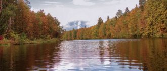
Buzuluksky pine forest
- Coordinates: 52.941468, 52.031265.
The extensive national park is located on the lands of two neighboring regions - Samara and Orenburg - but was formed precisely in the Orenburg region. The Orenburg part falls on the territory of the Buguruslan and Buzuluk districts. The name of the pine forest comes from the latter area, and it is there, in the village of Koltubanovsky, where the administration and museum of the park operate.
The most valuable area of the national park is a unique pine forest near the city of Buzuluk. Scientists have determined that the boron was formed after the Ice Age and is at least 6,000 years old.
It is difficult to imagine how many generations of trees have changed over such a long period of time. The oldest inhabitants of the forest are two pines, whose age has exceeded 300 years. The pine forest is surrounded by deciduous trees and steppes, and the area is inhabited by typical forest animals, birds and insects.
Kzyladyr karst field
- Coordinates: 51.196964, 56.897127.
The extensive landscape and geological monument is one of the most impressive attractions of the Kuvandyk region. On a piece of land about 12 kilometers long, mountain ranges stretch, cut by wide and deep hollows, karst sinkholes and caves.
Underground lakes are hidden in some grottoes, and birds nest in others. On the hills, barely covered with low steppe grass, lie large pieces of multi-colored gypsum and petrified calamite trees.
Kamsak Gorge
- Coordinates: 50.878838, 59.365564.
In the steppes of the Dombarovsky region there is a beautiful rocky gorge created by the persistent Kamsak river. The low right bank of the river is overgrown with greenery, and on the left side of the water flow 10-meter rock pillars rise.
Due to inclusions of various minerals, the wall has a greenish-white color. In the gorge there is a small cave in which, according to legend, a hermit monk lived.
Reservoirs and lakes of the Orenburg region
On the territory of the Orenburg region there are many salt and freshwater reservoirs of both natural and artificial origin.
Lake Razval
- Coordinates: 51.149670, 55.001213.
A small salt lake in the city of Sol-Iletsk appeared in an old salt quarry. Centuries ago, Mount Tuz-Tyube rose here, which translated from Kazakh means “Salt Mountain”. In the middle of the 18th century, the industrial development of the salt dome began, and after 150 years, a deep hole with a diameter of about 250 meters gaped in the place of the hill.
In 1906, the Peschanka River flooded the quarry, creating a beautiful lake with medicinal brine. In 1979, the reservoir disappeared, but a few years later it filled up again.
The concentration of salt in the water is so high that the lake does not freeze even in the most severe frosts. The collapse is often compared to the Dead Sea: there are also no plants or living organisms in the Orenburg reservoir. The fame of the healing waters and mud of the lake spread far beyond the region; in 2010, a healing and recreational area was organized on its territory.
Lake Shalkar-Ega-Kara
- Coordinates: 50.750370, 60.887639.
The largest reservoir of natural origin in the region is located in the Svetlinsky district near the border with Kazakhstan. The mineralized lake has an almost regular round shape, its length is 10 kilometers, width is 11 kilometers.
The reservoir is drainless and very shallow, the average depth is only 1 meter. Due to its characteristics, Shalkar-Ega-Kara completely dries out every 10 years and freezes to the bottom almost every winter. Only in early spring, during the flood period, does the lake connect with the Buruktal River.
If the connection between them lasts long enough, then roach, carp, perch, ide and other representatives of the ichthyofauna enter the pond poor in fish. The rest of the time, the lake is inhabited only by crucian carp, which are hunted by gull-billed terns nesting on the shores.
Lake Zhetykol
- Coordinates: 51.041227, 60.896793.
The second largest Orenburg lake lies in the Svetlinsky district. The name of the reservoir is Kazakh; it is translated into Russian as “seven lakes.” Zhetykol has no drainage, its waters are saturated with salts, and the average depth does not exceed 1.5 meters.
The reservoir is surrounded on all sides by hills on which migratory waterfowl nest. On one of the banks is the village of Ozerny.
Iriklinskoye Reservoir
- Coordinates: 51.779166, 58.772991.
The largest artificial reservoir in the region and the entire Southern Urals was created in 1966 on the Ural River. The reservoir was filled after the construction of a dam at a hydroelectric power station in the village of Iriklinsky. After the completion of large-scale work, the length of the reservoir was 70 kilometers and the width was 8 kilometers.
The new reservoir was supposed to supply water to industrial enterprises and populated areas. In order to create such a huge reservoir, residents of 22 villages, villages and towns had to be resettled from the Iriklinskaya Valley.
Sorochinskoye Reservoir
- Coordinates: 52.400056, 53.252640.
Another famous reservoir is located near the city of Sorochinsk. In size, Sorochinskoye is inferior to the Iriklinsky reservoir, its length is about 28 kilometers, width is 4 kilometers.
The reservoir was formed on the Bolshoi Uran and Samara rivers in 1997. Construction of the reservoir began much earlier - in 1976, but the project was frozen due to financial difficulties. The contractors managed to continue the work only 20 years later; all the objects were finally commissioned only in 2009.
At the moment, recreation areas have been organized on the shores, beaches have been equipped, but there is not a single tourist center. The reservoir is popular with fishermen and outdoor enthusiasts.
Unfortunately, the reservoir cannot be called environmentally friendly; the coast is polluted with garbage, which is why swimming is prohibited in many places. Nevertheless, pike, perch, carp, pike perch and other species of fish live in the water, and in the summer beautiful white swans fly to the Sorochinsky coast.
Church of the Intercession (Krasnokholm)[edit]
Church of the Intercession
In the Orenburg region around 1812, the Cossack village of Krasnokholm was formed. The village was formed by Cossacks who arrived to guard the border. One of the attractions of the village is the Church of the Intercession of the Holy Virgin, which was erected in 1900-1914 at the expense of the Cossacks of the village of Krasnokholmskaya. Construction was timed to coincide with the centenary of the victory in the Patriotic War of 1812. The building was completed and brought into proper shape later thanks to donations from parishioners. The church was built in a cruciform shape with high lancet windows and an octagonal fence, decorated with openwork metal gratings and is eclectic in architectural style. This church gives a unique appearance to the village.
In the 1930s, the temple was closed and used as a granary for storing grain. By order of the district authorities, it was decided to demolish the bells. Local residents refused to do this, and strangers had to be invited. The small bells were removed quickly, but in order to remove the large bell the masonry had to be broken and one worker died while removing the bell. Clergy and believers were subjected to persecution and repression.
Since the 1990s, the building was returned to the Church, and with the blessing of Archbishop Valentin of Orenburg and Buzuluk, services in the Temple were resumed in 2001.
Address:
461360, Russia, Orenburg region, Orenburg urban district, p. Krasnokholm, st. Russia, 85
Springs and waterfalls of the Orenburg region
The Orenburg land is fed by dozens of springs. Local mineral and hydrogen sulfide springs are of great importance for health tourism, and the especially revered consecrated springs attract hundreds of pilgrims.
Hanging springs of Rodnikovka
- Coordinates: 53.982143, 53.491824.
In the vicinity of the village of Nikolkino you can see unusual springs. Countless water springs make their way out of the steep slope of a high red hill and run down in cheerful streams into the Rodnikovka River.
Other streams fall from the steep wall and form small waterfalls. In some places, water flows have washed out small niches in the mountainous banks.
Kondurovsky hydrogen sulfide spring
- Address: s. Kondurovka, Saraktashsky district.
The cold spring near the village of Kondurovka has healing properties due to its high content of hydrogen sulfide. Water has an unpleasant taste and smell, but helps in the treatment of many diseases.
The spring comes out at the foot of the hill, the area around it is practically undeveloped. In 2011, believers consecrated the spring in honor of the icon of the Mother of God “Quick to Hear” and erected a wooden cross of worship next to the stream.
Dmitrievsky hydrogen sulfide spring
- Coordinates: 53.382083, 54.155889.
Another famous hydrogen sulfide mineral spring is located near the village of Dmitrievka, Ponomarevsky district. The spring forms a small round lake with amazingly clear blue water. Local residents surrounded the pond with a fence and organized several descents into the water.
The source remains cold even in hot weather, but neither the temperature nor the specific smell stops tourists who want to take healing baths. Swimming in the lake is good for health, but you must remember the contraindications: for some diseases, such a procedure can only cause harm.
Spring "Kainar"
- Coordinates: 51.229194, 56.671694.
The Belyaevsky district is famous for its springs, perhaps the most visited of them is the mineral spring on the territory of the Burtinskaya Steppe nature reserve. The Turkic name “Kainar” is translated into Russian as “source”.
Mineral water hardly heats up in summer and does not freeze in winter. A stream of the same name flows from the spring, which forms a tiny round pond. Several years ago, the lake was surrounded by wooden sides, and a neat gazebo for relaxation appeared nearby.
"Holy Key"
- Coordinates: 53.441246, 53.311949.
In a gully 5 kilometers from the village of Kuzkino there flows a revered holy spring. The key is located away from the roads, with endless fields stretching around it. The spring is well equipped; it is enclosed in a concrete well, over which a small wooden chapel is erected. The water in the holy spring is always cool and remains fresh for a long time; some believers consider it healing.
The key is sometimes called “Revealed”, as there are legends that saints have appeared in the beam more than once. The spring has been known for more than a hundred years; even in Soviet atheistic times, pilgrims from all over the Orenburg region and neighboring regions came to it. In 1998, the spring was recognized as a hydrological natural monument of regional significance.
Springs village Kiryushkino
- Coordinates: 53.560993, 52.288036.
The springs in the village of Kiryushkino, Buguruslanovsky district, are also considered sacred, but they are revered not by Christians, but by pagan Erzya. The three springs were nicknamed “Vishka Lisma”, “Poksh Lisma” and “Baban Kasha”.
The last source is especially important; its name translated from Erzya means “Babya porridge” - a ritual dish for a pagan holiday. The Erzya used spring water to treat diseases and protect against evil spirits; they sprinkled it on their homes, outbuildings, people and livestock.
Today, residents of surrounding villages still come to the source. A small wooden house is erected above the spring, and life-giving moisture is supplied through a metal pipe.
Silver Spring
- Coordinates: 52.569546, 56.102710.
It is also a fairly well-known spring in the region, where hundreds of vacationers flock. It is located in the Tyulgansky district, near the village of Tugustemir. There is a place to relax next to the source where you can barbecue. The spring water itself here is very cold, icy and, according to unverified sources, it actually contains silver.
Cathedral of St. George the Victorious (Orsk)[edit]
The wooden building was consecrated in 2005.
A stone building has been under construction since 2010.
On September 6, 2014, in connection with the complete completion of construction and finishing work, the great consecration of the cathedral took place in honor of the Holy Great Martyr George the Victorious.
The rite of great consecration was performed by the head of the Orenburg Metropolis, Metropolitan Valentin of Orenburg and Saraktash. Concelebrating with His Eminence were Bishop Iriney of Orsk and Gai, Bishop Feodosius of Isilkul and Russko-Polyansky, Bishop Alexy of Buzuluk and Sorochinsky, clergy of the Orsk diocese and guests in holy orders.
Among the many praying during the service were nuns from the Orsky Monastery in honor of the Iveron Icon of the Mother of God and the Minsk St. Elisabeth Monastery in Belarus.
Address:
Russia, Orenburg region, Orsk, st. Leninsky Komsomol, 2
Telephone:
8(3537)-23-36-48, 33-42-96
Monuments of archeology and paleontology
Orenburg ancient monuments are surprisingly numerous and diverse. Almost the entire territory of the region is dotted with the remains of extinct sea and land animals, and in some corners traces of the first human settlements have survived.
Mount Zmeinaya
- Coordinates: 51.421192, 55.404053.
A small mountain near the village of Belyaevka is not just another peak of the Southern Urals, but a most valuable monument of paleontology. Previously, there were many reptiles in the short grass on the slopes of the hill, so the mountain was dubbed Zmeinaya, although some Orenburg residents call it Khanskaya, or Khanova.
The steep slope is made of giant multi-colored slabs, in which ancient marine animals of the Jurassic period are forever frozen. The mountain has preserved so much diverse fossil fauna that research continues to this day.
Among the fairly common fossils like belemnites and ammonites, there are also rarer ones, for example, the bones of the sea lizard plesiosaur. At the suggestion of scientists, the state took the territory under its protection in order to preserve the precious finds.
Cemetery of pseudo-crocodiles
- Coordinates: 51.593391, 53.647579.
On the outskirts of the village of Rassypnoye there is a deep ravine called Mayachnaya. The slopes of the ravine are fraught with many surprises. At first glance, this is an ordinary hill, but in fact it is a cemetery of ancient animals. Millions of years ago, lakes splashed in its place, in which all kinds of amphibians and reptiles swam. It was here that paleontologists discovered the remains of pseudosuchia, or pseudocrocodiles - the most ancient ancestors of dinosaurs.
These extinct animals resembled large crocodiles; they were distinguished from their descendants by longer vertical limbs. Pseudosuchians moved on land not by crawling, like modern reptiles, but on outstretched legs, like dogs. Bones and even entire skeletons of fossil creatures have been preserved in Rassypnoye. Among the finds is the skull of a labyrinthodont, a lizard-like amphibian from the Mesozoic era.
Åland settlement
- Coordinates: 52.197000, 59.885117.
The existence of traces of an ancient city in the Kvarken region might not have been known if not for a happy accident. In 1987, specialists from Uralaerogeodesy carried out aerial photography in this area. Later, office employee A.E. Puchin, looking at the photographs, drew attention to a strange circle between the Suunduk and Solonchak rivers. Chelyabinsk archaeologists were informed about the curious find, and within a few months the first expedition to the ancient settlement was organized.
Archaeologists planned to carry out excavations, but soon the collapse of the USSR occurred, difficult times came for the whole country, and practically no money was allocated for science. I had to forget about a full-fledged study of the settlement.
The first excavations took place only at the beginning of the 2000s. Experts have established that the Åland settlement arose approximately 4,000 years ago; it was part of the “Country of Cities” system and was similar to the famous Arkaim. Dozens of artifacts have been preserved in the ground, such as tools made of stone, bone and bronze, fragments of pottery, as well as defensive ramparts, ruins of a stone fortress wall and ruins of dwellings.
The most beautiful Orenburg caves
The Orenburg region has prepared pleasant surprises for speleologists: in the local mountains there are several caves accessible to travelers. Many of the grottoes have a complex structure, so tourists should take care of their safety before visiting them.
Cave Gift
- Coordinates: 51.456516, 56.597183.
The largest gypsum cave in the region is located in a mountain near the village of Dubensky. The length of the underground labyrinth is 660 meters. “The Gift” consists of several rooms and three levels, the entrance is located at the top. In some places you can come across stalactites and stalagmites.
The halls are always cool; in summer the temperature stays at around 12°C. Visitors to the cave must have suitable equipment: helmet, warm clothing, flashlight. It is safer to travel through the tunnels accompanied by an experienced guide.
Yumaguzinskaya cave
- Coordinates: 51.605182, 57.607272.
The most famous cave in the Orenburg region is hidden in the depths of Mount Beloshapka, located near the village of Yumaguzin. Being at the foot of the mountain, it is difficult to notice the low entrance, buried in thickets of tall grass. Those brave souls who decide to make their way through the inconvenient underground corridor will be rewarded - a spacious hall with ancient fossilized plants and animals on the walls.
Cave "Mosaic"
- Coordinates: 51.375222, 57.090065.
“Mosaic” is one of the many gypsum caves of the Kzyladyr field. Getting into it is not easy: the entrance is low, in winter the underground corridors and rooms freeze, and in the spring they are filled with floods. Tourists usually visit the grotto in dry weather in the summer.
There are beautiful stains on the walls of the cave, and in places there are small stalactites and stalagmites. Amateur speleologists need to wear a helmet to avoid injuring their heads on sharp protrusions, and warm clothing, since the temperature inside does not rise above 14 °C even in the heat.
Holy Caves
- Coordinates: 51.997561, 53.893381.
The caves in the village of Pokrovka have a long history. At the end of the 19th century, Orsky Cossack Zakhary Kartsev settled here, on the banks of the Samara River. The hermit dug a cave for himself, improved the spring that babbled nearby, and spent all his days in fasting, labor and prayer.
People who thirsted for spiritual achievements and salvation were drawn to the righteous man. They also dug caves and settled near Zechariah. Gradually, a community of Christians leading a monastic lifestyle emerged. Over time, the monastery received official status, and Zachary took monastic vows with the name Zosima. Cells and a temple were built in the caves, then the brethren began to build buildings on the surface of the earth.
After the October Revolution, the monastery was closed, and the above-ground buildings were dismantled into bricks. In the 90s, monasticism in Pokrovka began to revive, believers restored the buildings, but the entrance to the caves was found only in 2002.
Today, the grottoes again enter the boundaries of the St. Nicholas Convent; you can get into the dungeon through the Church of the Nativity of John the Baptist. The cold, cramped cells are filled with icons and candles. The nuns themselves conduct tours of the holy caves and talk about the history of the monastery.
You may also be interested in interesting places in individual cities of the Orenburg region - Orsk and Orenburg
Orenburg region: unique examples of architecture
In the vast expanses of Orenburg there are also architectural delights that often end up in the photo albums of travelers who come here.
German places near Mednogorsk
Photo: © https://yandex.ua/maps/-/CCUaBUDg-C
- Coordinates: 51.402793, 57.669641.
A little east of the city of Mednogorsk lies the large German Bridge, built during the Austro-Hungarian Empire. The place is very mysterious, enigmatic and colorful, which can be seen even from the photo.
Trinity Simeon Convent of Mercy
- Address: st. Pushkina, 77, Saraktash village.
In the city of Saraktash there is probably the most popular and famous monastery in the entire region. In addition to the fact that everything here is imbued with centuries-old holiness, many note the presence of a special, sincere atmosphere created by the ministers. And the buildings of the monastery, as well as its territory, are a real architectural and landscape masterpiece.
Timashev Estate
- Address: Tyulgansky district, Tashla village.
But this exquisite architecture, unfortunately, has been almost completely destroyed. However, this prevents guests from coming here and admiring the walls and tall arches of the once majestic estate of the Timashev nobles. The date of construction of this unique place for the Orenburg region is 1767. It is surrounded by a beautiful park, which has also fallen into disrepair.
Catherine Bridge (Katkin Bridge)
- Coordinates: 51.724725, 54.311108.
Another interesting bridge can be found north of the village of Tatishchevo. True, the Catherine Bridge, which is also called Katkin, does not fulfill its function and is in a dilapidated state.
Don't miss the sights of the regions neighboring the Orenburg region - Chelyabinsk, Saratov and Samara regions, as well as Tatarstan and Bashkortostan
All of the listed attractions are just a small part of the beauty of the Orenburg region. The magnificent landscapes of this picturesque region deserve the loudest epithets, and traveling through it promises a lot of pleasant impressions.
Cathedral of St. Nicholas the Wonderworker (Orenburg)[edit]
St. Nicholas Cathedral
St. Nicholas Cathedral was founded in 1883. On May 4 (17 New Style), 1886, the cathedral was consecrated by His Grace Veniamin II (Smirnov), Bishop of Orenburg and Ural.
The cathedral's opening hours are daily from 7-00 to 20-00. The Sacrament of Baptism in the cathedral is held daily at 10-00 and 13-00. On ordinary days, if great and twelfth holidays do not fall on them, the following services are performed in our cathedral: - weekdays - 8-00 - Divine Liturgy, 17-00 - evening service, - Saturday 17-00 - all-night vigil, - Sunday: 7-00 – early, 9-30 – late Divine Liturgy, – Tuesday: after the Divine Liturgy – prayer service with blessing of water and reading of the Akathist to the Mother of God before Her icon “The Inexhaustible Chalice”, – Wednesday 17-00 – Akathist to St. Nicholas before the ark with its relics, – Friday 17-00 – Akathist to the Most Holy Theotokos before Her icon “Quick to Hear”.
Address:
460001, Orenburg region, Orenburg, st. Chkalova, 8.
Telephone:
8 (3532)31-95-88 – fax and accountant phone, 8 (3532)31-17-45 – security phone