TOP 5 - what to see in the Amur region
The region's most attractive attractions include both the gifts of nature and the creations of man.
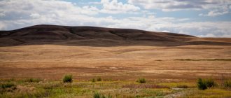
Zeya Nature Reserve
- Coordinates on the map: 53.962778, 127.372500.
The most famous Amur nature reserve was founded in 1963. The reserve is located in the heart of the region on the slopes of the Tukuringra ridge and in the valley of the Zeya River. The area of the protected area is almost 100,000 hectares.
There are hundreds of plants and mushrooms in the reserve, among which there are very rare species. It is also the northernmost point on the planet where Mongolian oak grows. The Zeya mountains and forests are inhabited by roe deer, bears, wapiti, elk and about 50 other species of mammals and 240 species of birds.
The world of insects is especially diverse; there are 1,400 species of butterflies alone in the reserve. The most valuable species of lepidoptera are the endemic Tukuringra corydalis and Ménétrier bear.
Burning mountains
- GPS coordinates: 52.282852, 126.437817.
Tourists come to the Shimanovsky district to see a spectacular natural phenomenon - smoking mountains on the Amur coast near the village of Anosovo. For several kilometers, clouds of gray smoke erupt from the depths of the sandy slope; one might think that the hill is a volcano ready to erupt lava. However, the unusual smoke is created not by boiling magma, but by smoldering deposits of brown coal.
The coal is located at a depth of more than 10 meters, but river water erodes the sandy slopes, constantly exposing new layers of the deposit. When a flammable substance comes into contact with air, it ignites. This process has been going on almost continuously for over 300 years.
Sometimes an underground fire flares up especially strongly, and tongues of flame burst out. The fiery landscape looks especially impressive at night. Despite the fact that there is a scientific explanation for this bright phenomenon, in the minds of some people the mountains are still shrouded in a mystical aura.
Baikal-Amur Mainline
BAM is a large-scale engineering project, on which thousands of people, including camp prisoners, worked during Soviet times. Almost 4,000 kilometers of railway track stretched from Baikal to Amur.
Traffic on the new road was opened in 1938. In the Amur Region, the highway runs along the shore of the Zeya Reservoir, crosses the Zeya River and other reservoirs. There are dozens of settlements near the BAM.
Vostochny Cosmodrome
- Address: ZATO Tsiolkovsky urban district, Vostochny cosmodrome railway, Uglegorsk station.
A cosmodrome was built near the city with the telling name Tsiolkovsky several years ago. “Vostochny” was supposed to become for Russia a replacement for the Kazakh “Baikonur”, which after the collapse of the USSR became the property of another sovereign state.
For many years, Russian specialists rented a site from Kazakhstan and at the same time looked for an alternative for it on their territory. In 2016, the first rocket successfully launched from the Amur Cosmodrome. Today you can come to Vostochny as part of an excursion group.
Evenki village
- Coordinates: 55.115110, 124.890591.
In the vicinity of the village of Pervomaiskoye, among the hills of the Tyndinsky district, an ethnographic complex dedicated to the life and history of the Evenks was built in 2012. The location for the “village” was chosen for a reason: almost half of the Evenks in the region live in Pervomaisky. On the territory of the complex, traditional Evenki tents, wooden outbuildings, a workshop, a museum, a hunter’s house and sculptures were erected.
Guests can enjoy excursions, reindeer rides and master classes on making souvenirs. Visitors are also invited to go fishing and try Evenki national cuisine. Those who wish can stay in guest houses for several days and relax quietly in the lap of nature.
Passport of the Municipal Formation of the city of Skovorodino (page 1)
Amur region
Skovorodinsky district
PASSPORT
Municipal formation
city of Skovorodino
Contents
| Introduction | 3 |
| Historical reference | 4 |
| Settlements of the municipality | 10 |
| Analysis of the socio-economic situation and main directions of development | 11 |
| Executive body of the municipality | 13 |
| Representative body of the municipality | 13 |
| Demographic information | 16 |
| Information about enterprises, organizations and social institutions located in the territory | 17 |
| Structure of the socio-political sector | 28 |
| Mass media | 31 |
| Electoral system | 32 |
| Calendar of significant dates | 33 |
Introduction
The city of Skovorodino was founded in 1908.
Administration address:
fax , area telephone code 8-41654, e - mail : skov.
*****@***ru Acting Head of the City
Chairman of the city Council of People's Deputies (20,418), elected in 2010.
Historical reference
The city of Skovorodino is a city of regional subordination, an administrative center and a railway junction. It is located at an altitude of more than 400 meters above sea level, higher than all other cities in the region, and has very harsh climatic conditions. The city occupies the left slope of the Big Never River valley in its upper reaches. In general, the name of the river is distorted. In the 19th century, the river was called Bolshoy Liver (from the Evenki levere
- swamp).
At the beginning of the 20th century, an expedition by engineer Anosov discovered a large gold deposit in our area. Gold mines were opened, and a road was required to connect the mines with the regional center. This is how the Dzhalinda embankment tract was built, and in 1908, a winter hut was built 30 versts from Reinovo on the left bank of the B. Never River. Coachmen passing along the highway stopped there and changed post horses. The winter hut was a spacious hut, built from unhewn logs on the outside, divided inside into two halves, one of which housed the winterer’s family and was a “room” for more important travelers, and the other, larger one, was intended for coachmen. In the middle there was a roughly hewn large table, several simple benches and bunks along the walls, in the corner there was a wide low stove with a stove for cooking food for the coachmen.
Model of the winter hut (MUK Skovorodinsky Regional Museum of Local Lore named after.)
As a result of surveys of the Amur Railway line, it was planned to build a 3rd class junction station with a main depot. In 1909 The construction of a station village began with the name Zmeiny, after the name of one of the hills on which there were many snakes. The station was officially named Nevers 1.
In August 1911 When inspecting the construction of the Amur Railway, the village was visited by the Minister of Railways Sergei Vasilyevich Rukhlov together with the Amur Governor-General Gondatti Nikolai Lvovich. donated 10,000 rubles for the construction of the church and in the same year the village of Zmeiny was renamed in his honor - the village of Rukhlovo. The station retained its former name Never 1. The village was part of the Amur province of Zeya district. In 1911 In the village there were 226 completed and 6 houses under construction, the population of the village was 635 people. Rukhlovo was located in two places. The part of the village lying between the station and the river in the valley of the B. Never River was called the Lower Village, and the part located on the slope adjacent to the valley on the other side of the railway track was called the Upper Village. In 1913 the population increased to 2,394 people.
In 1914 Train traffic began along the Amur Railway, although construction had not yet been completed. The operation of the unfinished road was determined by the outbreak of the First World War, and then the Civil War.
Construction of the railway (photo from the funds of the MUK Skovorodinsky Regional Museum of Local Lore named after.)
The village of Rukhlovo experienced difficult times in supplying the population with food and other goods, and in 1916. these difficulties have grown to the proportions of a food crisis. Help came from the unexpected direction, the merchant Topaz helped.
The village at that time consisted of 3 small streets in the northern part; in the southern part of the village there was a church and a priest’s house. Also in the village in 1915. a depot was built. After the end of the Civil War and the surrender of the interventionists, the village of Rukhlovo developed: the “upper” village began to grow, a station, buildings of various services, and residential buildings were built.
Skovorodino, 20s of the 20th century
On July 31, 1923, the Chairman of the All-Russian Central Executive Committee, Mikhail Ivanovich Kalinin, visited the village of Rukhlovo and spoke at a meeting of workers (today one of the streets bears his name). On April 21, 1970, a memorial plaque was installed on the building of the railway station in memory of his arrival in the village. Rukhlovo.
In 1926, the Zeya district was formed, the center of which was Rukhlovo.
On February 14, 1927, by a resolution of the Presidium of the All-Russian Central Executive Committee, the village of Rukhlovo was given the status of a city. In the same year, within the city limits, in order to study the phenomena of permafrost, the first in the USSR and one of the first in the world experimental permafrost station (OMS) was created under the leadership of Nikolai Ivanovich Bykov. Research into permafrost was carried out here. For the first time, OMS has summarized the experience of construction on permafrost soils. Several monographs, instructions, and albums have been published.
In A famous scientist, physicist, mathematician, philosopher, theologian, literary critic, Pavel Aleksandrovich Florensky, worked at the experimental permafrost station. He was arrested and convicted under the notorious Article 58 (counter-revolutionary conspiracy) and exiled to the Far East to the Svobodnensky branch of BAMLAG. The works made a huge contribution to the development of our region. It was he who first defined permafrost and became the founder of the science of permafrost - permafrost science. wrote several scientific papers. Unfortunately, most of them were published under other people's names. In the autumn of 1934 was sent to one of the most terrible camps in the Gulag system - the Solovetsky camp. In December 1937 this great scientist was shot.
Currently, the OMS has ceased to exist, since during the construction of the Baikal-Amur Mainline, a new experimental permafrost research station was organized in the city of Tynda.
at the permafrost station in Skovorodino
In 1929, the city had: a distillery, a brewery of the Rukhlovsky Consumer Society, 51 trading establishments, including 6 public, 10 cooperative and 35 private, 2 seven-year schools, 2 hospitals, a rural medical station, a consultation for women and children, a pharmacy .
In 1934 The Zeya region was formed with its center in the city of Rukhlovo.
In the city of Rukhlovo became part of the Chita region.
December 16, 1938 By decree of the Presidium of the Supreme Soviet of the RSFSR, the city of Rukhlovo was renamed the city of Skovorodino in honor of the first chairman of the village Soviet.
In 1938 The population of the city of Skovorodino was 11,938 people. The city has 2 power plants, a vodka factory, a brick factory, a lime factory, 3 industrial cooperatives, 4 schools: a complete secondary school for transport, an incomplete secondary school, an elementary school and a school for the deaf and dumb, 3 kindergartens, a library, a cinema, a railway club, 2 hospitals and many others. enterprises. The city publishes a regional newspaper, Amurskaya Zvezda. In 1939, the construction of the telephone line was completed and the city of Skovorodino received a direct connection with Moscow.
The peaceful work of the residents was interrupted by the outbreak of the Great Patriotic War. From the first days of the war, many people from Panorinsk went to the front, fewer and fewer men remained, but enterprises and transport worked with redoubled energy. The movement of trains along the railways of our city increased, the front did not know any interruptions in the supply of ammunition, food, uniforms, and military equipment.
“Everything for the front - everything for victory!” Women and teenagers took the place of the men who went to the front. In 1942 In the Skovorodino locomotive depot, and throughout the Far East, the first female locomotive driver, Platonida Borisovna Seryavina, appeared.
In 1943 By decree of the Presidium of the Supreme Soviet of the USSR she was awarded the medal “For Labor Distinction”.
Platonida Borisovna is not the only one who brought Victory closer with her heroic work. For the heroism and courage shown during the crossing of the Dnieper, Georgy Ivanovich Surnin, a resident of the city of Skovorodino, was awarded the title of Hero of the Soviet Union with the Order of Lenin and the Gold Star medal. In 1991, a monument was erected in the city - a bust of the Hero, and one of the streets bears his name.
August 17, 1945 Marshal of the Soviet Union, twice Hero of the Soviet Vasilevsky from the city of Skovorodino from the western communications center transmitted a radiogram - an ultimatum to the command of the Japanese Kwantung Army about the cessation of hostilities and complete surrender.
Also in August 1945. In Skovorodino, the 614th Khingan Rifle Regiment of the famous Khingan Division was formed. In memory of this significant event on September 2, 1989. At the meeting of veterans of the 614 Khingan Rifle Regiment, the memorial “Here the 614 Khingan Rifle Regiment of the 396 Khingan Division was formed” was solemnly opened.
Unfortunately, not all residents of Panorinsk were destined to return from the fronts of the Great Patriotic War; more than 300 residents of the city of Skovorodino gave their lives for their Motherland. But they will always live in people's hearts!
November 7, 1975 On the main square of the city, Victory Square, a memorial was opened “In memory of the soldiers from Panryoninsk who died during the Great Patriotic War. (Grieving mother). The stele of the monument lists all the names of the people who died during the war. A letter to descendants, read on May 9, 1995, was laid in the foundation of the monument. Since then, it has become a tradition to lay out addresses to the next generation every 10 years.
After the end of World War II, the city continued to grow and develop. In Skovorodino became part of the Amur region. In 1951 under the leadership of Grigory Mikhailovich Gryaznov, a city park was laid out opposite the Railwaymen's Club.
In the 60s, the railway fleet switched to diesel traction, and the construction of automatic telephone exchanges and residential apartment buildings with utilities began.
April 4, 1978 During a trip to the cities of Siberia and the Far East, Skovorodino was visited by the General Secretary of the CPSU Central Committee Leonid Ilyich Brezhnev, who spoke at a workers’ rally held on the station square.
In the 80s, the first electric locomotives appeared at the locomotive depot. In 1986, a railway bridge – a viaduct – was built.
In 1994, an Orthodox Parish was formed in the city of Skovorodino and an Orthodox Church was built.
On March 28, 1996, at a session of the city Council of Delegates, the Charter and coat of arms of the city of Skovorodino were approved.
In 2002, a training center was opened in our city, including branches of higher and secondary specialized educational institutions.
In 2003, Skovorodino was visited by the leader of the LDPR, Vladimir Volfovich Zhirinovsky.
In 2006, construction of an oil pipeline system began as part of the “Eastern Siberia – Pacific Ocean” project.
Currently, the city of Skovorodino continues to grow: the railway industry, gold mining industry, private business and much more are developing.
Settlements of the municipality
Skovorodino city
The city of Skovorodino is located in the central part of the Skovorodinsky district and is the regional center.
Village Lesnoy
The settlement 17 km of the Reinovskaya branch appeared in 1950. Due to large forest reserves, a timber industry enterprise was formed here. In 1957 The settlement received the status of a village and the name Lesnoy. By the Law of the Amur Region of 01.01.2001 “On establishing boundaries and granting the appropriate status to the municipal formation of the Skovorodino region and the municipalities within it,” the rural settlement - the village of Lesnoy was included in the city of Skovorodino.
Analysis of the socio-economic situation and main directions of development
A characteristic feature of the territorial development of the settlement is the fact that, subject to the relief and other natural factors, the city developed along the main historical railways: to Chita, Khabarovsk, Tynda. The development of the city of Skovorodino was carried out in the post-war years with 2- and 3-story buildings; in the 80-90s, residential construction was carried out with 5-story buildings. Manor-type development was intensively carried out and carried out; the main streets are: Pobedy, Krasnoarmeyskaya, Kalinina, 60 Let USSR. They connect the community center of the settlement with residential and two communal-industrial zones: northern and southern.
The architectural and planning core of the settlement is Victory Square, which is currently the administrative center of the city. The main compositional axis is Pobeda and Kalinin streets. Urban planning regulation of the development of the settlement is carried out on the basis of the development of the 1978 general plan. and a project to clarify the village boundaries of the city of Skovorodino in 2005. The name of the settlement of Skovorodino is directly related to the name of the city; there is a state memorial monument in the city. When developing urban planning documentation for the construction and operation of trunk systems and main structures of engineering infrastructure, as well as when carrying out work on engineering preparation of territories, the interests of the population are taken into account in order to avoid pollution and destruction of green fund objects, including the harmful effects of structures and communications.
In the settlement, to meet the heat supply needs of the population and organizations, there are 6 solid fuel boiler houses. There is no natural gas in the settlement. The population uses bottled gas.
In economic terms, the industry is represented by a number of medium and small enterprises in the construction complex and the local agricultural processing industry.
On the territory of the city of Skovorodino there are enterprises that provide the population with household, transport, utilities, and communication services.
The territory of the settlement is crossed by highways with a length of about 52 km, the TransSib railway, and the Bolshoi Never River. There is a bus service.
Transport links to the village of Never, the village of Lesnoy and the village of Albazino are provided by suburban buses.
On the territory of the settlement there are 2 settlements, inhabited by about 10 thousand people. Personal households of citizens – 180 units. The largest city in terms of population is the city of Skovorodino (9,481 people). Street lighting is provided in populated areas.
Social sphere
There are the Central District Hospital”, the National Healthcare Institution “Nodal Clinic at the station. Skovorodino, in the village of Lesnoy, service is provided by a visiting doctor. There are 4 pharmacies operating.
On the territory of the settlement there are 3 municipal general education institutions and 5 preschool institutions. 84 teachers work, 1,324 students study, 697 children attend kindergarten. Social and cultural services to the population are provided by 1 Cultural and Methodological), 1 Cultural and Leisure Village. Lesnoy), 3 libraries, 1 Children's art school (MBOUDOD "DSHI"). The number of creative workers is more than 50 people. Postal services are provided by 4 branches.
On the territory of the settlement there is a sports and recreation complex with a swimming pool, sauna, gym and sports halls. The owner of the complex is.
Social institutions are mainly staffed with highly qualified specialists.
The most socially significant and budget-generating enterprises for the settlement are: structural enterprises of the Transbaikal branch, ShCh-7, ECh-3, PCh-12, NGChVV-5, PMS-333, PMS-225 and others. They employ more than 3,000 people. The average salary of employees exceeds the regional average.
About 2,000 enterprises operate on the territory of the settlement, more than 100 of which are small. More than 350 entrepreneurs are registered. There are 3 mini-bakeries.
Favorable environmental conditions and transport accessibility contribute to the development of housing construction by individual developers. During the period from 2010 to 2013, 6 residential apartment buildings were put into operation. In the future, in 2014 it is planned to build 4 more residential buildings.
Executive body of the municipality
The executive body of the municipality - Acting Head of the municipality, acts on the basis of the Charter, in connection with the resignation of the Head of the city from March 29, 2013.
Administration of the city of Skovorodino:
Common department
Department of Social Work, Youth Affairs, Culture and Public Relations
Legal department
Financial department
Department for Municipal Property Management and Land Use.
Representative body of the municipality
The charter of the municipal formation of the city of Skovorodino was registered on January 24, 2011 No. Ru in the Office of the Ministry of Justice of the Russian Federation for the Amur Region..
The representative body of the municipality is the Council of People's Deputies of the city.
Year of election: 2010.
Term of office: 4 years.
Number of mandates: 14.
Number of deputies working on a permanent basis: 1.
Chairman of the Council of People's Deputies of the city of Skovorodino - born in 1962, higher education, member of the All-Russian political party "United Russia", work experience in a representative body:
On a non-permanent basis – 2 years 1 month;
On a permanent basis – 5 years 2 months.
| No. | Full name | Job title | Party affiliation | Year of birth | Education | Place of work | Telephone |
| 1 | Deputy | Member of the United Russia party | 1967 | Average special | Individual entrepreneur | 40 427 22 742 | |
| 2 | Chairman of the board | Member of the United Russia party | 1962 | Higher | Council of People's Deputies, editorial office of the regional newspaper | 20 418 40 053 | |
| 3 | Deputy | used part. | 1958 | Higher | Municipal educational institution of secondary school of the village. Forest | ||
| 4 | Deputy | Member of the United Russia party | 1960 | Higher | NHI "Nodal clinic at the station. Skovorodino | 20 397 5 2387 | |
| 5 | Deputy | Member of the United Russia party | 1940 | Average | Pensioner | 43 483 | |
| 6 | Deputy | Member of the United Russia party | 1968 | Secondary technical | 40 004 | ||
| 7 | Deputy | Member of the party "A Just Russia" | 1969 | Higher | Amurenergosbyt | 22 699 22 797 | |
| 8 | Deputy | Member of the United Russia party | 1974 | Higher | -Amur Construction Company" | 40 333 40 183 | |
| 9 | Deputy | Member of the United Russia party | 1960 | Specialized secondary | Municipal Unitary Enterprise "Hotel Center" | ||
| 10 | Deputy | Member of the United Russia party | 1955 | Higher | Individual entrepreneur | 43 294 | |
| 11 | Deputy | Member of the party "A Just Russia" | 1971 | Average | Skovorodinskaya motor depot | 22 965 | |
| 12 | Deputy | Member of the party "A Just Russia" | 1958 | Secondary technical | PMS-333 | 5 2914 20 121 | |
| 13 | Deputy | Member of the United Russia party | 1957 | Higher | Post office | 22 182 | |
| 14 | Deputy | Member of the United Russia party | 1963 | Higher | GBUZ Skovorodinskaya Central District Hospital | 22 053 22 646 |
Demographic information
| Due to its large volume, this material is placed on several pages: 1 |
Get text
The main nature reserves of the Amur region
In terms of the number of protected areas, the Amur Region can compete with the largest regions of the country. There are three large nature reserves, several parks and three dozen nature reserves in the region.
Norsky Reserve
- Coordinates: 52.501111, 130.292500.
The reserve covers a vast territory of more than 211,000 hectares between the Nora and Selemdzha rivers. The reserve began its work in 1998. Half of the territory is occupied by forests, and a particularly strict regime applies to a small area of 10,000 hectares.
The main goal of the reserve is to replenish the population of Siberian roe deer, which is under threat of extermination.
The employees do an excellent job: currently there are about 7,000 rare animals in the protected area. Unique Amur tigers visit the protected area and black and red-crowned cranes come to nest.
Khingan Reserve
- Coordinates: 49.016944, 130.446944.
Another large reserve is located at the southeastern border of the region in the Khingan Mountains. The area of the reserve exceeds 97,000 hectares. These lands received special status in 1963. Most of the reserve is occupied by plains and numerous small lakes, while a third falls on the spurs of the Lesser Khingan.
The main purpose of the reserve is to preserve the natural habitat of rare white-naped and Japanese cranes. In addition to cranes, the reserve is home to almost 300 species of birds, 47 species of mammals and about 1,000 species of plants.
Muravyovsky Park
- Coordinates: 49.871877, 127.701498.
Muravyovsky is a sustainable development park within the Tambov district, covering a plot of land with an area of 6,000 hectares. There are about 500 plant species in the park.
Large populations of birds nest and winter in the forests; more than 200 species of birds can be found here. Of these, 20 are listed in the Red Book of Russia. One of the rare species - the crane - became the reason for the creation of the park. In the 80s of the last century, Moscow scientist Sergei Smirensky proposed creating a crane park in the Amur floodplain to preserve a valuable species.
The idea was brought to life only in 1996. The protected area is non-state and has the status of a park for sustainable environmental management, since economic activity is not prohibited there and people coexist with wild animals.
Reserve "Aldikon"
- Coordinates: 52.181111, 130.434167.
A large wetland in the Mazanovsky and Selemdzhinsky districts received the status of a nature reserve in 2002. Almost 80% of the territory in the valleys of the Aldikon and Adrikon rivers is covered with swamps and overgrown floodplain lakes.
The wildlife of the reserve is unique: representatives of 4 completely different types are found here. In the protected area of 250,000 hectares, there are dozens of rare species of animals and plants that are on the verge of extinction.
Blagoveshchensky Nature Reserve
- Coordinates: 50.516667, 127.650000.
Another famous zoological reserve with an area of 6,200 hectares is located near Blagoveshchensk. The territory was given conservation status in 1975. The local meadows and coniferous-deciduous forests are home to many rare living creatures.
It was their protection that became the main goal of the Blagoveshchensky employees. The proximity to the regional center harms the protected areas: hundreds of vacationers come to the green zone, who often do not take care of nature, leaving garbage and unextinguished fires.
The most interesting rivers and lakes of the Amur region
On the territory of the Amur region there are several interesting natural and artificial reservoirs that attract ecotourists and fishermen.
Amur river
The deep-flowing Amur gave the name to the whole region. Almost half of the river is within the borders of China; in Russia, the water artery passes through the lands of the Trans-Baikal Territory, the Amur Region, the Jewish Autonomous Region and the Khabarovsk Territory. In the Amur region, two important rivers for the region flow into the river - Zeya and Bureya. Local residents have created beautiful legends about the relationship between the three rivers.
There are several settlements on the coast, including the administrative center of the region - the city of Blagoveshchensk. The Amur is unique; its ichthyofauna is the most diverse in Russia. Of the 108 species of fish living in river waters, 36 are of commercial importance.
Some fish, such as kaluga and Amur whitefish, are endemic. The harsh Amur is not always favorable to people; the water level in the river can rise to critical levels. In 2013, there was flooding that affected more than 100,000 people.
Cherpel Krivuns
- Coordinates: 53.506998, 123.536679.
Speaking about the beauties of the Amur, it is worth mentioning separately the three stunning bends, or krivuns, of the river in the Skovorodinsky district. The river twists whimsically among the rocks, changing its bed by 180°.
From a bird's eye view, the unusual curves resemble a huge horseshoe, and a piece of land caught in the grip of a water snake looks like a peninsula. The picturesque section of the river is recognized as a natural monument for its unique shape and rare Red Book plants growing on its territory.
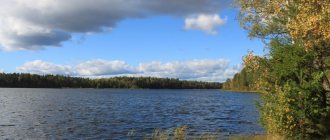
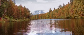
Zeya Reservoir
- Coordinates: 54.453530, 127.770747.
In 1974, construction of a new hydroelectric dam began on the beautiful Zeya River, which runs towards the Amur. After 6 years, the Zeya Reservoir, 227 kilometers long and 24 kilometers wide, was filled. The artificial reservoir has become the largest in the region and the third largest in all of Russia.
The ichthyofauna of the reservoir has suffered due to human actions; of the 34 species of fish that lived in the Zeya River, only 12 remained in the new reservoir. At the same time, the number of surviving species, especially silver crucian carp and Amur pike, has increased, which is why the reservoir is so attractive for fishing enthusiasts.
Bureya Reservoir
- Coordinates: 50.299471, 130.474203.
The smaller reservoir on the Bureya River is located on the territory of two regions: the Amur Region and the Khabarovsk Territory. The reservoir extends 234 kilometers in length and its width is 5 kilometers.
Such a vast area was flooded in 1979 for the newly built Bureyskaya hydroelectric power station; a huge dam was built specifically for this purpose near the village of Talakan. The construction of the hydroelectric power station lasted for 30 years; the enterprise was put into operation only in 2009.
On the banks of the reservoir there are rock formations; one of these rocks fell into the water in 2022, blocked the channel and almost caused flooding of nearby settlements.
Lotus Lake in Ivanovka
- Coordinates: Ivanovka village.
A small artificial reservoir in the village of Ivanovka is considered one of the most spectacular attractions in the region. In summer, the pond is covered with a delightful carpet of blooming relict lotuses. Graceful pink flowers are not a typical plant for the region, so they attract and enchant tourists.
The idea to grow lotuses belongs to rural teachers. The experiment turned out to be successful: the plants took root, adapted to local conditions and every year delight others with their delicate petals.
Skovorodino
Background, gold mines
The Bolshoi Never River, on the banks of which the city of Skovorodino is located, had a different name in the 19th century - Bolshoi Liver (“levere” translated from Evenki means swamp).
In 1866, the expedition of mining engineer Nikolai Pavlovich Anosov discovered a large gold deposit in the territory of the modern Skovorodinsky district. There is a legend that when the expedition was crossing the Dzhalinda River (the right tributary of the Urkan), Anosov’s horse twisted its leg on a small stone, which upon examination turned out to be a gold nugget. The Amur region, some of its territories (modern Zeya and Skovorodinsky districts) began to be called “Russian California”. In 1868–1907 On average, gold in these places was mined up to 2 poods per day. Since 1868, in addition to the Russians, the Chinese, Koreans and Japanese began to come to the gold mines.
Foundation of the future city
Numerous gold mines were opened; to connect them with the regional center, a road was needed - the Dzhalinda embankment road was built. In 1908, on the left bank of the Bolshoy Never River, 30 versts from Reinovo, a winter hut was built, which was a spacious hut. It was cut down from unhewn logs, inside it was divided into two halves - on one side there was a winterer with his family, there was a “room” in which more important travelers stayed. In the other half, which was larger, the coachmen stayed; here in the middle of the room there was a large, roughly hewn table, several benches, bunks along the walls, and in the corner there was a wide and low stove with a stove, where the coachmen could cook their food. In the winter huts, coachmen traveling along the highway stopped to rest and changed post horses.
After conducting surveys on the Amur Railway line, a decision was made to build a third-class junction station with a main depot. Already in 1909, construction began on the first structures of the station village, which was named Zmeiny - this is the name of one of the nearby hills where snakes were found. The station was officially named Never-1.
In August 1911, during a trip the purpose of which was to inspect the construction of the Amur Railway, the Minister of Railways S.V. Rukhlov, accompanied by the Amur Governor-General Nikolai Lvovich Gondatti, arrived in the village. Sergei Vasilyevich Rukhlov donated 10,000 rubles for the construction of the temple. In the same year, Zmeiny was renamed in honor of the minister and became known as the village of Rukhlovo. The station retained its previous name – “Never-1”. According to 1911 data, there were 226 houses in the village, 6 more houses were under construction, the population was 635 people. The village of Rukhlovo consisted of two parts - the part of the village located in the valley of the Bolshoy Never River (between the station and the river) was called the Lower Village; the part located on the slope adjacent to the valley on the opposite side of the railway was called the Upper Village. In just two years, the population of the village almost quadrupled and in 1913 amounted to 2,394 people.
In 1914, the first trains began running on the Amur Railway, although its construction had not yet been fully completed. The premature operation of the unfinished road was caused by the outbreak of the First World War.
With the outbreak of the war, difficult times came for the village of Rukhlovo; there were interruptions in the supply of food and other goods. In 1916, these difficulties developed into a food crisis. During this period, the merchant Topaz provided assistance to the residents of the village. At that time, the village consisted of three small streets in its northern half, and in the southern half there was a church and a priest's house. In 1915, the depot building was built. After the Civil War and the final victory over the interventionists, the village of Rukhlovo developed dynamically: the “upper” village grew, a station, residential buildings, and buildings for various services were built.
In 1918, a council of workers' deputies was elected in the village, the Rukhlovsky district was formed, the center of which became the village of Rukhlovo. In February 1920, Afanasy Nikolaevich Skovorodin was elected the first chairman of the village council. But already on February 28, 1920, A. N. Skovorodin was killed during the evacuation of Japanese troops from the village of Rukhlovo. The chairman was standing on the platform, where he was caught by a shot that thundered from the last carriage of the train leaving for Khabarovsk.
On July 31, 1923, the Chairman of the All-Russian Central Executive Committee M.I. Kalinin arrived in the village of Rukhlovo and spoke at a rally in front of the workers. Today, one of the streets in the city of Skovorodino is named after Kalinin, and on April 21, 1970, a memorial plaque was installed on the station building in memory of the arrival of M. I. Kalinin in the village of Rukhlovo.
Experimental permafrost station
In 1926, the Zeya District was formed with its center in the village of Rukhlovo, and on February 14, 1927, by a resolution of the Presidium of the All-Russian Central Executive Committee, the village of Rukhlovo was transformed into a city. In the same year, an experimental permafrost station was created on the territory of the city, which became the first in the USSR and one of the first in the world. Nikolai Ivanovich Bykov was appointed its leader. The station was created with the aim of studying the phenomena of permafrost; it was the first to generalize the existing experience of construction on permafrost soils. Based on the results of the research, monographs, albums and instructions were published.
In September 1933, the famous scientist (mathematician, physicist, philosopher, theologian) Pavel Aleksandrovich Florensky was sent to the station, arrested and convicted under the notorious Article 58 of a counter-revolutionary conspiracy. He worked at the station until 1934. In the fall of 1934, P. Florensky was sent to the Solovetsky camp, and in December 1937 the scientist was shot.
During the construction of the Baikal-Amur Mainline, a new experimental permafrost research station was organized in Tynda, and the OMS in Skovorodino ceased to exist.
Pre-war years
In 1929, the city operated: a brewery of the Rukhlovsky Production Association, a distillery, 51 trading establishments (6 public, 35 private and 10 cooperative), 2 seven-year schools, a rural medical station, 2 hospitals, a pharmacy, and a consultation for women. On August 1, 1932, the regional newspaper “Amurskaya Zvezda” began to be published.
In 1934, the Zeya region was formed, the center of which became the city of Rukhlovo. In 1937, the city became part of the newly formed Chita region.
By decree of the Presidium of the Supreme Soviet of the RSFSR dated December 16, 1938, the city of Rukhlovo was renamed Skovorodino in memory of the first chairman of the village council A. N. Skovorodin. In 1938, the population of the city of Skovorodino was 11,938 people. The city operated: two power plants, a brick, lime and vodka factories, three industrial cooperatives, four schools (complete secondary and junior high schools, an elementary school, a school for the deaf and dumb), three kindergartens, a library, a railway club, a cinema, two hospitals and other enterprises. In 1939, the construction of a telephone line was completed, and a direct connection with Moscow was established in the city of Skovorodino. In 1941, a railway school was opened.
During the war years
The peaceful work of the residents of the city of Skovorodino was interrupted by the outbreak of the Great Patriotic War. From the very first days of the war, many people from Panorinsk went to the front, fewer and fewer men remained in the city, but transport and enterprises continued to work with renewed energy. The movement of trains along the railway line increased, ammunition, food, uniforms, and military equipment went to the front without interruption. The places of the men who went to the front were taken by women and teenagers. In 1942, the first female engineer, Platonida Borisovna Seryavina, worked at the locomotive depot in the city of Skovorodino, who became the first for the entire Far East. In 1943, P. B. Seryavin was awarded the medal “For Labor Distinction.”
On October 30, 1943, Georgy Ivanovich Surnin, a resident of the city of Skovorodino, was awarded the title of Hero of the Soviet Union for the courage and heroism shown during the crossing of the Dnieper. In 1991, a bust of the Hero was erected in the city; one of the city streets bears his name.
In August 1945, the 614th Infantry Regiment of the 396th Khingan Division was formed in Skovorodino, distinguished itself in battles with the Kwantung Army. On September 2, 1989, in memory of this, at a meeting of veterans of the 614th Khingan Infantry Regiment, a memorial dedicated to the formation of the regiment was solemnly opened. On August 17, 1945, from the Skovorodino communications center, Marshal of the Soviet Union A.M. Vasilevsky sent an ultimatum to the command of the Japanese army to cease hostilities and complete surrender.
Not all of the residents of Panorinsky returned from the war; more than 300 residents of the city who went to the front gave their lives for their Motherland. On November 7, 1975, on Victory Square (the main square of the city), the “Grieving Mother” memorial was inaugurated, dedicated to the people from Panorinsky who died during the war of 1941–1945. A letter to descendants was laid at the foundation of the monument, which was read on May 9, 1995.
Modern city of Skovorodino
After the war, the development of the city continued. In 1948–1949 he entered the Amur region. In 1951, a city park was laid out, located opposite the Railwaymen's Club; the work on its creation was led by Grigory Mikhailovich Gryaznov. In the 1960s The railway fleet was transferred to diesel locomotive traction, and the construction of automatic telephone exchanges (automatic telephone exchanges) and multi-apartment residential buildings began.
On April 4, 1978, Leonid Ilyich Brezhnev visited Skovorodino, who was touring the cities of the Far East and Siberia, he spoke to the workers at a rally that took place on the station square. In the 1980s The locomotive depot was replenished with the first electric locomotives. In 1986, a railway bridge was built. In 1994, the Church of Evangelical Christians was built.
In 2002, a training center with branches of secondary specialized and higher educational institutions opened in the city. In 2006, construction of an oil transportation system began as part of the Eastern Siberia - Pacific Ocean project. On August 29, 2010, V.V. Putin, who was then the Chairman of the Government, opened the Russian line of the Russia-China oil pipeline, starting in the city of Skovorodino.
Springs and waterfalls of the Amur region
In many areas of the Amur region there are cold and hot mineral springs. Some springs are consecrated according to the Orthodox rite and are revered as shrines.
Byssinsky mineral spring
- Coordinates: 52.320000, 131.650000.
One of the most famous mineral springs in the region is located in the Selemdzhinsky district on the banks of the Byssa River. The water temperature in the spring reaches 45°C. Life-giving moisture can be drunk and used for various procedures; it is used in the treatment of diseases of the central nervous system and musculoskeletal system.
There are no sanatoriums or recreation centers on Byssa; tourists come here not for comfortable leisure time and good service. Getting to the “wild” resort is not easy; the nearest settlement is located 68 kilometers from the source.
Ignashinsky spring
- Coordinates: 53.531389, 122.441389.
The healing properties of the spring near the village of Ignashino have been known since the mid-19th century. In 1890, after research, it was decided to build a balneological resort. The initiative belonged to N.L. Kotelnikov, he later began bottling mineral water and selling it under the Ignashinka brand. Bottled water was even supplied to Moscow and St. Petersburg, and the future Emperor Nicholas II himself drank it.
The hospital existed until 1940. A year before the war, a terrible fire destroyed all the buildings and put an end to the almost century-long history of the resort. In 1965, a pioneer camp opened near the spring, but it was later liquidated. Today, village residents dream of reviving the popularity of the spring and are trying to improve the area around it.
Lake Kisloye
- Coordinates: 53.650278, 126.241389.
The mineral spring in the Magdagachinsky district forms a picturesque reservoir, which is famous for its healing waters and healing mud - sapropels. The lake is very small, its length is only 60 meters, and its maximum width is 40 meters.
The water has a sour taste, which is why the lake received the name Kisloe. Scientists have found that the bottom sapropels of the lake have a unique composition and can be used in the treatment of various diseases. Mud and water are used in the Buzuli sanatorium.
Source of St. Elijah Ave.
- Coordinates: 50.274444, 130.204444.
The holy spring in the village of Talakan attracts many tourists and pilgrims. The spring was consecrated in honor of the holy prophet Elijah and is revered by believers. The area around the spring is landscaped, there is a gazebo with benches, a small brick font was erected above the spring, to which a tiled path leads. To the side there is a place for collecting water and a wooden cross of worship is installed.
Source of St. John the Baptist
- Coordinates: 50.368798, 127.614253.
On the outskirts of Blagoveshchensk, in the village of Mokhovaya Pad, there is another revered spring. The freshwater spring was consecrated several years ago in honor of St. John the Baptist, and since then believers have come to it to pray and draw water. Next to the key there is a small platform and a worship cross.
Waterfall in the village New
- Coordinates: 50.653823, 127.678210.
The Amur region cannot boast of large and impressive waterfalls. The most visited attraction of this kind was created by people, and its height does not exceed 1.5 m. A small but beautiful artificial waterfall is located on a stream near the village of Novinka.
The stream rolls over a log wall, which most likely remains from an old destroyed mill. Downstream, local residents and travelers collect spring water.
Amur region: beautiful mountains and rocks
Mountains and rock masses occupy the northern and northwestern regions of the region. The Amur peaks are rich in minerals and are distinguished by a variety of flora and fauna.
Stanovoy Ridge
- Coordinates: 55.500000, 127.500000.
A 700-kilometer mountain range stretches across the south of the Far East through the territories of three regions of Russia: the Amur Region, the Republic of Yakutia and the Khabarovsk Territory. In Rus', the ridge became known back in the 17th century thanks to the explorer Vasily Poyarkov.
The mountain peaks are practically devoid of vegetation, while in the gorges between them the dense larch taiga is green and the roar of turbulent rivers. A variety of minerals, including precious metals, are mined in Stanovoy.
Tukuringra
- Coordinates: 54.333333, 126.333333.
The picturesque Tukuringra Range lies in the center of the area. The length of the mountain range is 230 kilometers, the largest peak reaches 1604 meters in height. On the slopes of the massif grow larches, birches, lindens, lemongrass and other trees.
At high altitudes, the forests give way to dwarf cedar, and the peaks are covered with scattered stones. When heading towards the ridge, you should be careful: the mountains of this landmark of the Amur region are located in an earthquake-prone area.
Mount Gorod-Makit
- Coordinates: 52.953333, 134.656389.
On the eastern outskirts of the region, near the very border with the Khabarovsk Territory, rises a beautiful mountain with the unusual name City-Makit. The peak with a height of 2295 meters is considered the largest peak of the Yam-Alin ridge and one of the highest points in the entire region.
The mountain stands on the watershed of the Zeya and Bureya rivers in inaccessible terrain, which can often only be reached by helicopter. Alpine meadows bloom on the slopes, and a beautiful mountain lake splashes in the surrounding area. If you're lucky, you might stumble upon a through cave of natural origin.
At the top of the mountain there is an obelisk with the image of the famous scientist and writer Grigory Fedoseev. Being an engineer-geodesist, the prose writer worked in the Amur region and described the local beauty in his famous story “The Evil Spirit of Yambuya.”
Oddly enough, the monument is called the main mystery of the peak: the obelisk was installed in 1974, but many subsequent expeditions did not meet it on their way.
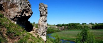
St. Michael's pillars
- Coordinates: 50.650079, 127.348913.
Delightful cliffs near the village of Mikhailovka are included in all lists of Amur beauties. The impressively sized rocks stretch out in a powerful ridge for several kilometers along the bank of the Amur, the lowest section barely reaches 15 m, the highest exceeds 75 m.
Wind and precipitation cut off the edges of the massif, creating spectacular pillars of various shapes. The erosion process continues and some of the stone pillars are unstable, so tourists should be careful when walking among the huge pillars.
Kumarsky cliff
- Coordinates: 51.606111, 126.686944.
On the bank of the Amur, a beautiful cliff about 25 m high stands like an indestructible wall. The cliff is composed of multi-colored limestones, dolomites and marble, its motley slope stands out against the background of ordinary gray rocks, moreover, it is the only hill on an area of tens of hectares.
At the foot lies the beautiful Karbat tract, where once stood the village of Kumara, the former Kumara fort, founded by the Cossacks more than three centuries ago. Rare plants grow on the top of the cliff, some of which are atypical for the area.
On topic: Sights of Blagoveshchensk
Amur archeological and architectural monuments
In the south of the Amur region you can see traces of several ancient civilizations and the remains of extinct animals that lived on this land millions of years ago.
Kundur dinosaur deposit
- Coordinates: 49.106667, 130.832500.
In 1990, 10 kilometers from Kundur station, builders of a new federal highway accidentally discovered a huge dinosaur cemetery. The discovery of the paleontological monument was a huge event in the scientific world.
Almost immediately after the incident, excavations began at the field. Research in the vicinity of Kundur was carried out earlier; the first expeditions were organized at the beginning of the 20th century, but the most productive searches were in the late 90s and early 2000s. Paleontologists found bones of several species of dinosaurs and the pearl of the collection - the entire skeleton of a long-necked herbivorous dinosaur.
Research has shown that the length of the animal was 10 meters and its height was 4.5 meters. Dinosaurs lived on the territory of the modern Amur region 65 million years ago, at that time giants passed through its lands to Asia and Europe.
Amur writings
- Address: working village Erofei Pavlovich, Skovorodinsky district.
Peoples have settled on the banks of the generous Amur since ancient times. Ancient people left bright drawings made with red ocher on the coastal rocks. Images of people and inscriptions in different languages, among which Chinese characters can be distinguished, are found almost along the entire length of the river. There are several complexes of petroglyphs, the most famous are located in the vicinity of the village of Erofei Pavlovich.
Arbinskaya writing
- Coordinates: 53.801382, 126.556798.
Messages from the past can be found not only near the Amur, but also on the banks of other rivers. Thus, on a huge granite rock on the bank of the Arbi River, a whole gallery of ancient paintings with images of human figures, animals and mythical creatures has been preserved.
Drawings and writings are painted on the wall with red ocher. The first historical monument was discovered and examined in 1967 by scientist A.I. Mazin, he also opened an altar nearby.
A few years later, excavations were carried out at the foot of the rock, during which archaeologists collected a whole collection of artifacts: metal and bone arrowheads, iron plates, ceramic fragments, basalt tiles, a bronze coin and other objects. Experts date the finds to the 1st century AD.
Map
| Skovorodino: maps |
Skovorodino: photo from space (Google Maps) Skovorodino: photo from space (Microsoft Virtual Earth)
| Skovorodino. Nearest cities. Distances in km. on the map (in brackets along roads) + direction. Using the hyperlink in the distance , you can get the route (information courtesy of the AutoTransInfo website) | |||
| 1 | Magdagachi | 136 (268) | SE |
| 2 | Tynda | 139 (175) | WITH |
| 3 | Zeya | 219 (309) | IN |
| 4 | Deadlock (Trans-Baikal Territory) | 265 () | Z |
| 5 | Mogocha | 274 (333) | Z |
| 6 | Neryungri | 302 (403) | WITH |
| 7 | Chulman (Republic of Sakha (Yakutia)) | 324 () | WITH |
| 8 | Shimanovsk | 333 (405) | SE |
| 9 | Tsiolkovsky | 373 () | SE |
a brief description of
The city is located on permafrost, in the upper reaches of the river. Bolshoi Never, on the left slope of the valley, 669 km northwest of Blagoveshchensk. Railway node
Information about the city of Skovorodino on the Russian Wikipedia website
Historical sketch
It arose in 1908 as a village during the construction of the Trans-Siberian Railway and was first called Zmeiny, then renamed Never-I (based on its location on the Bolshoi Never River), and in 1911 - Rukhlovo.
Since 1927, the city of Rukhlovo received its modern name in 1938 in honor of the first chairman of the local Council A.N. Skovorodin (1890-1920), who died here.
Economy
In Skovorodino there are enterprises for servicing the BAM.
Food industry - bakery, dairy.
Culture, science, education
Hydrological station, laboratory of the Tyndinskaya permafrost station.
Museums, galleries, exhibition halls
Albazinsky Museum of Local Lore 676065, Amur region, Skovorodinsky district, village.
Albazino, st. School Phone(s) Website: https://www.museumamur.ru/ Skovorodino Regional Museum named after. P.A. Florenskogo 676014, Amur region, Skovorodinsky district, Skovorodino, st. Pobeda, 28 Phone(s)
| Population by year (thousands of inhabitants) | |||||||
| 1931 | 3.3 | 1996 | 14.1 | 2007 | 9.9 | 2015 | 9.3 |
| 1939 | 19.9 | 1998 | 13.9 | 2008 | 9.8 | 2016 | 9.3 |
| 1959 | 15.1 | 2000 | 13.6 | 2010 | 9.5 | 2017 | 9.3 |
| 1970 | 11.4 | 2001 | 13.5 | 2011 | 9.6 | 2018 | 9.2 |
| 1979 | 13.0 | 2003 | 10.6 | 2012 | 9.5 | 2019 | 9.1 |
| 1989 | 13.8 | 2005 | 10.1 | 2013 | 9.5 | 2020 | 8.9 |
| 1992 | 14.1 | 2006 | 10.0 | 2014 | 9.4 | 2021 | 8.7 |