| Mozdok |
Mozdok
, a city in Russia, the administrative center of the Mozdok district of the Republic of North Ossetia-Alania, the center of the Mozdok deanery of the Vladikavkaz diocese. Located on the southern edge of the Terek-Kumskaya lowland, on the high left bank of the Terek River, 92 km north of Vladikavkaz. Railway station and highway junction. Population - 41.7 thousand people. (2018).
- On the map: Yandex.Map, Google map
The settlement in the Mazdogu
(from Kabardian
mez
, “forest” and
degu
, “deaf”) was founded in 1759.
In 1763, the owner of Lesser Kabarda, Kurgoko-Kanchokin, who accepted Russian citizenship and Orthodoxy, built a fortified outpost here in the center of the Caucasian border lines, a church was built, and a customs office was established. In the same year, the city of Mozdok
was established by decree of Empress Catherine II and became one of the six regular fortresses of the Caucasian line. The military-strategic importance of the city in the fortified line system was very great. Military equipment, weapons and provisions were delivered from Astrakhan through Mozdok; Until 1825, the Georgian Military Road passed through the city, connecting Russia with Transcaucasia. The first school and the first printing house in the North Caucasus were opened here.
In 1785, Mozdok received the status of a district town of the Caucasian region of the Caucasian governorship. In 1796-1803 it was part of the Astrakhan province, and from 1803 - part of the Caucasus (later Stavropol) province. The economic importance of Mozdok was determined primarily by its favorable geographical location. Located at the crossroads of the most important trade roads, Mozdok daily received and sent numerous merchant caravans from Central Russia to mountain villages, Cossack villages and to distant Transcaucasia. At the end of the 18th - first half of the 19th centuries, it was a major trading center in the North Caucasus and was famous for the Mozdok autumn fairs. In 1823, Russian peasants, the Dubinin brothers, built one of the first oil refineries in Russia in Mozdok, where kerosene production began.
During the Caucasian War in 1840, the city was attacked by detachments of mountaineers led by Imam Shamil.
Since 1860, it was part of the Terek region, and until 1863 it was its administrative center. In the 1870s, after the construction of a railway connecting Rostov-on-Don with the western coast of the Caspian Sea, Mozdok remained away from the highway and lost its economic importance. In 1897 it was a provincial town in the Pyatigorsk district, and at the turn of the 19th century it was a settlement. Mozdok remained a trading center for nearby Cossack villages and Ossetian settlements.
During the Civil War, Mozdok was the scene of military operations. In 1923, Mozdok was re-established as a city [1].
During the Great Patriotic War, fierce battles took place in the area of the city of Mozdok. On August 25, 1942, the city was occupied by Nazi troops. Liberated on January 3, 1943 by troops of the Transcaucasian Front during the North Caucasus Operation.
In 1944, Mozdok was transferred from the Stavropol Territory to the North Ossetian Autonomous Soviet Socialist Republic, and the city itself was elected the administrative center of the newly formed Mozdok region. By the end of the Soviet period, a curtain factory, mechanical repair and brick factories operated in the city; The food industry was developed (brewery, winery, dairies, meat processing plants) [2].
The military significance of the city again manifested itself at the turn of the 21st century, during the active phase of the anti-terrorist operation in the North Caucasus, when the city played a prominent role as one of the most significant strategic strongholds in the south of Russia.
Statistics
- 1856 - 10 thousand people, 6 churches, 1207 houses, 131 shops
- 1897 - 9.3 thousand people
- 1913 - 20.2 thousand people
- 1939 - 19.1 thousand people
- 1959 - 25.6 thousand people
- 1970 - 32.4 thousand people
- 1989 - 38 thousand people
- 2003 - 42.9 thousand people
Mozdok
(Republic of North Ossetia-Alania)
OKATO code:
90230501
Founded:
1759
City since:
1785 City of district subordination (Mozdok district of the Republic of North Ossetia - Alania)
Center:
Mozdok district
Telephone code (reference phone)
| 86736***** | 32-0-58 |
Deviation from Moscow time, hours:
0
Geographic latitude:
43°45′
Geographic longitude:
44°39′
Altitude above sea level, meters:
130 Sunrise and sunset times in the city of Mozdok
Brief history of North Ossetia-Alania
Since the 9th century, the Alan state was located on the territory of modern North Ossetia. In 1774 the region was annexed to the Russian Empire. In 1924 it was transformed into an autonomous region, and in 1936 - the North Ossetian Autonomous Soviet Socialist Republic.
In 1992, armed conflicts took place on the territory of North Ossetia. Due to its proximity to Chechnya, the republic was often subject to terrorist attacks. On September 1, 2004, a terrorist attack occurred with the seizure of a school in Beslan.
Necropolis near the village of Dargavs
Map
| Mozdok: maps |
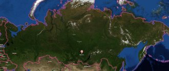
Mozdok: photo from space (Google Maps) Mozdok: photo from space (Microsoft Virtual Earth)
| Mozdok. Nearest cities. Distances in km. on the map (in brackets along roads) + direction. Using the hyperlink in the distance , you can get the route (information courtesy of the AutoTransInfo website) | |||
| 1 | Lukovskaya | 2 () | SW |
| 2 | Kizlyar | 6 () | SW |
| 3 | Pavlodolskaya | 13 (17) | Z |
| 4 | Bratskoe (Chechen Republic) | 22 () | SE |
| 5 | Gvardeiskoye (Chechen Republic) | 26 () | IN |
| 6 | Malgobek | 26 (44) | YU |
| 7 | Sagopshi (Republic of Ingushetia) | 30 () | YU |
| 8 | Inarki (Republic of Ingushetia) | 32 () | YU |
| 9 | Beno-Yurt (Chechen Republic) | 32 () | IN |
| 10 | Edissia (Stavropol Territory) | 33 () | WITH |
| 11 | Kurskaya (Stavropol Territory) | 35 (58) | NW |
| 12 | Znamenskoye (Chechen Republic) | 39 () | IN |
| 13 | Upper Achaluki (Republic of Ingushetia) | 44 () | YU |
| 14 | May | 48 (72) | Z |
| 15 | Upper Naur (Chechen Republic) | 49 () | IN |
| 16 | Chill | 51 (50) | Z |
| 17 | Terek | 51 (98) | SW |
| 18 | Karabulak | 53 (101) | YU |
| 19 | Plievo (Republic of Ingushetia) | 54 () | YU |
| 20 | Naurskaya (Chechen Republic) | 54 () | IN |
| 21 | Badgers (Republic of Ingushetia) | 55 () | YU |
| 22 | Sovetskaya (Stavropol Territory) | 56 () | NW |
| 23 | Troitskaya (Republic of Ingushetia) | 56 () | SE |
| 24 | Dolakovo (Republic of Ingushetia) | 57 () | YU |
| 25 | Yandare (Republic of Ingushetia) | 57 () | YU |
| 26 | Nadterechnoye (Chechen Republic) | 57 () | IN |
| 27 | Sunzha | 57 (118) | SE |
| 28 | Elkhotovo | 57 (99) | SW |
| 29 | Stepnoe (Stavropol Territory) | 58 () | WITH |
| 30 | Kantyshevo (Republic of Ingushetia) | 58 () | YU |
a brief description of
Located on the southern edge of the Terek-Kuma lowland, on the high left bank of the river. Terek, 92 km north of Vladikavkaz. Railway station. Road junction.
Territory (sq. km): 17
Information about the city of Mozdok on the Russian Wikipedia site
Historical sketch
The settlement in the Mazdogu tract was founded in 1759. In 1763, the owner of Lesser Kabarda, Kurgoko-Kanchokin, who accepted Russian citizenship and Orthodoxy, built a fortified outpost here in the center of the Caucasian border lines, a church was built, and a customs office was established. Mozdok - Kabardian “dense forest” (mez “forest”, degu “deaf”).
In 1785, Mozdok received the status of a county town in the Caucasus region of the Caucasian governorate (in 1796-1803 - Astrakhan province), since 1803 in the Caucasus province.
At the end of the 18th - first half of the 19th centuries. was a major trading center in the North Caucasus (famous for the Mozdok autumn fairs).
In 1823, Russian peasants, the Dubinin brothers, built one of the first oil refineries in Russia in Mozdok, and began producing kerosene.
During the Caucasian War, the city in 1840 was attacked by detachments of mountaineers led by Imam Shamil.
In 1856, in the provincial town of Mozdok, Kizlyar district, Stavropol province, there were 6 churches, 1207 houses, 131 shops.
From 1860 it was part of the Terek region, until 1863 it was its center. After being held in the 1870s. railway connecting Rostov-on-Don with the western coast of the Caspian Sea, Mozdok remained aloof from the highway and lost its economic significance and status as a city. In 1897 - a provincial town in the Pyatigorsk district of the Terek province.
At the turn of the 19th-20th centuries. Mozdok is a settlement, a shopping center of nearby Cossack villages and Ossetian settlements.
During the Civil War of 1918-22, Mozdok was the scene of military operations.
In 1923 and 1926, during the period of economic growth under the NEP, Mozdok was again confirmed as a city. Since 1942 it has become a city again.
During the Great Patriotic War of 1941-45 in the Mozdok area in 1942-43. Fierce fighting took place. The city was occupied by Nazi troops on August 25, 1942. It was liberated on January 3, 1943 by troops of the Transcaucasian Front during the North Caucasus Operation.
Municipal indicators
| Index | 2001 |
| Demography | |
| Number of births, per 1000 population | 12.2 |
| Number of deaths, per 1000 population | 15.2 |
| Natural increase (decrease), per 1000 population | -3 |
| Standard of living of the population and social sphere | |
| Average monthly nominal accrued wages, rub. | 1606.4 |
| Average housing area per inhabitant (at the end of the year), sq.m. | 20.8 |
| Number of preschool institutions, pcs. | 17 |
| Number of children in preschool institutions, thousand people | 2 |
| Number of daytime educational institutions (at the beginning of the school year), pcs. | 9 |
| Number of students in daytime educational institutions, thousand people | 5.4 |
| Number of doctors, people. | 129 |
| Number of nursing staff, people. | 490 |
| Number of hospital institutions, pcs. | 1 |
| Number of hospital beds, thousand units | 0.6 |
| Number of medical outpatient clinics, pcs. | 3 |
| Capacity of medical outpatient clinics, visits per shift, thousand units. | 0.9 |
| Economy, industry | |
| Number of enterprises and organizations (at the end of the year), pcs. | 1707 |
| Construction | |
| Volume of work performed by type of activity “Construction” (until 2004 - volume of work performed under construction contracts), million rubles. | 248 |
| Commissioning of residential buildings, thousand sq.m. of total area | 9.2 |
| Commissioning of residential buildings, apartments | 100 |
| Commissioning of preschool institutions, places | 0 |
| Commissioning of educational institutions, places | 1251 |
| Commissioning of hospital facilities, beds | 0 |
| Commissioning of outpatient clinics, visits per shift | 0 |
| Transport | |
| Number of bus routes (in intracity traffic), pcs. | 3 |
| Number of passengers transported by buses per year (in intracity traffic), million people. | 10.7 |
| Connection | |
| Number of residential telephone sets of the city public telephone network, thousand units. | 8.2 |
| Trade and services to the population | |
| Retail trade turnover (in actual prices), million rubles. | 348.6 |
| Retail trade turnover (in actual prices), per capita, rub. | 9078 |
| Public catering turnover (in actual prices), million rubles. | 13.7 |
| Volume of paid services to the population (in actual prices), million rubles. | 91.4 |
| Volume of paid services to the population (in actual prices), per capita, rub. | 2380.3 |
| Volume of household services to the population (in actual prices), million rubles. | 12.1 |
| Volume of household services to the population (in actual prices), per capita, rub. | 314.2 |
| Investments | |
| Investments in fixed assets (in actual prices), million rubles. | 141.2 |
| Share of investments in fixed assets financed from budgetary funds in the total volume of investments, % | 58.6 |
Data sources:
- Regions of Russia. Main characteristics of the constituent entities of the Russian Federation: statistical collection. Goskomstat of Russia. - M:, 2003.
Economy
Food industry enterprises - meat processing plants, dairy, breweries, wineries.
Curtain factory, brick factory.
In the Mozdok region, wheat, corn, barley, millet, and sunflower are grown. Viticulture, melon growing. They raise cattle, pigs, sheep and goats, and rabbits. Poultry farming, beekeeping.
Deposits of clay, gravel, sand.
Main enterprises
FORESTRY, WOOD PROCESSING AND PULP AND PAPER INDUSTRY
JSC "Carton Mozdoka"
362000, Republic of North Ossetia - Alania, Mozdok district, Mozdok, st.
Mayakovskogo, 45 Offers:
Cardboard, cardboard containers
LIGHT INDUSTRY
JSC "Mozdok Patterns"
363700, Republic of North Ossetia - Alania, Mozdok district, Mozdok, st.
Fabrichnaya, 1 Offers:
Curtain-tulle fabric, piece curtain products
Culture, science, education
Museum of Local Lore.
Universities of the city
Mozdok branch of the Moscow Academy of Economics and Law
363750, Republic of North Ossetia - Alania, Mozdok district, Mozdok, st. Kirova, 20 WWW: https://www.mfmael.ru/
Architecture, sights
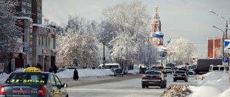
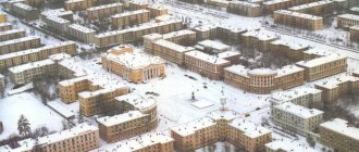
The central street of Mozdok is lined with multi-storey buildings and goes down to the Terek River. Streets with one-story houses surrounded by front gardens and gardens stretch parallel and perpendicular to it. The city has 2 large parks and a bridge over the Terek.
| Population by year (thousands of inhabitants) | |||||||
| 1856 | 10.0 | 1979 | 34.4 | 2005 | 41.8 | 2014 | 39.4 |
| 1897 | 9.3 | 1989 | 38.0 | 2006 | 41.3 | 2015 | 40.0 |
| 1913 | 20.2 | 1992 | 39.3 | 2007 | 40.8 | 2016 | 40.6 |
| 1931 | 15.5 | 1996 | 39.1 | 2008 | 40.5 | 2017 | 41.4 |
| 1939 | 19.1 | 1998 | 39.2 | 2010 | 40.1 | 2018 | 41.7 |
| 1959 | 25.6 | 2000 | 39.3 | 2011 | 38.8 | 2019 | 42.2 |
| 1967 | 31 | 2001 | 38.6 | 2012 | 39.1 | 2020 | 42.0 |
| 1970 | 32.4 | 2003 | 42.9 | 2013 | 39.2 | 2021 | 41.5 |
Military
There is an airbase near the city. From 1961 to 1998, the 182nd Heavy Bomber Aviation Regiment Long-Range Aviation, flying the Tupolev Tu-95, was based there.[14] The air base was used to support military operations in Chechnya and the Russo-Georgian War.[15][16][17] In June 2003, a suicide bomber attacked a bus carrying pilots and other personnel working at an air base on the Mozdok-Prokhladnoye highway, killing approximately 15 people and injuring 12.[18][19]
Fishing and hunting on the Terek River
The Terek River will also make your fishing dreams come true. Fishing is fraught with acquaintance with pike, roach, perch, ruffe, crucian carp, asp, ide, pike perch, carp, bream and catfish. Red Book fish simply do not exist here. And beyond Ossetia there are no-go zones. There are many catchable areas on the Terek River. Fishing is successful, for the most part, in the Stavropol, Chechen and Dagestan areas. Above, it is either a mad stream, or a network of strategic objects, or a water protection zone of natural parks. Water fishing enthusiasts praise the places near Stoderevskaya, Galyugaevskaya, Gvardeyskaya, Znamensky, Ishcherskaya, Nadterechny, Podgorny, Vinogradny, Staroshchedrinsky, Grebensky bridge, Khamamatyurt, and villages of the Babayurt district.
When praising fishing on the Terek River, visitors usually remember a hunt full of amazing sensations. You can shoot mountain, steppe and forest game. On the territory of Georgian and Russian lands it is allowed to shoot yak, tur, and deer (these three are only available for big money). Further conversation concerns wild boar, roe deer, chamois, Dagestan tur, wolf and fox. And also a gopher, a brown hare, a steppe ferret and a chipmunk. Flying game includes pheasant, partridge, grouse, woodcock, capercaillie, duck and goose. The extermination of Pallas' cat, musk deer, herons, swans, storks, cranes, owls, and some grebes is prohibited. The Red Book includes all birds of prey, a small number of rodents and a flying squirrel.
Geography
The city is located on the left bank of the Terek River, in the central part of the Mozdok region. It is located 95 km (by road) and 84 km (as a straight line) north of the city of Vladikavkaz.
The area of the urban settlement is 17.50 km2. From west to east the city has a length of about 6 km, from south to north about 6.5 km.
The city is located in the flat forest-steppe zone of the republic. The terrain is relatively flat. Height fluctuations are insignificant. In the southern part of the city stretches a chain of hilly hills. The average altitude in the city is about 130 meters above sea level.
The coastal zone of the Terek River is occupied by riverine forests protected by the State Forest Fund. To the south of the city in the valley of the Terek River there is Victory Park [hy] (Ossetian Uælahizy Park). To the southeast of the city stretches the largest forest in the region - the Alborovsky Forest.
The hydrographic network is represented mainly by the Terek River. To the south of the city in the valley of the Terek River there are dammed lakes. To the north of the city there are canals - Tersko-Kumsky and its branch Burunny. To the north-west of the city there is Lake Kara.
Tourism and recreation on the Terek River
The Terek River is located first in the mountainous and foothill parts of the temperate zone, then in the agricultural and steppe part of its sharply continental zone, and finally crosses a semi-desert area on the border with the dry subtropics of middle Dagestan. There are mountains, huge hills, absolutely flat plains, and even lowlands. As a result, the above-Terrek and beyond-Terrek landscapes allow for recreation of any direction. Moreover, they are connected with the rest of the country by railway tracks and highways: R-217 (Caucasus), A-161 (Military Georgian), Vladikavkaz-Alagir, Mozdok-Nazran, Grozny-Chervlenaya, Grebenskaya- Khasavyurt, R-215 (Astrakhan-Makhachkala) and Kizlyar-Sulak. In addition, Vladikavkaz airport is located in Beslan.
First of all, I would like to dwell on the chances for speleotourists, climbers and mountain trekkers. Very common are ascents to Zilga-Khokh, Arzu, Kuarzhin, Mount Geleva, Pioneer Peak, Kazbek and Stolovaya (this is the background of the center of Vladikavkaz in most photos). Once upon a time in the village of Ukhatskoye, people were cheered up by a homemade ski slope. That is, among extreme sports enthusiasts, hikes along the Trusovsky, Daryal and Baltic gorges have been known since Soviet times. If all this is not for you, just take a ride along the 2 km long Daryal tunnel. By the way, in the most successful recreational spots, the Terek River still has recreation centers:
- Ski resort "Armkhi" (climb from the mouth of the river of the same name along its bed);
- “Gudauri Resort” (a cable car line leads from Kobi to its peaks);
- “Alpine camp Gveleti” (road to the waterfall of the same name outside the village of Gveleti);
- BO water station "Terek" (Vladikavkaz, Kh. Khetagurova Ave., 12, there is a "cable car" to the town of Lysyaya Gora, and on it there is an equipped "video" and a path);
- BO "Quiet Island" (Chervlenaya, Chechnya);
- Country club "New Bridge" (Babayurt district, Dagestan).
Horseback riding on the Terek River is a very common activity. But already in the foothills and flat areas of the Terek region. You will be provided with a horse in Vladikavkaz, Beslan and Mozdok. In the river basin, these are the cities with the most developed infrastructure. The hikes take place along idyllic dirt roads in the space of landscape reserves - forests.
A beach holiday on the Terek River makes no sense. You can only have a picnic on a more or less suitable section of the water's edge (as a rule, they are all close to large cities). Bathing, as a rule, takes place in special storage ponds. There are especially many of them in the Babayurt region of the Republic of Dagestan - Bolshoy Achikol, Ocean, Beshenoye, Travyanoye, Zmeyka, Estuaries and Agrakhan Bay. Here the depth is finally suitable, and the swimmer is not carried away anywhere. But there are plenty of places for tent camping on the Terek itself. The brightest ones are located, first of all, in the tracts already described.
Event-based (also ethnographic and rural) holidays on the Terek River concern the following holidays: Tarangelos (in the villages of the Trusov Gorge), Lomisoba (in the settlements of the Daryal Gorge, Balta, Vladikavkaz, Beslan and Elkhotovo), Iron Bagany (Mozdok), Day Spring Equinox of Kabarda (May), Benoevskaya Spring (Chechnya), Shashlik Festival (Shelkovskaya, Chechnya) and Day of National Centers (ibid.). On the territory of the Kizilyurt district of Dagestan you can become a guest of the “Serpentine of Friendship”. The program of such events includes performances by folklore groups, fairs, and demonstrations of traditional holiday competitions and rituals.
Rafting on the Terek River is quite popular. Experienced rafters or kayakers begin it in the Trusovsky Gorge presented above (the villages of Kobi and Almasiani already overlook the Georgian Military Road). They stand on the water at the bridge. Until Almasiani it is a continuous climb of medium difficulty. In addition, both the 3 bridges themselves and the cables securing them are dangerous for the water operator. The Kobi Basin is 4 kilometers long. Along the Georgian Military Road, water collects in a single channel. The speed remains high. Behind the “crushed stone” bridge leading to Sioni, a rapid track begins. Behind the canyon, a simple straight section awaits you, ending with a push towards the left bank. Behind the branch of the stream (on the left) there is a serious threshold. And later you will pass a difficult rift about 1 km long. Those who like to take risks do not like to take risks and set sail behind all the dams of the Vladikavkaz agglomeration (in Beslan). The riverbed is passable for a kayak right up to the gorge. From the mouth of the Malka it passes exclusively through a sandy-clayey valley. Bon Voyage! Do not forget that you will have to enclose the strategic water protection zones of different hydroelectric power stations.

