This term has other meanings, see Novomoskovsky district.
| district[1] / urban district[2] | |
| Novomoskovsky district, Novomoskovsk city | |
| Flag | Coat of arms |
- (3,5 %)
Novomoskovsky district
- administrative-territorial unit (district)[5][6][7] in the Tula region of Russia.
Within the boundaries of the district there is a municipal entity, the city of Novomoskovsk.
with the status of a city district[8].
The administrative center is the city of Novomoskovsk.
Story
The district was formed on August 1, 1958 under the name Stalinogorsk
from the territory subordinate to the Stalinogorsk City Council and the territory of the abolished Gremyachevsky district[9].
On November 13, 1961, in connection with the renaming of Stalinogorsk to Novomoskovsk, the district was renamed Novomoskovsky
.
In 2000, the district included:
- Sokolniki city
and 13 rural districts:
- Gremyachevsky - p. Gremyachee
- Ivan-Ozersky - Maloye Kolodeznoye village
- Klyuchevsky - Krasnoye Gremyachevo village
- Kommunarsky - village Kommunarov
- Krasnobogatyrsky - Krasny Bogatyr village
- Ozerkovsky - Ozerki village
- Pervomaisky - village Pervomaisky
- Pravdinsky - Pravda village
- Prokhorovsky - Prokhorovka village
- Riga-Vasilievsky - village Riga-Vasilievka
- Spassky - p. Spasskoye
- Shirinsky - Shirinsky village
- Shishlovsky - p. Shishlovo
In 2006, a municipal district was created within the boundaries of the district and district center as part of the organization of local self-government. The city of Novomoskovsk became part of it as an urban settlement and ceased to be a city of regional subordination.
Municipal district from 2006 to 2008 divided into 5 municipalities:
- 2 urban settlements: the city of Novomoskovsk
- Sokolniki city
- Gremyachevskoye - village Gremyachee
In 2008, the urban settlement of the city of Novomoskovsk was transformed into the municipal formation of the city of Novomoskovsk
with the status of an urban district with the subsequent annexation to it of all settlements located on the territory of the municipal district.
Thus, since 2009, one municipal entity has been located on the territory of the district - the city of Novomoskovsk
with the status of an urban district.
Novomoskovsky district as an administrative-territorial unit of the region retains its status[6].
The city of Sokolniki was annexed to the city of Novomoskovsk by the decision of the Tula Regional Duma of October 24, 2008[10].
General information
Tula is a large transport hub - there are a large number of federal highways in the area, as well as the Moscow-Voronezh and Kaluga-Tula-Ryazhsk railway lines.
Agriculture is well developed in Novomoskovsk, since the climate of this area is favorable for agriculture and livestock raising.
The region's industry is represented by enterprises in the energy, chemical, construction and food industries. There are about 100 large enterprises alone, which creates environmental problems.
Among other cities, Novomoskovsk stands out for its amenities. Three times took prizes among cities in the competition “The Most Comfortable City in Russia.”
The city has interesting sights - many monuments, historical monuments and religious shrines.
Population
Area
| Population | |||||
| 1959[11] | 1970[12] | 1979[13] | 1989[14] | 2002[15] | 2009[16] |
| 37 038 | ↘31 287 | ↘26 734 | ↘26 289 | ↘25 211 | ↗145 252 |
| 2010[17] | 2011[18] | 2012[19] | 2013[20] | 2014[21] | 2015[22] |
| ↘143 848 | ↘143 347 | ↘142 626 | ↘141 159 | ↘140 007 | ↘139 234 |
| 2016[23] | 2017[24] | 2018[25] | 2019[26] | 2020[27] | 2021[4] |
| ↘138 447 | ↘137 555 | ↘136 635 | ↘134 932 | ↘133 791 | ↘133 021 |
Urban district
| Population | |||||
| 2009[18] | 2010[17] | 2011[18] | 2012[19] | 2013[20] | 2014[21] |
| 145 252 | ↘143 848 | ↘143 347 | ↘142 626 | ↘141 159 | ↘140 007 |
| 2015[22] | 2016[23] | 2017[24] | 2018[25] | 2019[26] | 2020[27] |
| ↘139 234 | ↘138 447 | ↘137 555 | ↘136 635 | ↘134 932 | ↘133 791 |
| 2021[4] | |||||
| ↘133 021 | |||||
Urbanization
The urban population (city of Novomoskovsk) makes up 91.47% of the total population of the district (urban district).
Settlements
The district (urban district) includes 98 settlements, including 1 urban and 97 rural:
| List of settlements | |||
| № | Locality | Type of settlement | Population |
| 1 | Akulshino | village | 15[17] |
| 2 | Alexandrovka | village | 0[17] |
| 3 | Almazovo | village | 18[17] |
| 4 | Belokolodez | village | 11[17] |
| 5 | Belomestnoe | village | 27[17] |
| 6 | Berezovka | village | 61[17] |
| 7 | Bogdanovka | village | 279[17] |
| 8 | Big Sagittarius | village | 11[17] |
| 9 | Big Teterki | village | 2[17] |
| 10 | Bolshoye Kolodeznoye | village | 84[17] |
| 11 | Borozdino | village | 3[17] |
| 12 | Vasilyevka | village | 9[17] |
| 13 | Verkhniy Yasenok | village | 0[17] |
| 14 | Verkhodonye | village | 65[17] |
| 15 | Grayvoronki | village | 18[17] |
| 16 | Gremyachevo | village | 41[17] |
| 17 | Gremyachee | village | 1337[17] |
| 18 | Gritsovo | village | 188[17] |
| 19 | Doctorovo | village | 4[17] |
| 20 | Erzovka | village | 7[17] |
| 21 | Znamenka | village | 12[17] |
| 22 | Znamensky | village | 2[17] |
| 23 | Ivan-Ozero | village | 103[17] |
| 24 | Ivankovo | village | 4[17] |
| 25 | Izbishchi | village | 170[17] |
| 26 | Ilyinka 1st | village | 221[17] |
| 27 | Ilyinka 2nd | village | 81[17] |
| 28 | Klyuchevka | village | 177[17] |
| 29 | Knyaginino | village | 136[17] |
| 30 | Kommunarov | village | 494[17] |
| 31 | Krasnoye Gremyachevo | village | 158[17] |
| 32 | Red Bogatyr | village | 787[17] |
| 33 | Crosses | village | 42[17] |
| 34 | Kukuy | village | 24[17] |
| 35 | Lyubovka | village | 9[17] |
| 36 | Maklets | village | 206[17] |
| 37 | Maksheevo | village | 14[17] |
| 38 | Malinovsky | village | 103[17] |
| 39 | Maloe Kolodeznoye | village | 101[17] |
| 40 | Malye Teterki | village | 0[17] |
| 41 | Matov Sad | village | 0[17] |
| 42 | Matt | village | 13[17] |
| 43 | Peaceful | village | 25[17] |
| 44 | Mikhailovka | village | 1[17] |
| 45 | New Village | village | 2[17] |
| 46 | Novomoskovsk | city | ↘121 674[4] |
| 47 | Novo-Yakovlevka | village | 17[17] |
| 48 | Ozerki | village | 300[17] |
| 49 | Olkhovets | village | 270[17] |
| 50 | Orlovka | village | 0[17] |
| 51 | Osanovo | village | 25[17] |
| 52 | Pashkovo | village | 11[17] |
| 53 | Pervomaisky | village | 901[17] |
| 54 | Petrovochka | village | 94[17] |
| 55 | Flat | village | 25[17] |
| 56 | Podlubnoe | village | 0[17] |
| 57 | Podosinki-Kozhino | village | 7[17] |
| 58 | Similar Vyselki | village | 0[17] |
| 59 | Is it true | village | 471[17] |
| 60 | Prigorye | village | 2[17] |
| 61 | Pridonye | village | 74[17] |
| 62 | Prokhorovka | village | 22[17] |
| 63 | Prudki | village | 10[17] |
| 64 | Wasteland | village | 41[17] |
| 65 | Pushkari | village | 59[17] |
| 66 | Riga-Vasilievka | village | 177[17] |
| 67 | Savino | village | 397[17] |
| 68 | Garden | village | 84[17] |
| 69 | Sergeevka | village | 11[17] |
| 70 | Simakovo | village | 0[17] |
| 71 | Sokolniki 1 | village | 1[17] |
| 72 | Sokolniki 2 | village | 12[17] |
| 73 | Spasskoye | village | 1751[17] |
| 74 | Gritsovo station | village | 24[17] |
| 75 | Staraya Uvarovka | village | 5[17] |
| 76 | Sentry | village | 6[17] |
| 77 | Sagittarius | village | 127[17] |
| 78 | Tetyakovka | village | 29[17] |
| 79 | Tikhonovka | village | 11[17] |
| 80 | Ulanovka | village | 1[17] |
| 81 | Urusovo | village | 12[17] |
| 82 | Fustovo | village | 8[17] |
| 83 | Khlopovo | village | 0[17] |
| 84 | Khmelevka | village | 110[17] |
| 85 | Kholtobino | village | 360[17] |
| 86 | Chusovka | village | 4[17] |
| 87 | Shatovka | village | 2[17] |
| 88 | Mines No. 35 | village | 2[17] |
| 89 | Mines No. 38 | village | 0[17] |
| 90 | Shirino | village | 6[17] |
| 91 | Shirinsky | village | 1548[17] |
| 92 | Shishlovo | village | 260[17] |
| 93 | Yudino | village | 3[17] |
| 94 | Yudino | village | 61[17] |
| 95 | Yasenok-Vyselki | village | 4[17] |
| 96 | Yasenok-Muravyovka | village | 0[17] |
| 97 | Yasenok-Podlubnoe | village | 6[17] |
| 98 | Yatskoe | village | 46[17] |
Notes
- from the point of view of the administrative-territorial structure
- from the point of view of the municipal structure
- Regions of Russia. Basic socio-economic indicators of cities. 2022.. - Moscow, 2022. - P. 98. - 456 p.
- ↑ 1234
The permanent population of the Russian Federation by municipalities as of January 1, 2022 (Russian). Retrieved April 27, 2022. Archived May 2, 2022. - Charter of the Tula region
- ↑ 12
Law “On the administrative-territorial structure of the Tula region” - ATU (undefined)
. Archived from the original on November 15, 2016. - Charter of the municipal formation of the city of Novomoskovsk: Article 1. Name of the municipal formation and its legal status 1. Name of the municipal formation - city of Novomoskovsk. The status of the municipality is urban district.
- Administrative-territorial division of the Tula region for 1917-1989 (undefined)
. Archived from the original on August 24, 2011. - On the annexation of the city of Sokolniki, Novomoskovsk district, Tula region, to the city of Novomoskovsk, Novomoskovsk district, Tula region (unspecified)
(inaccessible link). Access date: August 25, 2009. Archived November 25, 2010. - All-Union Population Census of 1959. The actual population of cities and other settlements, districts, regional centers and large rural settlements as of January 15, 1959 by republics, territories and regions of the RSFSR (unspecified)
. Retrieved October 10, 2013. Archived October 10, 2013. - All-Union population census of 1970. The actual population of cities, urban-type settlements, districts and regional centers of the USSR according to census data as of January 15, 1970 by republic, territory and region (unspecified)
. Retrieved October 14, 2013. Archived October 14, 2013. - All-Union Population Census of 1979. The current population of the RSFSR, autonomous republics, autonomous regions and districts, territories, regions, districts, urban settlements, village-district centers and rural settlements with a population of over 5,000 people (unspecified)
. - All-Union population census of 1989. Urban population (undefined)
. Archived from the original on August 22, 2011. - All-Russian population census 2002. Volume. 1, table 4. Population of Russia, federal districts, constituent entities of the Russian Federation, districts, urban settlements, rural settlements - regional centers and rural settlements with a population of 3 thousand or more (unspecified)
. Archived from the original on February 3, 2012. - The size of the permanent population of the Russian Federation by cities, urban-type settlements and regions as of January 1, 2009 (unspecified)
. Retrieved January 2, 2014. Archived January 2, 2014. - ↑ 1 2 3 4 5 6 7 8 9 10 11 12 13 14 15 16 17 18 19 20 21 22 23 24 25 26 27 28 29 30 31 32 33 34 35 36 37 38 39 40 41 42 43 44 45 46 47 48 49 50 51 52 53 54 55 56 57 58 59 60 61 62 63 64 65 66 67 68 69 70 71 72 73 74 75 76 77 78 79 80 81 82 83 84 85 86
87 88 89 90 91 92 93 94 95 96 97 98 99 All-Russian population census 2010.
Number and distribution of the population of the Tula region (unspecified)
. Access date: May 18, 2014. Archived May 18, 2014. - ↑ 123
Tula region. Estimated resident population as of January 1, 2009-2013 - ↑ 1 2
Population of the Russian Federation by municipalities.
Table 35. Estimated resident population as of January 1, 2012 (unspecified)
. Retrieved May 31, 2014. Archived May 31, 2014. - ↑ 1 2
Population of the Russian Federation by municipalities as of January 1, 2013.
- M.: Federal State Statistics Service Rosstat, 2013. - 528 p. (Table 33. Population of urban districts, municipal districts, urban and rural settlements, urban settlements, rural settlements) (undefined)
. Retrieved November 16, 2013. Archived November 16, 2013. - ↑ 1 2
Table 33. Population of the Russian Federation by municipalities as of January 1, 2014
(unspecified)
. Access date: August 2, 2014. Archived August 2, 2014. - ↑ 1 2
Population of the Russian Federation by municipalities as of January 1, 2015
(unspecified)
. Access date: August 6, 2015. Archived August 6, 2015. - ↑ 12
Population of the Russian Federation by municipalities as of January 1, 2016 (Russian) (October 5, 2018). Retrieved May 15, 2022. Archived May 8, 2022. - ↑ 12
Population of the Russian Federation by municipalities as of January 1, 2022 (Russian) (July 31, 2017). Retrieved July 31, 2022. Archived July 31, 2022. - ↑ 12
Population of the Russian Federation by municipalities as of January 1, 2022 (Russian). Retrieved July 25, 2018. Archived July 26, 2022. - ↑ 12
Population of the Russian Federation by municipalities as of January 1, 2022 (Russian). Retrieved July 31, 2019. Archived May 2, 2022. - ↑ 12
Population of the Russian Federation by municipalities as of January 1, 2022 (Russian). Date accessed: October 17, 2022. Archived October 17, 2022.
Architecture
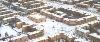
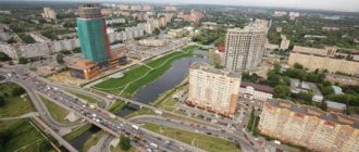
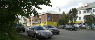
The central part of the city is characterized by a strict arrangement of streets running relative to each other at right angles according to the original development plan. The city center is Sovetskaya Square. Facing the square is the building of the Moscow Region Coal Research Institute. Next to it is a large four-story building with columns, which houses the municipal assembly and the administration of the city and district. The main street of the city, Komsomolskaya, runs through the square. A little to the east it is crossed by Moskovskaya Street, the widest in the city. Together, these two streets set the direction from the center and are a kind of “face” of the city.
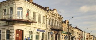
The central area combines pre-war, post-war and modern architecture. Among the pre-war buildings, houses with arches, buildings in the constructivist style, for example, the building of the Pobeda cinema on the central square of the city, or a high-rise building with a colonnade on the street, stand out. Moscow. Famous architects, the Vesnin brothers, took part in the implementation of the construction plan.
During the Great Patriotic War the city was severely destroyed. German prisoners of war took part in the restoration of the city. Post-war buildings, in particular, include the building of the drama theater, the building of the city committee (now the city administration), two-story residential buildings built in the post-war years.
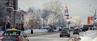
The streets are decorated with many green spaces.
