The works of Pushkin, Derzhavin, Aksakov, Krylov, Tolstoy, Shevchenko, Korolenko and Dahl are associated with the Orenburg region. Here the names of Yuri Gagarin, Lyudmila Petrova, Irina Safarova, and the Dobroskok brothers are woven into the history of the region.
However, when mentioning the region first, an association with the Orenburg downy scarf always arises. The down knitting craft originated here in the 18th century, and world fame came to it after the 1857 exhibition in Paris. Today, the owners of the product are singers Fergie, Madonna and Montserrat Caballe, actresses Annie Girardot and Sean Young and many others.
Its special feature is the down of local goats, which is considered the thinnest and most durable in the world. But working with it requires unique skills: craftswomen spend about a month making one large scarf.
For ease of route planning, we have marked all mentioned cities and attractions on the map of the region:
General historical information
In ancient times, nomadic tribes of Bashkirs and Kazakhs lived in the territory of what is now the Orenburg region. These lands were conquered by the Mongol-Tatars and for some time belonged to the Golden Horde (XIII century).
In the 18th century, when the annexation of Kazakhstan to Russia began, the Orenburg steppes began to be developed by the Russians. To protect the southern borders of the Russian Empire, the Orenburg Cossack Army was created.
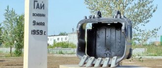
Initially, in 1735, Orenburg was founded as a fortress at the confluence of two rivers - the Or and Ural, but five years later they decided to create it in a new place, downstream of the Ural River, on Krasnaya Gorka. The name was kept the same, and the old city began to be called the Orsk Fortress (the modern city of Orsk).
Having existed in the new location for three years, in 1743 Orenburg was again moved, this time to the site of the Berd fortress. The city on Krasnaya Gorka was named Krasnogorsk Fortress (now there is the village of Krasnogor), and Orenburg was the main fortress of the border line until the mid-19th century.
Orenburg was a center of trade between Russia, Kazakhstan and Central Asia. There were Menovaya and Gostiny Dvors, and customs worked here. With the beginning of the construction of the railway between Samara and Orenburg (1877), woodworking, flour-grinding, tanning, oil-processing and other industries began to develop, and railway workshops were opened. In 1938, Orenburg was renamed the city of Chkalov, but in 1957 the previous name was returned.
Cities and villages
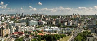
Orenburg
They say about Orenburg that it is a thrice-conceived and once-born city. The fact is that the first two places that were chosen for the foundation of the settlement turned out to be unsuccessful. The city stands on the banks of the Ori River, which at one time determined its name.
True, during Soviet times he was called Chkalov in honor of the test pilot. There is even a six-meter statue of him in the city. Only Valery Pavlovich himself has never been to Orenburg.
Local buildings amaze with their architectural diversity. Among them there is even a medieval castle. It is also worth taking a look at St. Nicholas Cathedral, which is the only one in all of Orenburg that survived the Bolshevik era. There is also something for young tourists to do - they can ride along the 6-kilometer children's railway.
- “National Village” is a pedestrian street where traditional dwellings of Kazakhs, Bashkirs, Russians and other residents of the Orenburg region coexist. Here you can get acquainted with the life and cuisine of each nationality.
- The pedestrian bridge over the Ural River is a bridge connecting parts of Orenburg, and at the same time Europe with Asia. During an intercontinental walk, you will be reminded of the invisible border by the symbolic border pillars installed here.
- , the Elizabeth Gate was the meeting point between Europe and Asia, and today it is a symbolic place for lovers. Those who want to live a happy married life come here to take photos.
- The Orenburg Fortress is known to everyone who has read “The Captain’s Daughter” by A. S. Pushkin. The writer came here in 1833 to obtain material for his work. By the way, his guide was V.I. Dal. Only parts of the structure that witnessed Pugachev’s uprising have survived to this day.
- The clock tower adorns one of the central streets of the city. Every day at 12:00 and 17:00 the chimes ring here. At the same time, various melodies are played, including “Orenburg Shawl”, “Farewell of the Slav” and the city anthem. And from the windows of the clock various characters connected with the history of Orenburg look out: Pushkin, Shevchenko, Pugachev, a craftswoman with a scarf, a soldier, etc.
More interesting things about Orenburg and its attractions.
Sol-Iletsk
Sol-Iletsk is a salt-packing city that supplies all of Russia and part of the world with its products. A place where one of the attractions is a pink building with dolphins at the entrance, which is called “Black Dolphin” and is a prison for especially dangerous criminals.
This is the city that saved the country from a watermelon shortage in 2007. A place where any tourist can get dirty with mud, lie in salt water and swim in fresh water in a couple of hours.
- Lake Razval is like the younger brother of the Dead Sea: just as lifeless and unusual. This is 7 hectares of healing water: tourists and locals say that it cures skin diseases, asthma and osteochondrosis.
- Lakes Tuzluchnoe and Dinino. People come to these ponds for black healing mud , which helps get rid of diseases of bones and tendons, nervous disorders and rheumatism, ulcers and scars, and also improves immunity.
- Bukobay yars are spherical natural sculptures with a diameter of about 70 cm. They are said to have a special energy. Whole groups come here to meditate. Here you can also see a tectonic fault 10 meters deep.
Resources and nature of the Orenburg region
The territory occupied by the Orenburg region is mainly rocky, sandy or mixed-grass steppes. Forests here occupy only about 4.5% of the entire territory and consist mainly of oaks, birch, linden and maple, with pine trees a little less common.
The Orenburg region is home to more than 80 species of animals (beavers, moose, wild boars, badgers, foxes, less often bears, etc.), about 280 species of birds (hazel grouse, woodpecker, wood grouse, black grouse, etc.) and more than 60 species of fish (the most numerous of which – the carp family).
Oil, gas, non-ferrous and rare metals, rock salt, limestone, clay, etc. are mined here. There are sources of varied mineral water, useful in its chemical composition.
The region has 510 protected natural sites on its territory. Among the natural monuments of the Orenburg region there are many mountains, cliffs, cliffs, there are even volcanoes, as well as nature reserves, lakes, springs and other interesting places. Let's briefly look at some of them.
All week we will introduce you to the amazing treasures of our region. Seven days - seven wonders of our beloved Orenburg region.
The Orenburg region is a land of unique natural contrasts. It is located on the border of two parts of the world (Europe and Asia) and several natural zones (mountains and plains, steppes and forests). These unique features give rise to many beautiful and amazing natural features, rare geological and archaeological monuments in the vastness of the region.
Scientists and tourists come here from all over the world to see with their own eyes the centuries-old pine trees growing on the sands of the Buzuluksky forest, the fluffy feather grass of the endless steppes, the legendary Przhevalsky horse, swamps covered with blueberry beads, reservoirs with healing water and healthy mud of Sol-Iletsk, purchase at memory of elegant and unusually warm downy scarves and products made from variegated landscape jasper.
The “Seven Wonders of the Orenburg Land” project will allow you to go on an exciting journey and get acquainted with the real wonders of the region, allowing you to appreciate the richness, diversity and uniqueness of the Orenburg region.
RED HORSES
The Przewalski's horse is the only existing subspecies of wild horses. It is listed in the Red Book of the Russian Federation, the Red Book of the International Union for Conservation of Nature and is an extinct species from nature. Until now, these amazing animals have been preserved only in zoos, specialized nurseries and game reserves, including the Orenburg Nature Reserve.
Did you know that:
scientists distinguish three subspecies of wild horses: the steppe tarpan, the forest tarpan and the Przewalski’s horse itself;
I. S. Polyakov, a scientist at the St. Petersburg Zoological Museum, made the first description of a wild horse and named it in honor of the discoverer - Przewalski's horse;
Since 2015, the Orenburgsky Nature Reserve has been implementing the twelfth in the world and the only Przhevalsky horse reintroduction project in Russia, “The Program for Creating a Semi-Free Population of the Przewalski Horse in the Orenburgsky Nature Reserve”;
in June 2022, the first Przewalski's horse foals were born at the Reintroduction Center;
Przewalski's horse has retained the characteristics of not only a horse, but also a donkey: on its head it has a short, erect mane, reminiscent of an “Iroquois”, but there are no bangs;
Przewalski's horses have 66 chromosomes, while domestic horses have only 54;
Przewalski's horse feeds on saxaul and caragana, which are inedible for domestic horses.
GAS
30 kilometers from Orenburg, on the very border of Europe and Asia, there is an oil and gas condensate field unique in terms of reserves and gas composition. It stretches for 120 km along the Urals, reaching more than 20 km in width. There are only a few deposits like this in the world; in Europe it was the largest.
Did you know that:
- the presence of special valuable components in the gas (methane, ethane, propane, butane, pentane, hexane, higher hydrocarbons, nitrogen, carbon dioxide, helium, hydrogen sulfide, mercaptans) allows us to consider the Orenburg field not only as a source of energy fuel, but also as a raw material base for gas processing and chemical industry;
- in November 1966, on the left bank of the Urals, not far from Orenburg, the first Orenburg gas was produced from exploration well No. 13, which was drilled by the team of master S.D. Ivanov;
- together with the CMEA countries (Bulgaria, Hungary, East Germany, Poland, Romania and Czechoslovakia), the construction of the Soyuz gas pipeline began in 1979;
- The Orenburg gas chemical complex is a complex production mechanism that includes drilling wells, production of gas, condensate and oil, their preliminary preparation in the fields, processing at gas processing and helium plants, underground storage of gas and liquid products, transportation of products to consumers;
- the specific smell of Orenburg gas is provided by organosulfur substances - mercaptans and hydrogen sulfide;
- in 1973-1978, the Orenburg Gas Processing Plant was headed by our fellow countryman, the future Prime Minister of Russia V.S. Chernomyrdin.
GOLD FIELDS
The Orenburg region is known as the grain granary of Russia. Deep black soil, which does not require any processing, allows you to harvest a fabulous harvest.
For many years, the Orenburg region has been famous for its durum wheat varieties, which have been repeatedly recognized as the best in quality in the world. In terms of the size of the sown area and the gross harvest, the region occupies one of the leading places in Russia.
Did you know that:
- in terms of nutritional and baking qualities, Orenburg durum wheat has no rivals either in our country or abroad, therefore this agricultural crop is considered the real “grain gold” all over the world;
- for growing durum wheat, a dry, hot climate and steppe brown soils are best suited; the natural conditions of the Orenburg region with its black soil, abundance of light and heat with some lack of moisture allow the cultivation of highly glassy grain, rich in protein, with good flour-grinding, baking and pasta qualities;
- the development of virgin and fallow lands in the Adamovsky, Novoorsky, Kvarkensky and Akbulaksky districts became a major step in increasing agricultural production in the region;
- The Orenburg region was twice awarded the Order of Lenin for exceeding the grain procurement plan: in 1956 (150 million poods of grain) and in 1968 (360 million poods).
ORENBURG DOWN SCARF
The Orenburg down scarf is rightfully considered one of the symbols of our country and the calling card of the region. It is distinguished by unusually fine workmanship, original decoration and patterns, in which you can see the endless Orenburg steppe, frosty patterns on the windows, and bunches of rowan berries.
The Orenburg shawl is a real work of folk art, an object of pride and fidelity to tradition, the soul and craftsmanship honed over centuries have been put into it.
Did you know that:
- The Orenburg scarf begins its official history in the 18th century, when the famous researcher P.I. Rychkov spoke about it in a report to the Academy of Sciences, and his wife presented the Free Economic Society with yarn made from the fluff of local goats;
- the fluff of Orenburg goats was a separate export item of the Russian Empire, and scarves were regular participants and favorites of international exhibitions in Brussels, Chicago, Canada, Japan, Algeria, Syria, Greece, France, England, Spain, India, and Germany.
- the peculiarity of the Orenburg scarf is in the knitting itself, its distinctive features are the subtlety and complexity of the patterns;
- attempts by foreign companies to breed Orenburg goats in the 19th century in France, South America, and Australia were not successful, since goats need thin fluff to retain heat, and the mild climate did not contribute to this;
- at the beginning of the 19th century in France, the Orenburg down shawl was a fashion accessory and a mandatory addition to the outfit;
- the down of Orenburg goats is the thinnest in the world: its thickness is 16-18 microns, and that of Angora goats (mohair) is 22-24 microns, so products made from Orenburg down are especially durable and soft;
- The thinness of an Orenburg scarf is traditionally determined by two parameters: whether the product passes through a wedding ring and whether it fits in a goose egg.
DEAD SEA OF THE STEPPE
In the Orenburg region there is a city where the richest salt mines sparkle deep underground - places where the purest table salt is mined. Rock salt has been mined here since ancient times. This craft gave the name to the amazing city of Sol-Iletsk.
According to geological exploration data, the Iletsk rock salt deposit has a unique, homogeneous varietal composition: over 80% of the total volume of deposits is salt of exclusively the highest grade, which is characterized not only by visual whiteness, but also by the presence of a balanced amount of useful micro- and macroelements.
Did you know that:
- The first scientific study of Iletsk salt was carried out by the great Russian scientist M.V. Lomonosov, who about;
- Columbus of the Orenburg region P.I. Rychkov in the 18th century compiled the first analytical study of the salt industry, about;
- in the salt mines, Afanasy Sokolov (Khlopusha), a future participant in the peasant war and Pugachev’s ataman, cut salt among the convicts;
- in 1906, as a result of the flooding of an open salt mine by the flood waters of the Peschanka River, the unique Lake Razval was formed, which, along with lakes Tuzluchnoye, Golodnye Voronki, Dunino, Novoe, Maloe Gorodskoye and Bolshoye Gorodskoye, is a popular place for salt and mud therapy;
- Lake Razval is not inferior in its properties to the Dead Sea in Israel, the water is saturated with salt more than 300 grams of salt per liter;
- In 1996–1997 in Paris, Iletsk salt was recognized as the best in the world and awarded the European Gold Prize for quality.
ORSKA LANDSCAPE JASPER
For several tens of thousands of years, jasper has been revered and loved for its high hardness, resistance to any external influences, inexhaustible variety of colors and patterns, and wonderful shine after polishing. There is no other gem that has more than two hundred shades in patterns and is so durable and strong. The only things harder than Orsk jasper are diamond and corundum.
Did you know that:
- The Urals are considered the largest jasper province in the world, and the most famous jasper deposit is Mount Colonel (in the old days Jasper or Slate Mountain);
- the famous naturalist and traveler P. S. Pallas described Orsk jasper this way: “The best jasper is especially in large collapse, the color is either coffee or white with red and yellowish stripes, there are pieces on which grass and trees are depicted”;
- jasper is called “the mother of all stones”, from Greek jasper - “spotted” or “variegated”;
- the first tools made from jasper 12 thousand years ago were found at the site of an ancient man in the Urals, including jasper knives, which are amazingly sharp;
- products made from Orsk jasper are known throughout the world; they are distinguished by a variety of colors and patterns: there are about two hundred colors, among which red-brown shades predominate;
- paired vases made of Orsk jasper, unsurpassed in craftsmanship, with colors reminiscent of autumn foliage, can be seen in St. Petersburg in the State Hermitage Museum;
- South Ural jasper was used to cover the floor of the royal bedchamber in the Kremlin, when finishing the Church of the Savior on Spilled Blood in St. Petersburg, the Mayakovskaya metro station in Moscow, and it was used to decorate the sarcophagus in the Lenin Mausoleum.
The Buzuluksky forest rises majestically as a huge green oasis in the endless steppes of the Orenburg region. It is located 15 kilometers north of the city of Buzuluk, on the border of the Orenburg and Samara regions. Bor is bordered on almost all sides by a strip of deciduous forest bordering the steppe, has the shape of a triangle, and extends 53 km in latitude and 34 km in longitude. In the middle of the forest, the Borovka River flows like a cool silver ribbon. In 2007, Buzuluksky Bor received the status of a national park.
Did you know that:
- The Buzuluk forest is called a “unique forest”, “the pearl of the Volga region”, “a diamond among the steppes”, “a magnificent forest kingdom in the homeland of gophers and feather grasses”;
- on an area of 111 thousand hectares grow 49 species of trees and shrubs, about 600 species of grasses and 52 species of mosses and lichens, 44 species of mammals, 144 species of birds, 8 species of reptiles, 4 species of amphibians, 24 species of fish and about 800 species of insects;
- the unique forest area dates back to the post-glacial period;
- The Buzuluksky forest secures with its root system about 60 thousand hectares of sand, the depth of which in some places reaches 90 meters;
- the attraction of the national park is two pine trees aged 300–350 years, one of which is more than 30 meters high and 145 cm in diameter;
- boron contributes to the enrichment of surface air with moisture and is a source of additional precipitation; reduces winds and dampens the destructive power of storm winds, weakens the drying effect of hot winds coming to the steppe Trans-Volga region from the southeast;
- On the territory of the Buzuluksky pine forest there are several small oil fields, the oil reserves of which are estimated from 40 to 80 million tons.
Lake Razval in Sol-Iletsk
Sol-Iletsk is a kind of resort. There are salt and mud lakes here, which every summer receive thousands of people who come to improve their health. The most famous among them is Lake Razval.
Previously, there was a mountain in its place, but at the beginning of the 18th century they began to mine salt here, and by the end of the next century a huge pit had formed in its place. A little later it was flooded, and Razval was formed - a kind of salt quarry.
The water of the lake is very saturated with salt and is similar in composition to the waters of the famous Dead Sea. People come here to treat rheumatism, bronchial asthma, skin and joint diseases. Now they continue to extract salt in these places and supply it to all stores in Russia.
Churches, cathedrals and temples
Orthodox Saraktash Convent of Mercy
Address: Saraktash village, st. Pushkina, 77 Phone: 8 (35333) 6-12-32 and Website: stobitel.ru Cost: children - 50 rubles, adults - 100 rubles. per excursion Opening hours: excursions by arrangement
The Saraktash monastery is called the Vatican of the Orenburg region. The largest Orthodox complex in Russia was founded in 1990 on the basis of the Intercession parish. That year was special for this place.
- The icon of the Mother of God was updated: printed at the end of the 19th century, the image darkened so much that the outlines of the Mother and Jesus became indistinguishable. Then it was decided to replace it. But a miracle happened: a few days later the faces of the saints brightened. And then gradually the whole icon.
- After long negotiations, the building of the former Church of Semeon of Verkhoturye, where the kindergarten was located, was returned to the church.
- A young priest, Nikolai Stremsky, arrived in Saraktash. At that time the monastery owned only a small prayer house.
By the way, Nikolai’s father’s family is the largest in Russia. He has 72 adopted children.
Holy Tikhvin Mother of God Convent (Buzuluk)
Address: Buzuluk, st. Sergo, 1 Phone: 8 (35342) 2-33-15 Website: buzulukjenmonastyr.prihod.ru
“The chosen vessel,” said the great elder Seraphim when he saw the peasant girl Euphemia Ovsyannikov. After such a blessing, she dedicated herself to the Lord and founded a women's community, which later received the status of a monastery.
During the years of Soviet power, its churches were used as a power plant and warehouses. The cells turned into cells of a transit prison, where prisoners were tortured and shot. In one of them, the locally revered schemamonk Maxim suffered martyrdom.
After the Great Patriotic War, the monastery began to be revived: the All Saints Church was opened. In 2000, it was transformed into the Tikhvin Convent.
Catherine's Church in Tugustemir
Address: s. Tugustemir, st. Tserkovnaya, 5
The Church of the Great Martyr Catherine was built by titular councilor Viktor Zvenigorodsky in memory of his wife, who died of consumption. Bricks for construction were made three kilometers from the future temple in a neighboring village.
According to legend, they were delivered to the construction site in an unusual way: they were passed along a chain from hand to hand.
The facade of the temple was decorated with 12 plaster apostles. A bell tower 43 meters high was built nearby. During the Soviet period, the temple was closed and partially destroyed.
To date, restoration work has not been completed.
Church of the Transfiguration of the Lord in Orsk
Address: Orsk, st. Stepana Razina, 100a Phone: 8 (35372) 6-60-51 Website: prihod.orsk-net.ru Opening hours: Mon-Sun 07:00-19:00
The temple has changed 3 locations throughout its history. It was moved twice due to floods until it was built on the mountain. But even here he did not stand for long - there was a fire. The building was restored, but this time made of stone.
Construction was timed to coincide with the visit of Nicholas II. The temple was created as a symbol reminiscent of this event.
But in 1934 it was dismantled, leaving only the bell tower, which was used for the needs of firefighters. It was revived in 1993.
Temple of the Archangel Michael
Address: s. Gorodishche Phone: Website: gorodische-orenburg.prihod.ru
The history of the temple begins with the construction of a wooden church in 1836, but it did not stand for 50 years - it burned down. In 1880, a new stone building was laid.
The whole village built, bricks were delivered to the construction site by hand. Young people even brought them to the future temple before the festivities. In Soviet times there was a grain storage facility, a tractor repair shop and warehouses.
- Here is the miraculous icon of the Most Holy Theotokos “Quick to Hear.”
- The temple contains the relics of Mary Magdalene, the Great Martyr Panteleimon, St. Seraphim of Sarov and many others.
If you have not yet chosen where you will live and want to save money when booking, we recommend using the RoomGuru service. Firstly, it contains hotels, apartments and guest houses from many different booking systems, so you won’t miss out on a worthwhile option. Secondly, you can immediately compare prices for one place in different services and book where it is cheaper (this is not always Booking!).
Holy spring in Kuzly
This hydrogeological monument is located in Verkhniye Kuzly, which is northeast of the village of Maksimovka, Ponomarevsky district, Orenburg region. Nature created a powerful spring here, which made a rather large depression in the slope (10 x 20 meters). Local residents consider the spring sacred (there is an icon installed) and healing, with an antibacterial effect. The composition of the water is carbonate-magnesium-calcium. The spring is well equipped: it is surrounded by a fence, a gazebo is installed, and pipes are laid for water drainage.
Camel Mountain
A famous natural landmark of the Orenburg region is the stone camel, or Camel Mountain. According to one legend, once upon a time, many years ago, a caravan of nomads passed through these lands, looking for more fertile lands suitable for life. The journey was long, but the endless steppes did not end. Heat, fatigue and lack of water led to the fact that people and livestock began to fall dead one after another. And in the end there was only one, the most persistent camel left. He continued on his way no matter what until he saw lush greenery ahead, growing along the bank of a winding river. Before the last leap to life-giving moisture, the camel sank to the ground to rest, but never got up again. The animal was petrified in the steppe under the scorching sun.
The camel's head is directed in the direction where the Ashesu stream flows 8 kilometers away. According to legend, this is the very river that he saw. In fact, this mountain is a 20-meter remnant of a quartzite rock, on which nature worked and, with the help of steppe winds, created a camel. Today Camel Mountain is a unique natural monument of the Orenburg region, located near the border with Kazakhstan in the village of Vostochny.
Natural attractions
Buzuluksky Bor National Park
Address: Koltubanovsky village, st. Pochtovaya, 3 Phone: 8(35342)3-76-25 Website: buzulukskiybor.ru Opening hours: check by phone Cost: depending on the excursion 50-100 rubles
110 thousand hectares of forest in the shape of a triangle in the middle of endless steppes. Pines that are 300-350 years old have been preserved here. To grasp the one and a half meter trunk of such a tree, three or four people are needed.
There are 3 routes for tourists in the park:
- "Ring" with a length of 25 km. Starts in the village of Koltubanovsky, includes a visit to the museum, as well as acquaintance with flora and fauna.
- “Visiting the beekeeper” (8 km) - a route with tasting of herbal teas and varieties of honey.
- “Confluence” is a 12-kilometer path, which can only be walked from May to September. It involves stopping at stations and taking quizzes.
Also, everyone can visit the Arboretum or run a cross-country race in the park.
Camel Mountain
Coordinates: 51°22'24″N 61°23'6″E How to get there: by car or from Vostochny village (20 min) or Svetly village (2 hours)
Not far from the mouth of the Ashesu stream in the steppe lies a stone camel. According to legend, in the distant past a tribe passed here in search of fertile lands. His journey was long. People and livestock died from dehydration and the scorching sun. Over time, only the camel remained, which, despite its lack of strength, stubbornly walked forward until it saw a river in the distance. Then he decided to lie down before the last jerk, but did not get up again - he was petrified in the same place.
There is another version according to which the camel came to measure its strength with the ridge of the Ural Mountains, but when it came to battle, it froze and turned into stone.
It is believed that the birch trees growing in the stones here are the souls of people who lived nearby.
It is best to visit the place in mid-summer, when part of the stream dries up and small lakes covered with snow-white water lilies form.
Iriklinskoye Reservoir
How to get there: by bus or by personal transport; the nearest settlement is Energetik village
Construction of a reservoir with an area of 25 thousand hectares started in 1949. It lasted 9 years in difficult conditions with a lack of equipment. And then it took another 8 years to fill it with water.
This is the largest artificial reservoir in the Southern Urals.
Orenburg Reserve
Phone: Website: orenzap.ru Cost: depending on the excursion 310-3000 rubles. How to get there: bus/car; Administration building - Orenburg, st. Donetskaya 2/2; to the sites: “Burtynskaya Steppe” - village. Burtyk; “Aituar steppe” - Aitkar village; “Ashisayskaya steppe” - village Pervomaisky; “Talovskaya steppe” - Kurlin village.
The Orenburg Nature Reserve is divided into 5 territories: Talovskaya, Burtinskaya, Ashisaiskaya, Cis-Ural and Aituarskaya steppes.
To get acquainted with the protected area, 4 excursion routes have been created. It is better to come here in May-June to see the blooming of tulips and feather grasses.
A permit is required to visit the reserve.
Guberlinskie Mountains
How to get there: by personal transport from the village. Ishkinino (40 min)
The edge of the steppe, broken and cut by the Guberlei River, is called the Guberlinsky Mountains. They stretch along the riverbed and cover an area of 400 km2. The highest point is Mount Poperechnaya (450 m above sea level). Due to the peculiarities of the landscape, the mountains are located below the level of the steppe.
There are many springs here. Near one of them there is a sign with the inscription: “The Tsar’s spring was named in honor of the visit by the heir to the Russian throne, Grand Duke Alexander II. June 11, 1837 From the Cossacks of Novotroitsk.” A road leads here, which is named similarly to the key.
Kamsak Gorge
Coordinates: N50.87755° E59.36852° How to get there: by car or with a tour, the nearest settlement is Goluboy Fakel village (10 min)
The gorge is located at the place where the Kamsak River connects with Oryu. Here the rapid current of the Kamsak slows down and goes deep into the water, leaving the surface calm. On the left bank there are 10-meter stone pillars, which the residents of the Orenburg region called soldiers.
And on the right there is a cave-adit with a pipe leading to the surface. Scientists suggest that a hermit lived here in the 17th-19th centuries.
Reserve "Shaitan-Tau"
Address: administration - Orenburg, Donetskaya, 2/2 Telephone: 8(35323) 0-13-97 Website: orenzap.ru Cost: depending on the excursion from 140 to 2600 rubles How to get there: by personal transport, or with an excursion ; the nearest settlement is the village of Yanybaevo (1 hour)
This is the youngest reserve in Russia; it was founded in 2014. Shaitan-Tau is a ridge whose name translates as “Devil’s Mountain.”
Locals say that this name is fully justified: strong winds always blow here, constant temperature changes, difficult terrain and instruments do not work.
But there is another name - “Dzyautyube”, which means “Fighting Mountain”. This is due to the fact that battles of nomadic tribes regularly took place on its elephants.
Kzyladyr karst field
How to get there: the nearest settlement is the village of Lugovskoy, 2 km away
The karst field stretches for 12 km and is a series of low mountains. Sopka Burkutbay (Mount Mayak), 306 m above sea level, is the highest point in this territory. The rocks consist mainly of gypsum, so a large number of karst sinkholes, grottoes, caves and underground lakes have formed here. Their sizes reach 15 meters in diameter and 20 meters in depth.
- Plants and animals listed in the Red Book live here.
- In the lakes on the banks of the river. Boorles are home to marsh turtles.
- In the 4th century there was a settlement of the Huns on the territory.
One of the most famous places in the field is the Pigeon Grotto, so named because of the nesting birds there. There are a large number of springs on the territory, the largest of them are: Kzyladyrsky, Ashchiblyak, Vodopadny, Izumrudny, Devil's Bridge. The water in them is brackish.
Krasnaya Krucha
Coordinates: 51°28'27″N 54°12'6″E How to get there: by personal transport; right bank of the Dimitrovskoe reservoir, from the village. Krasnokholm —12 km (15 min)
Krasnaya Krucha is a cliff on the shore of the Dimitrovskoye Reservoir, which got its name for its unique color. Its height is about 18 meters.
Due to the influence of water and wind, brown sandstone is blown out, crumbles and splits into cracks. Therefore, here you can find steps, turrets and even small grottoes.
Noble forest
The nature of the Noble Forest is rich in oak plantations, the age of which reaches 65-70 years. Birch, linden and aspen trees are less common here. This largest oak forest is located in the Kurmanaevsky district of the Orenburg region. The natural monuments of this area are not limited only to oak plantations. Also of local significance are:
- Danilovskaya Ostraya Shishka (“Spire”) is a peaked hill containing gray and dark gray gypsum-bearing clays.
- Big Shikhan is a limestone flat-topped hill.
- Deer Ravine, in the rocks of which there are ocher-colored pebbles, phosphorites, and fauna of the Jurassic and Cretaceous periods.
Also in the Kurmanaevsky district there is the Makarovsky ravine, the Saprykin garden, the Pudovkin Pine Forest, the Tarpanovsky cliffs and many more objects that are under the protection of the Ministry of Nature of the Orenburg region.
Samangul red stones
This is a small area in the steppe near the village of Kunakabay, on the surface of which red sandstones appeared through weathering. The nature of the Orenburg region worked on them for several millennia, and as a result, many niches and depressions of various shapes appeared. The height of these rocks in some places reaches 10 meters, and the length is about 2.5 kilometers.
Sarin plateau
This is one of the most interesting and beautiful natural places in the Orenburg region. It has been known as an enchanted area for several decades. Various anomalous natural phenomena often occur here. There are many legends about this place and the village of Sara, which is located on a plateau. In bad weather, various visions arise here. Perhaps the frequent fogs are to blame, but maybe that’s not the issue.
The Sarin Plateau is also unique in that its plain is located higher than the surrounding mountains, which creates interesting views. And in the village of the same name there is even a waterfall.
Another village is located here - Karagai-Pokrovka, behind which is the Karagai forest. This place is also rich in its legends, one of which is related to the fact that at night you can see a bride coming out of the forest here.
The second legend tells about an old expedition of geologists who disappeared in the Karagai forest. They still wander there at night, and sometimes locals and curious tourists hear the marching songs of geologists accompanied by a guitar around the fire.
On the edge of the village of Karagay there is another mysterious place - this is a hill on which not a single building can exist for long. There was a church and a club here, but today there are only ruins where the wind blows and it’s quite creepy at night.
Historical places
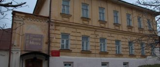
Museum-reserve of S. T. Aksakov
Address: s. Aksakovo, st. Aksakovskaya, 85 Phone: 8 (35352) 5-31-68 Website: aksakov-museum.ru Opening hours: Tue-Sun 10:00-18:00, Fri 10:00-21:00; lunch 13:00-14:00 Cost: children - 20 rubles, adults - 50 rubles; excursions from 150 rub.
The S. T. Aksakov Museum-Reserve is the estate where the writer spent his childhood and part of his youth. In the 1940s, its territory was given over to a machine and tractor station for housing and vegetable gardens for workers. As a result, some buildings were destroyed and some alleys were lost.
Currently, the house and outbuildings have been restored. The property also includes a pond with fishing facilities, a chapel and a park. The museum conducts:
- 18 excursion programs;
- Aksakov Readings;
- theatrical registration of marriages.
Complex "Red Mountain"
Coordinates: 51.827104, 56.372055 Address: Saraktashsky district, village Vasilyevsky Telephone: Website: krasnaya-gora.orensau.ru Cost: 50 rubles. from the car, 10 rubles. per person How to get there: by personal transport or minibus; the nearest settlement is Tatarsky Saraktash (10 min)
On the right bank of the river. Sakmara is the Red Mountain. Its second name is Saraktash, which means “stone sheep.” This is explained by the fact that one day travelers from afar mistook the large stones with which the mountain was strewn for a flock of sheep.
There is a fortress at the top. Red Mountain owes its appearance to the filming of the film “Russian Revolt” based on “The Captain’s Daughter” and “The History of the Pugachev Rebellion” by A. S. Pushkin. All the buildings in the complex are wooden: houses, mills, churches, wells.
After the work was completed, the film set turned into an open-air landscape and ethnographic museum. At its base there is a hotel complex and a restaurant.
Landscape Park Luna
Coordinates: 53.067520, 54.541233 Address: Sharlyk district, Luna village Opening hours and cost: by agreement
The park, located in a small village, was created by local residents. It is located on the shore of the lake and is designed in the style of Novgorod Rus'.
At the entrance there is a large carved gate, behind which one can see wooden houses, gazebos and a mill. The mill, by the way, performs a purely decorative function, but its blades spin in windy weather.
The area is private, but tourists are welcome here.
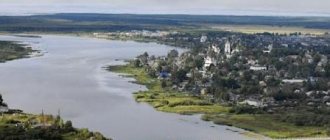
Sakmara River
The river flows through the territory of Bashkortostan and the Orenburg region and flows into the Ural River on the border of the city of Orenburg. It is a full-flowing river with a fairly fast current, rapids and riffles. The water here is cold even in summer. Sakmara is one of the most popular rivers for rafting with a difficult, but at the same time very interesting route, along which in places you can admire steep banks and rocks.
Pike, catfish and chub are found in Sakmara. And along the banks you can meet brown bear, lynx, squirrels and wood grouse. In addition to all this, the nature of the Orenburg region in these places can pamper tourists with thickets of wild raspberries and cherries.