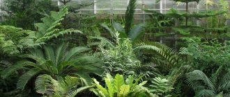
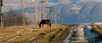
Adyr-Su gorge and Ullu-Tau mountain camp
Away from civilization.
The path of most tourists who decide to experience the beauty of the Elbrus region begins with a visit to the Adyr-Su gorge and the Ullu-Tau alpine camp - it is here that you will receive the first portion of delight from the grandeur and beauty of the places there.
It all starts with a 14-kilometer journey to a height of 1,000 meters on a giant elevator. And immediately behind it are flowering alpine meadows, fresh mountain air and stunning views of Mount Ullu-Tau - the camp site where most travelers stop is named after it.
Be careful: cellular communications will work intermittently, as will your sense of reality - civilization remains far below.
- Where and when: if you like walks in nature, then it is most comfortable to visit the gorge and the alpine camp in the warm season. The starting point is the village of Verkhny Baksan (from here, by the way, tourists get to Lake Syltrankel and to the Yusengi and Tyutusu gorges, more on that below). The village can be easily reached from Nalchik (100 km) or Minvod (160 km);
- Advice: Mount Ullu-Tau and the tourist center of the same name are located in the border zone (Russia-Georgia), so do not forget your identification documents - they will be checked, and also apply for the appropriate pass in advance.
Mentality
In the republic, two peoples have lived together for centuries: Kabardians and Balkars.
They have different languages and different histories. The first are direct descendants of the Circassians and Circassians, the indigenous settlers. They speak Adygebze. The second are relatives of the Karachais, a Turkic-speaking people. So if you speak Tatar or Kazakh, you can understand them. Kabardians are the dominant ethnic group in the republic, while Balkars occupy third position, behind the Russians. Local people, as elsewhere in the Caucasus, are extremely responsive. They will never leave you in trouble and will offer help if needed. Legends were formed about their character. Both Kabardians and Balkars are extremely poetic - they described the courage and generosity of their ancestors in mythical tales - the Nart epic. The Narts are heroic heroes, like our Ilya Muromets, only with a thick beard and no mustache. According to legends, they lived in the lands of the Caucasus and tried to establish peace and order. Legends about fearless warriors testify to the pagan period in the life of the Kabardians and Balkars. Now they profess Islam. There are a lot of villages and auls in the region, where life moves at a leisurely pace. People are engaged in cattle breeding and agriculture. Young people don’t like this way of life, so they move to the capital of the republic - Nalchik. The city is small by Russian standards, but it offers more prospects than a village. By the way, the events of the film “Tightness” took place here. If you love movie trips, then CBD should be the next item on your list.
Djily-Su tract
Healing waters in the depths of the volcano.
If you wanted not only to enjoy the landscapes of the Elbrus region, but also to take care of your health, then this place was created for you. The legendary Djily-Su tract is located on the northern slope of Elbrus, and its name means “warm waters” is not at all accidental.
There are many Narzan mineral springs flowing in this area - with very different temperatures and composition. They are heated by the hot magma of Elbrus, which is actually a dormant volcano. Here you can take healing baths right in the fresh air and try water from a variety of sources, including those with silver.
- Where and when: most often the tract is visited in the warm season, but the healing springs of Djily-Su do not freeze, so you can swim in them in winter. There is a direct road from Kislovodsk (85 km) leading here.
Elbrus
On the border of the Kabardino-Balkarian Republic with Karachay-Cherkessia there is an amazingly beautiful mountain that attracts crowds of climbers who dream of conquering the highest peak in Europe. This mountain is Elbrus. It is an extinct volcano, one of the largest on the planet. The mountain has two peaks - western and eastern, and their height is more than five thousand meters; they are shrouded in snow that does not melt even on hot summer days.
Every year, dozens of climbers climb Elbrus, usually starting their journey from the southern slope. There is a cable car here, and there are hotels and restaurants. The volcano mountain stores natural treasures - healing springs, for example, “Narzan Valley”. The majestic Mount Elbrus is visible from all corners of the region.
Emmanuel's Glade in Jily-Su
Middle Ages in a mountain valley.
When you find yourself in the Djily-Su tract, do not forget to visit this iconic place - it was here, at an altitude of 2500 meters, that the first conquest of Elbrus began almost 200 years ago. In the summer of 1829, the expedition of Russian general Georgy Arsenievich Emmanuel explored the Caucasus mountains and from here began their ascent to the highest point in Russia and Europe.
The clearing was named in honor of Emmanuel; climbers preparing for the ascent gather here to this day - there is a camp, a base for emergency rescue workers and a cafe.
- Where and when: the clearing, like the tract, is more often visited in the warm season. The walk from the tract to the clearing will take about an hour. The road from Kislovodsk also leads here (85 km).
Local cuisine: Khycin, Buza, Gedlibze
Any republic of the Caucasus will offer you baked goods for your table.
However, the Balkars have something special for you. Feel a gastronomic orgasm by tasting khychin: this is the thinnest pie through which you can sometimes see the sunlight. The filling is simple and unpretentious: usually salted cheese with potatoes and herbs, but the dish melts on the tongue. You can even bring it to your home: khychin heated in a piece of butter will taste just as good as fresh. Kabardians will surprise you with an incredibly tasty way of cooking chicken. Poultry with mushrooms, stewed in sour cream and broth, is the calling card of the people. The meat turns out tender, the spices give it a special national flavor. Be sure to try it, because you won’t be able to taste this dish anywhere else - a Kabardian invention.
Alcohol lovers in the CBD will be treated to buza. The drink is very specific: you’re unlikely to make one at home and definitely won’t buy it in a store. Corn or wheat flour is fried in oil and then mixed with sprouted barley. After fermentation, sugar is added and, to create a rich taste, it is kept for about five days. The result is a low-alcohol drink (4-6%), which is a bit like white kvass. The best thing is in the mountains.
Kabardino-Balkaria is amazingly beautiful. Here the mountains hit the sky with their tops, the forests are high, the meadows are endless, and the people are hospitable and responsive. The cuisine conveys all the shades of local nature. It is difficult to single out any attractions here; perhaps this region can be called one big attraction. Not only for Russia, but also for the Earth!
Tyzyl Gorge
In search of Bigfoot.
Perhaps the greenest and most little-known place in Kabardino-Balkaria is the Tyzyl Gorge. Here you will find everything:
- untouched nature with flowering meadows;
- mountain waterfalls (in particular, the largest - Tyzyl-Su);
- caves with fossils;
- sites of ancient people.
The local landscapes are reminiscent of locations from the movie “Jurassic Park” - it feels as if dinosaurs are about to appear from behind the rocks. There have also been legends among the locals for many centuries that Bigfoot lives somewhere here. At least he definitely has somewhere to hide from prying eyes - there are many secret grottoes in the gorge among rocks and streams.
- Where and when: the Tyzyl gorge looks most picturesque in summer. Distance from Nalchik – 60 km, from Kislovodsk – 136 km;
- Tip: remember that the roads here are quite difficult, so tourists usually get to the gorge by jeeping.
Koshtantau
The name comes from the word “Kosh”, which means “dwelling” or “parking”. And if you look at the mountain from a distance, it becomes clear that it looks very much like a tent. Koshtantau is a hard-to-reach mountain, quite high itself. The approximate height of the mountain is more than 5000 meters. It is popular among climbers, despite the danger and possibility of death while climbing it. Clouds seem to float near its majestic peaks, and at dawn the sun paints the mountain in amazing colors.
Yusengi Gorge
Historical pass between nations.
Near the Baksan River you can take an amazing route to the Yusengi Gorge, which is a small but historically important part of the larger Baksan Gorge. It was here, according to popular legend, that in 1942 old men, women and children from the village of Nizhny Chegem walked to the Georgian settlement of Mestia and carried molybdenum ore, thanks to which the tungsten-molybdenum plant continued to operate in Georgia during such difficult times.
The Yusengi Pass is generally considered a significant place for local peoples - since ancient times the Svans (mountain Georgians) and Balkars made crossings here. Today here you can admire the untouched nature, as well as meet various representatives of the local fauna: yaks, aurochs, wild boars, etc.
- Where and when: the hiking route to the Yusengi gorge, which begins on the outskirts of the village of Tegenekli, is popular all year round. Distance from Nalchik – 117 km, from Kislovodsk – 200 km, from the village of Verkhniy Baksan – 14 km;
- Tip: in one day you can visit not only the gorge, but also Lake Syltrankel, which is located relatively close in the same area (read about it below).
Chegem waterfalls
55 km from the city of Nalchik there is a place that amazes with its power and beauty - the Chegem waterfalls, bursting straight out of the rocks. Another name for them was Weeping Falls, because the overall picture gives the impression that the rocks are crying. This natural monument consists of a group of waterfalls on the Kayaarty, Sakal-Tup and Adaisu rivers, which flow into the Chegem River. In this place there was an interweaving of two elements - water and stone, which together were able to form absolutely fantastic landscapes.
Let's start with the Small Waterfall , which is also called the Maiden's Spit. Here you will find a parking lot, cafes, shops, but the waterfall itself is separate, to the side. To get to the waterfall, you need to walk a little along the river, over logs and stones.
And then - him. In a huge well, a powerful column of water falls from a height of about 30 meters. The roar from the waterfall, which is amplified by the echo from the rocks, makes it impossible to talk.
Then it’s very close to the Big Waterfalls. The road itself will be very impressive. The gorge is called Sous Auzu - sharp turns, sheer overhanging cliffs. The width of the gorge narrows in some places to 25 meters.
to the Big Waterfalls very close. On one side there is a market and a cafe, on the other there is a natural attraction.
Or closer
You can look at the waterfalls not only from below, but also from above. There are two viewing platforms here. On different sides from the waterfalls, but accordingly you need to climb the stairs.
For most tourists, especially attractive is the main Chegem waterfall , formed on the Kayaarty River, the water of which flows into the gorge not in one powerful stream, but diverges into a large number of small streams, at the point of fall turning into millions of splashes.
Getting to the waterfalls is very easy; the road is not perfectly smooth, but quite accessible for cars.
With the onset of cold weather, streams of water freeze, turning into bizarre blocks of ice that create the atmosphere of a fairy tale. Multi-ton icicles hang high above the gorge, covered with a kind of ice curtain.
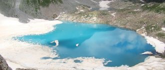
Lake Syltrankel
The most beautiful lake in the Elbrus region.
At an altitude of 3,000 meters exactly between the two mountain peaks Syltran and Mukal there is a “beautiful lake” - this is how “Syltrankel” is translated from Kabardian. And you definitely can’t argue with this: a glacial-type reservoir with a depth of 35 meters and an area of 30 hectares is distinguished by a rich greenish-blue color.
In clear weather, the eastern peak of Elbrus is visible from the shore of the lake. The reservoir is covered with ice for 10 months of the year, making it especially beautiful in winter. In the warm season, flowers and shrubs bloom among the rocks, which wild goats come to feast on.
- Where and when: tourists visit the lake all year round. Distance from Nalchik – 74 km, from Kislovodsk – 66 km;
- Tip: the lake can only be reached on foot along the path leading from the village of Verkhniy Baksan. The 10km path often has a steep upward angle, so be prepared for some physical challenge. This trekking route is not easy.
Monument “Forever with Russia”
Before the formation of the Republic of Kabardino-Balkaria, there were separate historical regions - Kabarda (Big and Small) and Balkaria. This region of Kabarda was annexed to the territory of Russia more than 400 years ago. And on the anniversary of the entry of these lands into Russia, the monument “Forever with Russia” was erected. The architect is V. Oltarzhevsky, the work was done by sculptors S. Makhtin and M. Listopad. The monument embodies the image of the Motherland, the image of a woman who gives peace to her people. At the bottom of the monument you can see bas-reliefs telling about important events in the history of the republic.
Location: Nalchik, 400th Anniversary Square.
Tyutusu Gorge
A hidden gem.
The unique and wild Tyutusu gorge is quite difficult to find; tourists rarely go there and even locals rarely walk along the valley. This is precisely why such a place is valuable.
There are different versions of the origin of the name of the Tyutyusu gorge: from Balkar this word may be consonant with “tyurtyu” - “barberry” and also “tyutyun” - “smoke”. Both options are quite fair: in summer you can actually pick a lot of berries in the gorge (including barberry), and the nearby Tyutyu Mountain is almost always shrouded in a haze of fog.
It is highly recommended for lovers of unexplored places to visit.
- Where and when: this gorge is best visited in summer or autumn. The nearest settlement is Verkhniy Baksan (15 km). Distance from Nalchik – 90 km, from Kislovodsk – 180 km.
Arc “Forever with Russia”
The theme of annexing the area of Kabarda and Balkaria into Russia runs through many architectural structures throughout the republic. In the capital of Kabardino-Balkaria, the city of Nalchik, a memorial arch was installed, its name is “Forever with Russia”, sometimes it is called the Arch of Friendship. It was located at the entrance to Nalchik on the road from Pyatigorsk. For ten years now, since 2007, it has served as a decoration of the city and has become one of the main attractions.
Location: Nalchik, Idarova street.
Bezengi
Caucasian Himalayas.
This region of Kabardino-Balkaria is the highest part of the Caucasus Mountains; five of the seven peaks of the Caucasus are located here, which reach a height of more than 5,000 meters. These mountains are covered with eternal glaciers (the main one and the largest in Russia gave the name to the entire mountain region), and for their severity and difficulty in overcoming they received the nickname “Small Himalayas” from climbers.
Here, at the intersection of two gorges, from which the Northern Massif and the Bezengi Wall (13 km long) begin, there is a large mountain camp of the same name “Bezengi”. This area is one of the most beautiful and majestic places in the entire Caucasus!
- Where and when: tourists visit the area and the alpine base all year round. The camp can be reached by transfer from Nalchik (100 km);
- Advice: firstly, you won’t be able to get to the mountain camp in a regular passenger car on mountainous off-road terrain, use a transfer. Secondly, the Bezengi base is located in the border zone of the Russian Federation, so for the trip you will need to issue a special pass, read the details here.
Dykhtau
Translated as “Steep Mountain”. It is considered the second highest after Elbrus. There are two high peaks, more than 5000 m. You can also highlight Pushkin Peak. There are more than 10 routes laid by climbers. The Bezengi climbers camp is also located there.
Dyrchau is also sometimes called the “Jagged Mountain”. When compared with Elbrus, the mountain does not look too huge. However, compared to others, she is quite formidable. Its slopes are covered with snow that does not melt, and there are also hanging glaciers. The path to the top is very difficult.
A funny fact - this place is also sometimes called the presidium in the Caucasus, since it is here that all the highest mountains - five thousand meters high - seem to have specially gathered, but Kazbek and Elbrus are missing.
Ushtulu Valley
Middle Ages in a mountain valley.
Near the village of Upper Balkaria there is a valley and the Ushtulu gorge of the same name - a picturesque place little known to tourists. People have lived in this region for a long time - at the end of the 19th century, mummies were even found in crypts here.
Also here you can explore the ruins of ancient villages (the mummies belong to their former inhabitants). As for the Ushtulu Valley itself, here you will see many representatives of the local flora and fauna, and you can also relax in cozy guest houses.
- Where and when: the Ushtulu valley, like the village of Upper Balkaria, can be visited at any time of the year. The distance from Upper Balkaria to the valley is 25 km, the distance of the region to Nalchik is 55 km;
- Tip: Upper Balkaria and the Ushtulu Valley are located near the Bezengi region (about 50 km), so when planning your trip, you can alternately devote 1-2 days to each of these points.
Cultural sites: Upper Balkaria, City of the Dead, One Hundred Steps to Kaisyn
Kabardino-Balkaria is a predominantly natural region. There are not as many cultural sites here as in other regions of Russia. However, the republic compensates for this small omission with its landscapes. Nevertheless, history buffs have something to see in the CBD. Move towards Upper Balkaria - there are many towers and ruins of the 9th century. It's not for you to climb through abandoned rubbish! Archaeologists are conducting excavations here, which are helping to find new features of the culture of local peoples. Residents of the republic also associate a terrible tragedy with Upper Balkaria. In 1944, the NKVD mistakenly accused local residents of aiding the Nazis, for which Balkars were deported en masse to other republics. The order was merciless:
“Destroy everything that can revive the soil for banditry. Do not show pity under any circumstances... During hostilities, take hostages.”
Therefore, Upper Balkaria has such cultural and memorable value for all local residents.
The City of the Dead is several necropolises in the village of Eltyubyu. The first burials here date back to the 10th century. There are several versions of the appearance of crypts. First: it is inconvenient to dig ordinary graves in the mountains. I think that the theory is simple and practical, like five kopecks. The second is more interesting from a historical point of view. At that time, Zoroastrianism was widespread in the Caucasus. According to the customs of this religion, the deceased cannot be burned or buried - this way you desecrate the two dominant elements - fire and earth. That's why people made crypts. By the way, some of them are decorated according to Muslim traditions. Apparently, the new religion was not able to supplant the old funeral customs, because some of the tombs date back to the 15th century. You probably know the feeling when you can’t part with a forgotten thing for a long time.
However, there are also architectural objects in the CBD that are not related to death. The poet Kaisyn Kuliev was born and raised in Eltyubyu. His work is an important aspect of the cultural life of the USSR. That’s why people’s love was manifested by the creation of the “One Hundred Steps to Kaisyn” memorial. This is a brilliant idea: the house where the famous poet was born is led by a wall where his poems are carved. You go, look at the nature that Kuliev admired, and read his poems. You immediately feel unity with the author - as if you are looking at the surroundings through his eyes. The road of life and creativity of Balkar pride.
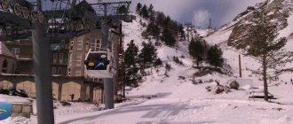
Cheget
One of the popular places in the republic is a mountain range located 5 km south of Elbrus. The most beautiful peaks of Cheget rise above 3.5 km above sea level. Modern Cheget is a famous ski resort. The ski area here is huge, and the level of difficulty is more suitable for experienced skiers than for beginners.
These are extreme trails for everyone who cannot do without risk and a dose of adrenaline.
Tourists are served by ski lifts. Many people get to the high-mountain cafe “Ai” and enjoy stunning views of the Caucasian ridges and peaks from the observation deck.
Amirkhan Tower
In the Cheget glade there are several comfortable hotels for those who want to spend a few days in the mountains. The big plus is that the comfortable accommodation is just a 5-minute walk to the ski lifts. There are cafes, restaurants, bars and disco clubs here. The ski season begins in November and ends in May.
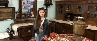
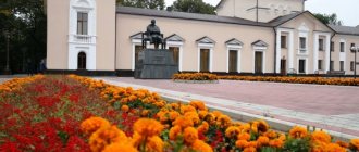
National Museum of the Kabardino-Balkarian Republic
The National Museum of the Kabardino-Balkarian Republic is located in its capital - the city of Nalchik. This is the main center of all local history in the region. There are clubs on history and local history, and there is also a library, excursions are held, and lectures are given.
The museum has seven exhibition halls and three exhibition halls. And the museum’s fund is divided into six collections, among them: archaeological, ethnographic, written sources, precious metals and weapons, nature, fine arts and photo libraries. The museum also hosts temporary exhibitions on various topics.
The museum is open daily except Mondays, opening hours are from 10.00 to 18.00. The museum is the best place to learn about the history of the area.
Location: Nalchik, Gorky street - 62.
Climbing routes
For beginners, climbing Elbrus along the southern slope is optimal. The route starts at Polyana Azau. The lift takes tourists to the Gara-Bashi station, located at an altitude of 3847 m, in one hour. Anyone can climb to the Oblique Shelf at an altitude of 5100 m by snowcat. For those who want to test themselves, it is better to overcome this stage on their own, without the use of technical means.
The southern route passes by Shelter 11 (4130 m) and Pastukhov Rocks (4700 m), which are named after the famous Russian climber Andrei Pastukhov. Next you will have to overcome the Col at an altitude of 5300 m. This part of the route is quite simple. But at the final stage you will have to work hard. To conquer Elbrus, you need to overcome a fairly steep climb. But the view from the Western peak is stunning!
Photo: Climbers training
The northern slope of the mountain is considered more difficult. The route is designed for trained climbers. Climbing to the top along the classic path of pioneers is not an easy task. This route is most often used to conquer the Eastern Peak. The glacier begins at an altitude of 3800 m, so you will need crampons here. At the Lenz Rocks at an altitude of 4800 m you will have to stop for a rest to acclimatize. Having gained strength and gotten used to the thin air, you can storm the summit.
On the eastern side of Elbrus there is a route along the Achkeryakol lava flow. This is a rather long and difficult climbing option. The route goes through Irik-Chat (3667 m) - one of the most beautiful passes in the Elbrus region. From here you have an excellent view of the lava flow and the Jikauchenquez ice plateau. The object of conquest is the Western Peak.
The name “Wild West” best suits the western slope of Elbrus. This is an option for extreme sports enthusiasts. Civilization has bypassed these places - there are no snowcats or ski lifts here. It is chosen by tourists in good physical shape, since all equipment from start to finish will have to be carried in backpacks. The victory is celebrated on the Western Peak.
Photo: Avalanche trail
For those who climb, there are shelters in the mountains. This is the name for places where you can hide from bad weather, relax, and spend the night. The first shelter on Elbrus appeared in 1909 at an altitude of 3200 m. It could accommodate only five people. In 1932, the “Shelter of the Eleven” appeared at an altitude of 4200 meters. It could already accommodate 40 people. Then the Saddle and Shelter of Nine shelters opened. They are still in effect today.
From the new shelters follows Fr. A dozen six-bed cylindrical houses are located near the Gara-Bashi station at an altitude of 3847 m. This is the most popular starting point for climbers before the assault on Elbrus. Nearby are the Hassan shelter for 12 people and the Kotelnaya shelter, which accommodates up to 50 people. On the southern side there are shelters Shuvalova, “Maria” and “Esen”.
“LeapRus” is considered the highest mountain comfortable shelter. It is located on the southern slope at an altitude of 3900 m and can accommodate 48 people. It has all the delights of civilization - heating, hot water and lighting. Electricity for tourists is provided by solar panels.
Photo: High-level mountain hotel
There is no bad weather
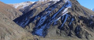
The Elbrus region is characterized by sudden changes in weather. On average, cycles last about a week. Good weather gives way to bad weather, then idyll reigns again. In the first half of summer, rain is a frequent visitor. At an altitude of up to 2000 m, the maximum temperature can reach +35. The average temperature is much lower. It decreases further with height. However, this is enough to slightly melt the glaciers. They give rise to such large rivers as the Kuban, Malka and Baksan.
Photo: Summer in the mountains
Autumn in the mountains begins in the second half of August, and winter at an altitude of more than 2000 m can come as early as October. The average January temperature is -12, but drops sharply with altitude. Because of this, Elbrus is called “Little Antarctica”. For every 200 m of ascent, the temperature decreases by one degree. In winter there is severe frost at the top. The temperature can drop to -40, and the wind speed, on the contrary, can increase to 40 m/sec! Such harsh conditions prevail at altitudes above 4000 m.
Most snow falls on the southern slopes. The northern side is less snowy. The average thickness of snow cover is 0.8 meters. The beginning of spring in the mountains occurs in the first half of May. During this period, at an altitude of up to 3000 m, the snow actively melts and comes down in the form of wet avalanches. The bright sun poses a danger all year round. To save yourself from an overdose of ultraviolet radiation, you need to have a protective cream and dark glasses.
Photo: Most snow falls on the southern slopes
Climatic conditions determine the specifics of the fauna and flora of the Elbrus region. The mountains are home to Caucasian aurochs, chamois, and roe deer. There are wild boars at the foot. If you're lucky, you might see yaks on the slopes. They tried to breed them artificially, but the experiment was unsuccessful. In the forests there are moose, jackals, wolves, and foxes. The belt of alpine meadows is favored by the Caucasian grouse, mountain turkey, stone partridge, as well as feathered predators - black vulture, eaglet, golden eagle and others. You should be wary of vipers, although the mountaineers claim that meeting one is lucky!
Photo: Yak
Monument to Mikhail Yuryevich Lermontov in Nalchik
The famous Russian poet, Lermontov M.Yu., glorifying the nature of the Caucasus in his works, earned special respect and love from the local residents of Kabardino-Balkaria.
In the city of Nalchik, starting a walk through the largest park in the North Caucasus, called Atazhukinsky Garden, at the entrance you can see a monument to the greatest poet, the hero of his time.
The monument to Lermontov was created by the sculptor Arsen Guchapshev and the architect Asya Midova. The monument is made of red granite, about three meters high, roughly processed, with a bronze bas-relief of the poet attached to it. Looking at the monument to the poet, one involuntarily recalls all his works, praising and very well describing the wonderful nature of the mountains.
Monument to the “Heroes of the Elbrus Defense”
The events of the Great Patriotic War affected every resident of our country. Monuments and memorial signs have been erected everywhere to the grandiose exploits of great heroes. The Republic of Kabardino-Balkaria, where fierce fighting took place, is no exception. To all those who died, not sparing their lives, defending the slopes of Elbrus, a monument to the “Heroes of the Defense of the Elbrus Region” was erected.
The monument is represented by aluminum steles of different heights; the names of 219 Heroes who died in battles are indicated on them. The design of the monument belongs to V. Savostikov, V. Korneev, N. Kravchenko, and it was installed in 1986, on May 9. Every year, on memorable dates, flowers are laid here as a sign of gratitude for a calm life and peace, in memory of the fallen soldiers.