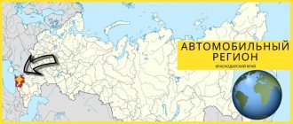
The code 23 of the Russian region is assigned to the Krasnodar Territory, geographically located in the southwest of the Russian Federation . The territorial entity has land borders and access to the sea. In terms of the number of residents at the beginning of 2020, the territory occupied 3rd position among other regions of the Russian Federation .
Main city
The capital is Krasnodar (called Ekaterinodar until 1920), built on the right bank of the Kuban River. The city is located at a distance of 120 km from the Black Sea coast, the distance from Moscow is 1300 km (by road, in a straight line - 1192 km). The number of residents, including suburbs, at the beginning of 2022 is more than 1022 thousand.
The city was founded as a fortified area at the end of the 18th century and received its original name in honor of Empress Catherine II, who donated land for the construction of the first fortress.
Recommendations
Notes
- President of Russian Federation. Decree No. 849 of May 13, 2000 “On the Plenipotentiary Representative of the President of the Russian Federation in the Federal District.” Entered into force on May 13, 2000. Published: “Collection of Legislation of the Russian Federation”, No. 20, Art. 2112, May 15, 2000 (Decree of the President of the Russian Federation of May 13, 2000 No. 849). On the plenipotentiary representative of the President of the Russian Federation in the federal district
. Effective May 13, 2000). - Gosstandart of the Russian Federation. No. OK 024-95 December 27, 1995 “All-Russian classifier of economic regions. 2. Economic regions,” ed. Changes No. 5 / 2001 OKER. (Gosstandart of the Russian Federation. No. OK 024-95 December 27, 1995. Russian classification of economic regions. 2. Economic regions
, as amended by Amendment No. 5/2001 OKER.). - Law No. 5-KZ
- Azarenkova et al., p. 114
- Charter of the Krasnodar Territory, article 13
- Charter of the Krasnodar Territory, Chapter 24
- Official website of the Krasnodar region. Biography of Alexander Nikolaevich Tkachev, Governor of the Krasnodar Territory (in Russian)
- Charter of the Krasnodar Territory, article 39.
- Federal State Statistics Service (Federal State Statistics Service) (May 21, 2004). Territory, number, settlements and rural administrations by constituent entity of the Russian Federation ( Territory, number of districts, settlements and rural administration by constituent entity of the Russian Federation
)".
All-Russian Population Census of 2002 (All-Russian Population Census of 2002)
(in Russian). Federal State Statistics Service. Retrieved November 1, 2011. - ^ a b c d
Federal State Statistics Service of Russia (2011).
“All-Russian Population Census 2010. Volume 1" [All-Russian Population Census 2010, vol. 1]. All-Russian Population Census 2010 [All-Russian Population Census 2010]
(in Russian). Federal State Statistics Service. - "26. The size of the permanent population of the Russian Federation by municipalities as of January 1, 2022.” Federal State Statistics Service. Retrieved January 23, 2022.
- "On the calculation of time." Official Internet portal of legal information
(in Russian). June 3, 2011. Retrieved January 19, 2022. - An official throughout the Russian Federation in accordance with Article 68.1. Constitution of Russia.
- ^ a b
Official website of the Krasnodar region. General information about the region Archived October 11, 2022 Wayback Machine (in Russian) - ^ a b c d f f gram hour i j k
Gorshenev - WWF. Central Asia: South-West Russia and the Crimean Peninsula on the Black Sea coast.
- Solnick, Stephen (29 May 1996). “Asymmetries in trading in the Russian Federation” (PDF). National Council of Soviet and East European Studies
: 12. - Chuman, Mizuki. "The Rise and Fall of Power-Sharing Agreements between Center and Regions in Post-Soviet Russia" (PDF). Democratization
: 146. - Filipov, David. “Russia spent $50 billion on the Sochi Olympics.” Washington Post
. Retrieved February 4, 2022. - "Industry of the Krasnodar region." investinregions.ru
. Retrieved November 7, 2022. - Krasnodar regional territorial branch of the Federal State Statistics Service. Population (in Russian)
- Federal State Statistics Service of Russia (May 21, 2004). “The population of Russia, the constituent entities of the Russian Federation as part of federal districts, urban settlements, urban settlements, settlements, settlements of 3 thousand or more people.” [Population of Russia, its federal districts, federal subjects, districts, urban settlements, rural settlements - administrative centers, rural settlements with a population of more than 3000 people] (XLS). All-Russian Population Census of 2002 [All-Russian Population Census of 2002]
(in Russian). - “All-Union Population Census of 1989. The current population of union and autonomous republics, autonomous regions and districts, territories, regions, urban settlements and rural district centers” [All-Union Population Census of 1989: current population of union and autonomous republics, autonomous regions and districts, territories, regions, districts, urban settlements and villages that are district administrative centers]. All-Union Population Census of 1989 [All-Union Population Census of 1989]
(in Russian).
Institute of Demography of the National Research University: Higher School of Economics [Institute of Demography of the National Research University: Higher School of Economics]. 1989 - via Demoscope weekly
. - Census 2010: there are more Russians. Census-2010.ru (12/19/2011). Retrieved July 7, 2012.
- Federal State Statistics Service of Russia
- ^ a b c
"Arena: Atlas of religions and nationalities of Russia." Wednesday, 2012.
. “Ogonyok”, No. 34 (5243), 08/27/2012. Retrieved 04/21/2017. .- ^ a b c d f
"Flash floods in Russia: 144 people died in the Krasnodar region."
BBC News
. London. July 7, 2012. Retrieved July 7, 2012. - ^ a b c
Elder, Miriam (July 9, 2012).
"Russian floods killed 150 people and left thousands homeless." The keeper
. London. Retrieved July 9, 2012. - ^ a b c d f
"More than 100 people died in Russia from floods and landslides in the Krasnodar region."
The keeper
. London. July 7, 2012. Retrieved July 7, 2012. - ^ a b
"Vladimir Putin flies to flood-hit southern Russia as death toll rises."
The keeper
. London. July 8, 2012. Archived from the original on July 10, 2012. Retrieved July 9, 2012.
Sources
- Legislative Assembly of the Krasnodar region. Law No. 5-KZ of May 5, 1995 “On the symbols of the Krasnodar Territory,” as amended. Law No. 2957-KZ of May 8, 2014 “On Amendments to the Law of the Krasnodar Territory” On the Symbols of the Krasnodar Territory “”. Entered into force on May 31, 1995. Published: “Kuban News”, No. 87, May 24, 1995 (Legislative Assembly of the Krasnodar Territory. Law No. 5-KZ of May 5, 1995. On the symbols of the Krasnodar Territory
As amended by the Law of 05.08. 2014 No. 2957-KZ.
On amendments to the Law of the Krasnodar Territory “On the symbols of the Krasnodar Territory”.
Effective from May 31, 1995). - “Charter of the Krasnodar Territory”, ed. Law No. 2870-KZ of December 30, 2013 “On Amendments to the Charter of the Krasnodar Territory.” Published: “Kuban News”, November 10, 1993 ( Charter of the Krasnodar Territory
As amended by the Law of December 30, 2013 No. 2870-KZ.
On amendments to the Charter of the Krasnodar Territory
.). - Gorshenev, M. A. (1983). Traveling around the Krasnodar region (in Russian). Physical education and sports.
- Azarenkova, A. S.; I. Yu. Bondar; N. S. Vertysheva (1986) [1986]. The main administrative and territorial transformations in Kuban (1793–1985)
(in Russian). Krasnodar book publishing house.CS1 maint: several names: list of authors (link)
Vehicle code
Civilian and military vehicles undergoing initial registration since the mid-90s. last century, received signs with code 23 (which region is encrypted with the code can be found out in reference books that are freely available). The plates have standard sizes; starting from 2022, it is possible to produce license plates according to the American or Japanese standard (in accordance with the landing area on the rear of the body).
The license plate allows you to determine whether it is the 23rd or 123rd region, but it is impossible to find out which city it is. The plates are sent to regional MREO traffic police departments in a random sequence in packs of 100 pieces; reference to a populated area is not provided. On some cars in the Krasnodar Territory , region 93 is registered; the driver can find out in which region of Russia the registration actions were carried out. But where the car came from by the number; information must be requested through official channels in the traffic police.
On September 13, 1937, the Krasnodar region was formed as a result of the division of the Azov-Black Sea region into the Rostov region and the Krasnodar region with a territory of 85 thousand square meters. km (with the Adygea Autonomous Region).
But this is an administrative date, the history of these lands goes back to ancient times...
In ancient times
Despite the proximity of the Black and Azov seas and the richness of natural conditions, before joining Russia this region was little developed - this was hampered by regular raids of nomads. The first permanent settlements began to be founded here 10 thousand years ago, as evidenced by numerous dolmens located in different places in the Krasnodar Territory, as well as in Transcaucasia.
Dolmens are giant stone tombs of various shapes, although it is still not entirely clear whether they are really tombs or structures for religious purposes. The Russian-speaking population that appeared in the North-West Caucasus in the 19th century called dolmens “heroic huts”, “didovs” or even “devil’s huts”. They were first discovered in the 18th century, but most of them are not under state protection and suffer from vandals.
In ancient times, there were colonies of ancient Greeks on the territory of the modern Krasnodar Territory, and in the middle of the 2nd century BC. Adyghe tribes settled here. In the Middle Ages, Genoese merchants also founded their colonies in this region, who got along well with the Circassians; Turks also lived here.
In the 10th century, the city of Tmutarakan was founded on the Taman Peninsula; this was the first Slavic settlement in these lands. The city existed until the Mongol-Tatar invasion.
At the end of the 15th century, Türkiye became the unchallenged ruler of the Black Sea. In Kuban, wars with nomads stopped. But the Nogais roamed the steppes of the right bank of the Kuban. Circassians settled in the foothills along the Black Sea.
"Nekrasovtsy" in Kuban
The second wave of settlers began with the arrival of the “Nekrasovites” - Cossacks under the leadership of the Cossack leader Ignat Nekrasov - to Kuban.
In the fall of 1708, after the defeat of the Bulavin uprising, part of the Don Cossacks, led by Ataman Nekrasov, went to Kuban. Then this territory belonged to the Crimean Khanate. According to various sources, from 2 thousand to 8 thousand Cossacks with their wives and children left with Nekrasov (this is approximately 500-600 families). They united with the Old Believers Cossacks who had previously left for the Kuban and formed the first Cossack army in the Kuban, which accepted the citizenship of the Crimean khans and received broad privileges. Runaways from the Don, as well as ordinary peasants, began to join them. The Cossacks of this army were called “Nekrasovtsy”, although it was very heterogeneous.
The “Nekrasovites” first settled in the Middle Kuban (on the right bank of the Laba River), near the modern village of Nekrasovskaya. But then a significant majority, including Nekrasov himself, moved to the Taman Peninsula (near Temryuk) and founded three towns: Bludilovsky, Golubinsky and Chiryansky.
But since the “Nekrasovites” made constant raids on the Russian border lands, they began to fight them. After the death of Ignat Nekrasov, they were offered to return to their homeland, but to no avail, then Empress Anna Ioannovna sent troops to Kuban, and in 1791 the last “Nekrasovites” left for Bessarabia and Bulgaria.
Reign of Catherine II
During the reign of Catherine II, the colonization of the Kuban and the Caucasus began. Catherine’s plans included the empire’s access to the Black Sea and the conquest of the Crimean Khanate, but the constant confrontation with Turkey complicated the implementation of this plan. When the Crimean Khanate fell, relations between the Nogais and Circassians in the Kuban worsened, they began to raid each other.
In 1774, after the conclusion of the Kuchuk-Kainardzhi Treaty, Russia gained access to the Black Sea and Crimea.
In this regard, there was no longer a need to preserve the Zaporozhye Cossacks. In addition, their traditional way of life often led to conflicts with the authorities. After the Cossacks supported the Pugachev uprising, Catherine II ordered the disbandment of the Zaporozhye Sich, which was carried out by General P. Tekeli in June 1775.
In 1778, Lieutenant General Alexander Vasilyevich Suvorov was sent to pacify the Russian border. On the right bank he built several fortresses for defense against the highlanders, established friendly relations with many Circassian princes, this stopped mutual raids for some time.
Suvorov divided the population of the Kuban region into robbers and the main part of the people living in peaceful labor. He reported: “No peoples have been observed arming themselves against Russia, except for a certain very small number of robbers, to whom, according to their craft, it does not matter whether they rob a Russian, a Turk, a Tatar, or one of their own fellow inhabitants.”
After the annexation of Crimea to Russia, in 1783, Suvorov again visited Kuban, where he swore an oath of allegiance to the Nogai tribes, then suppressed the rebellion of the Nogais, who then moved to the steppes of Stavropol.
Suvorov's first visit to Kuban lasted only 106 days, but during this time he was not only able to build a demarcation cordon line 500 miles long (from the Black Sea to Stavropol), but also fulfill the mission of a peacemaker. Leaving Kuban, Suvorov reported: “... I leave this country in complete silence.”
He always taught his soldiers peace and harmony, did not tolerate looting, was a tolerant person, and he was surrounded by representatives of different nations: Ukrainians, Poles, Georgians, Armenians, representatives of small Caucasian peoples. He assessed people not by nationality, but by their deeds, intelligence and loyalty to Russia.
In 1787, Catherine II, together with Potemkin, visited Crimea, where she was met by the Amazon company created for her arrival; in the same year, the Army of the Faithful Cossacks was created, which later became the Black Sea Cossack Army. In 1792, they were granted Kuban for eternal use, where the Cossacks moved, founding the city of Ekaterinodar.
Founding of Ekaterinodar
Ekaterinodar was founded in 1793 by the Black Sea Cossacks, first as a military camp and later as a fortress. The city received its name in honor of the gift of the Kuban land by Empress Catherine II to the Black Sea Cossacks (Ekaterinodar - Catherine's Gift). Since 1860 it has been the administrative center of the newly formed Kuban region. Ekaterinodar received city status in 1867, and with the holding in the 70-80s of the 19th century. railway in the North Caucasus (Tikhoretsk - Ekaterinodar - Novorossiysk), it turned into a large commercial, industrial and transport center of the North Caucasus.
Kuban in the 19th century
In the 19th century, Kuban began to actively develop. In the 2nd half of the 19th century. Kuban industry is developing especially rapidly.
Kuban Cossacks in the 19th century. fulfilled their main task - military service in the Russian army. Each of the Cossacks going into service purchased a horse, bladed weapons, and uniforms at their own expense.
During the Russian-Turkish War in 1877-1878. Kuban Cossacks were part of the active Russian army.
Kuban in the 20th century
In November 1917 - January 1918, Soviet power was established in the Black Sea region, and then throughout the Kuban, but the Red Guard units were able to capture Ekaterinodar only a month later, but the assault on the capital of Kuban ended with the death of L.G. Kornilov. Denikin, at the head of the Volunteer Army, went to the Salsk steppes.
The small working class and peasantry welcomed the first steps of Soviet power. But the abolition of estates, redistribution of land and requisition of food affected the interests of the Cossacks, who supported General Denikin, who led the Second Kuban Volunteer Campaign in August 1918. He rode into Yekaterinodar on a white horse, and units of the Red Taman Army were cut off and fought their way along the Black Sea coast (“Iron Stream”) for a month before joining the North Caucasus Army.
From April 1917 to March 1920 (with a six-month break), the Cossack government was in power in the Kuban, choosing its own third path. The confrontation between the Rada and the command of the White Army cost the life of its chairman N.S. Ryabovol. Kuban tried to join the League of Nations, but this ended in the dispersal of the Rada. After this, mass desertion of Kuban residents from the Denikin front began.
In the early 1920s, the Red Army, together with the red-green detachments, transformed into the Red Army of the Black Sea Region, liberated cities and villages.
In the Danube Army on the Balkan Peninsula there was a cavalry regiment, two squadrons and two hundred plastuns.
In the 19th century The social composition of the population is radically changing. Peasants freed from serfdom began to arrive in the region from the central regions. The share of the “non-resident”, non-Cossack population begins to increase. The Black Sea coast is being populated en masse, and new Cossack villages are being formed in the Trans-Kuban region.
Wrangel's attempt in August-September 1920 to land troops and develop a new offensive ended in failure.
Soviet power was restored and the transformation of war communism began. A “small” civil war broke out (1920-1924) with the abolition of the Kuban Cossack army, confiscations and food detachments on the one hand. On the other hand, workers’ support for the Mensheviks, uprisings, and the White-Green campaign against Krasnodar. The situation temporarily stabilized only under the NEP. In 1920, Ekaterinodar was renamed Krasnodar.
But already in 1927, the collapse of NEP began. And in the winter of 1928-1929. Stalin's policy of dispossession began. By the summer of 1931, collectivization in the region was completed. The drought of 1932 made it impossible to fulfill the state grain procurement plan, and the expectation of an upcoming famine forced the peasants to hide part of the harvest. To investigate the “kulak sabotage”, the Extraordinary Commission of the Politburo of the Central Committee of the All-Union Communist Party of Bolsheviks, headed by L.M., arrived in the North Caucasus. Kaganovich. The curtailment of trade began with the removal of goods from stores, the early collection of all loans, the arrests of “enemies” - as a result, 16 thousand Kuban residents were repressed, 63.5 thousand were evicted to the northern regions. The rebellious Cossack villages were renamed. It all ended in famine, from which up to 60% of the population died in the villages. But the 1933 harvest provided an opportunity to overcome the crisis.
Following the February-March plenum of the Central Committee of the All-Union Communist Party of Bolsheviks in 1937, great terror began in the region: every tenth worker or employee, every fifth collective farmer, every second individual farmer was repressed. 118 military personnel, 650 people, were subjected to repression. clergy.
In 1932-1933. A massive famine began in the region, which is believed to have been created artificially for the sake of the idea of complete collectivization.
And on September 13, 1937, the Azov-Black Sea region was divided into the Rostov region and the Krasnodar region.
Currently, the Krasnodar Territory is a subject of the Russian Federation in the south of the European part of Russia and is part of the Southern Federal District.
It borders with the Rostov region, Stavropol Territory, Karachay-Cherkessia, Adygea and the Republic of Abkhazia. It borders by sea with Crimea.
The administrative center is the city of Krasnodar.
The population of Kuban is 5.6 million people. The region is headed by the head of administration (governor) of the Krasnodar Territory Veniamin Ivanovich Kondratyev.
Andrey Eremenko Candidate of Cultural Studies, Associate Professor, Head of the Department of History, Ethnography and Nature, KGIAMZ
Coat of arms of the region
The coat of arms contains a green central shield with an image of a fortress, behind is a golden shield with a black imperial eagle. On top of the shields is a stylized princely cap , and along the lower edge there is a double ribbon of the Order of Lenin (introduced in 2004). For the image on the flags, a simplified version of the coat of arms is used (golden color with black ornaments).
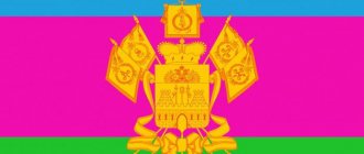
Flag of the region
Since the spring of 1995, a flag of 3 horizontal stripes of blue, crimson and green has been used as a flag ( where the outer stripes are 2 times narrower than the central one). In the center is a golden-colored coat of arms (depending on the date of manufacture of the flag, the coat of arms may have an old or new look). The color combination of the cloth corresponds to the symbolism of the Kuban Cossacks.
Kuban in the 19th century
In the 19th century, Kuban began to actively develop. In the 2nd half of the 19th century. Kuban industry is developing especially rapidly.
Kuban Cossacks in the 19th century. fulfilled their main task - military service in the Russian army. Each of the Cossacks going into service purchased a horse, bladed weapons, and uniforms at their own expense.
During the Russian-Turkish War in 1877-1878. Kuban Cossacks were part of the active Russian army.
In the Danube Army on the Balkan Peninsula there was a cavalry regiment, two squadrons and two hundred plastuns.
In the 19th century The social composition of the population is radically changing. Peasants freed from serfdom began to arrive in the region from the central regions. The share of the “non-resident”, non-Cossack population begins to increase. The Black Sea coast is being populated en masse, and new Cossack villages are being formed in the Trans-Kuban region.
Nationalities
Conducted in 2002 and 2010. All-Russian population censuses made it possible to determine the national composition of the inhabitants of the territory; the data (in% of the total) are presented in the table . The reporting did not include citizens who refused to indicate their nationality or found it difficult to answer. Nationalities numbering less than 0.1% of the total population are not listed.
| Nationality | Data 2002, % | Data 2010, % |
| Russians | 86,3 | 88,2 |
| Ethnic Cossacks | 0,3 | 0,1 |
| Armenians | 5,4 | 5,5 |
| Ukrainians | 2,6 | 1,6 |
| Greeks | 0,5 | 0,4 |
| Belarusians | 0,5 | 0,3 |
| Tatars | 0,5 | 0,5 |
| Georgians | 0,5 | 0,3 |
| Ethnic Germans | 0,5 | 0,2 |
| Adyghe people | 0,4 | 0,3 |
| Turks | 0,3 | 0,2 |
| Azerbaijanis | 0,3 | 0,2 |
| Gypsies | 0,1 | 0,3 |
| Ossetians | 0,1 | 0,1 |
Transport
The region has a developed transport network, represented by:
- airports capable of receiving large aircraft;
- highways of federal and local subordination;
- railways belonging to the North Caucasus branch of Russian Railways;
- seaports providing import and export of various goods and raw materials.
Air
The region, with its center in Krasnodar, is distinguished by a developed network of airports united under the auspices of the BAZEL Aero group. Airfields in Krasnodar (among the top 10 largest in Russia in terms of passenger flow), in the cities of Anapa and Sochi are classified as international, and there are local airfields in Gelendzhik and Yeisk.
Automotive
The following roads pass through the territory :
- federal highway M4 , connecting the capital of the Russian Federation with the cities of Krasnodar and Novorossiysk;
- highways P217 , A290 and 147 , allowing car to travel both within the region and to get to cities in neighboring regions;
- local highways A146 , A148 and P253 .
Railway
Railway tracks on the territory of the entity with region code 23 are the property of Russian Railways. There are transit routes that allow you to transport goods and people to neighboring territories and regions , as well as to the Republic of Crimea. There is a narrow-gauge Absheronskaya road, used for the delivery of goods and of interest to tourists.
Water
Krasnodar Territory with region number 23 , which has access to the Black and Azov Seas, has a developed water transport network. The port cities of Yeisk, Taman, Anapa, Novorossiysk and a number of others are located in the coastal zone. Ports account for about 40% of Russian freight transport by sea and river routes. The region is a major transshipment point on the route of Russian oil exports.
Floods 2012
Main article: 2012 flood in Russia
On July 7, 2012, at least 171 people died in the Krasnodar region as a result of heavy rains overnight, causing the worst flooding and landslides in more than seventy years.[28][29] More than 280 millimeters (11 inches) of rain was reported to have fallen in forty-eight hours, a typical amount for a four- or five-month period.[30] A local police spokesman said most of the dead were in the Krymsk region, where at least 159 people were killed when a 5-meter (16 ft) high wave of water swept through the town of Krymsk in the middle of the night.[29][30] Another ten deaths occurred in Gelendzhik, including five who were electrocuted when a transformer was caught in a flood, and two in Novorossiysk.[28][30] Authorities said 17 people were officially missing and there were fears the death toll would rise, while medics hospitalized 210 people, including 16 children.[ citation needed
]
The regional government stated that more than 24,000 people were affected by the flooding, more than 3,000 were evacuated, and that more than 10,000 rescue workers and 140 helicopters were searching for victims and evacuating survivors.[28][30] In Krymsk, 14 temporary shelters were created to accommodate approximately 2,000 evacuees.[ citation needed
] The transport system in the region reportedly collapsed and oil supplies from Novorossiysk were stopped when landslides threatened the port located in the lower part of the city.[28][30][31] Russian President Vladimir Putin flew to the area for urgent talks with officials in Krymsk, while authorities in the Perm region sent a rescue team to evacuate from the region dozens of children who were in summer camps on the Black Sea coast.[28] [31]
Residents of Krymsk claimed that the wave of water that hit the city was the result of a sluice gate opening a nearby reservoir, although this was refuted by the Investigative Committee of the Prosecutor General's Office. Local prosecutors previously confirmed that the gates were open, but said it was too early to determine whether that was the cause of the flooding.[29]
Sights of Krasnodar
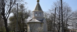
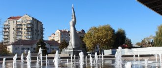
On the territory of the city of Krasnodar, 23rd district, there are several large churches (for example, St. Catherine's Cathedral). There is one of the surviving water towers in Russia according to the design of engineer V.G. Shukhova. A large number of monuments have been erected (more than a hundred), some of which were installed after 2010 (for example, to the district police officer Aniskin); on the territory of Krasnodar there are numerous fountains with lighting and music.
