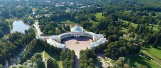
I collected in one post the sights of Crimea that are worth visiting if you come to the peninsula. Here you will also find photos, a detailed description, as well as a map of Crimea with attractions.
It’s hard to imagine a vacation on the peninsula without visiting its many interesting places. Many of them are located quite compactly, especially on the southern coast, so you can see several at once in one day.
The most convenient way to get around is by personal or rented car, however, public transport is well developed, you can get almost everywhere without problems, I have provided information on how to get there.
There are a total of 33 places worth visiting in this review, and I hope it will bring clarity and help you plan your trip. Opening hours are for summer time and may vary during low season.
Palaces of Crimea: what to see from the castles
Bird home
- Address: Alupkinskoe highway, 9A, Gaspra, Yalta.
This is the official symbol of Crimea, the photo of the legendary building is known to everyone. Although Swallow's Nest looks strikingly similar to a medieval castle, it only appeared in 1912. The masterpiece was created by order of the industrialist R. von Stengel by architect L. Sherwood.
After the revolution, the castle was badly damaged due to neglect and an earthquake, but in 1967 it was completely restored. Nowadays excursions are taken there; Various exhibitions and cultural events are regularly held there.
About Swallow's Nest...
Khan's Palace
- Address: Rechnaya street, 33, Bakhchisaray.
The Khan's Palace in Bakhchisarai represents a whole complex that was built during the first half of the 16th century. It was the residence of the Crimean khans. In 1736, it was burned by Russian troops (during the war with Turkey), but in the 20th century the palace was completely restored.
Now it is an architectural and historical museum complex. It consists of many different structures (mosque, baths, harem...), the most famous of them is the Fountain of Tears.
About the Khan's Palace...
Palace of Harax
- Address: Alupkinskoe highway, 13, Gaspra village.
The palace on the site of an ancient Roman estate in Gaspra was built for one of the members of the imperial family by the famous Crimean architect N.P. Krasnov. The architecture of the complex combined antique (with a hint of the location of the estate) and Scottish motifs.
Now the palace belongs to the Dnepr sanatorium, but anyone can explore it along with the park outside. The building also houses an archaeological museum, also accessible to everyone.
About the Kharaks Palace...
Massandra Palace
- Address: Simferopolskoe highway, 13, Massandra.
Its construction was ordered by Count Vorontsov; however, the estate was later purchased from him for Tsar Alexander III. The architect M. Messmacher largely preserved the original construction plan.
The Tsar did not live to see the complete completion of construction, although he visited here. The estate was in the possession of the Romanovs before the revolution, after which it was used as a children's sanatorium and a government building. Now it is a branch of the Alupka Museum. It houses a rich exhibition dedicated to the history of the Romanov dynasty.
About the palace in Massandra...
Livadia Palace
- Address: st. Baturina, 44A, Livadia.
The resort Crimea began as a royal vacation spot. The Livadia Palace complex near Yalta was built from 1834 to 1911; Since 1861, the estate belonged to the royal family. Alexander III died here and Nicholas II rested here every summer. The modern appearance of the complex was given by N.P. Krasnov.
During Soviet times, the palace was used as a sanatorium, then meetings were held there as part of the Yalta Conference and US President F.D. Roosevelt lived there. Now the palace is a museum complex; its exhibition tells about the royal family and the Yalta Conference.
About the palace in Livadia...
Vorontsov Palace
- Address: Dvortsovoye highway, 18, Alupka.
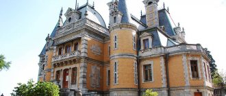
The estate near Alupka belonged to Count Vorontsov. By his order, the construction of a palace surrounded by a park was completed in the mid-19th century. The architecture of the complex combines classical, Gothic, Romanesque and Moorish traditions.
During Soviet times, the building was used as a museum and government building. The British delegation lived here during the Yalta Conference. Today the palace is a museum.
About Alupka Palace...
Palace of Princess Gagarina
- Address: Princess Gagarina Street, 5, Utes, Alushta.
The palace in the village of Utes was built in 1902 by the same N.P. Krasnov - in memory of the princess’s late husband, from whom she inherited the estate. The architecture of the building is dominated by the Gothic style, and all its features are strictly maintained.
The palace belongs to the Utes sanatorium, but anyone can explore it from the outside along with the park.
About Gagarina's palace...
Alupka
In Alupka, I was very impressed by the Vorontsov Palace - the former residence of Count Vorontsov. Nowadays there is a museum in the palace, and around 40 hectares there is the equally beautiful Alupka Park - very natural and harmonious. It is pleasant to walk here, inhaling the aromas of cypress and juniper. Always shady and cool, the park sometimes attracts more tourists than the palace. Kuindzhi's apartment museum is also worthy of attention.
As for natural attractions, it is worth visiting the Shaan-Kaya rock and the lake located near it - the views of the mountain range are simply excellent.
Find out what tourists think about Alupka.
The strict northern facade of the Vorontsov Palace in Alupka.
The most beautiful Crimean parks and gardens
Vorontsovsky Park
- Palace Highway, 18, Alupka village.
Famous Crimean palaces are usually surrounded by original park territory. Vorontsovsky Park is considered one of the most beautiful among palace parks. It was built at the same time as the palace.
The park has two levels, and from the lower one you can go to the sea (many tourists do this). The territory is divided into thematic areas; there are 4 artificial glades and 3 artificial lakes. There are several viewing platforms. You can visit the park for free; people often go to the beach there.
About Vorontsovsky Park...
Foros Park
- Address: Forossky descent, Foros.
It was founded by the hero of the War of 1812, General Raevsky, but made into a masterpiece by tea magnate A. Kuznetsov. The park is unique in terms of species richness of vegetation, and in this respect it is second only to the botanical garden.
The park is decorated with artificial ponds. It has regular and forested parts. The total area is 70 hectares. You can walk in Foros Park for free at any time.
About Foros Park...
Paradise Park in Partenit
- Address: Vasilchenko street, 1a, Partenit town.
This masterpiece of park art is relatively young - it appeared in 1964. The park is known under the name of I. Aivazovsky. The main local attraction is the old olive grove. However, the park has several thematic areas, decorated in different traditions. Recently they added a Japanese garden.
It is important to note that there is an entrance fee to this park.
About Paradise Park...
Nikitsky Botanical Garden
- Address: Nikitsky descent, 52, Nikita town, Yalta.
This is the most famous object of this kind in Crimea. The Botanical Garden in Nikita is considered one of the best in the world in terms of the volume and quality of collections. You can come here at any time of the year (greenhouses are open in winter). Traditionally, seasonal festivals are held in Nikita - tulips, irises, roses, chrysanthemums...
The park has been used several times for filming. You can purchase varietal planting material (including local selection) there.
About Nikitsky Botanical Garden...
Park "Montedor"
- Address: Drazhinsky highway, village. Nikita.
Perhaps he is the youngest - he appeared in 2022. They had been planning to create a Nikita branch in Yalta for a long time, but slowly.
Despite its youth, the park looks complete and sophisticated. It has an artificial pond and several themed areas (a floral “Garden of Eden”, a Mexican garden and much more). There is a fee to visit, but tickets are inexpensive.
About Montedor Park...
Rest
- Beaches of Koktebel
- Foros Park
- Nikitsky Botanical Garden
- Waterpark "Banana Republic"
- Waterpark "Blue Bay"
- Waterpark "Almond Grove"
- Water park "Zurbagan"
- Water park "At Lukomorye"
- Waterpark "Water World"
- Vorontsov Palace
- Vorontsovsky Park
- Livadia Palace
- Livadia Park
- Theater of sea animals "Aquatoria"
- Nazukina embankment in Balaklava
- Bakhchisaray Miniature Park
- Karadag Dolphinarium
- Embankment named after Gorky in Evpatoria
- Karadag Reserve
- Gurzuf Park
- Water park "Atlantis"
- Victory Park in Sevastopol
- Tavricheskaya embankment in Balaklava
- Massandra Park
- Cinemas of Yalta
- Dolphinarium "Nemo" in Sudak
- Aivazovsky Park
- Nizhnyaya Oreanda Park
- Embankment named after Tereshkova in Evpatoria
- Primorsky Park named after. Gagarin in Yalta
- Evpatoria Dolphinarium
- Yalta Zoo "Fairy Tale"
- Safari Park "Taigan"
- Water park in Koktebel
- Livadia Organ Hall
- Safari Ranch "Kozya Balka"
- Partenite Dolphinarium
- Golden Beam, Balaclava
- Fig Beach in Balaclava
- Ai-Todor lighthouse
- Saki Park
- Yalta lighthouse
- Glade of fairy tales Yalta
- Chersonesos lighthouse
- Ilyinsky lighthouse
- Winery New World
- Simeiz Park
- Frunze Park
- Viking Park
- Kerch embankment
- Sevastopol embankment
- Sevastopol Dolphinarium
- Primorsky Boulevard Sevastopol
- Dolphinarium Watercolor
- Dolphinarium "Nemo" in Alushta
- Dolphinarium "Nemo" in Feodosia
- Miskhorsky Park
- Gurzufskaya embankment
- The Lost World in Evpatoria
- Miniature Park Evpatoria
- Miniature Park in Alushta
- Ostrich farm "Exotic"
- Karting in Evpatoria
- "Miracle Donkey"
- Simferopol Children's Park
- Simferopol Zoo
- Jubilee Park Feodosia
- Yevpatoria Zoo
- Tropicpark in Evpatoria
- Seaside Park
- Rabbit park
Lakes, rivers and waterfalls in Crimea
Salgir River
The Salgir tops the ranking of Crimean rivers by length. Its length is determined to be 234 km. Simferopol stands on the banks of this river. Two reservoirs on Salgir provide the Crimean capital with water.
In ancient times, primitive people lived along the banks of the river - this is confirmed by archaeological finds. Now it attracts the attention of fishermen - the catch in Salgir is not bad.
About the Salgir River...
Belbek River
Belbek heads the TOP of Crimean reservoirs in terms of fullness, although its length is only 63 km. Near its mouth is the resort village of Lyubimovka, a famous suburb of Sevastopol.
The river carved a deep gorge in the rocks of the Main Range of the Crimean Mountains - the Belbek Canyon, recognized as one of the most interesting natural monuments of the peninsula. Reviews from fishermen also praise Belbek.
About the Belbek River...
Wuchang-Su Waterfall
- Coordinates: 44.492595, 34.092194.
A waterfall on the river of the same name is located on one of the slopes of the Ai-Petri massif. Its height is about 100 m, Uchan-Su is the highest of the Crimean waterfalls.
However, the Uchan-Su River is not full of water, so the best time to admire the waterfall is in the spring; in the summer it dries up. In winter, the stream turns into a cascade of icicles.
About the Uchan-Su waterfall...
Jur-Jur waterfall
- Coordinates: 44.805430, 34.459677.
Dzhur-Dzhur on the Ulu-Uzen River is the most powerful of the Crimean waterfalls. Located near Alushta. The height is small (915 m), but the power of the 5-meter flow makes an impression.
The surroundings of the waterfall are a nature reserve, so you can’t get to it by car. The foresters have equipped an observation deck convenient for observations and photography.
About the Jur-Jur waterfall...
Saki Lake
- Coordinates: 45.119422, 33.556253.
Saki Lake (within the city of the same name) is the most famous healing reservoir in Crimea. The silt from the bottom of this lake determined all the glory of Sak as a resort. Lake with an area of 8 square meters. km is estuary in origin (that is, it was formed due to the fencing of a sea bay by a natural embankment). The silt of Lake Saki treats diseases of the skin, joints, bones and nerves.
About Saki Lake...
Koyashskoye Lake
- Coordinates: 45.046578, 36.182577.
Koyash Lake is located in the south of the Kerch Peninsula. It is small (area about 5 sq. km, depth only about a meter), but is interesting for the diversity of flora and fauna of its shores, as well as the composition of the water.
Lake Koyashskoe is extremely salty; Microorganisms also live in water, the mass reproduction of which gives the water a rich pink color. The surrounding area of the lake is a nature reserve, but you can visit it.
About Koyash Lake...
Author's excursions
For those who value their time and want to fully immerse themselves in the atmosphere and history of a place, I would recommend taking advantage of the author’s excursions (group and individual). There are both standard and very unusual. Most with reviews will make it easier to choose.
Look below, selected author's excursions, perhaps you will like something. First of all, pay attention to the excursion to Mount Demerdzhi, it is called “Mysteries of the Valley of Ghosts”.
Prices for excursions in Crimea →
Caves and cave cities of Crimea
Marble Cave
- Coordinates: 44.797298, 34.279389.
There are many caves in Crimea, but only trained speleologists risk climbing into some. The Marble Cave is open to the public. It has 1 km of public routes.
The cave is one of the 5 most famous underground cavities in the world. It is not a city (there were no large settlements in it), but natural mineral formations make the halls of the cave look like fairy-tale palaces.
About the Marble Cave...
Kizil-Koba Cave
- Coordinates: 44.870155, 34.343972.
Kizil-Koba, or Red, is the largest of the Crimean caves. There are 6 known tiers in it, the total length of the passages is 17 km. The cave has an underground river and lakes.
Tourists are only allowed into some halls, but that’s enough. Mineral deposits created deposits underground, similar to the real work of a sculptor.
About the Kizil-Koba cave...
Kiik-Koba Cave
- Coordinates: 44.966732, 34.350175.
Located in the Belogorsk region. The cave is small (50 sq. m.), quite beautiful, and offers an interesting view. But the main thing is that this is the oldest and largest site of primitive man in Crimea, dating back to 100 thousand years BC.
Archaeologists discovered the skeletons of a woman and a boy in Kiik-Koba (the appearance of the Crimean Neanderthals was reconstructed from them) and several hundred flint tools. And tourists can photograph the drawings of ancient people decorating its walls.
About the Kiik-Koba cave...
Chufut-Kale
- Coordinates: 44.741069, 33.923642.
The cave city near Bakhchisarai was created as a fortress at the beginning of the medieval era. Natural caves were used, which people connected and supplemented with artificial structures. During the Crimean Khanate, Karaites lived here, which is why the name arose (Chufut-Kale - “Jewish city”).
The complex is a nature reserve and can be visited for a fee. You need to be prepared for long walks over rough terrain.
About the cave city of Chufut-Kale...
Mangup-Kale
- Coordinates: 44.592885, 33.800836.
This cave city, 20 km from Bakhchisarai, was the capital of the medieval principality of Theodoro. Mangup is the most famous of the cave complexes of Crimea. When examining the city, you can see the remains of both cave and above-ground buildings, since the inhabitants did not live exclusively underground.
Mangup-Kale is always mentioned in ratings such as “the best attractions of Crimea”.
About the cave city of Mangup-Kale...
Eski-Kermen
- Coordinates: 44.610938, 33.739417.
This cave city is distinguished not only by its scale, but also by its picturesqueness. It is located in the Bakhchisarai region. The territory is a protected area; staying there overnight is prohibited.
Residential, public and religious premises were discovered in the Eski-Kermen complex. Information signs allow you to understand everything even without a guide.
About the cave city of Eski-Kermen...
Evpatoria
The next city on our route around Crimea is Evpatoria. There are many religious shrines here - mosques, temples, tekies: the Duma-Jami mosque, Tekie dervishes, the temple of St. Elijah, Karaite kenas and so on. In addition, the city has many museums and monuments. What else to see? Turkish baths, kariz (ancient water supply) and the Old City in general.
In the vicinity of Yevpatoria there are several salt lakes where you can improve your health with the help of healing mud and mineralized water: lakes Moinaki, Donuzlav, Dzharylgach and Yarylgach.
Find out what tourists think about Evpatoria.
The most famous Crimean mountains and rocks
Roman-Kosh
- Coordinates: 44.612735, 34.243362.
The natural attractions of Crimea are often expressed in stone - a significant part of the peninsula is occupied by mountains. Roman-Kosh is the highest of the Crimean peaks (1545 m). The peak of a fairly regular shape is the highest point of the Babugan-yayly plateau.
You can climb Roman-Kosh without special equipment and preparation. From the top there is a beautiful view of the yayla and the Partizanskoe reservoir.
About Mount Roman-Kosh...
Mount Ai-Petri
- Coordinates: 44.451649, 34.060141.
Part of the Crimean Mountains consists of plateaus, called yaylas here. Ai-Petri is the most famous Crimean yayla. Geologically, the massif is the oldest coral reef. Over many thousands of years, erosion has given it an elaborate shape and formed the famous “teeth”. Because of this, the plateau is particularly picturesque.
You can climb to the top by cable car from Miskhor or by car. There are parking lots, cafes and various entertainments, such as bridges between the battlements. In winter, skiing is possible on Ai-Petri.
About Mount Ai-Petri...
Mount Karadag
- Coordinates: 44.933078, 35.230784.
Karadag is not just a mountain, but an entire mountain system, which is one of the most famous in Crimea. Karadag is an ancient volcano, and its geological composition is very different from other regions of the Crimean Mountains. Here you can find a huge number of different minerals.
Karadag is a protected area, but excursions are constantly taken there along various routes. They are of interest to lovers of nature, geology and history.
About Karadag volcano...
Mount Ayu-Dag
- Coordinates: 44.561590, 34.332739.
Ayu-Dag (Bear Mountain) is the most famous of the peaks of the South Coast. It is famous due to its characteristic shape (resembling a bear drinking water from the sea) and the location of the Artek international camp nearby.
The origin of the mountain is volcanic. The height is only 570 m, but the length is 2.5 km. The mountain is covered with forest, very rich in different forms of vegetation. The territory is a nature reserve and can be visited on a guided tour.
About Bear Mountain...
Golden Gate Rock
- Coordinates: 44.914611, 35.231500.
The rock has a through arched passage, which determined its name. It became “golden” because of the peculiar shade of the lichens covering it.
Since ancient times, various mystical properties have been attributed to the rock. Excursion boats try to take tourists through the “gate”, and they throw a coin into the water for good luck. Among advertising specialists, the photo of the Golden Gate competes in popularity with the Swallow's Nest.
About the Golden Gate rock...
Rock ships
- Coordinates: 45.007482, 36.174420.
Limestone rocks, which once formed part of a narrow spit, are located in the sea near Cape Opuk (Kerch Peninsula), you can see 4 rocks, the fifth is very low and hardly noticeable. The name comes from the shape of the rocks, reminiscent of ancient sailboats.
The ship rocks are surrounded by many legends. They are one of the most recognizable Crimean species.
About the rock-ships of Elken-Kai...
Zander
The next point on the route around Crimea is Sudak. In Sudak, I really like the Genoese fortress, the Sudak holiday home park near the embankment, capes Meganom and Alchak, as well as the Ai-Georgiy and Perchem-Kaya mountains. The views from these mountains and capes are stunning, and the climb is an adventure!
We recommend going on a boat trip with dolphins - it’s incredible. They swim right under the boat and jump out of the water! You can even swim in the open sea with them. Price - 600-700 rubles per person for 1 hour. The video can be viewed on Instagram using the hashtag #hunterboat. Book a tour by calling 89780652938, name is Vitaly.
Not far from Sudak lies the Cimmerian steppe - the red Kapsel valley, mercilessly scorched by the sun in the summer. Driving along it, admiring its harsh beauty, is a pleasure. You can go into coves and swim - some of them have campsites.
From Sudak we drove towards the Solnechnaya Valley along the highway - bizarre rocks with vineyards on the slopes and a steep serpentine turn your head in the literal sense of the word. There you can climb Mount Parsuk-Kaya and look into the karst cave “Ear of the Earth” - it goes 132 meters deep. On the way to Parsuk-Kaya we stopped at the still unknown church of St. John Chrysostom - excavations are just underway there.
Read our review about holidays in Sudak: what are the prices at the resort, what to do and where is the best place to live.
Our boat trip to a pod of graceful dolphins. Trekking to Cape Meganom is always interesting.
Crimean capes and bays
Cape Tarkhankut
- Coordinates: 45.347611, 32.494822.
It is the tip of a small peninsula, the western point of Crimea. Tarkhankut is a flat steppe plain that drops steeply to the sea. Erosion by water and wind has given the cliffs a bizarre shape that attracts photographers and filmmakers.
Tarkhankut attracts lovers of sea walks and “wild” swimming.” Its shores have clean water and good fishing.
About Cape Tarkhankut...
Cape Fiolent
- Coordinates: 44.501394, 33.489149.
Located between Sevastopol and Balaklava. It represents the beginning of the Main Range of the Crimean Mountains. The cape has a rather bizarre shape and is surrounded by many legends. The origin is volcanic, which is why you can find a lot of ornamental stones on Fiolent, such as jasper or carnelian.
The coast near Fiolent is popular among vacationers, as there are beautiful and clean beaches. On the cape itself is the St. George Monastery.
About Cape Fiolent...
Cape Meganom
- Coordinates: 44.793220, 35.080454.
It is considered the most mysterious cape of the peninsula - a place of power, the entrance to the kingdom of Hades, and much more. Meganom is one of the sunniest places on the entire coast, and many believe that it has the cleanest water in Crimea.
It is located not far from Sudak, but it is believed that it can be seen from any of the coastal heights of the South Coast. The shape of the cape resembles a reptile.
About Cape Meganom...
Balaklava Bay
- Coordinates: 44.496728, 33.597836.
Located next to Sevastopol, Balaklava Bay is “in the shadow” of Sevastopol. But that one is a whole complex of bays, and Balaklava is holistic.
The bay has a complex curved shape (1.5 km long, 450 m wide), and this has attracted sailors since ancient times. The USSR set up a secret submarine base here - the shape of the bay contributed to secrecy. Suitable for submarines and depth - up to 10 m in the upper reaches. There is a submarine repair plant in the bay; excursions are now available there.
About Balaklava Bay...
Fox Bay
- Coordinates: 44.895923, 35.164309.
Culturally, it is the opposite of Balaklava - that one was chosen by the military, and this one was chosen by various informals and anarchists. The bay is located between Meganom and Karadag, the length of the beaches is more than 2 km. Echki-Dag, almost devoid of vegetation, stretches above the bay, but the sea is rich in life.
Fox Bay is almost an official camping area for informals (nudists, fans of exotic religions and simply opponents of “foppish” vacations). It embodies Crimean multiculturalism and democracy.
About Fox Bay...
Laspi Bay
- Coordinates: 44.411796, 33.715486.
Located between Sevastopol and Yalta, it has a unique Mediterranean climate. Coniferous vegetation on the banks improves the health of the air.
The bay is considered one of the most picturesque places in Crimea, and therefore has often been featured in films. Both representatives of the Soviet leadership and camping tourists rested here with equal success.
About Laspi Bay...
Sights of the Sevastopol region: Sevastopol, Balaklava, Fiolent
The Sevastopol region is not only the city of Sevastopol itself, but also nearby resort places such as Balaklava and Fiolent. Many consider them independent resorts, although administratively they also belong to Sevastopol and are considered its suburbs.
Housing in the Sevastopol region →
Being in Crimea and not visiting the hero city of Sevastopol for at least a couple of hours is an unforgivable omission; there are simply a lot of attractions, including the ancient city of Chersonesos. Fiolent has amazing bays, a steep coastline, stunning landscapes and places for walking. Well, it’s better to see Balaklava once than to hear it a hundred times - it’s a hidden pearl of Crimea, a stunning photogenic bay, pleasure boats, fish restaurants on the embankment, the famous submarine museum and, again, a chic place for walking and trekking.
Read more
⇒
Temples and monasteries of Crimea
Toplovsky Monastery
- Address: Belogorsky district, Uchebnoye village.
This is a convent, located in a tract near Feodosia. The monastery is active. It is interesting because it offers bathing in three springs, which are considered healing. The most famous of them is the Three Saints. It is believed that the appearance of the monastery was due to the properties of this water.
About the Toplovsky Monastery...
St. George's Monastery
- Address: Sevastopol, Health Path.
Located on Fiolent. It is believed that it patronizes sailors and was founded by castaways who were supposedly miraculously rescued from Fiolent. Modern buildings of the monastery have existed since the end of the 16th century; archaeologists have discovered the foundations of older structures.
The monastery complex is successfully integrated into the surrounding landscape. Adjacent to the monastery buildings itself is a landscaped public garden. The monastery is active, but people who are far from Christianity come to the park for the sake of the views.
About St. George's Monastery...
Church of John the Baptist (Kerch)
- Address: per. Dimitrova, 2, Kerch.
Part of the complex of this church is one of the oldest buildings in Crimea - built at the beginning of the Middle Ages. Over the years, the church was repeatedly completed and rebuilt, but the original building was still partially preserved. During the restoration (after the Great Patriotic War), most of the later additions were removed, leaving the oldest part and the completion of the century.
The church is active, but is interesting precisely because of its antiquity.
About the Temple of John the Baptist...
Foros Church
- Address: Old Sevastopol highway.
The church was built in 1892 by order of tea merchant A.G. Kuznetsova. The merchant in this way celebrated the successful outcome for the royal family of the railway accident in Borki in 1888.
The architecture of the church combines pseudo-Russian and neo-Byzantine styles, and it looks very elegant. But the most interesting thing about it is its location almost at the cliff, on a stone canopy.
About the Resurrection Church in Foros...
Alexander Nevsky Cathedral in Yalta
- Address: Sadovaya st., 2, Yalta.
The cathedral is new (built in 1902), but already famous for its interesting architecture. The building embodies the essence of the Russian style, as it was understood at the beginning of the twentieth century.
The richest decor, imitation carvings, multi-domed structure, rich porch - from the outside the building resembles a fairy-tale tower. The interior decoration is also rich.
About Alexander Nevsky Cathedral...
Vladimir Cathedral (Sevastopol)
- Address: st. Suvorova, 3, Sevastopol.
The cathedral was founded in 1848, but construction actually began only after the Crimean War. The structure is of particular interest due to the burial there of the discoverer of Antarctica M.P. Lazarev, as well as the heroes of the First Defense, admirals Kornilov, Nakhimov and Istomin. For this reason, the cathedral is called the “tomb of the admirals” and is an important historical monument.
The building's architecture features interesting interior columns lined with unique Carrara marble.
Don't miss: Unusual places in Crimea
Juma-Jami Mosque
- Address: st. Revolutions, 36, Evpatoria.
For some reason, it is now customary to consider only Christian buildings as “temples.” But some interesting destinations in Crimea are of Islamic origin; the peninsula has always been an example of tolerance. The Juma-Jami Mosque (Khan-Jami) is located in Yevpatoria. This is the only multi-domed mosque in Europe; its appearance resembles Sophia of Constantinople.
The mosque was built in the second half of the 16th century. In it, the Crimean khans swore allegiance to the Sultan.
About the Juma-Jami mosque...
Territorial division of the peninsula
A satellite map of Crimea with attractions (detailed) provides comprehensive information on the regions of the peninsula, highlighting individual municipalities and cities of republican significance.
In Crimea, 25 independent units have been formed, which are divided into:
- There are 14 district entities with their own municipalities, mainly from the rural population.
- 11 units of large urban settlements with the status of republican cities, having subordinate territories (region, district), in which urban districts are formed. There are 56 units in total.
- In turn, they have their own subordination from rural settlements, their number is 947.
- The total number of districts is 14.
- There are 11 large cities of republican significance.
- City districts – 3.
- Settlements of regional subordination – 5.
- Urban entities – 56.
- Municipalities – 14.
- Districts of city subordination – 16.
- The total number of settlements is 1020, including 72 cities and 47 villages.
Crimea historical
Chersonese Tauride
- Address: Drevnyaya street, 1, Sevastopol.
It so happened that the best historical sights of Crimea were concentrated in Sevastopol. The Chersonesos complex is one of the most famous archaeological reserves in the world. This is the site of excavations of a large polis that arose on the Crimean coast during the Great Greek colonization. Chersonesus was a republic, the text of the oath of its inhabitants is known.
A tourist in Chersonesus can stroll through the streets of the ancient city. See the remains of warehouses, workshops, temples, residential buildings. Here you can even watch a performance in a real ancient Greek theater.
About Tauride Chersonese...
Necropolis of Panticapaeum
- Address: Mount Mithridates, Kerch.
There is no life without death - from Panticapaeum, the capital of the powerful Greek Bosporan kingdom, the necropolis, that is, the cemetery, is best preserved. It is located on the outskirts of Kerch.
The necropolis includes several mounds of local and Greek nobility; some of them are considered to be the burial places of the rulers of the Bosporus. Today access to the Golden, Tsarsky, Melek-Chesme mounds is open.
About the ancient city of Panticapaeum...
Sudak fortress
- Address: st. Genoese Fortress, 1, Sudak.
The fortress is evidence of the life and management of colonists from Italy in Crimea. Sudak (Soldaya) was one of the largest Genoese colonies.
Of all the Genoese fortresses in Crimea (they are in Sevastopol and Feodosia), Sudak is the best preserved. It was built at the height of the Middle Ages, but there are also earlier monuments on its territory (for example, Khazar burials). It is believed that Khan Mamai was killed here after his defeat in the Battle of Kulikovo. In recent years of the USSR, the building was thoroughly restored. Today the fortress is a museum-reserve and a site for historical festivals.
About the Genoese fortress in Sudak...
Malakhov Kurgan
- Address: Sevastopol, Malakhov Kurgan memorial complex.
The hill dominating Sevastopol is the last stronghold of the First Defense of the city during the Crimean War. The defense and capture of Malakhov Kurgan is the culmination of this conflict.
Today the mound is occupied by a large historical complex telling about the events of the Crimean and Great Patriotic Wars. A monument to Admiral Kornilov was erected on Malakhov Kurgan, and the combat positions of both the First and Second Defenses were preserved.
About Malakhov Kurgan...
Sapun Mountain
- Address: Sapun-Gora microdistrict.
Another Sevastopol peak is associated with the events of another war. The assault by Soviet troops on Sapun Mountain on May 7, 1944 became the main component of the operation to liberate Sevastopol from the Nazis. The capture of the hill ensured success for the attackers.
Today there is a museum-diorama “Storm of Sapun Mountain” and an open-air museum-exhibition there. The exhibitions are dedicated to the defense and liberation of Sevastopol in 1941-1944.
About Sapun Mountain...
Adzhimushkay quarries
- Address: st. Brothers Malchenko, 36, Kerch.
The underground catacombs on the outskirts of Kerch arose as a result of the extraction of building stone during the time of Greek colonization. The Adzhimushka quarries became the last line of defense of Kerch from the Nazis - 10 thousand soldiers and several thousand citizens held the defense underground for six months, withstanding the lack of water, gas attacks, flooding and underground explosions.
Today, some of the quarries have been examined, and an underground museum of the defense of Kerch has been equipped in them. This is a difficult place to understand; children under 6 years old are not allowed into the museum. You cannot climb into the quarries on your own - they still contain mines and ammunition from the war.
About the Adzhimushkaya quarries...
Fedyukhin Heights
- Coordinates on the map: 44.546307, 33.623553.
The place is special - it is historical on two levels. A small mountain range near Sevastopol became one of the positions of the famous battle on the Black River in 1855. In these places there were those very ravines that are forgotten on paper - in any case, the proverb was born here. During the Great Patriotic War, the heights also represented an important military position.
Today, a permanent historical park has been established there, where everyone can get acquainted with the peculiarities of military affairs and military life of all the peoples who have ever been to Crimea.
About Fedyukhin Heights...
In general, it doesn’t matter what a tourist’s taste is. He can be a principled ecologist, an equally consistent believer, or a skeptic with a scientific mindset and an interest in the mysteries of the past - all the time on the Crimean peninsula he will find something to see and where to go on an excursion. In conclusion, we also suggest watching a thematic video from YouTube, enjoy watching!
Liked? Share with your friends!
New World
New World is located just 20-30 minutes drive from Sudak. There is not much to do at the resort itself, except go on an excursion to the champagne factory. But lovers of nature and adventure will find great wealth in the small village - the Novosvetsky reserve.
The nature in the New World is so beautiful that we have already come four times to walk along the Golitsyn trail and breathe in the aromas of the juniper grove, admire capes Kapchik and Chicken, climb Peak Cosmos and Mount Karaul-Oba, walk along the valleys of Hell and Paradise, walk along the dangerous Staircase of Tauris. If you like trekking, follow the Karaul-Oba route through the massif and go down to the sea in the village of Veseloye.
On your way from the New World, take a look at Zelenogorye - this is Crimean Switzerland! I haven't been there yet, but I really want to.
Find out what tourists think about the New World.
Cape Chicken is called Rhinoceros. Looks like it, right?
The Chaliapin Grotto on the Golitsyn Path has excellent acoustics. They say Chaliapin sang here, that’s why they called it that.
