Baikal ice is very similar to mica
Listvyanka and Slyudyanka are twin brothers. Both settlements are located on the shores of Lake Baikal near Irkutsk and are popular holiday destinations. People also come to Slyudyanka to conquer the Khamar-Daban mountain range and see the unique collection of minerals in the local museum.
Mineralogical paradise
The name Slyudyanka speaks for itself. In these places, mica was mined 300 years ago! Then this transparent mineral replaced glass in windows. At the mining site they set up a winter hut, which they called Slyudyanka. Since then, the settlement has changed its status several times - it was a fort, a village, a city - but the name remained the same each time. This is a real mineralogical paradise - in addition to mica, lapis lazuli and marble were mined here.
The town with the “mineralogical” name is located on the western shore of Lake Baikal and administratively belongs to the Irkutsk region. The population exceeds 18 thousand people. The city has a railway station through which the famous Trans-Siberian Railway passes. Slyudyanka is also a transit point on the R-258 Baikal highway.
Fish is the main wealth of Baikal
People have inhabited these regions since ancient times. This is evidenced by rock paintings found by archaeologists at Cape Shaman. The Huns, Kurykans, Buryats, and Evenks lived on these lands. Russians came here in the 17th century. These were pioneers who were looking for opportunities to mine salt and furs. In 1647, the first fort appeared here - that’s what small fortresses were called. In 1802, a winter hut was built on the shore of the lake and mica mining began.
An important factor for the development of the settlement was the construction of a wheeled road. Thanks to this, Slyudyanka turned into a postal station and goods transshipment point between Irkutsk and Kyakhta. The construction of the railway gave even greater impetus. In this regard, in 1899, the Slyudyanka winter hut received the status of a village. This year began to be considered the date of its foundation. Now the village is a popular place for recreation and tourism.
HOW TO GET THERE
You can get to Slyudyanka from Irkutsk by your own car along the Kultuksky highway (M55 highway), the distance from Irkutsk to Slyudyanka is 115 km and can be covered in 1.5-2 hours.
By bus (Irkutsk - Slyudyanka):
A regular bus runs from Irkutsk to Slyudyanka from the suburban bus station every hour. The bus station telephone numbers are information and ticket offices, the ticket price is 100 rubles, the route schedule is here.
You can also get to Slyudyanka by minibus from the Irkutsk railway station (Chelnokova St., 1; reference phone 8-902-767-8618). Travel time is 1.5 - 2 hours.
By train (Irkutsk - Slyudyanka):
Every day you can get from Irkutsk to Slyudyanka by train (several flights a day, schedule here). Travel time is about 3 hours.
Note to tourists
The main asset of Slyudyanka is the Khamar-Daban mountain range. A huge mountainous country stretches south of Lake Baikal. Its length is 350 kilometers, width is 60 kilometers. The highest peak is Mount Utulikskaya Podkova (2396 m). It is Khamar-Daban that is a point of attraction for climbers, skiers and lovers of extreme hikes. Every year a ski marathon is organized here, which is called the “Baikal Around the World”.
Khamar-Daban mountain range
The second key natural attraction is Shamansky Cape. For the Buryats this place is sacred. The Circum-Baikal Railway is a monument of engineering art. This is also an excursion site. The mineralogical museum “Gems of Baikal” is interesting. His collection numbers about 12 thousand exhibits!
Listvyanka has an excellent mineralogical museum
There is a local history museum in the city. Historical architectural monuments include the railway station and St. Nicholas Church. But Baikal is rightfully considered the main attraction. People come from all over the world to see it. There are more than a dozen hotels, guest houses and recreation centers in the city and its surroundings. There is enough space for everyone.
Entertainment
Climbing Chersky Peak or waterfalls on the Podkomarnaya River
How to get there: the start of the tourist route to Chersky Peak is located at the concrete dam on the right bank of the Slyudyanka River
Chersky Peak is located 17 kilometers south of Slyudyanka. The peak received its name in honor of the famous Russian geographer and explorer of Siberia Ivan Chersky. The height of the peak reaches 2090 meters. This is the highest point of the Komarinsky ridge of the Khamar-Daban mountain system.
From Slyudyanka to Chersky Peak there is a hiking route - one of the most popular in the Baikal region: thousands of tourists go to conquer the peak every year. Another advantage of the route is its accessibility for travelers of any level of training.
To conquer Chersky Peak you will not need to take any special climbing equipment with you. However, in bad weather it is easy to lose your way along the route, so it is recommended to hike to the summit from mid-May to September.
The total length of the route is 20 kilometers in one direction, the elevation difference is 1620 meters. On the way to the peak you can see lakes with waterfalls, noisy mountain rivers, rocky cliffs, and perennial cedars.
The path is divided into two main stages: the first - from Slyudyanka to the Khamar-Daban weather station, the second - from the weather station to the top of Chersky Peak. At the top, tourists are greeted by a rocky platform with a cross installed on it, as well as a picturesque panorama of Khamar-Daban with the surface of Lake Baikal visible in the distance.
After conquering Chersky Peak, do not rush to return to Slyudyanka. On the way back you can visit the most beautiful waterfalls on the Podkomarnaya River.
Climbing the mountain "Monomakh's Cap"
How to get there: from Slyudyanka you need to go to the “Warm Lakes” tourist center. The distance is 77 kilometers, travel time is just over an hour. At the camp site you can find out where exactly the route to the summit begins.
The small mountain “Monomakh's Cap”, covered with dense greenery, has a rare shape of a regular pyramid and is one of the lowest mountains on Lake Baikal: the peak is located at an altitude of 685 meters above sea level. At the foot of the mountain there are three Warm lakes. It is from the lakes that the tourist route to the top of Monomakh’s Cap begins, which from the ground seems impregnable. But the route is not as difficult as it seems at first glance: even unprepared tourists can overcome it.
The journey to the top takes about half an hour. The first third of the path is along a gentle serpentine road, the rest is along a steeper climb. But at the top, tourists will be rewarded - an observation deck with breathtaking views of the Warm Lakes, the bends of the Snezhnaya River and other mountains of Khamar-Daban.
If you have not yet chosen where you will live and want to save money when booking, we recommend using the RoomGuru service. Firstly, it contains hotels, apartments and guest houses from many different booking systems, so you won’t miss out on a worthwhile option. Secondly, you can immediately compare prices for one place in different services and book where it is cheaper (this is not always Booking!).
Recommendations
Notes
- ^ a b
Charter of the Irkutsk region - ^ a b Register of administrative-territorial entities of the Irkutsk region
- ^ a b
Federal State Statistics Service of Russia (2011).
“All-Russian Population Census 2010. Volume 1" [All-Russian Population Census 2010, vol. 1]. All-Russian Population Census 2010 [All-Russian Population Census 2010]
(in Russian). Federal State Statistics Service. - "26. The size of the permanent population of the Russian Federation by municipalities as of January 1, 2022.” Federal State Statistics Service. Retrieved January 23, 2022.
- ^ a b
Law No. 49-OZ - ^ a b c d f
Law No. 72-ounce - "On the calculation of time." Official Internet portal of legal information
(in Russian). June 3, 2011. Retrieved January 19, 2022. - Post office. Information and computing center of OASU RPO. ( Post office
).
Search for postal facilities ( Search for postal facilities
) (in Russian) - Federal State Statistics Service of Russia (May 21, 2004). > [Population of Russia, its federal districts, federal subjects, districts, urban settlements, rural settlements - administrative centers, rural settlements with a population of more than 3000 people] (XLS). All-Russian Population Census of 2002 [All-Russian Population Census of 2002]
(in Russian). - “All-Union Population Census of 1989. The actual population of union and autonomous republics, autonomous regions and districts, territories, regions, urban settlements and villages-rayon”, No. 45, April 24, 2009 (Legislative Assembly of the Irkutsk Region. Resolution No. 9/ 5-ZS dated April 15, 2009 Charter of the Irkutsk Region
As amended by Law No. 2-U dated December 14, 2022.
On amendments to the Charter of the Irkutsk Region
... Valid from the day following the ten-day period after the day of official publication.). - Legislative Assembly of the Irkutsk Region. Law No. 49-OZ of June 21, 2010 “On the administrative-territorial structure of the Irkutsk region,” as amended. Law No. 12-OZ of March 23, 2022 “On Amendments to Articles 25 and 33 of the Law of the Irkutsk Region “On the Administrative-Territorial Structure of the Irkutsk Region” and the Law of the Irkutsk Region “On Amendments to a Geographical Object and (or) on the Renaming of Geographical Objects " Came into force after the official date of publication. Published: “Regional”, No. 71, June 25, 2010 (Legislative Assembly of the Irkutsk Region. Law No. 49-OZ of June 21, 2010 On the administrative-territorial structure of the Irkutsk Region
As amended by the Law of March 23, 2022 No. 12- OZ.
On amendments to Articles 25 and 33 of the Law of the Irkutsk Region “On the Administrative-Territorial Structure of the Irkutsk Region” and the Law of the Irkutsk Region “On the Procedure for Considering the Naming of Geographical Objects and (or) Renaming of Geographical Objects"
. Valid from the date of official publication. ) - Legislative Assembly of the Irkutsk Region. Law No. 72-oz of December 2, 2004 “On the status and boundaries of municipalities of the Slyudyansky district of the Irkutsk region,” as amended. Law No. 11-OZ of January 14, 2014 “On the transformation of the working village of Baikal (port) of the Slyudyansky district of the Irkutsk region, the extension of the Law “On the status and boundaries of municipalities of the Slyudyansky district of the Irkutsk region” to the entire territory of the new subject of the Russian Federation - the Irkutsk region and making changes to it." Came into force on December 31, 2004, but not earlier than 10 days from the date of official publication. Published: “East Siberian Truth”, No. 248–249, December 14, 2004 (Legislative Assembly of the Irkutsk Region. Law No. 72-oz of December 2, 2004. On the status and boundaries of municipalities of the Slyudyansky district of the Irkutsk region
As amended by the Law dated January 14, 2014 No. 11-OZ.
On the transformation of the working village of Baikal (port) in the Slyudyansky district of the Irkutsk region, on the expansion of the Law of the Irkutsk region “On the status and boundaries of municipalities of the Slyudyansky district of the Irkutsk region” to the entire territory of the New subject of the Russian Federation - Irkutsk region - and about amendments
... Valid from December 31, 2004, but not earlier than 10 days after the official date of publication.). - Register of administrative-territorial entities of the Irkutsk region
(in Russian)
DK Zheleznodorozhnikov
A true monument to constructivism of the twenties in the city of Slyudyanka. The building of the cultural center also has a cinema, and a huge number of events are held for residents. The building is a pleasant bluish color, restored after the 2008 earthquake.
Being the cultural center of the city, the Zheleznodorozhnikov Palace of Culture does not stand out among cultural centers in other cities, but the unusual architecture allows us to call the building one of the most interesting and worth attention.
Location: Paris Commune Street - 1A.
Steam locomotive Lebedyanka
This facility is located near the Water Tower. The steam locomotive, together with the tower, is a kind of “reconstruction” of a water filling station. A great place for a photo shoot or an evening stroll, the monument is in excellent condition and is constantly being repainted.
A very interesting place for children who like technology. The monument fits perfectly with the surrounding infrastructure and will become an interesting object to visit when traveling to Slyudyanka.
Location: Paris Commune Street - 1A.
Aikha-Shulun
Aikha-Shulun, or Shaman Cape, is one of the most popular attractions in these regions. There are legends among local residents that Aikha-Shulun is the historical homeland of the Buryats. According to legend, the corpse of a strong and influential shaman was buried in this place, after which they began to perform various rituals and make sacrifices to the spirits. Research and expeditions are often carried out here, which may also interest you.
About the climate
Climatic conditions in the city of Slyudyanka are characterized as moderate continental. This is primarily due to the close proximity of Lake Baikal. Winter here is much milder than in the Irkutsk region. Spring is protracted and long, in summer the maximum temperature is observed in August, autumn lasts a long time...
The town itself is located in a natural basin, surrounded on almost all sides by mountain ranges and Lake Baikal. Because of this, there is little rainfall here. Mountain winds blow very often.
Church of St. Nicholas the Wonderworker
A beautiful temple near the railway station was erected in 1915, but almost 15 years later it was closed. Only towards the end of the war, in 1947, was it returned for the needs of the residents.
The inside is very clean and bright, with interesting architecture, because the object is a cultural monument of regional significance. Moreover, it is considered one of the most prayed for due to its long history.
Location: 40 Let Oktyabrya Street - 40.
Monument to the Bear and Monkey
A small monument at the exit from the city shows the viewer the main characters of I. A. Krylov’s fable - a bear and a monkey. They are located at a distance from each other, the monkey is twirling a shiny mirror in its paws. The object is made of white marble and is intended to serve as a reminder for passing drivers.
The characters are recognizable and funny, and this monument is ideal for a photo souvenir. Moreover, it is located literally on the outskirts of the city of Slyudyanka.
Location: Lenin street - 119.
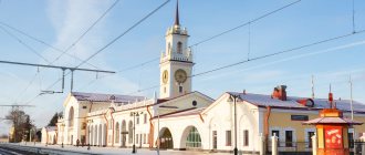
Train Station
The station building is the only building in all of Russia entirely built of marble. It looks great: silver arches, huge windows and a dark blue sign with the name of the station. The inside is clean and modern, with an interesting exhibition about the history of the station. You can see photographs of this place from different years.
It is known that the building itself was erected by Italians. On the territory of the station there is a small souvenir shop for city guests.
Location: Tonkonoga street - 18.
How to get to Slyudyanka?
The city is located in relative proximity to Irkutsk (110 kilometers by car) than to Ulan-Ude (345 kilometers by car).
You can also travel from both cities by train, the distance approximately corresponds to the mileage described above...
If you are coming from Irkutsk, you will come across a settlement on the way. Kultuk. If from the side of Ulan-Ude, then such Baikal settlements as the city of Babushkin, the village of Vydrino, the city of Baikalsk.
➡ HELPFUL INFORMATION:
- How to get to the lake Baikal from other regions, read here!
- You can compare prices on the most popular travel sites and book your holiday rental in Slyudyanka at the best price!
- Hotels in Irkutsk
- Hotels and camp sites in other places of the lake
- Review of the most interesting places of the lake on the website
- Description of Baikal from the first person
- Search for cheap flights
➡ PS +1000 to your karma,

