About Nyazepetrovsk
- District passport
- Creation of Nyazepetrovsk and Nyazepetrovsky district
- Symbolism
- Nyazepetrovsky dialect
- Hunting in the Nyazepetrovsky region
- Nyazepetrovskoye Reservoir
Passport of Nyazepetrovsky district
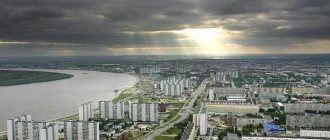
The administrative center is the city of Nyazepetrovsk , founded in 1747. The distance from the regional center (Chelyabinsk) is 230 km.
The area of the district is 3459 sq. km.
District population 16,680 (2017)
It consists of one urban settlement (Nyazepetrovskoye), four rural settlements: Grivenskoye, Kurginskoye, Unkurdinskoye, Shemakha.
The relief is hilly and ridged. The main elements of the surface are the tops of watersheds, slopes, and interval depressions. The slopes have varying steepness, most of them are of considerable length, and are often complicated by hilly microrelief.
The hydrographic system is extensive. More than 100 rivers flow here, 90% of them are small and very small rivers less than 10 km long. These are mountain rivers belonging to the river basin. White. They are characterized by large slopes, significant current speeds, narrow valleys, and rocky bottoms.
The largest river is Ufa , flowing from east to northwest, with a total length of 918 km, in the region - 96 km.
Tributaries of the river Ufa:
- R. Uraim, flows from south to north, length 74 km;
- R. Nyazya, flows from northeast to south, length 53 km;
- R. Kukazar, flows from northeast to southwest, length 39 km;
- R. Suroyam, flows from south to northeast, length 35 km;
- R. Maniska, a tributary of the river. Nyazya, flows from north to south, length 32 km.
Small rivers are dispersed throughout the Nyazepetrovsky region and are often represented by temporary watercourses that look like dry valleys, which are filled with water only during spring floods or summer floods.
Spring floods are high everywhere and reach from 1 to 4 m in some periods.
There are oxbow lakes on the river. Ufa and two reservoirs:
- Nyazepetrovskoe on the river. Ufa, mirror area - 19.5 sq. km.
- reservoir on the river Nyazya total area is 1.63 km.
There are more than 20 monuments of the Stone, Bronze, Iron Ages and the Middle Ages in the area. The most famous are the Serny Klyuch settlement and the Araslanovskaya Pisanitsa.
History of Nyazepetrovsky district
The Nyazepetrovsky municipal district was formed in 1923, and since 1934 it has been part of the Chelyabinsk region.
Nyazepetrovsk itself was founded in 1747 at the confluence of the Ufa and Nyazi rivers. Initially, it was a village that arose in connection with the construction by merchant Pyotr Osokin of an iron smelting and ironworks plant with a large pier, through which Kyshtym and Kasli iron was sent to greater Russia. In 1756 N.N. Demidov acquired the Shemakha dacha. The territory was settled by Russian settlers from Nizhny Novgorod, Tula, and Tver provinces.
The name of the city originates from two words. According to legend, Naza is the name of a Bashkir girl who drowned herself in a river because of unrequited love; the Nyazya River is named by this name. In sources of the 18th century. mentioned in the form Naza, Nazya, Naza-Ilga. In the dictionary of toponyms in Bashkortostan it is derived from the Bashkir dialect word nazy - “spruce”, “spruce”, i.e. “river (elga) where spruce trees grow." The second part of the city’s name is the name of the plant’s founder, Peter Osokin.
Osokin bought the place for next to nothing from the Bashkirs. The plant was called an iron-making plant. At first he produced sheet roofing iron. The first workers were serfs and hired people. The entire population of the city was located on Bolshaya, Purchased, Purchased Verkhnyaya, Bizyarskaya and Zaprudnaya streets. By 1754, 243 people lived in 49 houses.
Ore was supplied from 34 surrounding mines. During the war with Napoleon, the plant produced cannonballs, bombs, grenades and grapeshot for the Russian army. In 1812, the State Council gave the order to cast 7995 pounds of 19 pounds of artillery shells. By 1906, the company produced pig iron and castings, ferromanganese, raw iron, forged crimped ingots, and tool steel.
Osokin is not the only owner of the plant. The owners were the Mosolov brothers from Tula, the Simbirsk merchant Myasnikov, Yakov Petrov, Irina Khlebnikova (daughter of the previous owner), Lev Rastorguev from Yekaterinburg and his heirs.
Osokin's craftsmen marked high-quality roofing iron. In 1896, at the All-Russian Industrial and Art Exhibition in Nizhny Novgorod, the plant was given the right to depict the State Emblem of the Russian Empire on products, and the stamp also included an image of a fish. This mark is also depicted on the district coat of arms.
In 1912-1916, the Western Ural Railway began to actively develop, as a result of which the population increased and new settlements appeared. The timber industry is also actively developing during these years.
During the Great Patriotic War of 1941-1945, a factory evacuated from the city of Kramatorsk, a military hospital and the Rostov Military School were located in the area.
Symbols of Nyazepetrovsk and Nyazepetrovsky district
The coat of arms of the Nyazepetrovsky district was approved by Resolution No. 303 of the Nyazepetrovsky District Council of Deputies on August 28, 2003. The coat of arms is based on historical, geographical, economic and toponymic features.
“In an azure and green shield, beveled on the left with a silver line like a spruce crown, there is a golden walking bear, carrying on its back a silver casket, topped with a fish in the belt.”
The bear is a symbol of foresight, heroic strength, and at the same time good nature, allegorically showing a calm, peace-loving, hardworking person. The casket on the back of the golden bear allegorically speaks of the natural resources of the Ural region, the reliability of their conservation and thrifty use. Gold is a symbol of the highest value, greatness, strength, strength, generosity. A silver line like a spruce crown dividing the field of the coat of arms allegorically shows the Nyazya River. Silver is a symbol of perfection, nobility, purity, faith, and peace.
The colors of the coat of arms - azure and green - allegorically characterize the Nyazepetrovsky district as a mountain forest and one of the few ecologically clean regions of the Chelyabinsk region. Among the natural monuments in the area are a larch grove and a relic spruce forest, a section of the Ufa River and the Shemakhan karst field. Azure is a symbol of truth, honor and virtue, clear skies and expanses of water. Green color is a symbol of spring, joy, hope.
The coat of arms is included in the State Heraldic Register under No. 1288.
The coat of arms of Nyazepetrovsk was approved by Resolution No. 23 of the Nyazepetrovsk City Council of Deputies on August 27, 2003. The blue color and “chockedness” (relief in the form of waves) indicate a geographical feature: the location of the city at the intersection of rivers.
In a golden field there is an azure (blue, light blue) cross, the upper elongated shoulder of which is like a spruce with a disappearing top, the side arms are curved, and the lower narrow shoulder is chipped. In the free part there is the coat of arms of the Chelyabinsk region.
The composition of the coat of arms of the city of Nyazepetrovsk is based on the name of the city and its geographical location. The main figure of the coat of arms is a cross. The general meaning of the cross is the union of opposites: positive and negative, higher and lower, life and death. Vertical lines - heavenly, spiritual and intellectual; horizontal - earthly, rational.
The upper elongated shoulder, like a spruce, allegorically conveys the name of the city, composed of two parts: from the Bashkir dialect word nazy - “spruce”, “spruce”, i.e. “the river where spruce trees grow” and named after Pyotr Osokin, who founded an iron smelting and ironworks plant, much later repurposed into a machine-building plant. The disappearing top of the cross expresses the idea of movement and development. The color of the cross is blue, allegorically showing the cross-shaped confluence of the rivers Ufa and Nyazi. Azure is a symbol of truth, honor and virtue, clear skies and expanses of water.
The golden field of the coat of arms speaks of the natural resources surrounding the city. Gold is a symbol of the highest value, greatness, strength, strength, generosity.
The coat of arms is included in the State Heraldic Register under No. 1285.
Nyazepetrovsky dialect
“Alive, like life,” Conrey Chukovsky once said about the Russian language. This fully applies to Nyazepetrovsky dialect. According to T. P. Ilyina, the author and compiler of the “Ethnolinguistic Dictionary of the Nyazepetrovsky Dialect,” “Nyazepetrovsky people create a language on the fly. What pearls one often hears from their lips - from the wise and witty to the obscene!
In general, the Nyazepetrovsky dialect is characterized by:
- softening the sound [h] to [sch] (let's eat instead of how much),
- coarsening of the sound [sch] to double [shsh] (put out instead of dragged),
- replacing the sound [ts] with [s] (light instead of flower),
- change in normative stress in words, for example sankI, cranes,
- refusal of neuter verbs, pronouns and adjectives (the glass is broken, the wine is white and red), etc.
A special feature of Nyazepetrovsk speaking is that it actively included the words of the original population of the Urals - the Bashkirs.
But its main advantage is liveliness, richness, colorfulness, imagery.
Caves in Nyazepetrovsky district
Shemakha Cave is located 2.5 km southeast of Skaz station, on the left bank of the Sukhaya Shemakha River. The cave is of a horizontal corridor type, the total length of the passages is 1610 m.
The research was started by the famous karst scientist D. Sokolov in 1940.
The cave is difficult to navigate. The best time to visit is February - early March. Passing the cave in summer is not recommended, since rising water during unexpected rain in the summer can lead to rapid flooding of narrow passages. Special equipment in the form of a wetsuit is required. In winter, the water freezes; you can walk on the transparent ice, looking at everything that lies at the bottom. In winter, to pass the cave it is enough to have an inflatable boat and rubber boots. Without special equipment, only the front part of the cave is accessible.
The large karst bridge is located over the Ice Proval cave, which is located near the city of Nyazepetrovsk. This is a tongue of ice that does not melt all year round.
Hunting in the Nyazepetrovsky region
in the Nyazepetrovsky district :
- Kuvatalskoe,
- Mezhevoye,
- Nyazepetrovskoe,
- Prokhorovskoye,
- Shemakha,
- Uraimskoe
Hunting seasons:
- April - May: in the spring they hunt black grouse, wood grouse, drake and woodcock.
- August - September: hunting for the owner of the taiga - the bear
- October - November: hunting for wood grouse, black grouse and roe deer at roar.
- November - December: big hunting season for wild boar and young-of-the-year roe deer.
- November – February: hunting for white hare, fox, wood grouse, black grouse.
Nyazepetrovskoye Reservoir
Among fishermen, the artificial reservoir is called the “pike-perch mecca.”
It is for this fish from the perch family that 70% of fishermen come to Nyazepetrovsk. In one fishing trip you can catch up to 400 kg of tails. The maximum weight of Nyazepetrovsk pike perch is seven kilograms, but most often two to three kilogram individuals are caught on the fishing rod. The reservoir is also home to carp, perch, pike, ide, roach, burbot and bream. Share:
Links[edit]
Notes[edit]
- ^abcdefghijkl Resolution #161
- ^ a b Federal State Statistics Service (2011). “All-Russian Population Census 2010. Volume 1" [All-Russian Population Census 2010, vol. 1]. All-Russian Population Census 2010 [All-Russian Population Census 2010]
. Federal State Statistics Service. - "26. The size of the permanent population of the Russian Federation by municipalities as of January 1, 2022". Federal State Statistics Service. Retrieved January 23, 2022.
- Federal State Statistics Service. Federal Agency for Technological Regulation and Metrology. No. OK 033-2013 January 1, 2014 “All-Russian classifier of municipal territories. Code 75 644 101 ". (Federal State Statistics Service. Federal Agency for Technological Regulation and Metrology. No. OK 033-2013 dated January 1, 2014. Russian classification of municipal territories. Code 75 644 101.
). - "On the Calculation of Time". Official Internet portal of legal information
. June 3, 2011. Retrieved January 19, 2022. - Post office. Information and computing center of OASU RPO. ( Post office
).
Search for postal service objects ( postal Search for objects
) (in Russian) - ↑
Federal State Statistics Service of Russia (May 21, 2004).
“The population of Russia, the constituent entities of the Russian Federation as part of federal districts, urban settlements, settlements, settlements is 3 thousand or more people” [Population of Russia, its federal districts, federal districts, districts Urban settlements, rural settlements - administrative centers and rural settlements with a population of over 3,000] (XLS). All-Russian Population Census 2002
. - “All-Union Population Census of 1989. The current population of union and autonomous republics, autonomous regions and districts, territories, negative phenomena, urban settlements and rural district centers” [All-Union Population Census of 1989: current population of union and autonomous republics, Autonomous regions and districts , territories, regions, districts, urban settlements and villages performing the functions of district administrative centers. All-Union Population Census of 1989 [All-Union Population Census of 1989]
.
Institute of Demography of the National Research University: Higher School of Economics [Institute of Demography of the National Research University: Higher School of Economics]. 1989 - via Demoscope Weekly
.
