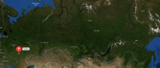
Syzran is located on the territory of the Samara region. The satellite map of Syzran is located on the coast of the Volga River.
A map is the best assistant on any journey. It helps to understand the interweaving of roads in an unfamiliar area and find the shortest routes to a populated area. The most amazing and beautiful sights can be found with its help. The map allows you to independently create convenient routes for walking around the city. After all, using it, it’s easy to find any house number and the most inconspicuous alley.
Syzran has a unique deposit of oil shale. Map of Syzran scheme
Indicates that sandstone and sand deposits are located near the city. You can also use it to find deposits of water sources.
Where is Syzran?
Syzran is the administrative center of the Syzran urban district and the Syzran municipal district.
The city is located in the Samara region on the right bank of the Volga River at the mouth of the Syzranka River. The approximate population is 173 thousand people. The total area of the territory is 117 square kilometers. The climate in Syzran is temperate continental with cold winters and hot summers. The average annual air humidity is 71%. Syzran is one of the most polluted settlements in Russia. One of the main environmental disasters is an oil spill within the city. This problem became especially acute in 2012, when an oil lens was discovered in the area of the Partisan Gully. According to Rosstat, every year 30-50 tons of pollution are released into the city’s atmosphere.
The time zone of the city of Syzran is MSK+1, the offset relative to Coordinated Universal Time (UTC) is +4.
City of Syzran (Samara region)
The city of Syzran in the Samara region is located on the right bank of the Volga at the mouth of the Syzranka River, 137 km west of Samara. The area of the city is 117 km², the population is 173,260 people. (2017, third in the region in number after Samara and Tolyatti).
The fortress city of Syzran was founded in 1683 by governor Grigory Kozlovsky to ensure the safety of the trade route. Kozlovsky was instructed to personally recruit a regiment of servicemen, move with it to the Samara Bow and establish a fortress on the Syzranka River. Kozlovsky chose an elevated place between the Syzranka and Krymza rivers (a tributary of the Syzran River). Construction continued throughout the summer of 1683.
According to the description, the fortress was of an irregular quadrangular shape, entrenched in a high earthen rampart and surrounded by a wall of pine logs. It was protected on three sides by natural barriers - the rivers Syzran, Krymza and a branch of the Volga River, called “Volozhka”. On the fourth side, the archers dug a deep ditch, which was subsequently filled with water. The total length of the fortress wall is 290 fathoms (about 630 meters). The corners are reinforced with four log towers.
Syzran, Spasskaya Tower
The fifth tower with the fortress gate in the center of the southern defensive wall was made of stone. Since 1688, this main gate tower was called Spasskaya in honor of the icon of the Savior Not Made by Hands, which was located on the first tier of the tower, directly above the gate.
At that time, the Spasskaya Tower had two tiers. The first is the so-called gate part, and the second tier was occupied by gunners, and it was called “pechury”. “Why “pechury”? Yes, because the gunners crawled out of it after the shot, like from a stove, grimy,” experts explain. In total, there were 10 cannons in Syzran - two were copper, the rest were made of cast iron. Two cannon barrels from that time still survive. At the moment they stand near the Syzran Museum of Local Lore as a memory of historical Syzran. Since its foundation, the fortification has served as an outpost for guarding caravans going from East to West. The village acquired city status only in 1796.
Syzran, St. John the Baptist Monastery
The first Syzran Kremlin was wooden, with 7 towers in the corners, surrounded by a rampart and a moat. But the military function of the city soon faded into the background. In the 18th century, the city turned into a large trading center, grain trade, agriculture, leather, shoemaking, tailoring, woodworking crafts developed here, and a merchant class was formed.
Coat of arms of Syzran, approved on December 22, 1780. On the upper part is the coat of arms of Simbirsk, and on the lower part is “a black bull in a golden field”
In 1780, Catherine II established the city's coat of arms - a black bull in a golden field - for success in the trade of livestock and grain. In 1781, Syzran became a district town of the Simbirsk governorship. In 1782, a regular development plan was drawn up for Syzran. At that time, the city consisted of three parts, separated by the Syzran and Krymza rivers. In 1796, Syzran became a district city of the Simbirsk province.
From the second half of the 19th century, fairs began to be held in Syzran 4 times a year. The entire area around the Spasskaya Tower turned into a shopping area. At that time, Syzran ranked fourth in the Volga region in grain processing, second only to Nizhny Novgorod, Ulyanovsk, Samara and Saratov.
Coat of arms of Syzran in 1863: “On a golden shield there is a black bull with fierce eyes. At the top is the coat of arms of the Simbirsk province. The shield is crowned with a silver tower crown of three teeth, surrounded by golden ears of corn tied with an Alexander ribbon."
Along the rivers there were a large number of powerful mills of the merchants Chernukhins, Perezhogins, Sterlyadkins, Ilins, Tsvetkovs, Revyakins. Syzran mills were mainly steam-powered. The only surviving building of the merchant Chernukhin's mill is still located in Volzhsky Lane on the way to the city beach. True, there is now a local entertainment establishment there. By the way, the merchant Chernukhin himself was recognized as an expert in the flour-milling industry.
Syzran, view from the Zakrymskaya side to the Bazhenov mill
On the Krymza River, behind the modern Crystal stadium, there was a mill of the merchant Bazhenov. During Soviet times there was a toy factory there. In 2007, the abandoned mill was blown up and residential buildings were built on the cleared area. The impetus for the development of the city was given by the construction of the railway in the last third of the 19th century. At the turn of the 19th and 20th centuries, the main industry in Syzran was flour milling. The city ranked 4th in Russia in grain processing, second only to Nizhny Novgorod, Saratov and Samara.
Syzran, Sobornaya street
As a result of a fire in July 1906, about 5,500 buildings burned down in Syzran, and most of the city was destroyed. A fire broke out in the courtyard of the house of one of the local merchants, where jam was being made. The open flame was not controlled; it spread to neighboring wooden buildings. Due to strong winds, the fire engulfed the entire city center in a matter of minutes.
In total, the city burned for about a day. The consequences of the fire were catastrophic: in a short time, Syzran was almost completely wiped off the face of the earth. The fire did not affect only a couple of streets near the railway station, a residential area of the city on the other side of the river, and the monastery. The total losses from the fire in prices of that time amounted to approximately 18 million rubles. At least 1,000 people died.
Syzran, branch of the state bank
After the fire, stone construction of the city began. Merchants built mansions for their families and public needs. Churches were built with donations from townspeople. By 1916, there were 15 large industrial enterprises in Syzran with incomes of at least 20 thousand rubles, small ones - more than a hundred.
Syzran construction of the Alexander Bridge across the Volga
Syzran, railway station
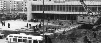
During the years of Soviet power, changes in the structure of industrial production were influenced by the discovery of large deposits of oil and oil shale. In 1919, the industrial development of oil shale began, which was used as fuel during the Civil War, then they began to be used in the medical industry. On May 17, 1926, a large flood began in Syzran. The disaster in scale and damage caused was second only to the fire of 1906.
At that time, the main part of the city was located in lowlands, protected by dams from the Volga flood. The deterioration of the dam coincided with an unprecedentedly severe flood. Dams were demolished, mills, a power plant, and many houses were flooded. According to statistics, a third of the city's economy was destroyed. But Syzran coped with this disaster.
Since 1928, Syzran has been the center of the Syzran district of the Middle Volga region.
During the war years, the industrial potential of Syzran increased 4-5 times due to evacuated enterprises. In those years, some central ministries and departments were located on the territory of the city, since the second capital - Kuibyshev (the name of Samara in 1935-1991) could not accommodate all the institutions evacuated from Moscow. . In 1942, on the basis of the working settlements of Batraki, Pravaya Volga, Pervomaisk and the village of Kostychi, the Oktyabrsky district of the city was created. By decree of the Presidium of the Supreme Soviet of the RSFSR of August 7, 1956, the Oktyabrsky district was transformed into the city of regional subordination of Oktyabrsk.
In the post-war period, the petrochemical, chemical, energy, light, woodworking, food industries, and mechanical engineering developed in Syzran. The city ranks third in the Samara region in terms of industrial potential. Syzran is a major railway junction in six directions. From Syzran, railway lines diverge into six directions: two lines to the east: the first to Samara, the second through the Zhigulevskoye More station to Bezymyanka station; line from north to south from Ulyanovsk to Sennaya; two lines to the west - to Penza and Ruzaevka.
Syzran has retained the appearance of a Volga merchant city of the 19th century. Until 2010, the city had the status of a historical settlement in Russia. With the publication of the decree of the Ministry of Culture and the Ministry of Regional Development of the Russian Federation on July 29, 2010, the city lost its historical status.
There are 143 historical, cultural and architectural monuments located in the city. The Spasskaya Tower of the Syzran Kremlin (1683) is the oldest building in the city, its main attraction. Inside it is the Kremlin Museum. On the territory of the Kremlin hill stands the Church of the Nativity of Christ (1717). The churches of the Feodorovskaya Mother of God (1738), Ilyinskaya (1776) and the Ascension of the Lord (1852-1957) are distinguished by their architecture. The Kazan Cathedral (1872) with its bell tower is clearly visible from the Kremlin hill. Its main shrines are the icons of the Feodorovskaya Mother of God and the Kazan Mother of God.
From the complex of monastic buildings of the Ascension Monastery (1685), the Church of the Ascension (1738) has been preserved. Work is underway to restore the monastery buildings. On the site of the former monastery grounds is located the largest district of the city - the South-Western (known as “Mongora”), built up mainly with multi-storey buildings.
Old Believers Church of the Exaltation of the Cross
The Church of the Exaltation of the Cross is the only surviving Old Believer temple in Syzran. It was built at the expense of the Belokrinitsky Old Believer community. Construction began in 1905 and was completed in 1912. Today, the Church of the Exaltation of the Cross exists in a damaged state - although the main volumes have been preserved, the ceilings have been lost. The currently operating Old Believer Church of the Exaltation of the Holy Cross is located at the address: Syzran, Frunze Street, building 78.
Coat of arms of Syzran, approved on March 19, 2002. French quadrangular shield with a pointed base, a walking black bull in a golden field on green ground
The main street of the city, Sovetskaya, is a single urban planning ensemble of buildings; like the entire historical center of the city, it is made in a variety of architectural styles: a representative of modernism is the Klyarov house (1910), the mansion (architect F. O. Shekhtel) of the merchant Sterlyadkin (1914).
The dominant position on Sovetskaya Street is occupied by the eclectic style - the city bank (1863), the house of the tradesman Myasnikov (1909), the house of the Syromyatnikov merchants (1910), the house of Markushina (late 19th century). On the neighboring streets of the historical center of the city there are buildings made in the Biedermeier style, as well as examples of Russian serf architecture, wooden carvings on the streets of Sverdlov, Ulyanovskaya, Kirov, Internatsionalnaya.
Syzran Airport
Syzran does not have its own airport. The nearest international airport is Kurumoch named after Sergei Korolev, which is located in Samara. The distance from the center of Syzran to the airport is 140 km. Airfield type: civil. The airport has the status of an object of federal significance and is considered one of 12 hub airports in Russia. Operating hours: 24 hours a day.
The airport serves major Russian and international airlines: Aeroflot, Azur Air, Czech Airlines, Vueling, KrasAvia. flyDubai. Popular destinations of regular and charter flights: Moscow, Sochi, Istanbul, Ufa, St. Petersburg. The annual passenger traffic is more than 3 million people.
Skip to content
Main menu:
- HomeAbout the organizationGalleryProjectsAchievements PartnersSport. Teams.Our sportUsefulCreativityContacts
- home
- About the organization
- Gallery
- Projects
- Achievements
- Partners
- Sports Teams
- Our sport
06/16/2017 Origin (etymology) of the word Syzran.
The history of the founding of the city of Syzran is inextricably linked with the founding of other cities and villages (towns, etc.) in the area. It is clear that development always proceeded along trade routes and from borders; in the Volga region, first fortresses, later cities, were based on the Volga River, then fortresses were based on tributaries. Let's go through the years of founding of cities in the district, starting from the west, Penza (1663), Kuznetsk (1699), Saransk (1641), Alatyr (1552), Surskoye (1552), Karsun (1647), Ulyanovsk (1648), Sengilei (1666 ), Terenga (1682), Shigony (1480), Tolyatti (1737), Samara (1586), Khvalynsk (1556), Baltai (1696), Petrovsk (1698). On the map, inside this area (circled in black), there are forests and swamps, in some places even relict ones; of course, the boundaries are conditional. The main inhabitants of some settlements were “runaway” peasants who appeared here long before the founding of fortified cities.
Now let’s remember where the peasants fled from the landowner, to the forests and swamps. There weren't many forests left in central Russia and the Black Earth Region. People fled beyond the Volga, beyond the Urals. Some of the freedom-loving people remained in the local forests. Some people were intoxicated by the newly acquired freedom and were drawn to a crazy path, and this is how the Zhiguli Freemen was formed; nature itself created favorable conditions for this.
Let's return to Syzran, as we know, the year of foundation is considered to be 1683. Not far from the source of the Syzranka River, which gave the city its name, there is one of the sources of the Syzganka River, a distance of about 20 km. Isn’t it true that the names of these rivers are consonant. Let us pay attention to the year of formation, consonant with the word Syzran, Syzgan (later Bazarny Syzgan), Syzganskaya Sloboda was founded in 1638 by archers. It is clear that there cannot be two settlements with the same name. Why exactly did it turn out to be Syzran, and as a Western European clerk (German, French, etc.) writes down the word Syzgan from the words of a commoner speaking the southern dialect of the Russian language (for example, a Cossack), let's read the name of our city written in Latin, Syzran - we will hear Syzgan. Both settlements received their names from the rivers of the same name, the basins of these rivers (the Syzganka basin is circled in yellow, the Syzranka basin is circled in green. It becomes clear that both rivers received their names from the toponym Syzgan. Translated from Tatar, the word “Syzgan” means ran away, escaped, etc. words for those times “runaway.” In modern words, “freedom-loving.” Every Syzran citizen can call himself freedom-loving.
There is a version that the word Syzran was formed from the phrase “from the wound”. Barge haulers got up from the wound to pull the barges. I think barge haulers appeared in these places later than the formation of Syzran, because the banks were full of robbers, and barges were a very tasty morsel, and the barge haulers themselves could rebel and go into the forests with goods. It was more profitable for ships to move with sails and oars.
Umyarov I.
Home | About the organization | Gallery | Projects | Achievements | Partners | Sports | Useful | Creativity | Contacts | Map of site
Train Station
The Syzran-1 railway station is a large junction station of the Samara region of the Kuibyshev railway and the central railway station in the city. The station is located at Privokzalnaya Square, 1. The railway station is open every day around the clock.
Long-distance trains run through the Syzran-1 railway station in the following directions: Moscow, Samara, Kislovodsk, Irkutsk. Suburban trains are also serviced at the station.
The second railway station of Syzran “Syzran-City” is located at st. Slantsevaya, 6, near the Torpedo stadium. The railway station is open 24 hours a day.
Automobile highways
The following roads pass through Syzran:
- M5 "Ural" is a federal highway with a total length of 1879 km. It is part of the Asian routes AH6 and AH6, as well as part of the European route E30. The route passes through the territory of the following regions of Russia: Ryazan region, Tatarstan, Chelyabinsk region, Bashkortostan, Penza region, Mordovia, Moscow region, Orenburg region. The road surface of the M-5 route is asphalt.
- P228 is a federal highway that runs through the Samara, Saratov, Ulyanovsk and Volgograd regions. The total length of the route is 678 km. The road surface is asphalt.
- E30 is a European route that originates in Ireland and passes through the UK, Russia, Germany, Poland, and the Netherlands. The total length of the highway is 5,800 km.
What is Syzran known for?
- In 1872, the Kazan Cathedral was built in Syzran. The temple was built with funds raised by parishioners. In 1930, the temple was closed, but during the war, believers opened the cathedral to parishioners.
- In the central part of the city there is the Syzran Kremlin, which was built by order of Peter I in the 17th-18th centuries. The reason for the construction of the Kremlin was the regular raids of nomadic tribes and bandits into the territory of Syzran. Inside the building there is a church, which is named in honor of the Savior Not Made by Hands. The Spasskaya Tower is an object of cultural significance and has the status of an object of federal significance.
- Also in the city there is a mansion of the merchant Sterlyadkin - a two-story building of one of the richest merchants. Construction lasted from 1908 to 1914. The house has three facades, which are made in Art Nouveau style.
- In 1871, the first women's gymnasium opened in Syzran. A large library was also opened here. The facade of the building has remained unchanged to this day.
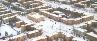
Map of Syzran with houses
Syzran has long been a merchant city. Traveling through the streets of the city, you can find many remarkable objects. There are more than three hundred of them in the city.
Using the Syzran routes on the map, it is worth visiting the following attractions:
- On Sovetskaya Street you can see beautiful ancient buildings: the mansion of the merchants Syromyatnikov, the house of the Klars, the building that belonged to the tradesman Myasnikov and other buildings.
- A drama theater and a park area for children can also be found on Sovetskaya Street.
- Ancient houses, which are examples of the architecture of the past two centuries, can be found on Kirov and Ulyanovskaya streets.
- In the city you can see the Kremlin. Of its buildings, the Church of the Nativity of Christ, as well as the Spasskaya Tower made of stone, have been preserved. Inside the tower you can visit an interesting museum. A detailed map of Syzran will help you find these objects. The architectural complex is surrounded by a beautiful square with numerous monuments.
- The magnificent Kazan Cathedral is also worth a visit. It was built in the 19th century. The temple contains unique shrines - these are icons with particles of the relics of saints.
- The oldest building in the city is the Ilyinsky Monastery. Which appeared in the 17th century.
The city has its own icon painting school. You can learn the history of the city in the local history museum. Where unique collections of paintings, sculptures and decorative arts are presented. The halls of the museum contain more than 50 thousand exhibits.