Sterlitamak is one of the largest and most beautiful cities in Bashkortostan.
The satellite map of Sterlitamak shows that this settlement is surrounded on one side by the Ural Mountains, and on the other by the East European Plain.
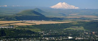
One of the mountains, Shikhan, is listed in the Red Book.
The map provides all possible assistance in finding the desired object. It makes it easy to walk along the streets of an unfamiliar city and find the addresses of all historical or architectural attractions.
Since the city is considered the largest engineering center, as well as a major center of the chemical industry, the map of Sterlitamak will help you find all major objects.
Where is Sterlitamak?
Sterlitamak is one of the largest Russian cities located in the Republic of Bashkortostan.
It is the administrative center of the Sterlitamak district, has the status of a city of regional importance and forms the municipal formation of the urban district of the city of Sterlitamak. The city is located on the left bank of the Belaya River south of the geographical center of Bashkiria. Towards the east of the city are the Ural Mountains (50 km away). The approximate population is 280 thousand people. The total area of the city is 108 square kilometers.
In the central part of Sterlitamak flows the Sterlya River, which flows into the Ashkadar River. Five road bridges were built across the Sterlya River within the city. The Belaya River flows along the border between Sterlitamak and Ishimbaysky district. The climate in the city is temperate continental: cold snowy winters, warm and hot summers. The average annual air humidity is 72%. The annual precipitation rate is 553 mm.
The time zone of the city of Sterlitamak is MSK+2, the offset relative to Coordinated Universal Time (UTC) is +5.
Map of Sterlitamak with streets
Geographically, the city is divided into two large areas: eastern and western, which are divided into smaller microdistricts.
It is worth using the Sterlitamak street map to find the following streets:
- Lenin Avenue is considered one of the main and important streets. Its location is in the western part of the urban area. This highway connects the industrial area and the central one. There are many significant city objects on its territory: Gagarin Park, drama theatre, Iskra cinema, as well as many shops.
- In the western part of the city you can find October Avenue. Along it there are various banks, the Palace of Culture, shops, bowling clubs and cafes.
- Mira Street stretches from the Ashkadar River to the VTS microdistrict. It arose in the 19th century and was called Noble. Using a map of Sterlitamak with streets in good quality, you can find a garment factory, a lyceum and a central library on the territory of a given street.
- Chernomorskaya Street connects the streets of the city center with the south-eastern districts. There is a meat processing plant building on it.
- In the east of the city there is Gogol Street. It was created in the 80s of the last century.
- Only residential private houses are located on Belorusskaya Street.
- One of the central streets is Krasnaya. It crosses the entire city and connects all existing areas.
With a map of Sterlitamak by district you can find any district:
- Near the old city there is a military-technical cooperation area. On its territory there is a machine plant, a clinic and the private sector.
- The Sterlya and Ashkadar rivers flow through the territory of the Old City. In it you can find the Tatyana Church, a mosque, the Kolkhoz Market, as well as Kirov Park.
- The railway station area is located in the old part of the city. On its territory you can find a shopping center.
- In the Soda district there is a factory of the same name. It is also located in the old part of the city, but is considered more comfortable. It houses a huge sports and fitness complex. A detailed map of Sterlitamak will allow you to find it.
- The Kurchatovsky district is distinguished by its amenities. It has a developed infrastructure.
- In the Uralsky district there is a petroleum technical university, as well as a palace of culture.
- The new districts of the city include Solnechny and South-West. There are many new buildings on their territory and well-developed infrastructure.
Sterlitamak Airport
There is a civil airport in Sterlitamak, which is located 15 km from the city and 4 km southeast of the village of Preobrazhenovka. The airport was actively used until 1997. The last regular flights were operated to Moscow. Currently, the airfield is sometimes used by local airlines. Public events are also held on the airport grounds. Since 2008, the airport has been undergoing reconstruction: major repairs of the runway, restoration of buildings and infrastructure.
How to find a plot on the public cadastral map of Sterlitamak
Information is presented by type of property. To find out publicly available information on a site, you need to enter its cadastral number, location address, or click on the official map of Sterlitamak and the data will open for you:
- cadastral number;
- appointment;
- registered area;
- for the house, the year of construction;
- location coordinates.
By navigating a cadastral map from a satellite, you can assess the infrastructure surrounding the land plot, adjacent lands and objects.
To expand the list of information received about a land plot or building, here you can also order a report on the property or on the history of the transfer of rights, as well as a certificate of cadastral value.
Train Station
The railway station in Sterlitamak is a sectional station of the Bashkir region of the Kuibyshev Railway. The number of platforms is 2, the number of tracks is 15. The railway station is located at st. Vokzalnaya, 27g. The railway station operates 24 hours a day. The railway station building has a spacious waiting room, free Wi-Fi, luggage storage and personal belongings, a café, and a medical center.
Popular long-distance train destinations: Ufa, Tashkent, Ulyanovsk, Orenburg, Moscow, St. Petersburg, Nizhnevartovsk. Also at the railway station there are commuter trains to Karlaman and Kumertau.
Location and geography of Sterlitamak
Sterlitamak on the map of Russia is located in the Republic of Bashkortostan (Volga Federal District of the Russian Federation).
This is the second most populous city in Bashkiria, with a population of 276,394 people as of 2022. According to the territorial division of the subject, it is the administrative center of the Sterlitamak region, but is not part of it. Received the status of a city of republican significance. The map scale is adjusted by the “+” and “-” symbols on the side. Today Sterlitamak is considered the leading link in the industrial cluster of the Trans-Ural region (with specialization in mechanical engineering, oil refining and the chemical industry). Industrialization was facilitated by a successful geographical location with an extensive network of transport arteries.
Of the major Russian cities, Izhevsk (460 km), Samara (584 km), Kazan (610 km), and Yekaterinburg (617 km) are close to Sterlitamak. At a 30-kilometer distance from Sterlitamak there are two Bashkir cities, Ishimbay and Salavat. They form a single polycentric agglomeration. By order of the head of government Mikhail Mishustin, a special economic zone (SEZ republic) with a total area of 470 hectares was formed here in 2022.
What is Sterlitamak famous for?
- In 1975, the Liberation monument was erected on the banks of the Sterlya River. The monument is dedicated to the memory of the heroes of the Civil War of 1919. The monument depicts militia soldiers and a girl from the sanitary detachment Nina Teplova.
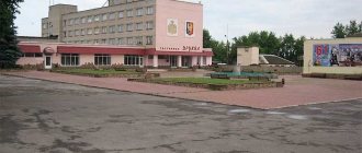
- In the central part of the city there is the Zemstvo Government Building, a building from the pre-revolutionary period. Currently, the building houses the Social Security Administration.
- Among the city's attractions, it is necessary to highlight the Zhilkin bakery, where bread was baked from 1909 to 1946. Currently, the bakery building houses a rolling shop. The building is two-story: the first floor is made of brick, the second is made of wood.
- In 1991, the Bashkir Drama Theater opened in Sterlitamak. The premiere performance took place in the same year. The Bashkir Drama Theater is located on Lenin Avenue.
Map of Sterlitamak with houses
With Sterlitamak routes on the map, you can explore the city well and make a travel plan to its interesting places:
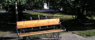
- It’s worth going for a walk with children to Gagarin Park. It offers a variety of amusement rides and visitors can also admire the fountain.
- Interesting performances can be seen at the Russian Drama Theater. It is the oldest theater in the republic. It can be found in the Old Town. A map of Sterlitamak with streets and houses will help you do this.
- There is also a local history museum in the Old Town. It is small in size, but it has many exhibits telling about the history of the city, and also has a collection of various fossils.
- Fans of active recreation will enjoy a trip to the Shikhany ski resort. It is located next to Mount Kush-Tau.
- The Tatiana Temple is considered a valuable landmark of the city. It contains rare icons with particles of holy relics. Yandex maps of Sterlitamak will help you find the way to the temple.
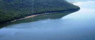
- Lake Tugarsalgan is considered a unique natural attraction. This place is under special state protection.
Road transport infrastructure of Sterlitamak
To see the city of Sterlitamak from a satellite with an overlay of roads, streets and house numbers, click the “layers” button and select “hybrid”.
A special feature of the industrial region is its developed transport network. You can get to Sterlitamak by water or railway, by car or plane.
Roads
To get information about traffic jams in Sterlitamak, click the corresponding button on the map.
The road network in the vicinity of Sterlitamak is represented by:
- federal highway Ufa-Orenburg;
- Ufa Highway (access to Sterlitamak);
- Orenburg highway to Salavat;
- regional highway to Krasnousolsky;
- Raevsky tract;
- Sterlibashevsky tract.
There are bypass roads around the city intended for large transit vehicles.
Railway transport
The Ufa-Orenburg section of the Bashkir branch of the Kuibyshev Railway passes through the city. There are 3 stops:
- north of the city – Kosyakovo stop (suburban direction);
- Sterlitamak central railway station – commuter trains and interregional trains stop;
- platform "150 km" in the southwest.
From Sterlitamak stations you can leave in the directions of Ufa, Tashkent, Kumertau, Karlaman. The main disadvantage of the Sterlitamak railway is the low speed of trains.
Water and air transport
The water transport of Sterlitamak lost its ground after the shallowing of the navigable rivers Ashkadar and Belaya in the 1950s of the last century. Now there is no cargo and passenger shipping that is significant for the economy of Sterlitamak.
On the map, the operating airport closest to Sterlitamak is located in Ufa (at a distance of 140 km). The air harbor has international status and accepts all types of aircraft (including wide-body Boeings). Air communication has been established with Adler, Kaliningrad, Moscow, St. Petersburg, Simferopol, Arkhangelsk, Novosibirsk, Min. Vody, Istanbul, Antalya, Dushanbe and other cities. A total of 40 Russian and foreign airlines use it.
Geographical characteristics of this city - relief, reservoirs, forests
The Sterlitamak region is located on a gently ridged part of the Pribelskaya Plain. Erosion processes are frequent here, and the relief is interspersed with plains and ridges, residual hills. The average absolute height of the earth's crust is 150-210 m.
The calling card of Sterlitamak and the region are the shikhans (single mountain hills), which stand out spectacularly against the background of the plains and steppes. There are many of them throughout the territory, and Yuraktau, Kushtau, and Toraktau, located in the valley of the White Sopka River, are recognized as natural monuments of republican significance.
The soils are represented by leached and typical chernozems. The thickness of the humus layer reaches 40-65 cm, the top layer contains up to 10-12% humus. Also represented by “spots” are podzolized chernozems, gley, turf, forest, and saline soils.
In pre-industrial times, Sterlitamak and the surrounding area were famous for their forb-grass steppes and meadow-steppe forbs, but due to the activities of the petrochemical industry, fescue-feather grass steppes, devoid of forbs, are encroaching. The forest area of the Sterlitakak district is 13,160 hectares. 6.9% are conifers, 36% are broad-leaved trees, 67% are mixed forests.
Using our map, you can find the nearest rivers, lakes and forests yourself. Routes passing through the city.
Four rivers flow through the territory of the Sterlitamak region:
- small Olkhovka and Sterlya - flow into Ashkadar;
- Ashkadar is a tributary of the Belaya;
- Belaya - a tributary of the Kama;
- Kama flows into the Volga.
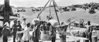
When a pier for transporting Iletsk salt was founded in 1766, the future city was founded in the area between the Ashkadar and Sterli rivers (which at one time gave its name to the city). Over the course of more than 2 centuries, the location has shifted to the left bank of the Belaya, but in the interfluve the historical part of the city has been preserved, where Sterlya and Ashkadar still carry their waters.
Administrative division
The Sterlitamak region includes 20 municipalities and 110 settlements. The territorial structure of the city is the western and eastern parts with their own microdistricts:
- western location – Uralsky, Komsomolsky, Kommunistichesky, Kurchatovsky, Leninsky, Nakhimovsky, Solnechny, Pervomaisky;
- eastern location – Yuzhny, Shakhtau, Ashkadarsky, Zheleznodorozhny, Mikhailovsky, Severny, Sovetsky, Krasnoznamensky.
The territory separator is the railway tracks.
If some object is not on the Yandex map, turn on the 2GIS or OSM map.