City in Stavropol Krai, Russia
| Svetlograd Svetlograd | |
| Town[1] | |
| Types of Svetlograd | |
| Flag Coat of arms | |
| Location Svetlograd | |
| Svetlograd Location Svetlograd Show map of Russia Svetlograd Svetlograd (Stavropol Territory) Show map of Stavropol Territory | |
| Coordinates: 45°21′N 42°51'E / 45.350°N W. 42.850 ° E. / 45.350; 42.850Coordinates: 45°21′N 42°51'E / 45.350°N W. 42.850 ° E. / 45.350; 42.850 | |
| A country | Russia |
| Federal subject | Stavropol region[1] |
| Administrative region | Petrovsky district[1] |
| Town | Svetlograd |
| Based | 1750 |
| City status from | 1965 |
| Height | 130 m (430 ft) |
| population (2010 Census)[2] | |
| • General | 38,520 |
| Administrative status | |
| • Capital from | Petrovsky district[1], Svetlograd |
| Municipal status | |
| • Municipal district | Petrovsky municipal district[3] |
| • Urban village | Urban settlement Svetlograd[3] |
| • Capital from | Petrovsky municipal district[4], urban-type settlement Svetlograd[3] |
| Timezone | UTC + 3 (MSK [5]) |
| Postal code(s)[6] | 356530 |
| OKTMO I WOULD | 07646101001 |
| Web site | Svetlograd.org |
Svetlograd
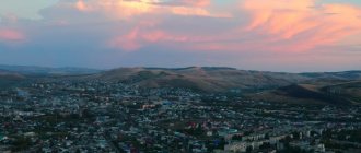
(Russian: Svetlograd) is a town and the administrative center of Petrovsky District in Stavropol Krai, Russia, located on the Kalaus River, 85 kilometers (53 mi) northeast of Stavropol, the administrative center of the krai. Population: 38,520 (2010 Census);[2]39,370 (2002 Census);[7]37,213 (1989 Census).[8]
Population
City population dynamics:
| Year | 1789 | 1819 | 1850 | 1889 | 1907 | 1959 | 1970 | 1979 | 1989 | 2000 | 2002 | 2003 | 2004 | 2005 | 2006 | 2007 | 2010 | 2011 |
| Population (thousand people) | 0,118 | 0,559 | 5,532 | 5,938 | 8,996 | 24,3 | 30,9 | 33,6 | 37,2 | 40,4 | 39 370 | 39,4 | 39,5 | 39,5 | 39,5 | 39,4 | 38 520 | 38 496 |
National composition
- 4) Gypsies - 338 people (0.86%)
- 1) Russians - 36 thousand 900 people (93.73%)
- 2) Armenians - 604 people (1.53%)
- 3) Ukrainians - 406 people (1.03%)
Microdistrict division
The city consists of microdistricts:
- Slide
- Energy town
- Long
- Cheryomushki
- Victory
- Nosachev village (incorporated into the city in 1965)
- Kachavan
- Railway
- Solenoye Ozero village (incorporated into the city in 1965)
- Elderberry
- Tutinovoye
- Kislichee
- Factory town
- Center
Map
| Svetlograd: maps |
Svetlograd: photo from space (Google Maps) Svetlograd: photo from space (Microsoft Virtual Earth)
| Svetlograd. Nearest cities. Distances in km. on the map (in brackets along roads) + direction. Using the hyperlink in the distance , you can get the route (information courtesy of the AutoTransInfo website) | |||
| 1 | Konstantinovskoe | 17 () | Z |
| 2 | Blagodatnoe | 22 () | Z |
| 3 | Gofitskoe | 32 (36) | SE |
| 4 | Kugulta | 36 () | Z |
| 5 | Grachevka | 38 (38) | Z |
| 6 | Ipatovo | 42 (56) | WITH |
| 7 | Summer Rate | 47 (49) | IN |
| 8 | Grateful | 52 (70) | SE |
| 9 | Staromaryevka | 55 () | SW |
| 10 | Trunovskoe | 58 () | Z |
| 11 | Hope | 65 (97) | SW |
| 12 | Pelagiad | 66 () | Z |
| 13 | Mikhailovsk | 67 (102) | Z |
| 14 | Alexandrovskoe | 69 (89) | YU |
| 15 | Donskoe | 70 (141) | Z |
| 16 | Moskovskoe | 73 (127) | Z |
| 17 | Verkhnerusskoe | 74 () | Z |
| 18 | Stavropol | 74 (89) | SW |
| 19 | Marvelous | 74 (96) | NE |
| 20 | Ryzdvyany | 78 (163) | Z |
| 21 | Safe | 79 (166) | NW |
| 22 | Novoselitskoye | 79 (93) | SE |
| 23 | Tatar | 81 (97) | SW |
| 24 | Abundant | 88 (145) | Z |
| 25 | Bird's eye | 90 () | Z |
| 26 | Chernolesskoye | 95 (116) | SE |
| 27 | Priyutnoye (Republic of Kalmykia) | 99 () | NE |
| 28 | Kursavka | 101 (209) | YU |
| 29 | Novotroitskaya | 102 () | Z |
| 30 | Nevinnomyssk | 106 (154) | SW |
| 31 | Solnechnodolsk | 106 (169) | Z |
| 32 | Arzgir | 106 (197) | IN |
a brief description of
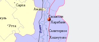
Located in the Ciscaucasia, on the Stavropol Upland, on the river. Kalaus (tributary of the Eastern Manych), 85 km northeast of Stavropol. Railway junction lines and highways.
Territory (sq. km): 255
Information about the city of Svetlograd on the Russian Wikipedia site
Historical sketch
Founded in 1750 as the village of Petrovskoye; name after the first settler, peasant Peter Burlak.
In 1965, the village was transformed into the city of Svetlograd; the name is unmotivated.
Economy
Textile and haberdashery factory. Meat, poultry and food processing plants. Butter, cheese and wine factories. Production of building materials. Railway transport enterprises.
In the Petrovsky district, wheat, corn, barley, sugar beets, and sunflowers are grown. They raise cattle, sheep, horses, and pigs.
Natural gas field.
Culture, science, education
Branch of the Stavropol Museum of Local Lore.
Universities of the city
Svetlograd branch of the Institute of Friendship of the Peoples of the Caucasus
356537, Stavropol Territory, Svetlograd, Exhibition Square, 30
Stavropol State University (Svetlograd branch)
356530, Stavropol region, Svetlograd, Kuznechnaya st., 285
Museums, galleries, exhibition halls
Svetlograd Museum of Local Lore 356500, Stavropol Territory, Svetlograd, st. Lenina, 2 Phone(s): (86547) 30-752
| Population by year (thousands of inhabitants) | |||||||
| 1939 | 18.0 | 1996 | 39.9 | 2007 | 39.4 | 2015 | 37.8 |
| 1959 | 24.3 | 1998 | 40.2 | 2008 | 39.5 | 2016 | 37.5 |
| 1967 | 28 | 2000 | 40.4 | 2010 | 39.3 | 2017 | 36.9 |
| 1970 | 30.9 | 2001 | 40.4 | 2011 | 38.5 | 2018 | 36.4 |
| 1979 | 33.6 | 2003 | 39.4 | 2012 | 38.6 | 2019 | 35.7 |
| 1989 | 37.2 | 2005 | 39.5 | 2013 | 38.3 | 2020 | 35.4 |
| 1992 | 38.3 | 2006 | 39.5 | 2014 | 38.1 | 2021 | 34.9 |
Historical sketch
Petrovsky district was formed in 1924. Before this, the villages included in its composition were listed in Blagodarnensky, and even earlier - in the Novogrigorievsky district of the Stavropol province.
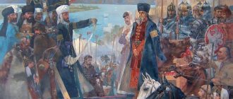
Before the annexation of the North Caucasus to Russia, the Nagais lived here. Serfs fled to these places to escape the oppression of the landowners. They were called barge haulers. One of these barge haulers, Peter, the leader of the fugitive Ukrainian peasants, settled in the 1750s near the Kalaus River near a sandy mountain covered with dense forest. Peter, together with the Nagais and his gang, engaged in theft and robbery. Soon his fellow countrymen, the same runaway peasants, many of them with their families, began to come to him. And so, in the deep forest, the Petrov village arose.
In 1782, by Decree of Catherine II, the settlement of the region by the civilian population was allowed. The Petrovskaya community was registered in 1786. According to a statement compiled in 1787, 139 Kyiv Cossacks and 40 Kharkov villagers lived in the village of Petrovskoye. “The physical development of Peter’s peasants leaves nothing to be desired: in most cases, high growth and a strong physique with corresponding muscular strength (5-7 pounds of weight - no matter) are the characteristic physical characteristics of Peter’s peasants. It’s not for nothing that Peter’s recruits are often enlisted in the guard,” - this is the verbal portrait of Peter’s peasant compiled by teacher G. Kosoglyadov at the end of the 19th century. The Petrovka women were also beautiful. People came here for brides from Stavropol itself.
Along the banks of the rivers Kalaus, Buivola, Karamyk, where there was timber and fertile soil, villages were formed by people from the central provinces of Russia and the left bank of Ukraine. Their names reflect either the names of the first settlers - Petrovskoye, Konstantinovskoye, Donskaya and Nikolina Balki, Shvedino; or natural differences - Medvedskoye (Gofitskoye), Orekhovka, Berestovka (Blagodatnoye), Sukhaya Buivola. They settled according to their clan in so-called hundreds. Each had its own name, preserved in the names of streets and districts - Karamyk, Kachavan, Hutun in Svetlograd, Shumayka in Nikolina Balka, Kizilevka in Orekhovka.
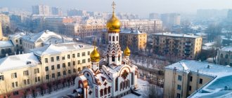
The first thing the settlers did was build a church in the center of the village. At first they were wooden, and in the 19th century they began to build stone ones. Unfortunately, many churches were destroyed in the 30s of the 20th century. A similar fate befell the church in Petrovsky, which was one of the most beautiful in the Stavropol province.
Initially, houses were built of wood, which led to massive deforestation, and this, in turn, to the opening of sand. Petrivka residents often suffered from eastern dry winds, which, carrying sand, caused great damage to farms. After all, the main occupation of the peasants was agriculture and cattle breeding. Surplus bread was sold not only at local bazaars and fairs, but also sent to the nearest railway stations in Rostov and Novorossiysk. Therefore, plague-making, i.e., transportation, was developed. And the cattle were even sent to Moscow.
By the end of the 19th century, the village of Petrovskoye became prosperous and served as a trading center for the surrounding villages. They sold not only bread and livestock, but also vegetables, grapes, and handicrafts. Trade turnover in good years reached 2,000,000 rubles.
Pottery production was greatly developed, since the shores of Kalaus were rich in clay. Brick and tile factories appeared in many villages. Houses began to be built from adobe and covered with tiles. And at the beginning of the 20th century, urban-type buildings appeared in Petrovsky - two-story stone buildings covered with iron.
In 1843, the first school was opened in the Petrovskaya volost, and in 1879 a special building was built for it. This is the first stone building; it now houses the Young Technicians Station. By the beginning of the 20th century, each village had 1-2 schools - necessarily a parish school and a state school, the so-called ministerial school. A public library was opened at the first ministerial school in the 1890s. On the initiative of the local intelligentsia, at the expense of the community, a gymnasium was built and opened in the village of Petrovskoye in 1908 - the first in Blagodarnensky district.
In the 19th century, medical care was provided by paramedics, but they were not available in every village. And the district doctor was only in Petrovsky. The “Volnaya” pharmacy opened in 1882.
Personal horses were used for communication between villages. This was one of the most important natural duties of the peasants. They were required to transport officials, officials, and messengers on business. In addition, there were state postal stations in Petrovsky, Vysotsky, Medvedsky and Konstantinovsky. The postal and telegraph office in Petrovskoye and the post office in Medvedskoye served nearby villages.
The first telephone exchange with 26 numbers began operating on October 1, 1929.
Gallery
The railway station building was built in 1915 (2009).
The former building of the zemstvo hospital, built in 1912 (winter 2011).
Gymnasium No. 1 is the oldest educational institution in the city.
Red Bridge over the Kalaus River within the city (winter 2011).
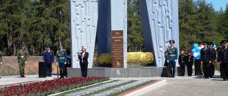
Stelaa at the entrance to the city
Svetlograd
(Stavropol region)
OKATO code:
07246501
Founded:
1750
City since:
1965 City of regional subordination
Center:
Petrovsky district
The city was formerly called:
| Petrovskoe | 1786 | 1965 |
| Telephone code (reference phone) | |
| 86547***** | 33-3-33 |
Deviation from Moscow time, hours:
0
Geographic latitude:
45°20′
Geographic longitude:
42°51′
Altitude above sea level, meters:
130 Sunrise and sunset times of the Sun and Moon in the city of Svetlograd