Chechnya is a mountainous republic located in the eastern part of the North Caucasus. It is distinguished by transitional types of climate - ranging from arid in the Terek-Kuma semi-desert, ending with the snowy peaks of the Side Range.
Formed by the union of several mountain and lowland teips (tribes), present-day Chechnya has long been associated with two brutal wars for independence, which lasted more than 10 years. After 2009, when hostilities officially ended, Chechnya recovered and transformed.
Chechen Republic: briefly about the main thing
When the Second Chechen War began, the administration of the Chechen Republic was formed. Its leader was Akhmat Kadyrov, who went over to the side of Russia. In 2003, the Chechen Republic adopted a new Constitution, according to which it became part of the Russian Federation. Also, in 2003, presidential elections were held in which Akhmat Kadyrov was elected. However, he was killed on May 9, 2004 in Grozny due to a terrorist attack.
Alu Alkhanov took the place of Akhmat Kadyrov in 2004. He resigned after 3 years, in 2007. Ramzan Kadyrov, the son of Akhmat Kadyrov, became the new president of the Chechen Republic in 2007.
According to the State Committee of Russia, the population of Chechnya is 1,324,767 people. (2013). The most populated is the capital - the city of Grozny (250,803 people), the second place is occupied by the city of Urus-Martan (52,399 people).
Representatives of various nationalities live in the Chechen Republic: Chechens, Russians, Kumyks, Chamalals, Nogais, Ingush, Tatars and many others. etc. The official languages of the republic are Chechen and Russian.
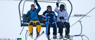
The republic contains a large number of beautiful places: rivers, lakes, waterfalls, high mountains, etc.
General features of the regional economy
Perhaps the main and most famous feature of the Chechen economy is its subsidization. On average, the republic receives up to 60 billion rubles of annual financial assistance from the center. And according to this indicator, Chechnya is one of the three most subsidized regions of Russia.
Another anti-record: the Chechen Republic ranks fourth in the country in terms of unemployment (almost 17%). The most difficult situation is observed in villages, where there are only 2 to 10 workers per 100 residents. Paradoxically, the total income of the population of Chechnya is growing every year. The reasons for this growth are various social payments, benefits, “shadow earnings,” as well as money from labor migrants earned in Moscow and other countries.
In terms of gross product, the economy of Chechnya ranks only 85th among the constituent entities of the Russian Federation. The oil and gas sector still dominates in the structure of the republic's economy. In addition, the construction industry, chemical and food industries are developed here. Construction of a thermal power plant continues in Grozny.
The lion's share of agricultural products is provided by livestock farming (in particular, sheep and poultry farming). Cereals, sugar beets, potatoes and vegetables are grown on the lands of Chechnya.
Interesting facts about Chechnya
- The main religion is Islam;
- State languages: Chechen and Russian;
- Now the republic is home to just under one and a half million people;
- The bulk of the republic's population are Chechens;
- In Chechnya, penny coins do not circulate and prices in local retail outlets are always multiples of one ruble;
- In Chechnya, cars are almost never stolen (but times are changing);
- Contrary to popular belief, no one forces Chechen women to wear headscarves;
- Almost all surnames in Chechnya are based on the name of an ancestor;
- This republic was the first territory where a ban on the operation of slot machines was adopted;
- According to local traditions, men are considered adults from the age of 15. That is, at this age they must themselves be responsible for all the actions they have committed;
- Chechens, like the Ingush, call themselves Vainakhs. Translated into Russian, the word “vai” means “one’s own”, and “nakh” means “people”. Thus, Vainakh means “one’s people” or “one’s people.”
Photos of Chechnya
The authors of the photographs are Timur Agirov and Abdullah Bersaev (personal pages on livejournal.com and the Open Caucasus project).
History of the Chechen Republic
People have lived in the plains of Sunzha and Terek since time immemorial, but in the 13th century the ancestors of modern Chechens were forced to leave for the mountainous areas. The reason for this was the turmoil brought during the Tatar-Mongol invasion.
Thus, until the 16th century, the bulk of Chechens lived in mountainous areas. Around the same period, in the society of representatives of the Vainakh ethnic group, the teip, or as it is also called, the tribal structure of society, began to emerge, in which the territory of a person’s residence and his family ties, which are very strong among this people to this day, were of great importance.
Since the 16th century, Chechens began to gradually move to the flatlands again. And at the same period, one Shikh-Murza Okotsky begins to establish connections with Moscow and sends his like-minded people to the capital of Russia, called upon to discuss the entry of Chechnya into Russia.
Around the same time, the first Cossack settlers appeared here, marking the beginning of the formation of the so-called Terek Cossacks. In the 18th century it ceased to be free, and the Cossacks officially became part of the Russian armed forces. The main task of the Terek Cossacks was to protect the southern borders of Russia.
In the 18th century, Russian military campaigns into the territory of Chechnya became regular. The cause of the conflict was the constant complaints of the Cossacks about the raids of the indigenous population on their settlements, which did not contribute to the security of the borders.
In the 19th century, Emperor Alexander II issued a decree according to which Chechnya officially became part of the Russian Empire, along with other districts. This territory began to be called the Terek region.
After the Russian civil war of 1917, an Islamic state was created on the territory of the republic. The head of the North Caucasus Emirate was Uzun Haji (emir). However, the emirate soon lost its independence and became known as the Mountain Autonomous Soviet Socialist Republic, as it became part of the Russian Soviet Federative Socialist Republic (RSFSR).
Then, with the advent of Soviet power, at the beginning of the 20th century, the Terek region was divided into Ingush and Chechen districts. Then, in 1934 and 1936, it was alternately renamed the Chechen-Ingush Autonomous Okrug and the Chechen-Ingush Autonomous Soviet Socialist Republic.
During the Great Patriotic War, at the end of winter 1944, the entire population of Chechnya was deported to Kazakhstan and Central Asia. The reason for these repressive measures was the unfair accusation of the Chechens and Ingush that they allegedly acted as accomplices of the fascist troops.
As a result, the Chechen-Ingush Autonomous Soviet Socialist Republic was disbanded. Its territories were partially annexed to other geographical entities, and partially included the Grozny region. Thus, the city of Grozny was preserved and became the administrative center of the newly formed region. In 1957, a decision was made to restore justice to the Chechen-Ingush Autonomous Soviet Socialist Republic, and the indigenous population returned to their native lands. However, the problem of the land issue still exists between some regions.
Districts[ | ]
Achkhoy-Martanovsky[ | ]
| List of settlements | |||
| № | Locality | Type | Population |
| 1 | Achkhoy-Martan | village | 20 172 |
| 2 | Valerik | village | 8023 |
| 3 | Davydenko | village | 1702 |
| 4 | Zakan-Yurt | village | 5835 |
| 5 | Qatar-Yurt | village | 12 806 |
| 6 | Kulary | village | 5358 |
| 7 | New Sharoy | village | 1924 |
| 8 | Samashki | village | 11 275 |
| 9 | Old Achkhoy | village | 940 |
| 10 | Hambi-Irzi | village | 3297 |
| 11 | Shaami-Yurt | village | 4018 |
| 12 | Yandy | village | 2488 |
Vedensky[ | ]
| List of settlements | |||
| № | Locality | Type | Population |
| 1 | Agishbatoy | village | 686 |
| 2 | Ari-Aul | village | 1 |
| 3 | Arsoy | village | 1 |
| 4 | Barze | farm | 0 |
| 5 | Belgatoy | village | 621 |
| 6 | Benoy | village | 440 |
| 7 | Buni | village | 0 |
| 8 | Vedeno | village | 3186 |
| 9 | Verhata | village | 971 |
| 10 | Upper Tsa-Vedeno | village | 556 |
| 11 | Upper Kurchali | village | 218 |
| 12 | Gezincu | village | 73 |
| 13 | Guni | village | 849 |
| 14 | Dargo | village | 2160 |
| 15 | Jani-Vedeno | farm | 0 |
| 16 | Duts-Khutor | village | 388 |
| 17 | Dyshne-Vedeno | village | 4834 |
| 18 | Ihara | village | 8 |
| 19 | Kezena | village | 9 |
| 20 | Kel-Aul | village | 0 |
| 21 | Cat-Are | farm | 0 |
| 22 | Kulinkhoy | village | 13 |
| 23 | Kurchali | village | 0 |
| 24 | Makazhoy | village | 373 |
| 25 | Marzoy-Mokhk | village | 576 |
| 26 | Mahkets | village | 5028 |
| 27 | Mesedoy | village | 227 |
| 28 | Neftyanka | village | 300 |
| 29 | Nizhnye Kurchali | village | 130 |
| 30 | Knife | farm | 0 |
| 31 | Oktyabrskoe | village | 1167 |
| 32 | Rigahoy | village | 5 |
| 33 | Sadoy | village | 0 |
| 34 | Selmentausen | village | 909 |
| 35 | Middle Kurchali | village | 92 |
| 36 | Tazen-Kala | village | 685 |
| 37 | Tevzana | village | 3378 |
| 38 | Tunzhi-Aul | village | 0 |
| 39 | Hazhi-Evla | village | 734 |
| 40 | Kharachoy | village | 762 |
| 41 | Harkaroy | village | 11 |
| 42 | Khattuni | village | 2626 |
| 43 | Hinda | village | 0 |
| 44 | Hoy | village | 49 |
| 45 | Tsa-Vedeno | village | 1285 |
| 46 | Sherdy-Mokhk | village | 54 |
| 47 | Elistanzhi | village | 2570 |
| 48 | Ersena | village | 420 |
| 49 | Eshilhata | village | 406 |
| 50 | Yukarçoy | farm | 0 |
Groznensky[ | ]
| List of settlements | |||
| № | Locality | Type | Population |
| 1 | Alkhan-Kala | village | 11 415 |
| 2 | Barthoy | village | 299 |
| 3 | Berkat-Yurt | village | 3109 |
| 4 | Vinogradnoye | village | 3489 |
| 5 | Gazgorodok | village | 1499 |
| 6 | Goryacheistochnenskaya | village | 1617 |
| 7 | Gunyushki | village | 149 |
| 8 | Dolinsky | village | 1459 |
| 9 | Friendship | village | 130 |
| 10 | Ilyinovskaya | village | 1788 |
| 11 | Ken-Yurt | village | 1832 |
| 12 | Kerla-Yurt | village | 1506 |
| 13 | Krasnostepnovskoe | village | 168 |
| 14 | May | village | 176 |
| 15 | Embankment | village | 78 |
| 16 | Nagornoye | village | 1081 |
| 17 | Oktyabrskoe | village | 2971 |
| 18 | Pervomayskaya | village | 5245 |
| 19 | Petropavlovskaya | village | 4303 |
| 20 | Pobedinskoe | village | 3540 |
| 21 | Pravoberezhnoe | village | 2269 |
| 22 | Proletarskoe | village | 1845 |
| 23 | Rainbow | village | 2462 |
| 24 | Sadovoye | village | 3206 |
| 25 | Terskoye | village | 1341 |
| 26 | Tolstoy-Yurt | village | 8097 |
| 27 | Tsentora-Yurt | village | 2770 |
Gudermes[ | ]
| List of settlements | |||
| № | Locality | Type | Population |
| 1e-06 | city of republican significance | ||
| 1 | Gudermes | city | 57 179 |
| 1.000002 | rural settlements | ||
| 2 | Azamat-Yurt | village | 1500 |
| 3 | Biltoy-Yurt | village | 1872 |
| 4 | Braguns | village | 3304 |
| 5 | Upper Neuber | village | 4099 |
| 6 | Gerzel-Aul | village | 3887 |
| 7 | Gordali-Yurt | village | 1703 |
| 8 | Darbankhi | village | 2101 |
| 9 | Jalka | village | 7415 |
| 10 | Ishkhoy-Yurt | village | 3800 |
| 11 | Kadi-Yurt | village | 4355 |
| 12 | Komsomolskoe | village | 4392 |
| 13 | Koshkeldy | village | 4823 |
| 14 | Melchhi | village | 2859 |
| 15 | Nizhny Noibera | village | 6780 |
| 16 | New Engenoy | village | 3021 |
| 17 | New Benoy | village | 1741 |
| 18 | Oyskhara | village | 9489 |
| 19 | Khangish-Yurt | village | 858 |
| 20 | Shuani | village | 2351 |
| 21 | Engel-Yurt | village | 4458 |
Itum-Kalinsky[ | ]
| List of settlements | |||
| № | Locality | Type | Population |
| 1 | Basho | village | 0 |
| 2 | Bauloy | village | 34 |
| 3 | Bashin-Kali | village | 0 |
| 4 | Baturgu | village | 0 |
| 5 | Becigi | village | 0 |
| 6 | Bugaroy | village | 303 |
| 7 | Veduchi | village | 384 |
| 8 | Upper Tsamadoi | village | 0 |
| 9 | Upper Bara | village | 9 |
| 10 | Gezakh | village | 9 |
| 11 | Guhoy | village | 685 |
| 12 | Guchum-Kali | village | 221 |
| 13 | Zumsoy | village | 222 |
| 14 | Itum-Kali | village | 1068 |
| 15 | Kenahoe | village | 0 |
| 16 | cockatoo | village | 420 |
| 17 | Konzhukhoy | village | 0 |
| 18 | Hatches | village | 0 |
| 19 | Motzkara | village | 86 |
| 20 | Mulkoy | village | 0 |
| 21 | Sakan-Iiste | village | 0 |
| 22 | Tazbichi | village | 739 |
| 23 | Tuskhara | village | 334 |
| 24 | Ushkaloy | village | 361 |
| 25 | Heldi | village | 0 |
| 26 | Hildeharoy | village | 590 |
| 27 | I want | village | 0 |
| 28 | Tsatsakh | village | 0 |
| 29 | Shunda | village | 18 |
| 30 | Eziho | village | 0 |
| 31 | Erstaho | village | 0 |
Kurchaloevsky[ | ]
| List of settlements | |||
| № | Locality | Type | Population |
| 1 | Alleroy | village | 11 132 |
| 2 | Akhkinchu-Borzoi | village | 1889 |
| 3 | Akhmat-Yurt | village | 7115 |
| 4 | Achereshki | village | 252 |
| 5 | Bachi-Yurt | village | 16 485 |
| 6 | Belts | village | 943 |
| 7 | Geldagana | village | 12 350 |
| 8 | Jaglargi | village | 511 |
| 9 | Dzhankhoy-Khutor | village | 0 |
| 10 | Dzhigurts | village | 1967 |
| 11 | Ilaskhan-Yurt | village | 5041 |
| 12 | Koren-Benoy | village | 413 |
| 13 | Kurchaloy | city | 27 478 |
| 14 | Myrtup | village | 11 838 |
| 15 | Nicky-Hita | village | 657 |
| 16 | Regita | village | 783 |
| 17 | Usum-Khutor | village | 0 |
| 18 | Khidi-Khutor | village | 1093 |
| 19 | Tsotsi-Yurt | village | 18 306 |
| 20 | Enikali | village | 1130 |
| 21 | Yalkhoi-Mokhk | village | 4452 |
Nadterechny [ | ]
| List of settlements | |||
| № | Locality | Type | Population |
| 1 | Beno-Yurt | village | ↗7762[5] |
| 2 | Bratskoe | village | ↗5641[5] |
| 3 | Upper Naur | village | ↗6247[5] |
| 4 | Gvardeiskoye | village | ↗8472[5] |
| 5 | Goragorsk | village | ↗5778[5] |
| 6 | Zebir-Yurt | village | ↗911[5] |
| 7 | Znamenskoye | village | ↗12 396[5] |
| 8 | Kalaus | village | ↘1033[5] |
| 9 | Komarovo | village | ↘1406[5] |
| 10 | Meken-Yurt | village | ↗2918[5] |
| 11 | Mineral[6] | farm[7] | →247[8] |
| 12 | Nadterechnoe | village | ↗9748[8] |
| 13 | Podgornoye | village | ↗1951[5] |
Naursky[ | ]
| List of settlements | |||
| № | Locality | Type | Population |
| 1 | Alpatovo | village | 4861 |
| 2 | Further | village | 182 |
| 3 | Ishcherskaya | village | 4808 |
| 4 | Kalinovskaya | village | 7988 |
| 5 | Kapustino | farm | 494 |
| 6 | Blades | farm | 137 |
| 7 | Kozlov | farm | 30 |
| 8 | Korneev | farm | 284 |
| 9 | Krechetovo | farm | 98 |
| 10 | Levoberezhnoe | village | 2353 |
| 11 | Mayorsky | farm | 63 |
| 12 | Mekenskaya | village | 3860 |
| 13 | Peaceful | farm | 101 |
| 14 | Naurskaya | village | 9050 |
| 15 | Nikolaevskaya | village | 1867 |
| 16 | Novoe Solkushino | village | 2257 |
| 17 | Novoterskoye | village | 3764 |
| 18 | Abundant | farm | 113 |
| 19 | Lean | farm | 396 |
| 20 | Rubizhne | village | 2643 |
| 21 | Savelyevskaya | village | 2263 |
| 22 | Free | village | 244 |
| 23 | Selivankin | farm | 232 |
| 24 | Semikolodtsev | farm | 13 |
| 25 | Suvorovsky | farm | 268 |
| 26 | Ulyanovskoe | village | 1087 |
| 27 | Frunzenskoe | village | 1415 |
| 28 | Chernokozovo | village | 3085 |
| 29 | Yubileiny | village | 796 |
Nozhai-Yurtovsky[ | ]
| List of settlements | |||
| № | Locality | Type | Population |
| 1 | Aiti-Mokhk | village | 1674 |
| 2 | Alleroy | village | 1085 |
| 3 | Alkhan-Khutor | village | 898 |
| 4 | Baytarki | village | 1660 |
| 5 | Balance | village | 1361 |
| 6 | Bas-Gordaly | village | 155 |
| 7 | Benoy | village | 1216 |
| 8 | Benoy-Vedeno | village | 2391 |
| 9 | Betty-Mohk | village | 955 |
| 10 | Besil-Irzu | village | 261 |
| 11 | Bilts | village | 305 |
| 12 | Bulgat-Irzu | village | 1059 |
| 13 | Galayty | village | 1895 |
| 14 | Gansolchu | village | 225 |
| 15 | Gendergen | village | 689 |
| 16 | Gilany | village | 1198 |
| 17 | Gordali | village | 586 |
| 18 | Gurzhi-Mokhk | village | 826 |
| 19 | Dattah | village | 911 |
| 20 | Devlatbi-Khutor | village | 200 |
| 21 | Dengi-Yurt | village | 475 |
| 22 | Zamay-Yurt | village | 1593 |
| 23 | Zandac | village | 5006 |
| 24 | Zandak-Ara | village | 706 |
| 25 | Isay-Yurt | village | 112 |
| 26 | Ishkhoy-Khutor | village | 205 |
| 27 | Koren-Benoy | village | 368 |
| 28 | Lem-Korz | village | 188 |
| 29 | Maxi-Khutor | village | 48 |
| 30 | Little Shuan | village | 267 |
| 31 | Meskets | village | 3447 |
| 32 | Mehkeshti | village | 181 |
| 33 | New Zamay-Yurt | village | 137 |
| 34 | Nozhay-Yurt | village | 6744 |
| 35 | Ozhi-Yurt | village | 275 |
| 36 | Osi-Yurt | village | 358 |
| 37 | Pachu | village | 281 |
| 38 | Roghun-Kazha | village | 367 |
| 39 | Sayasan | village | 1145 |
| 40 | Simsir | village | 1701 |
| 41 | Sovragi | village | 105 |
| 42 | Sogunts | village | 498 |
| 43 | Sterch-Kerch | village | 580 |
| 44 | Tatay-Khutor | village | 537 |
| 45 | Turty-Khutor | village | 376 |
| 46 | Hashki-Mokhk | village | 40 |
| 47 | Hochi-Ara | village | 323 |
| 48 | Tsentaroy | village | 317 |
| 49 | Chechel-Khi | village | 284 |
| 50 | Church-Irzu | village | 1061 |
| 51 | Shovkhal-Berdy | village | 840 |
| 52 | Shuani | village | 193 |
| 53 | Engenoy | village | 1137 |
Sernovodsky[ | ]
| List of settlements | |||
| № | Locality | Type | Population |
| 1 | Assinovskaya | village | 10 184 |
| 2 | Bamut | village | 6025 |
| 3 | Sernovodskoe | village | 10 805 |
Urus-Martanovsky[ | ]
| List of settlements | |||
| № | Locality | Type | Population |
| 1 | Alkhazurovo | village | 4600 |
| 2 | Alkhan-Yurt | village | 9783 |
| 3 | Gekhi | village | 11 744 |
| 4 | Gekhi-Chu | village | 2342 |
| 5 | Goyskoe | village | 1943 |
| 6 | Goyty | village | 16 177 |
| 7 | Goi-Chu | village | 5078 |
| 8 | Krasnopartizansky | village | 694 |
| 9 | Martan-Chu | village | 5983 |
| 10 | Michurina | village | 335 |
| 11 | Roshni-Chu | village | 5195 |
| 12 | Starye Atagi | village | 10 884 |
| 13 | Tangi-Chu | village | 2643 |
| 14 | Urus-Martan | city | 63 955 |
| 15 | Shalazhi | village | 4998 |
Shalinsky[ | ]
| List of settlements | |||
| № | Locality | Type | Population |
| 1 | Authors | village | 14 988 |
| 2 | Agishty | village | 1227 |
| 3 | Belgatoy | village | 4551 |
| 4 | Germenchuk | village | 10 736 |
| 5 | Duba-Yurt | village | 6315 |
| 6 | Mesker-Yurt | village | 10 368 |
| 7 | New Atagi | village | 8728 |
| 8 | Serzhen-Yurt | village | 5615 |
| 9 | Chiri-Yurt | village | 5734 |
| 10 | Shawls | city | 56 226 |
Sharoysky[ | ]
| List of settlements | |||
| № | Locality | Type | Population |
| 1 | Buti | village | 57 |
| 2 | Kyunghee | village | 1552 |
| 3 | Kesaloy | village | 52 |
| 4 | Kiri | village | 200 |
| 5 | Khakmadoy | village | 177 |
| 6 | Himoi | village | 309 |
| 7 | Hulandoy | village | 57 |
| 8 | Cesi | village | 111 |
| 9 | Chairs | village | 139 |
| 10 | Sharoy | village | 311 |
| 11 | Gorgeous | village | 129 |
Shatoisky[ | ]
| List of settlements | |||
| № | Locality | Type | Population |
| 1 | Aslanbek-Sheripovo | village | 1097 |
| 2 | Beckum-Kale | village | 214 |
| 3 | Benoy | village | 432 |
| 4 | Big Varanda | village | 470 |
| 5 | Greyhound | village | 4063 |
| 6 | Vashindaroy | village | 746 |
| 7 | Vysokogornoe | village | 161 |
| 8 | Yards | village | 512 |
| 9 | Gorgachi | village | 142 |
| 10 | Gush-Kert | village | 501 |
| 11 | Give | village | 536 |
| 12 | Dachu-Borzoi | village | 1791 |
| 13 | DTS "Chishki" | locality | 183 |
| 14 | Deh Yiste | village | 161 |
| 15 | Zones | village | 352 |
| 16 | Laha-Varanda | village | 947 |
| 17 | Maly Kharsenoy | village | 27 |
| 18 | Muscali | village | 37 |
| 19 | Musalt-Aul | village | 220 |
| 20 | Nihala | village | 443 |
| 21 | Nokhchi-Keloy | village | 404 |
| 22 | In memory | village | 192 |
| 23 | Pionerskoe | village | 304 |
| 24 | Nearby | village | 269 |
| 25 | Sanoi | village | 0 |
| 26 | Sutti | village | 153 |
| 27 | Plots | village | 258 |
| 28 | Tumsoy | village | 385 |
| 29 | Ulus-Kert | village | 645 |
| 30 | Urdukha | village | 343 |
| 31 | Hakkoy | village | 30 |
| 32 | Hal-Kiloy | village | 468 |
| 33 | Harsena | village | 160 |
| 34 | Chishki | village | 1186 |
| 35 | Sharo-Argun | village | 303 |
| 36 | Shatoy | village | 2953 |
| 37 | Yukerch-Keloy | village | 165 |
| 38 | Yarysh-Mardy | village | 49 |
Shelkovskaya[ | ]
| List of settlements | |||
| № | Locality | Type | Population |
| 1 | Borozdinovskaya | village | 551 |
| 2 | Burunskoe | village | 907 |
| 3 | Voskresenovskoe | village | 915 |
| 4 | Sunrise | village | 206 |
| 5 | Grebenskaya | village | 6227 |
| 6 | Dubovskaya | village | 2039 |
| 7 | Green | village | 4 |
| 8 | Kargalinskaya | village | 4181 |
| 9 | Karshyga-Aul | village | 553 |
| 10 | Kobe | village | 1805 |
| 11 | Kurdyukovskaya | village | 2164 |
| 12 | Peaceful | village | 226 |
| 13 | Novo-Shchedrinskaya | village | 2044 |
| 14 | Oraz-Aul | village | 303 |
| 15 | Paraboch | village[9] | 473 |
| 16 | Sandy | village | 20 |
| 17 | Runic | village | 5 |
| 18 | Sary-Su | village | 1699 |
| 19 | Starogladovskaya | village | 2412 |
| 20 | Staro-Shchedrinskaya | village | 2173 |
| 21 | Kharkovskoe | village | 1502 |
| 22 | Scarlet | village | 9545 |
| 23 | Chervlyonnaya-Uzlovaya | village | 1244 |
| 24 | Shelkovskaya | village | 11 112 |
| 25 | Shelkozavodskaya | village | 1238 |
War in Chechnya
During the collapse of the USSR, various national movements intensified in Chechnya. The Executive Committee of the national congress was created here, thus, two branches of government worked simultaneously in the republic. The national movement was led by Dzhokhar Dudayev. The major general set his goal to achieve Chechnya's secession from the Soviet Union. The official head of the republic, Doku Zavgaev, did not give in to his position, and as a result, this contradiction formed the basis of a long-term military conflict.
After perestroika in 1991, Boris Yeltsin signed a decree introducing a special situation in the Chechen-Ingush Autonomous Soviet Socialist Republic. In response to this, Dzhokhar Dudayev began creating self-defense units. The first armed conflict between Russian and Chechen troops occurred in November 1991, when Dudayev’s fighters blocked planes with Russian military on board at Khankala airport. As a result of negotiations, Russian military personnel were withdrawn from Chechnya, leaving there most of the military equipment and weapons, which subsequently passed to Dudayev’s fighters.
The Chechen-Ingush Autonomous Soviet Socialist Republic ceased to exist and was divided into Chechnya and Ingushetia. In the last autumn of 1992, military operations took place on the territory and the displacement of the Ingush from the suburban area, and in the summer of 1992 it officially became part of the RSFSR as the Ingush Republic. In the same year, the Council of Russian Deputies recognized the existence of the Chechen Republic and introduced corresponding amendments to the constitution.
Ichkeria
Despite the fact that the independence of Chechnya was not recognized by any state, the republic actually existed independently, having its own government, courts, flag, coat of arms, anthem, etc. In 1993, it received a new name and became known as the Chechen Republic of Ichkeria.
The situation in Chechnya at that time was extremely tense. Business in the republic was mainly criminal, and was often based on hostage-taking, oil theft or drug trafficking.
The rampant crime became the reason that opposition movements began to form in Chechnya that did not support the Dudayev regime. Thus, the Provisional Council of the Chechen Republic arose here, whose members fought to overthrow Dudayev and enlisted the support of Russia.
This was followed by two large military campaigns. The first Chechen war, which began with the storming of Grozny, lasted from 1994 to 1995. Dzhokhar Dudayev died in 1995 from an air missile strike.
The second Chechen war began in 1999. Active hostilities in Chechnya ended in the early spring of 2000. Further, the military conflict was of a partisan nature. Now the Chechen Republic is officially part of the Russian Federation.
Authorities of Chechnya
The head of the Chechen Republic is Ramzan Kadyrov. He has held this position since 2007, after the official voluntary resignation of Alu Alkhanov.
And the first president of the Chechen Republic was Akhmad Kadyrov, the father of Ramzan Kadyrov. Under him, a constitution was adopted in 2003, according to which the republic became part of the Russian Federation. Akhmat Kadyrov died in 2004. He became one of the victims of the terrorist attack in Grozny.
Parliament of Chechnya:
- Council of the Republic - 21 people, according to the number of districts of the republic;
- The People's Assembly - 40 deputies - 20 from party lists and 20 from single-mandate constituencies.
On April 11, 2007, Odes Baysultanov was appointed Chairman of the Government of the Chechen Republic.
Geography of the Chechen Republic
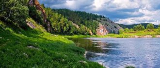
Geographically, Chechnya is located in the North Caucasus in the area of the Sunzha and Terek rivers. To the north of the republic steppe and semi-desert terrain predominates, to the south there are mountain ranges (Caucasus Mountains), and in the middle there is forest-steppe. The local climate can be classified as continental.
In addition to the Terek and Sunzha, on the territory of the republic there are 17 more rivers, 15 lakes, and five waterfalls. There are also many mountain ranges here, five of them are over four thousand meters.
Conventionally, the republic can be divided into several main zones:
- Predgorny. This land, partially covered with forest, has been famous for its fertility from time immemorial. Thanks to the fairly mild climate, fruit-bearing southern plants and trees have long taken root here. The value of this site was also given by the fact that many trees grow here, which are used to build houses and other structures;
- Mountain. People call this area the “black mountains”. Here there are mostly mountain ranges, “decorated” with beautiful waterfalls and gullies. It is noteworthy that a large area of rocks here is covered with black soil, thanks to which not only many ordinary trees grow in the forests, but also fruit-bearing species: plum, pear, dogwood, apple tree, etc. The huge number of herbs growing in the local forests, among which there are many medicinal ones, is also striking;
- Alpine. Here the picture is different. The harsh climate and cold caused the appearance of eternal snow and glaciers on the tops of the ridges. In the northern part of Chechnya, where the mountains are slightly lower, you can see valleys covered with black earth soil. During the warm season, they are usually used as pasture;
- Plain. There are two main plains in the Chechen Republic, one is located on the left bank of the Terek, and the second is between the Black Mountains, Termsky, Grozny, and Sunzhensky mountain ranges.
The republic can be proud not only of its incredibly beautiful mountain landscapes and generous fertile soil, but also of the presence of various natural resources on its territory. Chechnya has three dozen gas and oil fields. Gypsum, mineral paints, sandstone, limestone, etc. are also mined here. Famous healing mineral springs are also located here.
Natural attractions
Bragunsky ridge
Coordinates: 43.4116667, 45.9236111 How to get there: from Grozny north towards the village of Vinogradnoye
Stretching for 24 kilometers along the Terek River, the ridge is famous for its geothermal springs, which are part of a specially protected natural area of republican significance. The water temperature reaches +98 degrees. According to travelers, the springs have healing properties.
The springs formed by the tectonic rupture are used to treat a number of diseases of the gastrointestinal tract, kidneys and liver.
Mount Karakh
Coordinates: 43.4286111, 45.9113889 How to get there: from Grozny to the north towards the village of Vinogradnoye
One of the peaks of the Bragunsky ridge, rising 336 meters above sea level. The easiest and easiest peak to climb from the list of mountain ranges in Chechnya. But it is worth noting that the landscapes, air and climate, unlike the southern ranges, are completely different here.
Assa River
Coordinates: 43.1517, 45.2455 How to get there: from Grozny to Zakan-Yurt
The river, originating from the northern slopes of the Caucasus Range in Georgia, flows through the territory of Chechnya and Ingushetia. The rapid and stormy Assa forms a picturesque gorge.
Local residents tell a beautiful legend about the river, how Assa protected a shepherd from robbers - scaring away with her flow, she forced the offenders to stay on the other bank.
Lake Kezenoy-Am
Coordinates: 42.4638, 46.0911 How to get there: from Grozny towards Argun, then along the mountains through Shali, Serzhen-Yurt, Vedeno to the Kharami pass
The largest lake in the North Caucasus is located on the border of Chechnya and Dagestan at an altitude of 1870 meters above sea level. Research by geologists has shown that the deep and crystal clear lake appeared as a result of an earthquake. A rock collapse occurred and blocked the flow of two rivers at once - Khorsum and Kauhi.
The cataclysm formed a hundred-meter natural dam and, connecting the rivers, created a picturesque and deep lake.
In 2015, a sports and tourist complex opened its doors on the shore, where tourists began to actively flock.
The path to the lake is not easy and quite long, so it is best to hire an experienced guide.
Mount Ashenethe
Coordinates: 42.9292, 46.3017 How to get there: from Grozny towards Argun, then along the mountains through Shali and Vedeno
A mountain whose peak is not difficult to conquer. From an altitude of 1250 meters above sea level, views of mountain ranges open up. The easy route and close distance to the capital of Chechnya made the place touristic and frequently visited.
According to one legend, mountain Christians called Lam-Krists once lived on the top of Ashenete.
Lake Bezinom
Coordinates: 42.4348, 45.5510 How to get there: from Grozny to the south, through Starye Atagi to the village of Dai
Conveniently located at the foot of the mountains, Lake Bezinom is located 10 kilometers from the village of Dai in the Vedeno region in the south of Chechnya. The area of the pool is two hectares.
The lake was formed due to the raging elements - a landslide blocked the valley of a small river. Initially, the depth reached 50 meters, but over time the reservoir became shallow without losing its value - it is a specially protected natural area of republican significance.
Mount Kirilam
Coordinates: 42.4138, 45.5115 How to get there: from Grozny to the south through the village of Khimoi
A small but very picturesque peak is located in the south of the republic, a hundred kilometers from the capital. The maximum height is 2800 meters above sea level, and the terrain of the area allows tourists to climb without special training.
Mount Tebulosmta
Coordinates: 42.3424, 45.1843 How to get there: Russian border with Georgia
The highest mountain peak in Chechnya is located at an altitude of 4492 meters above sea level on the border of the republic with Georgia. The area is covered with eternal snow and is famous for rock crystal druses, the size of which sometimes reaches one meter.
This amazing natural landmark was first conquered in September 2022. The pioneers were trained professionals - instructors from the Russian University of Special Forces. It took 17 hours to climb the steep western slope. In the near future, it is planned to create a special camp for mountain training and mountaineering at one of the passes on the way to Tebulosmta.
Mount Dyclosmith
Coordinates: 42.2932, 45.4651 How to get there: Russian border with Georgia and Dagestan
The mountain did not immediately acquire its modern name. In pre-revolutionary years, the massif was called Dzana-Kort, which translated from Chechen means “mountain asking for rain.”
The peak is the natural border of Chechnya, Dagestan and Georgia. The ascent to an altitude of 4285 meters above sea level lies through the passes of East and West Diklo, West Diklosmt.
Mount Comito
Coordinates: 42.3158, 45.3559 How to get there: Russian border with Georgia
Located on the border with Georgia, the mountain peak rises 4261 meters above sea level. Komito is considered one of the highest points in Chechnya and Russia.
Despite the height and difficulty of the climb, it has acquired the unofficial status of a popular tourist route. The path to the top stretches along a narrow path along small mountain rivers and streams, eternal snow and glaciers.
Mount Donosmta
Coordinates: 42.3016, 45.4113 How to get there: Russian border with Georgia
Donosmta is part of the Main Caucasus Range complex, forming a natural border between Chechnya, Georgia and Dagestan.
For the first time, one of the highest mountain peaks in our country was conquered back in 1889, when mountaineering became popular in the Russian Empire.
The peak, 4176 meters above sea level, belongs to the third category of difficulty, so only trained and experienced climbers dare to take on the long and difficult climb.
If you have not yet chosen where you will live and want to save money when booking, we recommend using the RoomGuru service. Firstly, it contains hotels, apartments and guest houses from many different booking systems, so you won’t miss out on a worthwhile option. Secondly, you can immediately compare prices for one place in different services and book where it is cheaper (this is not always Booking!).
Rivers
The rivers on the territory of Chechnya are scattered. There are 20 main rivers in total, these are: Terek, Argun, Gekhi, Sunzha, Sharoargun, Aksai, Baas, Khulkhulau, Martan, Yamansu, Shalazha, Gums, Yaryk-su, Roshnya, Fortanga, Michik, Netkhoi, Shalazha, Chemulga, Assa.
There are 14 lakes, the largest and deepest of them is Lake Kezenoyam, located in the North Caucasus and is mountainous (belongs to the Vedeno region).
- Lakes of the Achkhoy-Martan region: Galayn-Am, Gekhi-Am.
- Lakes of the Shelkovsky region: Bolshoye, Solenoye, Cherkasskoye.
- Lakes of the Shatoi region: Urgyukhoy-am, Bezik-Ome.
- Lakes of the Naursky district: Kapustino, Mayorskoye, Generalskoye and Chechenskoye. One lake belongs to the Sharoysky district - Amga, as well as to Itum-Kalinsky - Chentiy-am.
There are only five waterfalls, these are: Argun, Genikh, Sharo-Argun, Khulkhuloi and Aksai waterfalls.
The highest peaks of the mountains were called “Four-thousander peaks”, befitting their height: Maistismta (4082 m), Donosmta (4174 m), Komito (4262 m), Diklosmta (4285 m), Tebulosmta (4493 m).
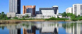
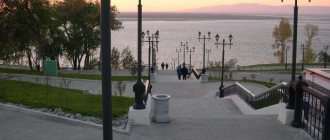
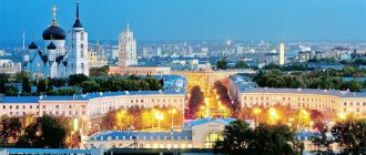
The city of Grozny is the capital of the republic
Grozny is the capital of Chechnya and the center of the administrative region of the same name. The city is located on the banks of the Sunzha River. It dates back to 1818, when the fortress was founded here. Russian soldiers erected it in just four months. Since at that time this area was a “hot spot” on the map of the North Caucasus, the fortress was nicknamed Grozny.
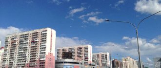
Modern Grozny is a fairly well-kept city with several dozen industrial enterprises and a significant number of new buildings. The main attractions of Grozny are the grandiose “Heart of Chechnya” mosque and the no less impressive complex of high-rise buildings “Grozny City”. The latter is located in the heart of the city and includes five residential buildings, an office building and a five-star hotel.
Fauna of Chechnya
Due to the fact that there are several different climatic areas on the territory of the republic, its flora and fauna are striking in their diversity. The climate here, depending on the area, can be continental, arid or alpine. In one area, the average winter temperature can be only “-3” degrees, and in another from “-12” to “-15” degrees. Precipitation in the republic is also uneven.
Considering that on the territory of Chechnya there are different natural zones, ranging from steppes and deserts, to forests, forest-steppes and glaciers in the mountains, you can meet a wide variety of fauna here.
In total, more than 400 species of animals live on the territory of the republic. Of these, about 200 are “Red Book”, which is why the republican authorities pay great attention to the fight against poachers exterminating rare species of animals.
Bears, lynxes and forest cats live in the mountains and gorges. The local forests are home to foxes, roe deer, chamois, weasels, badgers, Caucasian red deer and saiga.
The last animal, in appearance, very much resembles a ram with long legs, and prefers to live on dry, flat steppes. But in the mountains it is almost impossible to find this Caucasian animal. Also, here you can often see a wild jackal, which is a cross between a fox and a wolf. The jackal is omnivorous, and in the absence of meat or fish, is ready to eat, for example, fruits or wild berries.
The flora of the republic is also very rich. And if camel thorn and wormwood mainly grow on arid soils, then the black earth lands delight us with high yields of wheat, corn and various garden crops. And in the mountain meadows many medicinal herbs grow, and here local residents often set up apiaries to collect surprisingly aromatic, tasty and pure honey.
Coat of arms of Chechnya
Emblem of the Chechen Republic
The State Emblem of Chechnya was approved on June 22, 2004. The coat of arms is made in a round shape of a two-dimensional plane. It has four colors: yellow, white, red and blue.
In the central part of the Coat of Arms is the Symbol of Unity and Eternity in the form of a national Chechen ornament, which is painted red. The mountains, the oil rig and the historical Vainakh tower are painted blue.
On a blue background, yellow ears of wheat are depicted, framing the inner circle. They symbolize the wealth of the people of Chechnya.
The outer circle has an image of a red pattern of ornaments in the national style of the Chechens on a yellow background.
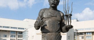
Historical and cultural monuments
Stele "Grozny"
How to get there: the central part of the traffic circle at the beginning of the P306 highway
On a small concrete pedestal stands a huge globe, symbolizing the long-awaited peace that has come after long bloody wars. The perimeter of the globe is surrounded by a “ribbon”, the inscription on which reads “Grozny is the center of the world.”
The mountainous republic is surrounded by picturesque nature and a unique landscape: from north to south, the desert gives way to dense forests and alpine meadows, the eternal ice of the peaks of the Caucasus mountains.