Kursk region is located in the southwestern part of the Central Federal District. If you look at a map of the Kursk region from a satellite, you can see that its western borders border with Ukraine. In terms of area, this region is one of the smallest in Russia - only 29 thousand km2. It is an agricultural area with a large amount of arable land.
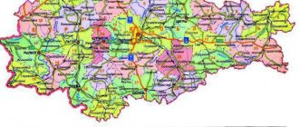
A map of the Kursk region by region allows us to see that the region is surrounded by the borders of several regions:
- Lipetskaya;
- Voronezh;
- Orlovskaya;
- Bryansk;
- Belgorodskaya.
The hydrography of the region belongs entirely to the Dnieper basin, although the region is not distinguished by significant water resources. Looking at the areas on the map of the Kursk region, you can find only a few rivers longer than 100 km. These are water arteries such as:
- Svala;
- Psel;
- Sejm;
- Tuskar.
Also in the region there are about 870 small lakes and 780 artificial hydrographic structures - ponds and reservoirs.
Using maps of the Kursk region with diagrams, you can find all the cities and towns in the region, and by zooming in, you can see streets and houses, administrative buildings and stations, roads and natural objects in each settlement.
Geography of the Kursk region
Geographically, the region is located in the southwest of the Central Russian Upland, between 50°54´ and 52°26´ northern latitude. It covers an area of 29.8 thousand square kilometers. From north to south it extends for 171 km, and from west to east – for 305 km.
The region has a temperate continental climate, with warm summers and relatively mild winters. Cloudy weather prevails throughout the year, occupying 60% of all days, and clear weather accounts for only 20%. Annual precipitation is 500–600 mm per year.
Administrative division and economy of the Kursk region
There are 28 districts and 480 village councils in the region. Within the Kursk region there are 2,775 rural settlements and 32 urban settlements. There are five urban districts and 28 municipalities.
The economy of the Kursk region is dominated by agriculture and ore mining. Kursk NPP is operational. 72% of the region's lands are cultivated. Growing of grain, fodder and industrial crops predominates. They raise cattle, poultry and pigs.
Both road and rail transport are developed in the Kursk region. The latter is largely tied to the territory of Ukraine.
Kastorinsky and Konyshevsky
More than 15 thousand people live in Kastorinsky, the center is the working village of Kastornoye. On the territory there are sugar and dairy factories, railway enterprises. There is a lot to see in the area, there are 16 burial mounds, the 18th-century Church of the Assumption of the Blessed Virgin Mary and holy springs.
In the Konyshevsky district of the Kursk region, the administrative center is the town of Konyshevka. There are few residents in the area - 8,744, and the administrative center accounts for almost 40%. In the area there are two churches of the 19th century, protected by law, and the monastery of Our Lady of the Sign.
Population of the Kursk region - general information
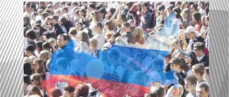
The Kursk region is one of the most populated in Russia. In 2017-2018, the population of the Kursk region was 1 million 116,000 people. The average population density was 37 people/m2. The share of the urban population is 68%.
The ethnic composition of the residents of the Kursk region is quite homogeneous. Over 90 percent of the population are Russians. There are much fewer Ukrainians in the region – only 1–2%. Armenians are in third place. Representatives of other nationalities are present in very small numbers.
The population dynamics of the Kursk region is quite negative. There was a steady increase in population until 1930, but then there was a rapid decline in the number of inhabitants, which continued until approximately 1960. At its maximum, the number was up to 3,000,000 people. By 1960 there were already only 1,500,000 people, that is, 2 times less than in 1930. After 1960, the population declined at a slow pace and not constantly. Thus, in recent years there has been no pronounced demographic dynamics in the region.
In 2003, the number of deceased residents was more than 2.2 times greater than the number of births. In 2010, this gap decreased significantly and amounted to a value close to 1.6.
Dmitrievsky and Zheleznogorsky
Dmitrievsky has 14,854 inhabitants (the center is the city of Dmitriev), which is home to about 44.56% of the total population.
15,890 people live in Zheleznogorsk, but only 10.52% live in urban areas, in the center, the working village of Magnitny. By the way, the city of Zheleznogorsk is the administrative center, but is not part of the district.
History of the region's population
Favorable climatic conditions and proximity to trade routes contributed to the settlement of the Kursk region. Initially, northerners lived here. Important trade routes passed through their lands.
Until the end of the 16th century, most residents led a nomadic lifestyle and moved frequently. In the next 2 centuries, the settlement of the region was facilitated by the transition to agriculture. In addition to immigrants from primordially Russian territories, Lithuanians began to actively move into the Kursk region. There were many Ukrainians in the south.
Among the Russian population of the Kursk region there were many representatives of southern Russian groups. Western and Central Russian nationalities were also common, but their share was smaller.
Ponyrovsky and Pristensky, Rylsky and Sovetsky
Almost 11 thousand people live in Ponyrovsky, the center is the town of Ponyri.
Pristensky has a population of 15.5 thousand inhabitants, the center is the town of Pristen. In the village of Kirovsky there is a museum “Command Post of the Voronezh Front”.
The Rila municipality has a population of 31,609. The center is the city of Rylsk. In the center of the village of Kapystich there is a settlement, excavations of which revealed that the settlement was founded back in the 9th and 11th centuries.
17 thousand people live in the Sovetsky district, the center is the town of Pshensky.
Age structure of the population
The average age of a resident of the Kursk region is 41.3 years. Compared to the previous census, it has increased by 1.3 years. This is due to the increase in life expectancy of the population. This value is close to the average for the population of the Central Federal District, where it is 40.9 years, and for Russia as a whole - 39 years. The decline in the birth rate is also the reason for the increase in the average age of residents.
The number of young residents of the region is steadily declining. In 2002, their share was 17.14%, and in 2010 – 14.78%. The picture is similar in the country as a whole - a decrease from 18.14 to 16.19 percentage share, and in the Central Federal District - from 15.33 to 13.85.
At the same time, the share of elderly people, on the contrary, increased – from 24.82 to 25.54 percent.
Solntsevsky and Sudzhansky
In the Solntsevo district, the center is the town of Solntsevo, the total number of residents of the municipal unit is 13,733. In the village of Orlyanka there is a church built in 1794.
In Sudzhansky (26,773 people), the center is the city of Sudzha. There are many industrial enterprises and 2 chalk developments. In the village of Gusevo there is the estate of P.D. Dolgorukov, and in the village of Gornal there is a large settlement.
Sex structure of the population
In the Kursk region, the same situation with the ratio of men and women is observed as in the country as a whole. Thus, the share of women was 54.7 percent, and the share of men was 45.3 percent.
The proportion of married men is greater than the proportion of married women. For every thousand males (16 years of age and older) in the region there were 659 married people, and for every thousand women of the same age there were 528 married people. This is largely due to the larger proportion of women in the population. After all, there are 105.5 thousand more of them in the region than men.
Some residents are in so-called unregistered marriages. There are 71 such people per thousand men, and 57 per thousand women. 225 men and 143 women (per thousand people) consider themselves bachelors (celibate).
The number of divorced men is 63 per thousand and another 13 separated. For women, these figures are 91 and 13 people, respectively.
The largest proportion of men was noted in the Kursk region - 47.3 percent. And the largest proportion of women (54.8 percent) is in the Glushkovsky and Sudzhansky districts.
History of the Kursk region
History of the Kursk region. Middle Ages.
Since the 1st millennium BC. e. The east of the region was nomadic and pastoral, while the west was sedentary and agricultural. It was the same in subsequent centuries, both during the era of Kievan Rus, and later, until the second half of the 2nd millennium: steppe nomads lived east of Kursk, settled agricultural Rus' lived to the west. The first border between them passed along the rivers Snova, Tuskar, then through Besedino and Oboyan. Here was also the first line of Slavic-Russian fortresses, most of which were settled on ancient settlements dating back to Scythian times. These fortresses were created by the Slavs of the Northern Union at the end of the 8th - beginning of the 9th century.
Since 882, the Seversk land, including the entire west of the Kursk land, became part of the united Old Russian state. And since then, for many centuries, Kursk “towns” and Kursk warriors - kmeti - stood as a frontier shield between Russia and the steppe, taking on the first blows of first the Khazars, then the Pechenegs, and the Polovtsians. This forced the princes to constantly worry about strengthening the lines of border fortresses. In the region, such lines stretched along Tuskar (the settlements of Kurskoye, Shuklinskoye, Pereverzevskoye, Svobodenskoye), along the Seim (Lipinskoye, Korobkinskoye, Artyushkovskoye, Yurasovskoye, etc.), along Kuritsa (Gnezdilovskoye, Northern Nartovskoye), along Svapa (Ratmanskoye, Starogorodskoye, Moiseevskoye , Krasny Kurgan, Mukhinskoye), along Psl (Oboyanskoye, Gochevskoye, Gornalskoye, Sukhodolskoye, etc.). In total, at least 60 Slavic-Russian settlements arose on Kursk land in the 8th - 9th centuries.
The fate of these fortress-fortifications developed differently. Some of them were abandoned by our ancestors and deserted even before the Mongol-Tatar invasion, others in the era of Kievan Rus turned into fortified estates of feudal lords, others remained border fortresses until Batu's defeat. And only a few became real cities.
Only two pre-Mongol cities have survived to this day: Rylsk and Kursk.
Rylsk is repeatedly mentioned in the chronicle, starting in 1152. It was the center of the small Rila principality. Archaeological exploration on Mount Ivan Rylsky, which is located in the city itself, showed that Rylsk as a fortified settlement arose in the 1st millennium BC. e. It was revived as a Slavic fortress at the end of the 8th century. When the fragmentation of Kievan Rus began into a number of independent principalities, Rylsk and the Rylsk principality became part of the larger and independent Chernigov, and then the Novgorod-Seversky principality. During the Mongol-Tatar yoke, the Rila principality and the Rila princes continued to exist as feudal dependents of the Golden Horde.
We find the first written mention of Kursk in the “Life” of a major political and church figure in Kievan Rus, written before the Mongol-Tatar invasion, Theodosius of Pechersk.
As can be seen from the Life, Theodosius came to Kursk with his father as a child. At this time, in Kursk there were already markets, bakeries, feudal lords and a ruler (prince or princely governor). There were brick churches. The Life describes a picture of an already formed ancient Russian city.
It is known for certain that Theodosius died in 1074. The Ustyug chronicle reports that Theodosius died at the age of 82. This means that he was born in 992, and, therefore, came to Kursk at the end of the 10th century.
There are other ancient mentions of pre-Mongol Kursk in chronicles. But there were doubts as to whether it was in the same place where it is now, or whether it was transferred here in later times.
Nowadays, numerous archaeological finds have proven that Kursk from time immemorial stood where it is now. This, in particular, is evidenced by the large number of pieces of glass bracelets found within the city. Such bracelets were worn only in pre-Mongol Kievan Rus, and only by city women. And the very name of the city “Kursk”, clearly derived from the name of the Kur River, shows that it would be unreasonable to look for it on another river.
In two places within the boundaries of Kursk, accumulations of plinth - a special form of pre-Mongol ancient Russian brick - were discovered. Plintha was made only in cities and was used exclusively for the construction of city churches. By the way, the plinth found in Kursk dates back to the 10th century. This means that in the second half of this century Kursk was certainly already a real city. And we can celebrate the millennium of our glorious warrior city.
As a city, as the center of the Kursk principality, Kursk, since the feudal fragmentation of Kievan Rus, was under the rule of the Chernigov, Pereyaslav, and even distant Suzdal princes. And the people of Kursk, like the inhabitants of other principalities, were constantly involved in strife between the princes.
At the beginning of the 13th century, Kursk kmets, as part of Russian squads, heroically fought the Mongol-Tatars in the Battle of Kalka.
The chronicles do not speak about the fate of Kursk and the Kursk people during Batu’s invasion. But archeology told about it. Several years ago, when laying a gas pipeline, the southern part of Red Square was cut through a deep trench. In a trench, at a depth of about one and a half meters, a huge accumulation of bones and skulls of adults and children was discovered. The length of the bone is more than 10 meters, thickness - up to half a meter. It could only be a mass grave of victims of the Mongol-Tatar invasion.
History knows that the Mongol-Tatars exterminated all adults and children in those cities that refused to submit to the invaders and offered armed resistance to them. Proof of precisely this heroic resistance is the terrible bone mound on Red Square in Kursk.