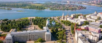
The city of Kursk is located in the European part of our country, a little more than five hundred kilometers south of Moscow. Currently it is the administrative center of the Kursk region. Its historical part is located on two hills, along the right bank of the Tuskar River. The name of the city, according to the official version, comes from the Kur River, which flows into the Tuskar River at this point. It is believed that the Kur used to be more full-flowing and the establishment of a settlement here, and subsequently the construction of a fortress, was quite reasonable. The popular version of the name of the city leans more towards the partridge bird, which was found in large numbers in these parts. She is even depicted on the city's coat of arms. The first mention of Kursk was in the Life of Theodosius of Pechersk (1008 - 1074, one of the founders of the Kiev Pechersk Lavra) and dates back to 1032. Most likely, there was a large settlement here before, but only the year 1032 is documented. The countdown of the age of Kursk begins with it. According to the Laurentian Chronicle (written in 1377 by the monk Laurentius for Prince Dmitry, later called Donskoy), the Principality of Kursk was formed in 1095. Its first prince was Izyaslav Vladimirovich (1077 - 1096, second son of Vladimir Monomakh and the English princess Gita of Wessex). He built a fortress in the city, and Kursk became an important outpost of Kievan Rus.
At the beginning of the 13th century, the Mongol invasion of Rus' began. The first battle took place on the Kalka River in 1223. The troops of a number of principalities of Rus', in alliance with the Polovtsians, opposed the Mongols. Representatives of the Kursk Principality also took part in the battle. Due to the lack of general unity of command, the Battle of Kalka was lost. You can learn about this historical moment from the article “Kozelsk”. The final conquest of Rus' occurred a little later, during the Western Campaign of the Mongols (1236 - 1242) under the leadership of Batu Khan (1209 - 1255, Batu Khan, grandson of Genghis Khan). Kursk resisted the Mongols and was completely destroyed in 1238. These were difficult times not only for the city, but for all of Rus'. However, the Russian people are very stubborn, and gradually the city was rebuilt. A few decades later, the problem repeated itself. In 1285, Nogai's horde (1240 - 1300) again destroyed Kursk. At the cost of enormous efforts, the city was restored again.
In 1362, the Lithuanian prince Olgerd (1296 - 1377, son of Gediminas) captured the city and annexed it to the Grand Duchy of Lithuania. For many years, Kursk was a Lithuanian city and only in 1508 it became part of the Grand Duchy of Moscow. However, this did not give much development to the city. At that time it remained the outskirts of the principality. Constant raids by Crimean Tatars and other nomads led to a decrease in population and a decline in crafts. By the end of the 16th century, it was decided to raise the importance of Kursk. A new fortress was erected here, the walls of which reliably protected people from the enemy. Some residents were resettled from a number of neighboring cities to Kursk. These efforts were not in vain, the city came to life and began to develop. Subsequently, there were still attempts by Polish-Lithuanian troops to capture the city, as well as raids by the Crimean Tatars, which haunted the residents of Kursk. At the slightest danger, people took refuge in the fortress, and its garrison repelled all attacks. The city became a serious stronghold of the country. Gradually, the borders of the state expanded, and Kursk turned into an industrial city.
Under Empress Catherine II (1729 - 1796), the territorial division in the central part of the Russian Empire was changed. Along with others, the Kursk governorate was created in 1775. The city of Kursk becomes its center. Even Belgorod was part of the Kursk governorship for some time. At the beginning of 1797, Emperor Paul I (1754 - 1801, son of Catherine II) abolished all governorships and made Kursk the center of the Kursk province.
Kursk has always been an Orthodox city. It remains the same in our time. There are a large number of Orthodox churches here, each of which has its own distant history. One of the pearls of Orthodoxy, without a doubt, is the Kursk Root Icon. At the site of her discovery, a monastery subsequently arose.
Indigenous deserts
Not far from the city of Kursk there is an ancient monastery of the Kursk Root Hermitage. It is located in the village. Svoboda, on the right bank of the Tuskar River. Entering the gates of the monastery, you will have to go down all the time, since many buildings and temples are built on steep slopes. It will take some effort to go down to the river and then back up, but this blue-turquoise splendor is worth it.
Internal staircase of the monastery
General characteristics
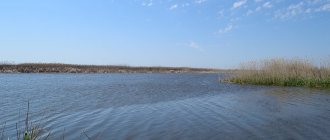
The width of the river ranges from 10 to 100 m. The average depth of the Seim is 2–3 m: in the lowlands it becomes deeper, and shallower on the rifts. The lower reaches are replete with pits. Their depth is 10–15 meters. Pools serve as reliable shelter for fish escaping the winter cold.
In summer, certain sections of the river become shallow and the Seim can be forded.
The bottom is loamy, sandstone is found in the upper reaches, and sandy loam soils are found in the lower reaches. The riverbed is winding, with frequent and sharp bends and bends. Water flows at a speed of 0.3 - 0.7 m/s.
The source is located within 178 m, and the mouth is 112 m above sea level.
The first ice appears on the Seimas in November or December. The beginning of ice drift is the first days of April. The flood continues for over 2 months. The river replenishes its supply by melting snow, and it is also fed by groundwater.
History of the Root Desert
The history of this place begins back in 1295. Times were hard then. Rus' fell under the yoke of the Mongol Empire, which means it was necessary to give part of its material wealth to the invaders. The already difficult situation of ordinary people worsened even more. In order to somehow make ends meet, in addition to cultivating grain crops, people hunted in the forest. Some set traps for various game, while others collected mushrooms and berries, fortunately the forests allowed this to be done. In those distant times, just north of Kursk, in the upper reaches of the Tuskar River, a dense forest stretched for many kilometers. Once the residents of Rylsk were engaged in fishing there. It was a hot sunny day and one of them decided to wash himself with cool river water. Not reaching a few meters from the river, he noticed a small plank lying between the roots of a tree. Having picked it up and turned it over, the man was stunned with surprise. It was an icon of the Mother of God. Looking down, he discovered a small spring with fresh, cold water. His friends came up and were also surprised by the find. After thinking a little, they decided to leave the icon in this very place and placed it in the hollow of a large tree.
Having learned about the amazing find, many people flocked here. They wanted to pray and find hope in solving their problems. A wooden chapel was built near the source, into which the icon was transferred. It began to be called the Kursk Root Icon. Kurskaya - because it was found near Kursk, and Korennaya - because it was found on the roots of a tree. Years and centuries passed. The fame of the icon gradually spread throughout Rus'.
In 1597, Tsar Fyodor Ivanovich (1557 - 1598) issued a decree on the creation of a monastery at the site where the icon was found. They began to erect the corresponding buildings. His successor, Tsar Boris Godunov (1552 - 1605), also took a large part in the formation of the new monastery. He granted treasury, bells, vestments, etc. to the Root Hermitage. One event prompted him to such generosity. In 1601 - 1603 there was a famine in Rus', but the Kursk land had good harvests and supplied grain to the capital. Many believed that this was because of the miraculous Kursk Root Icon. Maybe it's a coincidence, maybe not. In any case, Tsar Boris Godunov had his own opinion on this matter.
During its existence, the monastery underwent many trials. It was burned, ravaged and robbed, but it was reborn. There were always caring people who helped restore and expand the monastery. For example, in 1714, by decree of Field Marshal B.P. Sheremetyev. (1652 - 1719, founder of the Sheremetyev family) the lower church was built in the Root Hermitage. It is located on the banks of the Tuskar River, where a miraculous spring still supplies people with water.
Root hermitage, lower church and gallery to it
Over the years, the Kursk Root Icon of the Mother of God was in Moscow several times. In 1676, she was taken to the Don to bless the Cossack troops. For some time she was in the Root Desert itself, but to ensure safety, her main location was the Znamensky Cathedral in Kursk. Every year a religious procession was held from Kursk to the Root Hermitage, led naturally by the Kursk Root Icon. A lot of people always gathered for this event.
During the Russian Civil War (1917 - 1922), the icon was taken to Serbia. Here she stayed almost until the end of World War II. In November 1944, she was first transported to Karlovy Vary and then to Munich. The First Hierarch of the Russian Church Abroad, Metropolitan Anastassy (1873 - 1965), moved from Germany (Federal Republic of Germany) to the USA (United States of America) in 1950. The New Root Hermitage was built near New York, where the Kursk Root Icon was transported in February 1951. It remains in this location to this day, with the exception of official visits to other parishes in the United States and many countries around the world. Currently, the Kursk Root Icon is one of the very significant shrines not only of the Russian Church Abroad, but also of the entire Orthodox world.
Tributaries
Over 900 rivers flow into the Seim, three of them are more than 100 km in length (Tuskar, Svapa in the Russian Federation and Kleven in Ukraine). The territory of the Kursk region has 639 tributaries, the length of 110 of them is more than 10 km. In Ukraine, only 7 rivers flowing into the Seim are longer than 10 km.
The largest tributaries are:
- Seimitsa Kotlubanskaya.
- Seimitsa Donetsk.
- Full.
- Tuskar.
- Big chicken.
- Reut.
- Prutishche.
- Swapa.
- Amonka.
- Snagost.
- Vir.
- Kleven.
- Ezuch.
Seraphim of Sarov
Kursk land is the birthplace of Seraphim of Sarov (1754 - 1833, in the world - Prokhor Isidorovich Moshnin). He was born in Kursk, in the family of the eminent merchant Isidor Moshnin and his wife Agafya. Prokhor lost his father early, whom he loved and adored. At the age of about ten he became very ill. One day there was a religious procession not far from their house. Before this there was a heavy downpour, and the procession slightly changed the direction of its movement, passing through the Moshnin estate. Agafya took her son out into the air and asked him to carry the Kursk Root Icon over him, and then Prokhor venerated it. Believe it or not, but after a while the child, who had been ill for a long time, began to recover. This event sank deeply into Prokhor’s soul. Probably, even then he made a choice of his future path in life.
Root Hermitage, monument to Seraphim of Sarov
In memory of his fellow countryman, a monument to Seraphim of Sarov was erected in the Root Desert. He was not only strong in spirit, but also a very wise man. One of his sayings says: “Whoever is busy knowing himself has no time to notice others. Judge yourself and stop judging others."
Shipping
The Sejm has long been used for transporting people and goods. In the Middle Ages, the river was the only safe and fast way to travel. It connected the Dnieper, Volga and Don, allowing free trade with Byzantium, Volga Bulgaria, and the peoples on the shores of the Black and Caspian Seas.
We recommend reading: What river is Murom on? On the map of the rivers flowing through the city
The first shipping company was founded in Kursk by Governor A. N. Zubov. This happened in 1780. Barges loaded with products went to the Seim after the end of the icebreaker. Then the ships reached the Desna, from there they went to the Dnieper, and there they reached the Black Sea. In two months the barges reached the city of Kherson.
This waterway was used by a Nizhny Novgorod merchant named Gekov. He managed to navigate at least three barges loaded with grain and bread along the river. His journey was extremely difficult, because many merchants refused to use the river to transport goods.
In 1817, several more barges reached Kherson, with a total value of goods of 40 thousand rubles. The long journey was also not without incidents and losses. Barges capsized or became stuck in shallow water.
It was possible to eliminate the troubles associated with the winding banks of the river, shallow water and a large number of built mills only after the construction of a lock system in 1839.
The author of the project was M. A. Puzanov. He was considered the best hydraulic engineer. Thanks to his project, 60 piers and 17 locks were erected on the river. After their construction, the river became safer.
The waterway created by Puzanov was nicknamed Alexandria in honor of Empress Alexandra, the wife of Nicholas I. In 1843, 24 barges were carried along it.
In May 1846, the Lyudinovo steamship, which was the property of the merchant Maltsev, arrived in Kursk for the first time. The ship's captain found the lock system usable. But it existed only until the middle of the 19th century. By this time, the locks themselves had worn out, and shipping communications had become unprofitable.
During the Soviet period, the river was used to transport passengers. Motor ships of the Zarya type cruised around the Seim.
Nowadays, the river is navigable only in the lower reaches to the village of Verbovka, Chernihiv region; in other sections you can only see fishing boats of Seim residents and small boats used to transport tourists.
Recommended reading: the ancient name of the Volga.
Kursk during the Great Patriotic War
The city of Kursk was not spared by the Great Patriotic War (06/22/1941 – 05/09/1945). In 1941, Nazi Germany attacked the Soviet Union. The front gradually moved east. At the end of August the bombing of Kursk began, and at the beginning of November the Germans approached the city. The power of the Wehrmacht (German armed forces) was too great. Despite the resistance of the Red Army and militias, on the night of November 3, Kursk was captured by the enemy. The sad days of the occupation began. During this time, many people died from hunger, cold and epidemics. In addition, about three thousand residents were shot and almost ten thousand were driven to Germany as free labor (practically slaves). The city was liberated on February 8, 1943 by troops of the 60th Army under the command of Major General I.D. Chernyakhovsky. (1907 – 1945).
The territory around liberated Kursk formed a kind of ledge that wedged itself into the German defenses over a long distance. Two fronts of the Red Army were located here: Central and Voronezh. The Wehrmacht leadership wanted to encircle the armies of these fronts with attacks from the flanks. From July 5 to August 23, 1943, the famous Battle of Kursk took place here, which is one of the key battles of the Great Patriotic War. These events are described in more detail in the article “Kursk Bulge”.
Plants and animals
Flora
Meadow of gladioli in the Kursk region.
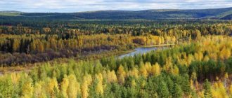
The Seim is a forest-steppe river with an open floodplain. The fields here are replaced by water meadows, reeds and willows grow on the banks. Forests occupy no more than 5–8% of the basin; they are mainly located on the left bank of the Seim and consist of floodplain black forest (elm, alder, ash, aspen, willow), oak forests, birch and pine groves.
The river abounds in plants, many of which are listed in the Red Book. The mirror surface of the Seim is decorated with a rare type of water lily - white.
In swampy meadows and in the lowlands one can find Siberian iris, swamp grass, marshmallow, bloody palmroot, and ovoid cache.
In the floodplain of the river there are cat's paws, flea thyme, and lush cloves.
Along the sands of the floodplain routes - grandiflora uniflora, unilateral ortilia, umbellate wintergreen, Russian juvenile, common heather.
In the forests of the basin there is five-leaved cathode.
Some of the plants form large populations, for example, thin swordweed (wild gladiolus): near the village of Karyzh in the Glushkovsky district there is a gladiolus meadow, which is a unique phenomenon and is under special protection.
The common orchis and the male orchis are endangered.
About 50 species of different mushrooms grow in the area of the Kursk Reservoir.
Fauna
The fauna is no less diverse and interesting. Roe deer, elk, wild boars and foxes are found in forests and fields. Beavers live in the river, as evidenced by dams and fallen trees with characteristic cuts.
You can see these animals in large numbers on Lake Lezvino, where a reserve has been created for them. Beavers often have nutria, otters and muskrats as their neighbors.
The shores abound with swallow and swift nests; here the birds have established huge colonies. Herons, storks, geese and ducks live in the floodplain.
The Seim is a habitat for 30 species of fish. Crayfish and mussels are found in the creeks.
Automobile highways
The following roads pass through Kursk:
- M2 "Crimea" is a federal highway, which is also part of the European route E105. The total length of the road is 720 km. The highway originates in Moscow and passes through Kursk, Belgorod, Tula, and Orel. The end point of the route is the state border with Ukraine. Road surface: concrete and asphalt.
- P298 is a highway that has the status of an object of federal significance. The route is part of the Asian route AH61 and the European route E38. The road originates in Kursk and passes through Voronezh. The total length of the road is 439 km. Road surface: asphalt.
- E38 is a European route that passes through the territory of 3 countries: Russia, Kazakhstan, Ukraine. The route originates in the city of Glukhov and passes through Voronezh, Saratov, Uralsk, Kursk, Aktobe, Kyzylorda. The final point of the route is the city of Shymkent. The total length of the highway is 3,400 km.
- E105 is a European route with a total length of 3,770 km. The route passes through the cities of Russia, Ukraine and Norway: Kirkenes, Murmansk, Tver, Moscow, Kharkov, Simferopol, Zaporozhye, St. Petersburg, Veliky Novgorod, Petrozavodsk. The final point of the route is the city of Yalta.
Fishing and rafting
Seim is popular among fishing enthusiasts. After the end of spawning on the river, dozens and hundreds of people appear who want to sit on the bank with a fishing rod. Families come here; in the summer, tents and campfires appear near the Seim. The best time for fishing is June or July.
Perch, pike, and bream are caught using spinning rods and regular fishing rods. There are a lot of fish, chub and perch are hiding in the coastal reeds, and pike are lying in wait for their prey in the grass on the left bank. In the spring you can catch asp in the Seimas. This fish swims along with strong currents and melt waters from the Desna. After the water subsides, the asp returns to its native habitat.
Winter types of fishing are also in demand. They seriously prepare for ice fishing, stocking up on clothing and gear. In winter, the river freezes almost completely, but neither snow drifts nor blizzards stop experienced fishermen.
Kayaking is also popular. The tourist season begins in April and ends in November. All this time, continuous lines of kayaks stretch along the Seim. During the trip, many fish, sunbathe on the beach and visit attractions, the abundance of which is famous for the coastal cities and villages.
City in modern times
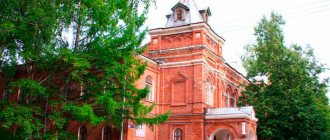
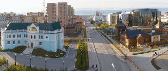
In 2022, Kursk celebrated its 985th anniversary. A tourist visiting this place for the first time will be amazed by the magnificent architecture, which accurately reflects how old the city of Kursk is.
Many architectural monuments are waiting their turn for reconstruction, thereby allowing them to preserve their original appearance. Along with ancient buildings, modern skyscrapers are being built. This contrast looks very interesting and unusual.
In universities, academies, and colleges, a special role is given to information technology. This makes it much easier for students to find and collect the information they need.
Instrument making, machine tool manufacturing, medicine manufacturing, etc. have developed greatly in the city.
Spring flood
The rivers of the Kursk region reach their highest level in the spring. In the last few decades, floods have become much less noticeable. The average duration of spring floods is about 20 days. This period varies depending on the size of the rivers and the terrain. On large flows it can last more than a month, and on small flows – up to 10 days. Near the Seim River this gap is quite significant, particularly within the lowlands.
The water level begins to rise 6-7 days before the ice breaks up. This time usually occurs at the end of March - beginning of April. Ice movement occurs within 5 days, and on large rivers twice as long. By the end of April, the flood usually ends, and already in May the water level drops noticeably.
What to see
- Spadshchansky Forest is a nature reserve located near Putivl after the confluence of Lyubka and Rekht. The place is famous for the events of the Great Patriotic War.
- Sofronievsky Monastery.
- Molchansky Monastery.
- Forest park with oak groves near the village. Molchanovka Kursk region.
- Central Chernozem Reserve.
- Vistula oak grove.
Museum of Partisan Glory "Spadshchansky Forest"
Interpretation of the name and legend about the origin of the Sejm
Nothing is known for certain about the etymology of the name. It is assumed that the Seim received its name from the seven tributaries that form it. In the “Book of the Big Drawing” of 1627 they are called Seimitsy, and the river is called Sem.
There is a legend about the origin of the Seim. It tells about the girl Desna and her old father Dnieper. A beautiful, cheerful, kind girl, she was the kind of clever girl you won’t find anywhere else in the world. Dnepr loved his only daughter immensely, protected and protected her.
Years passed, it was time to look for a groom for her. The girl's heart was won by a young man named Seim. Although he was good, he could not compare in stature, beauty and agility with Desna. The father did not allow Desna to become the wife of the Seim.
A little time passed, and Dnepr fell ill. Before his death, the old man called his daughter and told her that he was going to become a river and set off on a journey to the blue sea. He asked the Dnieper for his daughter, so that she too could become a river. Then he will be able to protect her after death in the same way as during life. They will forever be connected, never separated.
Desna wanted to fulfill her father’s request, but then she remembered her beloved. She did not want to leave Seim alone in this world. Then the Dnieper called the young man and said that he would agree to the wedding if he, turning into a river and walking half a thousand miles away from the Desna, could catch up with her. The young man agreed to fulfill this condition within one month.
So the father and daughter turned into rivers: the Dnieper hurried to the sea, and the Desna slowed down and began to wait for the betrothed, who soon overtook the bride. Together they went to bow to the old man. The Dnieper rejoiced, accepted the Seimas into its family, and since then they have lived in peace and tranquility.
Hydraulic structures
Kursk NPP.
On the Seimas there are dams and structures designed to generate energy: a hydrological post near the village of Mutin, a dam near Putivl, the Kursk Nuclear Power Plant.
The main hydrological post is located near the village of Mutin (Sumy region).
In 1976, the Kursk Nuclear Power Plant was erected at the Seimas; its coolant is the Kurchatov Reservoir. To do this, the river course had to be changed. The new artificial channel is located north of the old one and runs from the village of Sorokino to Makarovka, Kursk region.
Repeated attempts were made to build a system of locks on the river to regulate water levels and improve navigation; Thus, more than 10 dams were built on the Kursk-Tetkino section alone. Due to their gradual destruction, individual sections of the river near Putivl began to slowly become shallow.
To restore the water balance, in 1994 a project was developed for the construction of hydraulic structures at the Seimas. In 2010–2011 sandstone dams were built near Putivl, as a result of which water was redirected from the Lyubka River (the left branch of the Seim) along the main channel, which runs closer to the city.
Now this hydraulic structure has a significant impact on the speed of the river flow: 10 - 15 km before the dam, the flow slows down, the water loses transparency, after overcoming the obstacle, the speed increases, the channel becomes shallow, but the river becomes cleaner.
There are several small bridges across the river, including pontoon ones.
Psel
The length of the Psel River bed in the Kursk region is more than 200 km, the rest falls on Ukrainian territory (about 500 kilometers). Of the 25 existing tributaries, the largest merge with the river in the middle of its course. The length of the right tributary Grun is 55 km. The Khorol River, which carries its waters for 300 km, flows into Psel on the left side. Some places are characterized by high swampiness.
The Psel River itself is distinguished by a calm flow, spacious sandy banks and varied vegetation. It is shallow, with a beautiful winding channel and asymmetrical banks. The bottom is mostly sandy, sometimes muddy. There are aquatic inhabitants, of which there are up to 50 species. There are hares and foxes on the banks, and in the thick of the forest you can encounter roe deer and wild boar.
