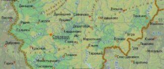
The physical and geographical position of the region within the East European Plain is determined by the main features of nature: a temperate continental climate with a significant influence of air masses from the Atlantic, which causes a significant amount of precipitation, the presence of many small rivers, lakes and swamps, a wide distribution of forests and sod-podzolic soils with low fertility. A unique feature of the physical-geographical position is the fact that the Smolensk region, occupying the most elevated section of the East European Plain, is located on the watershed of the three largest rivers in Eastern Europe: the Volga, Dnieper and Western Dvina, which also belong to the basins of three seas - the Caspian, Black and Baltic.
The Smolensk region has a unique political and geographical position, associated primarily with the western border of the state, which accounts for 463 km, which is about 1/3 of the entire perimeter of the region’s border. But this is a special state border with the Republic of Belarus, which is part of the Union State. The regions located on the Belarusian side (Vitebsk and Mogilev) have common historical roots and close modern economic ties with the Smolensk region. (An indicative historical fact is that it was in Smolensk on December 31, 1918 that the Belarusian Soviet Socialist Republic was proclaimed, of which the Smolensk province became a part. However, this lasted only one month, and on February 2, 1919, the Smolensk region became part of the RSFSR.) Smolensk region borders on five regions of Russia: in the north - with Pskov and Tver, in the east - with Moscow, in the southeast - with Kaluga, in the south - with Bryansk. From an economic and geographical point of view, the position is undoubtedly favorable, which creates favorable conditions for the development of all areas of activity in the region. An assessment of the political and geographical situation would be incomplete without pointing out the territorial proximity of the European Union and NATO, which are actually second-order neighbors for the Smolensk region.
The peculiarities of the political and geographical position in different periods of history resulted in numerous wars: the Smolensk region has more than once been the scene of fierce battles holding back the enemy on the outskirts of Moscow. That is why Smolensk has long been called the “City-Key”.
City of Smolensk (Russia)
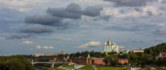
Smolensk is an ancient city in western Russia and the center of the region of the same name. It is one of the oldest cities in the country, whose history goes back more than 1,150 years. Smolensk has played a significant role for many centuries, being a kind of key and shield of Moscow. The city, many times destroyed by wars and sieges, has preserved a magnificent historical heritage and many attractions, among which stands out an impressive fortress wall with towers and a whole scattering of ancient churches.
What else could CFO mean?
In the media, the abbreviation Central Federal District in the vast majority of cases refers to the Central Federal District. Sometimes an option such as TsFORF can be used (the last two letters in this case mean “Russian Federation”).
However, to reduce the CFO, other decoding options are possible. Thus, in accounting documents or management accounting, the CFO will mean “center of financial responsibility”; financiers can abbreviate in this way “stock transaction center,” and in the structures of the Ministry of Internal Affairs the abbreviation is used to designate the departmental “Financial Support Center.”
Guides: Russia
Moscow
Saint Petersburg
May be interesting: Other cities in Russia
Legal status
There is no information about federal districts in the Constitution of the Russian Federation. A number of experts believe that this type of territory is still a territorial-administrative unit, only of a new type. Analogies are drawn with the division of the past - the General Governments (GI) and the districts of regional activities (the French Fourth Republic).
The Plenipotentiary Representative of the President of the Russian Federation, who operates in central cities, is not the head of local authorities. His main activity is monitoring the work of federal government structures. Among the latter are:
- Troops of the Russian Guard.
- Central Bank Office.
- Customs departments of the FSB.
- Rosrezerv.
- Roskomnadzor.
- Prosecutor General.
- Rosprirodnazdor.
- Centers
In each federal district there are city centers in which the authorities supervising the work are located. Their activities are controlled by the plenipotentiary representative of the President of the Russian Federation and his subordinate structures, municipal bodies and structures. In a number of federal districts, centers are not the largest populated areas. This is observed in Privolzhsky (Nizhny Novgorod compared to Kazan) and North Caucasus (Pyatigorsk is smaller than many cities). A similar situation was observed before the abolition of the Crimean Federal District (Simferopol is smaller than Sevastopol).
Geography and climate
Smolensk is located in the west of the European part of Russia, 400 km from Moscow, near the border with Belarus. The city is located on the Smolensk Upland, indented by picturesque ravines and valleys of small rivers. Smolensk lies on the banks of the Upper Dnieper, which divides the city into two parts. The historical core is located on the left bank of the river.
Smolensk has a temperate continental climate, characterized by warm and rainy summers and moderately cold winters. The best time to visit the city is from May to September.
View of Smolensk from the banks of the Dnieper
General information about the Central Federal District
The phrase “Central Federal District” entered the vocabulary of the country’s residents in May 2000, when, in accordance with a presidential decree, the entire territory of the country was divided into “enlarged regions” - federal districts.
The first plenipotentiary representative of the president in the Siberian Federal District was Georgy Poltavchenko, who held this post from 2000 to 2011. The Central Federal District occupies a relatively small place on the map - its area is only 650,205 km2 (for comparison, the Far Eastern District has an area of 6,952,555 km2). But the Central Federal District is the “absolute leader” in population. About 40 million people live here - almost a quarter of the country's total population.
The peculiarities of the Central Federal District also include a very high percentage of the urban population - 80% of the residents of the Central Federal District live in 320 cities located in the district.
Story
Smolensk is one of the first cities of Rus'. Its exact founding date is unknown, although there are written references to a settlement here dating back to 862 - 863. Smolensk is mentioned in the Tale of Bygone Years as the capital of the Krivichi. However, the earliest archaeological finds within the city date back only to the 11th century.
In 1127, Rostislav Mstislavich began to reign in Smolensk. During his reign, the Smolensk Principality was formed - one of the most significant principalities of Ancient Rus'. This period is considered the real heyday of Smolensk, when the city was one of the largest and richest cities in the Russian land.
At this time, the population of Smolensk reached 40 thousand people.
In 1232, Smolensk was captured by the Polotsk prince Svyatoslav Mstislavich. During the Tatar-Mongol invasion, the city was not damaged, but lost its significance and became dependent on the Principality of Lithuania. In 1387, a plague raged in Smolensk, killing almost all the inhabitants.
Smolensk in winter
Smolensk was dependent on Lithuania until the beginning of the 16th century. In 1440, the townspeople rebelled, which was suppressed with difficulty by the Lithuanians. In 1514, Smolensk was taken by the troops of Moscow Prince Vasily III and for almost a century it was the most important western fortress of Muscovite Rus'.
In 1609, with the beginning of the Time of Troubles, Smolensk was besieged by the troops of the Polish king Sigismund III. The siege of the city lasted 20 months. Ultimately, the city was captured by the Poles and included in the Polish-Lithuanian Commonwealth. Only in 1654 was Smolensk again annexed to Russia.
After the wars and sieges of the 17th century, Smolensk was actually rebuilt. In August 1812, the city was captured by Napoleon's troops. During the retreat of Russian troops, Smolensk was set on fire. After the end of World War II, the city was restored throughout the 19th century. During the Great Patriotic War, Smolensk was occupied by German troops in July 1941 and liberated in September 1943. In 1985, Smolensk was awarded the title of Hero City.
Train Station
1-300×200.jpg
The neighborhood with the Republic of Belarus creates favorable preconditions for the socio-economic development of the region in many areas: industry, trade, tourism, etc. Joint events (exhibitions, fairs, conferences) are regularly held under the auspices of the Union State. The influence of Belarus also has a beneficial effect on the development of tourism: joint tourist routes are currently being developed. In addition, sanatorium and resort services provided in Belarus at fairly low prices with a high level of service have led to an increase in outbound tourist flows from the Smolensk region.
Attractions
The most important attractions of Smolensk are the preserved sections of the old fortress walls with defensive towers, as well as many ancient churches (some of them were built before the Tatar-Mongol invasion).
Smolensk fortress wall
Smolensk fortress wall
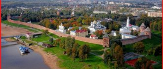
The fortress wall is the most famous landmark of Smolensk. This is an impressive fortification structure, built between 1595-1602 by order of Ivan the Terrible by the famous Russian master Fyodor Kon.
Scheme of the Smolensk fortress
The Smolensk fortress had a length of 6.5 km and powerful battlements up to 6 meters thick and up to 19 meters high. 37 towers were built to protect the walls. Moreover, they all had different heights and shapes. Most of the fortress walls of Smolensk were destroyed by Napoleon's troops during the retreat in November 1812. Only 17 towers and about a third of the original walls have survived to this day.
Interesting towers of the Smolensk fortress
Veselukha
Veselukha is one of the most famous towers of the Smolensk fortress wall. It has a sixteen-sided shape and is located on a hill. The name of the tower is due to the fact that in its vicinity there was a favorite vacation spot for the townspeople and from here a beautiful panorama of the Dnieper opens up.
Nikolsky Gate
The Nikolsky arched gate was built in 1595 - 1602 and is protected by a powerful triangular tower. The gate is named after the church of the same name, destroyed in 1812.
The section from the Nikolsky Gate to the Veselukha Tower is the longest surviving fragment of the old walls.
Zimbulka
Zimbulka is a powerful quadrangular tower located between the Dolgochevskaya and Nikolskaya towers.
Kopytenskaya Tower
The Kopytenskaya tower has a quadrangular shape and a gate. Located in Lopatinsky Park.
Lopatinsky Garden is one of the most famous parks in the city and one of the favorite places among citizens. The park was founded in 1874 and is located in the historical center of Smolensk near the fortress wall.
Other sights of Smolensk
Assumption Cathedral
Assumption Cathedral is the main church of Smolensk, built in the Russian Baroque style in the 17th century on the site of an ancient church from the 12th century, destroyed by the Poles. This building is located on the top of Cathedral Hill, which is the oldest part of the city. Despite a series of wars, the cathedral has remained practically intact and has a magnificent ancient interior.
St. George's Church
St. George's Church was built at the end of the 18th century in the Russian Baroque style. Located near Cathedral Mountain. From here you have a beautiful view of the Dnieper.
Church of the Apostles Peter and Paul
The Church of the Apostles Peter and Paul is one of the oldest churches in Smolensk, built in the style of ancient Russian architecture of the pre-Mongol period in the first half of the 12th century. During the Polish occupation in the 17th century, the temple was turned into a Catholic church, and in 1812 it was plundered by the French. In the 18th century, the Church of St. Barbara was added to the building.
Svirskaya Church
The Svirskaya Church is another ancient sacred building in Smolensk, dating back to the end of the 12th century. The church was built in the style of ancient Russian architecture, but at the same time has features of Romanesque architecture. This temple is located on the banks of the Dnieper west of the historical center of the city.
Church of St. John the Evangelist
The Church of St. John the Evangelist is a small ancient church built in the 12th century. The building has a simple whitewashed facade and is located on the banks of the Dnieper. The church was rebuilt in the 18th century and, like many historical buildings in Smolensk, was plundered by the French in 1812. The temple was also seriously damaged during the Great Patriotic War. It is currently under reconstruction.
Church of the Immaculate Conception of the Blessed Virgin Mary
The Church of the Immaculate Conception of the Blessed Virgin Mary is a Catholic church in the brick neo-Gothic style, built at the end of the 19th century. Now the building is empty and not accessible to the public.
Church of St. George the Victorious
The Church of St. George the Victorious was built in 1810 and two years later it was destroyed by the French. In 1820, the building was restored and a hospital was built nearby, which is still in operation.
Vozdvizhenskaya Church
Vozdvizhenskaya Church is an ancient church in the Baroque style, built in the second half of the 18th century. Located in the eastern part of the city on the banks of the Dnieper.
Spaso-Preobrazhensky Monastery
The Spaso-Preobrazhensky Monastery was founded in the 13th century and is one of the oldest monasteries in Smolensk. During the Time of Troubles and Polish intervention, it was ruined by the Poles and then abolished. In the 17th century the monastery was restored and existed until 1918. During Soviet times, the monastery was closed and revived again only in 2001.
Ascension Monastery
The Ascension Convent was founded in the first half of the 17th century by the Jesuits. In 1665 it was turned into an Orthodox monastery. After the revolution, the monastery was abolished and an exhibition hall was located in the church. Currently, the monastery is active.
Interesting places in Smolensk
Bolshaya Sovetskaya Street
Bolshaya Sovetskaya Street is one of the central avenues of Smolensk, which connects Victory Square and the bridge over the Dnieper. The street was founded by order of Peter I between 1698-1708 and is famous for its architectural ensemble of historical buildings of the 19th and early 20th centuries.
On Bolshaya Sovetskaya Street there is the Holy Trinity Convent, founded in the 17th century. The Trinity Cathedral, which is the architectural dominant of the monastery, was erected between 1672-1675.
Monument to Prince Vladimir on the embankment
In 2013, in honor of the 1150th anniversary of the founding of the city, a new embankment was built along the Dnieper. In 2015, a monument to Prince Vladimir was erected on it.
Smolensk Art Gallery
The art gallery in Smolensk was founded in 1920 and is located in the historical building of the former real school. It houses interesting collections of ancient Russian art, Russian art of the 18th, 19th centuries and the Soviet period, as well as Western European art, including works by Italian, Dutch and German artists.
5-300×225.jpg
Moscow's special influence is manifested in the fact that neighboring regions are turning into its recreational zone. Currently, a phenomenon called the “second home”, used most often for recreational purposes, is gaining enormous proportions. The Moscow region has already been practically developed: more than 3.5 million land plots belong to Muscovites. In the Smolensk region, the eastern regions (Gagarinsky, Vyazemsky) fell into the zone of priority recreational influence, next in line are other convenient territories located in close proximity to the Moscow-Minsk highway, as well as unique natural areas near the Smolensk Poozerie National Park and others protected areas and hunting grounds. In addition, tourist groups from Moscow form the main stream, stimulating the development of cultural and educational tourism.
Economic ties with other neighboring regions are developing less intensively: our neighbors, in particular the Kaluga, Bryansk, and Tver regions, are also more oriented towards Moscow.
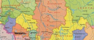
Composition of federal districts
Periodically, the composition of the Federal District was changed in order to more conveniently control the implementation of various activities to solve federal problems. The last change was carried out in 2022. At the moment they are not planned. At the moment things are as follows:
- Central Federal District - 17 regions (Belgorod, Bryansk, Vladimir, Voronezh, Ivanovo, Kaluga, Kostroma, Kursk, Lipetsk, Moscow, Orel, Ryazan, Smolensk, Tambov, Tver, Tula, Yaroslavl) and one city of federal significance - Moscow.
- Northwestern Federal District - 7 regions (Arkhangelsk, Vologda, Kaliningrad, Leningrad, Murmansk, Novgorod and Pskov), one federal city - St. Petersburg, one republic - Komi, as well as the Nenets Autonomous Okrug.
- Volga Federal District - 8 regions (Nizhny Novgorod, Kirov, Ulyanovsk, Penza, Saratov, Samara and Orenburg) and 6 republics - Tatarstan, Mari El, Chuvashia, Udmurtia, Bashkortostan, Mordovia, as well as the Perm Territory.
- Southern Federal District - 3 regions (Astrakhan, Volgograd and Rostov), 3 republics - Kalmykia, Adygea and Crimea, one federal city - Sevastopol, Krasnodar Territory.
- North Caucasian Federal District - 6 republics (Karachay-Cherkessia, Kabardino-Balkaria, North Ossetia-Alania, Ingushetia, Chechnya and Dagestan), Stavropol Territory.
- Ural Federal District - 4 regions (Tyumen, Chelyabinsk, Kurgan and Sverdlovsk) and three autonomous districts - Yamalo-Nenets, Khanty-Mansiysk and Ugra.
- Siberian Federal District - 5 regions (Irkutsk, Kemerovo, Novosibirsk, Omsk and Tomsk), 3 republics - Altai, Khakassia, Tyva and two territories - Altai and Krasnoyarsk.
- Far Eastern Federal District - 3 regions (Amur, Magadan and Sakhalin), 2 republics (Buryatia and Yakutia), Transbaikal and Kamchatka territories, Chukotka Autonomous Okrug and Jewish Autonomous Region.
