Rivers and lakes of the Mari Republic
The region has a very large number of rivers and lakes, and their total area is about 2.5 thousand hectares. Almost every reservoir has some events and mystical stories associated with it.
Sea Eye Lake
- Coordinates on the map: 56.162632, 48.759988.
A small reservoir a few kilometers from the border with Tatarstan is approximately 20,000 years old. It is considered the most popular in the republic not only because of the water’s unusual emerald hue, but also because of its great depth, which is completely unusual for its modest size. From a bird's eye view, it resembles a pit dug right into the mountainside, which is why the locals call it Mishul (Funnel).
Lake Nuzhyar
- GPS coordinates: 56.585027, 46.359204.
The most transparent lake in the republic is located in the Gornomariysky district. Fishing here is not very good - as reviews say, only perch is found here. But this is an ideal place for swimming.
The sandy bottom is practically without vegetation, and the water transparency reaches 8 meters. The banks of the reservoir do not have cliffs, and the depth increases gradually. In general, here nature has created good conditions for a wild but comfortable holiday.
Lake Tabashinskoye (Zryv)
- Coordinates: 56.981567, 47.805644.
Tabashinskoye is considered both the most mysterious and deepest lake in the region. According to some data, its bottom is located at a depth of 53 m, according to others - 171 m!!! Such an incredible depth is considered impossible for lakes of karst origin, to which it belongs. Scuba divers claim that the middle of the reservoir is a funnel, and real trees grow at the bottom. But instead of animals and birds, voiceless fish live in their crowns.
Lake Yalchik
- Coordinates: 56.008837, 48.426991.
It is considered the largest in the republic and consists of two parts - Big and Small Yalchik, connected by a canal. At certain times of the year it dries up and the lakes become isolated from each other. The water here is always clean, and most importantly, warm, so there are always a lot of vacationers on the shores.
Lake Zhenskoe
- Coordinates: 56.368046, 46.190357.
The reservoir, which has such an unusual name, is located in the Yurinsky district, spread between the Vetluga and Rutka rivers. The lake is suitable for swimming, but that’s not the only reason it attracts attention. It seems incredible, but tourists try to see the gilded monastery dome with a cross in its depths.
According to legend, back in the 20th century, on the site of the reservoir there was a convent, the inhabitants of which took a strict vow not to commit adultery. But when one of them violated it, that same night the monastery went underground, and in its place a wonderful lake formed. Everyone managed to escape except that same harlot.
Mouth of the Ilet River
- Coordinates: 55.931795, 48.242583.
The banks of the right tributary of the Volga are very popular among local residents and tourists. Here everyone can find something to suit their taste. There are organized beaches for a comfortable holiday, muddy beaches for those who want to improve their health, and stormy currents for rafting and kayaking. The sandy bottom, crystal clear water and mixed forest leave the most pleasant impressions and a desire to return here again and again.
Lake Green
- Coordinates: 55.975904, 48.331294.
It is located near the border with Chuvashia and is not yet known to a very wide circle. Only local residents and fishermen come to the shores of this lake to relax and sit with a fishing rod away from the civilized world. A small body of water, surrounded by pine forests and sandy beaches, is considered the main attraction of these places.
Salt Lake
- Coordinates: 56.563259, 47.362667.
This body of water on the left bank of Bolshaya Kokshaga is unique. There are no others like him in the Volga region. The surface layer of its waters contains a high concentration of salts, characteristic of the seas.
The water of the lake is completely opaque and has a dark brown tint. And if you lift a little sludge from the bottom, you can smell the pungent smell of hydrogen sulfide. The lake is considered a natural monument and is located in the Medvedevsky district.
Lake Glukhoe
- Coordinates: 56.038685, 48.455037.
The second name of the lake is Glukharinoe. This is a small, only a few hundred meters in length and width, crescent-shaped reservoir with a depth of about 3-4 meters. It is located on the territory of the Mari Chodra National Park and is popular among residents of the Volzhsky region. The water in it is both cloudy and clear, but always clean.
Lake Shilma
- Coordinates: 56.459328, 48.345748.
The reservoir in the Sovetsky district of Mari El is considered one of the creepiest. According to stories, at its bottom there is a mass burial of prisoners of war who were shot and drowned in the lake.
The corpses of hopeless soldiers who died from illness were also dumped there. Despite these rumors, it is popular among fishermen, because at its bottom there is a pike whose weight reaches 7-8 kg.
Winter holidays
Conditions for winter recreation in the republic have been created. An active recreation center has been opened in Yoshkar-Ola, offering skiing to everyone. In the village of Korty, not far from the capital, there is a training base where professional athletes are trained. Here residents and guests have the opportunity to go skiing.
Winter fishing is organized on numerous lakes of the republic. Enthusiasts of this activity even hold winter fishing competitions. Numerous recreation centers and hotel complexes are ready to receive vacationers all year round.
Mari El: beautiful mountains and rocks of the republic
Each mountain peak or hill in Mari El is endowed with sacredness and mysticism. Most of them are geological natural monuments.
Mount Karman-Kuryk
- Coordinates: 56.395264, 48.794307.
Translated from Mari, its name means Fortress Mountain. This is a dome-shaped outlier about 220 m high on the Mariysko-Vyatsky ridge, made of limestone and dolomite. Its slopes are covered with coniferous and deciduous forests; the grasses growing under them are considered rare and are listed in the Red Book.
There were also legends. It is believed that the Votyaks, the ancestors of modern Udmurts, preferred to settle in these places. And in the cave, which can still be seen today on the northern slope of the mountain, lived mythical female creatures with bare breasts - widows.
Mount Alamner
- Coordinates: 56.229782, 46.689829.
This hill is considered one of the largest historical monuments of the Volga region. At its top there was first a settlement, and then a settlement. At one time it was considered the largest center of culture and trade.
Only part of the fortress rampart and moat have survived to this day. And for the past 20 years, archaeologists have been conducting excavations here and trying to understand the secrets of history. The mountain has already opened some, but there are periods that still remain a black spot.
Mount Chuksha
- Coordinates: 56.514743, 49.015939.
Capercaillie Mountain, as its name is translated from the Finno-Ugric dialect, is the highest point of the Mari-Vyatka ridge. There is a quarry on it - not a very common structure for these places. It is because of her that the mountain is overgrown with mysterious legends and is considered almost an anomalous zone.
The fact is that tourists, seeing smooth hewn stones for the first time, begin to make their own assumptions and compare Chuksha even with the Egyptian pyramids and Stonehenge. It is these speculations and the “drunk” stream meandering along the slopes of the mountain that make it unusually popular and crowded during the tourist season.
What to bring
The best gift from Mari El will be national Mari souvenirs.
For example, you can bring:
- A figurine of Yoshkin's cat.
- Goat's milk cheese.
- Mari balsam.
- Vodka “Yoshkin Kot”.
- Mari Ivan tea.
- Products with Mari embroidery.
- Birch bark products.
- Canned mushrooms.
- Sausages from the Zvenigovsky meat processing plant.
- Magnets, mugs, plates with Mari symbols.
Mari El is a republic whose sights reflect the rich heritage of the Mari people, interesting for its unique untouched corners of nature and people who have preserved the memory of their ancestors.
Author: Marina K.
Article design: Oleg Lozinsky
Sacred places in Mari El
The Mari, like other ancient peoples, have their own places of worship. There are about 700 Sacred Kyusoto Groves in the republic alone. But besides them, there are other places sacred to many Mari.
Black stones
- Coordinates: village Kozhlaer, Morkinsky district.
Strange stones (or megaliths?) are located in the vicinity of the village of Kozhlaer, Morkinsky district, on the slope of Mount Onis Kuryk. There are 18 of them in total, but no one knows how they appeared here and when. But any local resident can tell you that they are magical.
The stones create a magnetic field around themselves, which is successfully used instead of physiotherapy in the treatment of joint diseases. But it is not recommended to move them from place to place, as disaster may occur.
Poklonnaya Gora
- Address: Podgornaya village.
This is one of the main sacred mountains of the Mari. At its top there is a grove called Kyusoto, in which they worshiped and still worship their ancient gods - the sun, wind, water. They climb the mountain along a steep wooden staircase.
The sacred grove is completely saturated with smoke from the fire and the aroma of sacrificial food. There are items of clothing hung on the trees, because according to the customs of the Mari, if you are bothered by pain, you need to take something off and leave it in the grove with it. And next year make the obligatory sacrifice to the gods.
Sistyvar prayer site
- Address: s. Vilovatovo, Gornomariysky district.
It is located in the very center of the triangle formed by drawing lines between the villages of Vilovatovo, Paratmary and Kizhvachi. 3000 years ago, primitive people called Abashevites lived here. They left behind burial mounds up to one and a half meters high and 15-16 meters in diameter.
Local residents believe that it is in this place that energy exchange takes place between the earth and space. Since ancient times, people came here to pray and brought water to imbue it with energy. It was believed that such water helps against many ailments.
Later, a small chapel was built near the mounds, where many believers came to pray, but in Stalin’s times it was destroyed. In 1995, the church was rebuilt and today this place is still popular. There are especially many believers here on May 22, the day of memory of St. Nicholas the Wonderworker.
Sheremetyev Castle (Yurino village)
The castle was erected in 1880, and its construction was started by the landowner Vasily Sheremetyev, the grandson of the same Count Sheremetyev who served Peter the Great. Inside the castle there were about a hundred rooms, some of which contained galleries with paintings by famous artists.
The architecture of the castle is dominated by neo-Gothic, oriental and baroque styles. From the beginning of the 90s to this day, the object has been actively restored - today the external part has been completely restored, while the internal rooms are in need of repair and restoration.
Wildlife sanctuaries and reserves of the republic
The unique nature of the Volga region can still be seen in our time in the wild, pristine form in which it existed for many centuries before the advent of civilization. In order to preserve it and pass it on to descendants, numerous protected areas are being created on the territory of Mari El, which are under state protection.
Bolshaya Kokshaga Nature Reserve
- Coordinates: 56.676389, 47.272500.
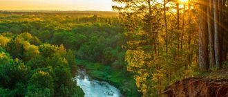
The only natural reserve of the republic is located in places called the Forest Trans-Volga region. If you look at them from above, you can only see a thick green carpet, pierced by strings of rivers and streams, with spots of lakes scattered here and there.
It was created to preserve the unique nature of the Bolshaya Kokshaga River, the banks of which became home to many representatives of flora and fauna. The most numerous species of mammal here is the brown bear. It’s not for nothing that his image appears on the reserve’s emblem.
Today, employees are developing it in several directions, including ecotourism. One- and two-day routes are organized for visitors, in which they can come into closer contact with nature and the inhabitants of these protected places.
Kamennaya Gora Nature Reserve
- Coordinates for the map: 56.637063, 49.067687.
These places in the Kuzhenersky district amaze with their beauty and pristine nature. The landscape is so reminiscent of the Alps that the name Mari Switzerland seems to have become firmly attached to them. The entire territory of the reserve lies in a gorge, which is located in the valley of the Vizimbir River.
In many places, rocks reach the surface here, the height of which reaches 278 m. These are mainly dolomites and sandstones. The forests on the territory of the reserve are mixed. And among the rare plants that have been preserved are relict Siberian spruce trees, which are about 12,000 years old.
The main attraction of the reserve is considered to be a spring named after the Kazan Icon of the Mother of God - a place of pilgrimage for many believers. It is believed that the water in it is not only tasty, but also has healing qualities.
Mari Chodra National Park
- GPS coordinates: 56.150035, 48.366490.
The territory in the south of the Mari-Vyatka shaft is truly considered the pearl of the republic. These are the purest lakes, rivers, unique natural complexes that have not only ecological but also historical value. The main waterway of the park is Ilet, and Lake Yalchik is very popular among tourists.
Translated from Mari, the name of the park sounds like Mari Forest. Indeed, its entire territory is covered with pine forests and deciduous forests. The main species is considered to be the otter, and some inhabitants, such as the black stork and osprey, are rare.
Eco-trails and horse riding routes are constantly organized here for tourists. One of them is the old Kazan tract, where Emelyan Pugachev passed with his peasant army. And at the foot of Maple Mountain there grows an oak tree, which is called Pugachev’s Oak. This route is considered one of the most popular, but there are many others that are no less interesting.
Lebedan State Nature Reserve
- Coordinates: 56.226111, 47.690556.
The reserve is located in the Zvenigovsky district and belongs to specially protected areas. Today a forest grows here, but at the beginning of the last century these places were so swampy that it was not possible to grow anything here. The swamp was drained only in 1912.
In the 70s of the 20th century, scientific work was carried out here repeatedly, the purpose of which was to collect evidence that even the most unpromising territory can be improved thanks to proper reclamation. But the matter was not completed. Today Lebedan is an important forest reclamation site and has environmental and scientific significance.
Gornoye Zadelye Nature Reserve
- Coordinates: 56.850397, 49.068839.
This name is given to the territory near the village of Gornyak in the Kuzhenersky district, located in the Nolkin Kamen tract. There are ancient quarries here, the exact age of which is unknown.
Some of them go 200 m deep. Stone was mined in them, from which millstones were made. Under the arches of the adits, even in summer, low temperatures remained and stalactites and stalagmites grew. Today, visiting them is prohibited due to severe dilapidation.
The reserve is also famous for the fact that on its territory very rare representatives of flora and fauna have been preserved, listed in the Red Book of the Republic, such as the Real Lady's Slipper, Robert's Holocaust and the Swallowtail butterfly.
Story
The Republic of Mari El received its name from the ethnic self-name of its indigenous population, Mari (“husband”, “man”); El translated from the Mari language means “country”. The entry of the Mari region into the Russian state determined the nature of the further history of the Mari people, which developed over four and a half centuries in close connection with the history of the people of Russia. The most important result of the entry of the Mari region into Russia was the preservation of the Mari as an ethnic group.
The Mari people gained their national statehood in the 20th century. On November 4, 1920, in the historical territory of settlement of the Mari, the All-Russian Central Executive Committee and the Council of People's Commissars of the RSFSR adopted the decree “On Education”. On November 25, 1920, the decree of the All-Russian Central Executive Committee and the Council of People's Commissars "On the Autonomous Region of the Mari People" determined the administrative and territorial composition of the region with its center in the city of Krasnokokshaysk (since 1927 - the city of Yoshkar-Ola).
In 1929-1932 The Mari Autonomous Region was part of Nizhny Novgorod, in 1932-1936. - Gorky region. On December 5, 1936, the Mari Autonomous Region was transformed into the Mari Autonomous Soviet Socialist Republic and is currently a full-fledged subject of the Russian Federation - the Republic of Mari El.
On June 21, 1937, the extraordinary 11th Congress of Soviets of the Republic approved the Constitution of the Mari Autonomous Soviet Socialist Republic.
The Mari people, as part of the Russian state, retained their language and acquired their own written language. In 1775, the first edition of the grammar of the Mari language was published, which meant the birth of Mari writing. Nowadays, the Mari language, along with Russian, has the status of the state language of the Republic of Mari El. The Mari have preserved their traditional religious beliefs and rituals. Currently, the sacred prayer groves of the pagan Mari are protected by the state.
During the pre-war five-year plans (1929-1940), 45 industrial enterprises were built and put into operation in the region. Engineers, technicians, and skilled workers were sent to new buildings and enterprises from the industrial centers of the country, especially from the city of Gorky. In Moscow, Leningrad, Gorky and other cities, national personnel were trained for industry and agriculture of the republic. The output of large-scale industry in the Mari Autonomous Soviet Socialist Republic in 1940 increased by 7.4 times compared to 1913. By 1941, collective farms united 94.2% of peasant farms. The construction of railways began (the first of them, Green Dol - Yoshkar-Ola, was completed in 1928). A cultural revolution was carried out: illiteracy was largely eliminated, tribal feudal and religious remnants disappeared; national cadres of the working class and the people's intelligentsia have grown; national literature and art emerged.
Great Patriotic War 1941-1945 became a huge test of strength for millions of Soviet people both at the front and in the rear, a test that our grandfathers and fathers withstood with honor, ensuring decades of peaceful life in their country and all of humanity.
In the post-war five-year plans, the economy and culture of the Mari Autonomous Soviet Socialist Republic received further development. New large enterprises in machine-building, instrument-making and other industries have emerged in the republic. The material and cultural standard of living of the people has increased significantly. The rise of the economy and culture was accompanied by a comprehensive expansion of mutual assistance and deepening ties of the Mari Autonomous Soviet Socialist Republic with other republics.
The Mari people are part of the fraternal community of related Finno-Ugric peoples of Russia. From year to year, social, cultural and scientific ties between the peoples of the Finno-Ugric world are strengthened. The republic becomes widely known, the world community gets the opportunity to get acquainted with the original culture of the Mari people.
Mari springs and springs
Mari El is a real spring region. Small and large, springs appear here in the most unexpected places to drink their icy water to tired travelers.
Shabashi Village Source
- Coordinates: 56.872666, 48.448876.
The village is long gone, but there is a holy spring, thanks to which it became famous throughout Russia. continues to exist to this day. Every year, on the feast of the Kazan Mother of God, whose name it bears, pilgrims flock to it from all over the country.
The key was driven into this place after a local peasant found an icon in a field several centuries ago. Surprisingly, even in Stalin’s times they tried to cover it with earth, but the key still made its way to the surface.
Recently, a church was erected next to it, replacing the old temple that was destroyed in godless times. And now services are held here regularly.
Silver spring in the village of Fomichi
- Coordinates: Fomichi village, Kuzhenersky district.
It is located on the right bank of the Nemda River, about a kilometer from the village itself. Water from the spring flows in a small bubbling stream from the rock and flows into Nemda. It is always tasty and cold, with a high concentration of silver.
There is even a local legend about this about robbers who hid the extracted treasures in the bowels of the earth - where the spring originates. And since products in the old days were most often made of silver, water, eroding the treasure, dissolved its particles in itself.
The spring was studied by Lithuanian psychics, who noted the positive energy emanating from it. And silver water not only helps with thirst, but also treats digestion.
Source Boiling Square
- Coordinates: 56.925012, 48.255700.
Not only beautiful, but also a mineral spring can be seen in the Mari Chodra National Park. It is a small body of water with springs gushing out from the bottom. They create snow-white foam on its surface, so that the lake seems to be boiling, which is why it received its name.
Notable forests and woodlands
Most of the region is occupied by forests. Pine forests, birch groves, oak groves are a source of special pride for the Mari. It was from the trees that they asked for protection and shared their joy with them, because according to the Faith of the Ancestors, every tree is a Deity. But not all of them are light, there are also evil spirits whose goal is to cause pain to people. These are the ones you need to know about and beware of, and this knowledge must be passed on to your descendants.
Karamas forest
- Coordinates: 56.693637, 49.005685.
For a long time, this forest was considered a mysterious place, and legends and traditions associated with it have been preserved to this day. It was located between two old villages that have not survived to this day.
The places were remote and attracted robbers. Moreover, the Urzhum highway passed through the forest, along which merchant carts traveled.
The robbers killed the merchants and threw the corpses in the forest without burying them. And after some time, the villagers began to hear the voices of the dead at night and at dusk, but no one was visible.
Sendinskaya larch grove
- Coordinates: 56.807210, 49.976041.
This is a very small area on the territory of the Mari-Turek district. It recently received the status of a specially protected natural monument and for good reason. After all, the Sukachev larches that grow here are over 100 years old.
The first plantings of this valuable crop were made at the beginning of the 20th century, before the First World War. Any agricultural activity that could damage trees is prohibited here. And you can admire the beautiful larches as much as you like.
Italian garden
You can have a pleasant time enjoying the peace and beauty of the surrounding areas in the Italian Garden. This small city park was created quite recently, and you won’t be able to wander under the shade of large trees yet, but the place is striking in its elegance. In the center of the garden is a monument to the Florentine philanthropist Lorenzo di Piero de' Medici. According to the city administration, this Italian figure, who left his mark in the Renaissance, is an excellent example to follow. It was his actions that inspired the government of the republic to significantly transform Yoshkar-Ola in recent decades.
Italian garden
Anomalous sights in Mari El
Strange and mysterious places are everywhere. Most importantly, people themselves endow them with mysticism. There are a lot of such places in the lands of the Mari. What else can you expect from an ancient people who still lives according to the Faith of their Ancestors?
Ovda-Korem ravine
- Address: village Nursola, Kuzhenersky district.
This place was once inhabited by ovdas - mysterious women with huge breasts. Their favorite pastime was riding horses, which they stole from local residents. Back in the middle of the last century, people found round passages that led underground to the dwellings of police officers. But then they disappeared. They say that widows are now hiding in the dense forests of the Kirov region.
Viy Pamash
- Coordinates: 56.911297, 48.739767.
The strange spring is located in the Novotoryalsky district. Despite the fact that its water cures many ailments, being around it can make you feel both good and bad. Water, depending on the time of day, has different energy.
Before lunch it is positive, and towards evening it changes to negative. Both have a healing effect, but they help against different diseases. In order not to aggravate the course of the disease, you need to know exactly what time of day you can draw water with maximum benefit.
Bruges waterfront
Tourists in Yoshkar-Ola can see a real European corner - the Bruges embankment. It got its name in honor of an ancient city located in Belgium. Along the shore of Malaya Kokshaga there are beautiful houses that can be called real works of art. Each of them has different architectural features. The roofs of the buildings are painted in bright colors and decorated with decorative elements of the Gothic style. The embankment began to develop in the city in the early 2000s, when a decision was made to renew the city. It acquired its current appearance in 2011. Now it is a favorite place for walks among residents and guests of the city.
Bruges waterfront
Open air museums
Such ethnographic complexes already exist in all regions of Russia. The Mari Republic is no exception. Here you can learn more about the history and culture of this mysterious people, get acquainted with their epic and taste national dishes.
Ethnographic Museum in Kozmodemyansk
- Address: Promyshlennaya st., 2, Kozmodemyansk.
This museum was created with the aim of preserving antiquities and traditions of the mountain Mari. It opened in 1983. It is noteworthy that many ancient buildings were transported here from Cheboksary in disassembled form. Thanks to this, they were preserved, while their other contemporaries went under water when the Cheboksary hydroelectric station was launched.
The museum's exposition includes 60 buildings for various purposes and more than 7,000 exhibits. Many houses were built without a single nail. In addition, performances are staged in the museum. Visitors are invited to get acquainted with wedding and funeral rites, listen to the playing of the harp and study all aspects of peasant life.
On topic - Sights of Kozmodemyansk
Where to go with a child
Mari El, whose attractions attract adult tourists, is also interesting for young travelers. There are a number of institutions in the republic that will delight children and teenagers.
List of places:
- Planetarium in Yoshkar-Ola. There is a planetarium in Yoshkar-Ola on Chavaina Boulevard, 31a. You can get acquainted with the virtual reality of space every day except Mondays from 10 to 23 hours. For more information about possible changes in the schedule and ticket prices, please call. (8362)397533.
- Mari Theater for Young Spectators. Located in the capital of the republic, on the street. Voznesenskaya, 87. The theater began operating in 1991. The repertoire includes various productions for children and youth in Russian and Mari. Open from Tuesday to Sunday from 10.30 to 17.30. Detailed information about the theater poster and ticket prices can be obtained by tel. (8362)304670.
- Mini-zoo named after. G. Gibadullina. In the village In Medvedevo, Medvedevsky district, you can visit a mini-zoo. The zoological garden is located on a small piece of land in the middle of a small artificial lake. The road to the zoo passes through a small original bridge consisting of 7 horseshoes. The zoo features various birds - turkeys, swans, guinea fowl, ducks, chickens. Mammals include foxes, raccoons, wolves, and rabbits.
Cost of visit:
| Children under 3 years old | Without payment |
| Children under 14 years old | 30 rub. |
| Senior schoolchildren and students, pensioners | 50 rub. |
| Adult population | 70 rub. |
At 11 a.m. the zoo hosts circus performances. More information about the cost of visiting and dates can be found by phone. (8362) 581625. The institution also provides additional paid services - pony rides, boat rides, catamaran rides.
