The smallest region in Russia is Ingushetia. In addition, it is the youngest subject of the Russian Federation. However, the history of these lands goes back to ancient times. The population of Ingushetia is the subject of our story. The Republic ranks 74th in the Russian Federation in terms of population and differs from other regions in many demographic and socio-economic indicators.
Geographical position
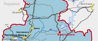
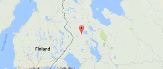
The Republic of Ingushetia is located in the North Caucasus. It borders with Georgia, North Ossetia, Stavropol Territory and the Chechen Republic. The region is located on the northern side of the Caucasus Range, in the foothills area. The length of the Caucasus Mountains on the territory of the republic is about 150 km. The relief of Ingushetia is determined by its location; mountainous parts with deep gorges and peaks in the south predominate here; the north of the region is occupied by steppe areas.
The republic has significant reserves of fresh water; its rivers belong to the Terek River basin. The largest water artery of Ingushetia is the Sunzha River.
The soils of the republic are predominantly chernozem, and this makes it possible to grow almost any agricultural crop here.
About 140 thousand hectares of the region are occupied by broad-leaved forests, where valuable tree varieties such as oak, plane tree, and beech grow.
The subsoil of Ingushetia is rich in minerals. There are deposits of marble, oil, gas, and limestone here. The republic is world famous thanks to its mineral waters such as Borjomi.
Climate and ecology
The Republic of Ingushetia is located in a zone of favorable high-mountain continental climate. The weather varies depending on the altitude of the area. Steppe territories are characterized by long, warm summers and short, mild winters. In the highlands, winter lasts longer and can be quite severe. The average temperature in winter is around -3...+6 degrees. In summer, the average temperature is from 20 to 30 degrees Celsius. As we can see, the population of Ingushetia lives in very favorable conditions; the nature here is not only beautiful, but also favorable to people.
Since the Caucasus is a fairly old mountain, there is relatively low seismicity here, so the main danger posed by the mountains is avalanches and landslides. The environmental situation in Ingushetia is quite favorable; there are few industrial enterprises here, and therefore there are no large amounts of emissions into the environment. Damage to nature is caused by people, primarily tourists, as well as oil companies. But so far the level of cleanliness of water and air does not cause any particular concern among environmentalists.
Settlement history
People have lived on the territory of Ingushetia since the Paleolithic era. The Ingush are an ancient nation of the Caucasian race. The people were formed from local tribes and numerous ethnic influences. Over many millennia, several significant archaeological cultures existed here. The immediate ancestors of modern Ingush are considered to be representatives of the Koban culture. The tribes living in these territories had several names: dzurdzuketia, sanars, troglodytes. The fertile lands of Ingushetia constantly attracted conquerors, so local peoples had to build fortresses and towers for defense.
But strong neighboring states are gradually pushing the Ingush into the mountains. Only in the 17th century do they manage to return to the plain. At the same time, Islam came to these lands, which gradually became the dominant religion. At the end of the 18th century, Ingushetia became part of the Russian Empire. At the beginning of the 19th century, the Nazran fortress was founded, which was rebuilt by the six largest Ingush families who swore allegiance to the Russian Tsar. In 1860, the Terek Republic was created here, which became the Mountain Republic after 1917. During World War II, the authorities decided to deport the local population due to the growth of gangs. In 1957, the Checheno-Ingush Republic was restored. After the collapse of the USSR, due to difficult processes, the Republic of Ingushetia was formed. At that time, the population of Ingushetia was small, but gradually the people consolidated around their historical territories and began to build their own state.
INGUSHETIA
The most ancient archaeological sites in modern territory. I. (near the villages of Plievo, Gamurzievo) belongs to the Middle Paleolithic (Mousterian). Mesolithic and Neolithic monuments are not highlighted. In the early Bronze Age, communities of the Maikop, Kura-Araks and Catacomb cultures interacted here (near the village of Muzhichi (formerly Lugovoe)). The antiquities of the North Caucasian culture date back to the 3rd millennium BC; they were replaced by monuments close to the monuments of the Ginchin culture. At the turn of the 2nd and 1st millennia BC, the Eastern Koban group (culture) of the Koban culture (community), represented by the Psedakh burial ground and the Keskem treasure, spread in mountainous India; in the VI-V centuries. BC, the features of the Scythian-Sauromatian cultures (Lugovoi and Nesterovsky burial grounds), and later the Sarmatian circle, intensified in it. Early written information about the ancestors of the Ingush dates back to the 1st millennium BC. In cargo. sources include such ethnonyms as “gligvi”, “dzurdzuki”, “kist”, “gelavi”. “Kartlis Tskhovreba” (a collection of Georgian chronicles) reports that the most ancient ancestor of the Nakh peoples (Ingush, Chechens (including Akkins and Kists), Batsbis) was the legendary “Kavkas”. And his destiny was the territory “from the Lomeki River to the borders of the Caucasus in the west.” Ossetians call the Ingush “makkalon” (tribe of kites), and Kabardians call them “michkish”. In Russian They are known in history under the names “Kishta”, “Kalkan” and “Ingush”. Local culture I - beginning. II millennium was closely connected with the Sarmatians, including the Alans (some researchers believe that “Vainakhs” (“Dzurdzuks”) and “Alans” are different names for one people (Ya. S. Vagapov, M. B. Muzhukhoev, R. D. Arsanukaev, N. D. Kodzoev, etc.)). Modern historians believe that by the end. V century On the territory of Alanya, 2 ethnocultural groups emerged: Western (Asdigor), localized in the upper reaches of the modern. Kuban, Pyatigorye and modern. Balkaria, and the eastern - Proto-Ironians (Irkhan), located on the territory of modern. North Ossetia, I. and Chechnya. In 550-551 Eastern Alans together with Savirs as part of the Persians. troops invaded Colchis, and in 562 they made a campaign to the East. Georgia. Finds of Sasanian coins in the territory of the East. Alanya is also said to have close ties with Persia. Zap. The Alans traditionally maintained friendly relations with the Byzantine Empire. From 558 to 572 Byzantium. historians mention the “leader”, “king” of the West. Alans Saroziya (Sarodia, Saroy) - a friend and ally of the Romans. In the end V century territory of modern I. along with other areas of the Northern. The Caucasus was invaded by nomads from the Center. Asia - the Huns. Some of the Alans who lived in the steppe regions were destroyed, some, together with the Huns, went on campaigns to the West. Europe, and the rest moved south, closer to the mountains. Starting from this time, nomads of various ethnicities appeared in the Caucasus: Bulgarians, Utrigurs and Kutrigurs, later Avars, Savirs, and the Turks took a dominant position. In the 5th century Bolg developed here. union of Turkic tribes. The Khazars, who first appeared in the Ciscaucasia during the period of the Hunnic invasion, in the middle. VI century were included in the Turkic Kaganate. K con. 70s VI century Alans (probably inhabitants of the plains and foothills) became dependent on the Turkic Khaganate. The basis for this may have been their allied relations with the Avars (in 558, the Alan king Sarozius helped the Avar ambassador get to K-field). All R. VII century The Khazar Khaganate arose on the ruins of the Turkic state. With its strengthening east. The Alans who owned the Daryal Pass became dependent on the Khazars and became their tributaries (the eastern part of Alania was part of the Kaganate as a special administrative-territorial unit, in which the headquarters of the Kagan’s governor was located and the Khazar army was permanently stationed). Control over this and other passes in Transcaucasia played a strategically important role for the Khazars, especially during the Arab-Khazar period. wars (mid 7th century). Arab-Khazar. the wars led to the weakening of the Khazar Kaganate, and in the end. 9th century The Alans were able to regain political independence. In the end IX - beginning X century A struggle broke out between Byzantium and Khazaria for influence over Alania. The Byzantines began missionary activity among the Alans, trying to convert them to Christianity and thereby strengthen their alliance. The Byzantines managed to spread Christianity among parts of the West. Alans, but still during the Byzantine-Khazar era. wars in 913-914. The Alans supported the Khazars and played a decisive role in the defeat of the Byzantines. army. But it's ok. 932 The Alans went to war against the Khazars. Having suffered defeat, the Alans, under pressure from the Khazars, renounced Christianity and expelled the Byzantines. priests. The Khazar Kaganate was finally destroyed in the 10th century. as a result of the campaign of the Russian squad. book Svyatoslav in 965
In the 13th century. North The Caucasus, including the territory of India, was conquered by the Mongol-Tatars and became part of the Golden Horde. In the end XIV century Tamerlane (1336-1405) penetrated into the foothills of India, into the region of modern. the villages of Galashki, Muzhichi, Dattykh, Angusht. In the beginning. XV century Ingush settle along the valleys of the Sunzha, Nazranka, Kambileevka, and Achaluk rivers. But in the 2nd half. XVI century as a result of the Kabard campaign. book Temryuk (Dec. 1562), supported by the Nogai Murzas and Russians. Tsar Ivan IV the Terrible, the Ingush were again forced to go to the mountains. In the mountains, societies based on a territorial principle—shahars—developed. A number of societies (self-governing rural communities or their associations) are known from written sources - Kyakalinskoye (Galgaevskoye), Tsorinskoye, Feppinskoye (Kistinskoye), Dzhairakhovskoye. In the beginning. XVII century The Ingush began to return to the forest and forest-steppe, the migration took place along the gorges of the Fortanga, Assa, Terek, Sunzha, Kambileevka rivers and continued until the 1st half. XIX century In the 19th century societies merged into a single Ingush. people and their modern territory was determined. resettlement.
The battle of the prince's troops. Svyatoslav with the troops of the Khazar Kaganate in 965. Miniature from the Radzivilov Chronicle Con. XV century (BAN. 34.5.30.L. 34) Battle of the Prince’s troops. Svyatoslav with the troops of the Khazar Kaganate in 965. Miniature from the Radzivilov Chronicle Con. XV century (BAN. 34.5.30.L. 34)
In the 17th century some of the lowland Ingush societies were recognized as a neutral zone between the Russian and Ottoman empires. Since the 40s XVIII century Contacts of the Ingush began with the administration of Russian border fortresses (Kizlyar, Mozdok, etc.), some Ingush clans accepted Russian citizenship, signing an oath of allegiance to the Russian Empire. According to the Kyuchyuk-Kainardzhi Treaty of 1774, the territory of settlement of Ingush societies became part of the Russian Empire. To develop and manage new lands, the Azov-Mozdok (Caucasian) fortified line was built in 1774; the Russian government began to resettle residents from the central provinces here (the largest number of people were resettled to the Terek in 1880-1890). Aug 22 (September 3) 1810 the “Act of Surety” was signed, according to which a number of Ingush. clans living in the Tara Valley, accepted Russian citizenship, pledging to protect the area of the Georgian Military Road and provide military assistance to the Russian Empire in the region. They were given the right to use lands along the right bank of the river. Terek. In 1810, a Russian fortress was erected near the village of Nazran.
In 1822, the territory of modern India became part of the Caucasus region, February 8(20). 1860 - part of the Terek region, March 24 (April 5) 1888 - part of the formed Sunzha department of the Terek region. In the 40s XIX century along the river Sunzha, the construction of fortresses of the Sunzhenskaya fortified line between the fortresses of Vladikavkaz and Grozny began, the Cossack villages of the Terek Cossack army were founded - Troitskaya (1845), Karabulakskaya (1859), Sunzhenskaya (now Ordzhonikidzevskaya, 1850), etc. As of 1879, on the territory of 3 Ingush. adm. areas (Sunzhensky, Nazranovsky, Achalukovsky), which were part of the Vladikavkaz region, there were 12 Orthodox churches. Since 1888, the urban population, along with the Cossacks, submitted to the chieftain in military and civil terms. The population of the Sunzhensky area was multinational (according to the All-Russian Population Census of 1897, Ingush made up 40%; other peoples included Kabardians, Ossetians, Russians, and Chechens). In 1905, the Nazran district was formed on the lands of the Sunzhensky site. with its center in Vladikavkaz.
During the civil war of 1917-1922. The confrontation between the Cossacks and the local urban population resulted in armed clashes. One part of the population supported the Terek Soviet Republic formed in the region in March 1918, the other part supported the Mountain Republic (May 1918 - May 1919). During the North Caucasus operation of the Red Army in 1920, the territory of modern. I. was occupied by the Red Army troops. 20 Jan. 1921 The Terek Soviet Republic was abolished, part of its territory, including the Nazran region, became part of the formed Mountain Autonomous Soviet Socialist Republic. In 1924, an autonomous region was formed from part of the territory of the Mountain Autonomous Soviet Socialist Republic. Ingushetia (as part of the South-Eastern region), in the same year transformed into the Ingush Autonomous Region. as part of the North Caucasus region. Adm. center - Vladikavkaz (had the rights of a separate district of the region, and was also the administrative center of the North Ossetian Autonomous Region). Ingush Autonomous Region. was divided into 4 districts: Galashkinsky (Asinovsky), Nazranovsky, Prigorodny, Psedakhsky (Achaluksky). In 1934 it was merged with the Chechen Autonomous Region. to the Chechen-Ingush Autonomous Region, which in 1936 was renamed the Chechen-Ingush Autonomous Soviet Socialist Republic.
On Sept. 1942 zap. part of the territory of the Chechen-Ingush Autonomous Soviet Socialist Republic was occupied by fascist German troops, in January. 1943 liberated during the North Caucasus operation. 31 Jan In 1944, decree (GKO USSR) No. 5073 was adopted on the abolition of the Chechen-Ingush Autonomous Soviet Socialist Republic and on the deportation of its population to Sr. Asia and Kazakhstan. In 1944, after the deportation of the Ingush and Chechens, the Chechen-Ingush Autonomous Soviet Socialist Republic was abolished, part of its territory became part of the North Ossetian Autonomous Soviet Socialist Republic and the Dagestan Autonomous Soviet Socialist Republic. The Chechens and Ingush were accused of aiding and turning to the fascist occupiers. authorities asking for autonomy.
9 Jan 1957 The Presidium of the Supreme Soviet of the USSR decided to restore the autonomy of the Chechens and Ingush and allow their return to their former place of residence. At the same time, the Prigorodny district and part of the Malgobek district remained in the North. Ossetia, the Ingush returned here from exile, which became one of the reasons for the armed Ossetian-Ingush. conflict in Oct.-Nov. 1992 As compensation, 3 districts of the Stavropol Territory, inhabited by Terek Cossacks, were transferred to the Chechen-Ingush Autonomous Soviet Socialist Republic. On Nov. 1990 The Supreme Council of the Chechen-Ingush Autonomous Soviet Socialist Republic adopted a declaration of state sovereignty, and in May 1991 renamed it the Chechen-Ingush Republic. 1 Oct. 1991 The Provisional Supreme Council of the Chechen-Ingush Republic proclaimed the division of the Chechen-Ingush Republic into a sovereign Chechen Republic and an Ingush Autonomous Republic within the RSFSR. On Dec. In 1991, at a national referendum, the Ingush confirmed that India is part of the Russian Federation. 26 Apr In 1991, the Supreme Council of the Russian Federation adopted the Law “On the Rehabilitation of Repressed Peoples,” and on June 4, 1992, the Law “On the Formation of the Ingush Republic within the Russian Federation.” 28 Feb. In 1993, the 1st President I.-R. Aushev was elected. From 31 Oct. 2008, the post of President of I. is occupied by Yu. Evkurov.
Population dynamics of Ingushetia
Since 1926, regular calculations of the number of residents of the republic began. At that time, 75 thousand people lived here. As a result of the unification of a large number of territories into a republic in 1959, the population of Ingushetia increased to 710 thousand, and by 1970 it reached one million. In 1989, 1.2 million people lived in the republic. After the collapse of the USSR and gaining independence, the number of residents sharply decreased to 189 thousand people. From this time on, a gradual population growth began; the republic even managed to overcome the crisis years almost without problems. Today the population of Ingushetia is more than 497 thousand people.
Previous situation
If you look at the general statistics of the republic, you get an interesting conclusion - the number of residents for the most part grew, only in some years its number decreased.
A sharp drop in numbers has occurred twice since 1929. The first time was in 1990, and there is a well-founded explanation for such a jump from more than a million to 189 thousand inhabitants. At that time, the territories were changing, undergoing division and the identification of other borders. To better control vast territories, the leadership then decided to divide the area into small regions with their own governors.
The second increase in the population of the Republic of Ingushetia occurred in 2014 from 508 to 412 thousand inhabitants. Low birth rate, high death rate and overpopulation had a lot to do with it. Since 2014, the situation has normalized; now there is a natural increase every year, which increases its number.
The population of the Republic of Ingushetia has constantly varied, but in recent years the situation has stabilized. For such an area, there are a lot of people in the region. And although the birth rate is falling every year, and the death rate is exceeding, growth continues due to newcomers. There is a development of new territories, an increase in the population of villages and urban settlements. This trend has a beneficial effect on the life of a small republic.
Administrative division and population distribution
The republic is divided into 4 districts: Nazran, Sunzhensky, Dzheirakh and Malgobek, and also includes 4 cities of republican subordination: Magas, Karabulak, Nazran and Malgobek. Since the final area of the republic has not been determined due to the territorial conflict with North Ossetia and the unconfirmed border with Chechnya, statistics usually indicate an approximate size of 3,685 square meters. km. The population density is 114 people per 1 sq. km. The most populated is the Sunzha Valley, where the density reaches 600 people per 1 sq. km. Ingushetia differs from many regions in that more than half of the population lives in villages.
Statistics
According to State Statistics Committee: Wikipedia: Articles without sources (type: not specified)[ source not specified 2595 days
]
- Population density
- 147.7 people/km²; - Urban population
- 198 thousand people;
Men
- 93,915 thousand people; - Women
- 104,581 thousand people;
— 269 thousand people;
- Men
- 124,279 thousand people;
- 144,519 thousand people;
— 42,5 %;
— 57,5 %.
Economy and standard of living
Ingushetia is a region with an underdeveloped economy; large federal subsidies come here, which ensure the stability of the region. Industry is poorly developed in the republic; it is mainly represented by the mining industry. Most of the population works in agriculture and in the public sector. Today, the number of poor people in Ingushetia is growing, as production is declining. The region has adopted a special program to support 5 thousand disabled people and 28 thousand large families. The Republic of Ingushetia, whose population is experiencing difficulties finding employment, has an unemployment rate of 8.7%, which is significant by Russian standards. It is especially difficult for young people with higher education to find work, since the production sector is stagnating.
Experts explained why Ingushetia is an unattractive region for migration
photo: social networks The Analytical Center of the Institute of Digital Transformations and Economic Trends Research gave an assessment and forecast of changes in the population, age structure, and availability of labor resources in Ingushetia until 2024.
The Republic ranks 73rd among the regions of the Russian Federation in terms of population. Expert summary:
Further growth in the region's population . The growth rate will gradually decrease, but will remain quite high: from 5.4 thousand people. in 2022 to 4.8 thousand people. in 2024
The main reason for the growth of the region's population is positive natural growth , which will gradually decrease from 5.6 thousand people. in 2022 to 4.8 thousand people. in 2024
The limiting factor for population growth in the region is migration to other countries. Negative migration growth will be about 300-400 people. in year. The main region of disposal is Georgia.
The region has a very low level of income (83rd place in the Russian Federation), but despite this, the favorable climate and ecology attract internal migrants mainly from the regions of the North Caucasus Federal District.
The region ranks 8th in terms of the difference in the number of women and men. In the future, the gender difference will increase against the backdrop of increasing life expectancy for men.
Against the background of a growing population, the residence of a younger population (3rd place in terms of average age in the Russian Federation) in the region and an increase in the retirement age, the working age population in the region will increase. By 2024, its share will increase by 3.4% and will be 32 thousand more people.
Support the publication
- Join the CLAN
Or
It is predicted that the Republic of Ingushetia than arrive. It is predicted that the negative internal migration growth due to departure to other regions of the Russian Federation will be about 100 people. in year. In the future, the dynamic development of the Republic is expected through projects with government funding.
The main reasons for departure are the relocation of residents to regions with higher income levels, mainly to other federal districts.
61% of those leaving the region remain in the North Caucasus Federal District . 17% leave the Central Federal District, 6% - the Southern Federal District, followed by the Ural Federal District and Northwestern Federal District - 5% and 4.2%, respectively.
The main regions of disposal : these are regions with high income - Moscow and the Moscow region, St. Petersburg and the Leningrad region, Khanty-Mansi Autonomous Okrug, as well as industrially developed regions of the North Caucasus Federal District - Stavropol Territory.
The Republic of Ingushetia is an unattractive region for migration both for residents of neighboring countries and for Russian residents due to the low level of income of the population and high unemployment.
The main reason for arrival is return migration of the population, i.e. return to the “home” region of residents who previously left for study, work and other reasons.
Expert assessment and forecast of the demographic situation in Dagestan How the demographic situation is changing in Russia as a whole can be read at the link. The study was conducted at the request of the editors of the weekly magazine Argumenty Nedeli.
