- October 10, 2019
- Regions
- Evgenia Yushkova
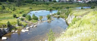
Previously, the name Yekaterinburg was not even mentioned. At the confluence of two rivers (Uktuska and Iset) lay a sparsely populated mountainous area that many Russians had never heard of. In those days, in the area of the Ural ridge there were no residential buildings or farm yards, only taiga, wild animals and wilderness. Now here is the largest industrial and cultural center, the fourth most populous city in Russia.
Founding history
The first settlers settled on the territory of today's Yekaterinburg at the end of the 17th century. These were Old Believers who found solitude far from noisy cities. Gradually, the villages grew and were populated by peasants and artisans.
At the beginning of 1702, the head of the Siberian Order, the Dutchman A. Vinius, arrived in these places. It turned out that Uktusk is rich in iron ore and minerals. By order of Peter I, a state-owned ironworks was founded on its shore. Construction took two years. During this time, Uktuska was blocked by a dam, and hammer factories, blast furnaces, a forge and several outbuildings grew on its banks. In the surrounding area, a wooden church was erected, a commander's courtyard, orders and residential buildings were built. A fort was built nearby. Already in 1704, the company produced the first products from cast iron and iron: nails, boilers, bombs, cannonballs, buckshot, anchors.
The glory of the new plant was short-lived. A fire in 1718 destroyed almost all wooden buildings and equipment. 4 years later, artillery captain Vasily Tatishchev arrived here with an order to select a new site for the construction of a more powerful plant. He ordered to place it at the mouth of the Iset River. On November 18, 1723, the largest ironworks in Russia by the standards of that time produced its first products. From this day the city's chronology begins.
Why was Yekaterinburg called Yekaterinburg
The city owes its sonorous name to the Russian engineer with Dutch roots, William de Gennin. He proposed to name this settlement in honor of the wife of Peter I, Catherine. There is an opinion that the toponym is also connected with the name of the patroness of mining, the Holy Great Martyr Catherine of Alexandria. The history of the name of the city of Yekaterinburg is inextricably linked with the construction of factory workshops and residential areas for artisans.
The city was rapidly developing and rebuilt. It became the center of the mining and ore mining cluster of the Ural region. Yekaterinburg occupied major positions in the production of cast iron and copper, the casting of cannons and cannonballs, and the manufacture of edged weapons.
The period of formation of the Russian Empire
During the reign of Catherine the Great, the city acquired the status of a district town. This happened in 1781. The design of his coat of arms is interesting. At the top, on a red background, was a silver bear carrying the Gospel in a gold frame on its back. Above it is a silver cross. In the lower part on the green field there is a silver smelting furnace and a mining shaft. These are symbols of the mining and metallurgical industries.
The Great Siberian Highway, laid in 1763 through the territory of Yekaterinburg, became a powerful impetus for the development of the city. This was the main trade route of the Russian Empire, providing access to the riches of Siberia.
In the first years of the 19th century, Yekaterinburg industry reoriented toward mechanical engineering. In 1807, Ekaterinburg once again confirmed its importance for the state, receiving the status of a mountain city in Russia. Academician Johann Gmelin wrote:
Anyone who wants to get acquainted with mining and factory work should only visit Yekaterinburg
The time period 1878 - 1888 was marked by the construction of the Ural branch of the railway, connecting Yekaterinburg with Perm and Tyumen, and in 1897, communication with Chelyabinsk was established, and access to the Trans-Siberian Railway appeared. The city lived, grew and developed. At the dawn of the 20th century, its population was more than 50 thousand people. 49 large enterprises and more than 300 small workshops operated here.
Founding of Yekaterinburg
FACTORY FORTRESS
In the spring of 1723, by decree of Emperor Peter I, construction of the largest ironworks in Russia began on the banks of the Iset River.
The free river flow was blocked by a dam, factory workshops and a church rose next to it, and smooth streets of houses stretched out. The new settlement was surrounded on all sides by powerful defensive structures. The date of birth of the city was November 7 (18), 1723, when a test launch of war hammers was carried out in the workshops. In honor of Empress Catherine I and the patroness of mountain crafts, St. Catherine the Great Martyr, the plant-fortress was named Yekaterinburg. All construction in Yekaterinburg proceeded according to the master plan developed by a student of the artillery academy, M.S., who arrived from the Olonets factories. Kutuzov. The first general plan of Yekaterinburg indicates that the development of the city on the Iset was carried out according to the best examples of fortification art from Germany, the Netherlands and France. The European character of the city is reflected not only in its name (the German “burg” translated into Russian means “city”), but also in its layout.
Yekaterinburg was built as the capital of the mining region, spread over a vast territory on both sides of the Ural ridge, in two parts of the world - Europe and Asia. In the first years of operation, the Yekaterinburg plant itself surpassed all other metallurgical enterprises not only in the country, but also in the world in terms of technological equipment.
In 1725, the Mint ("Toll") yard was opened in Yekaterinburg, which provided the Russian state with copper coins for a century and a half. In 1726, a lapidary factory was built, which became the main supplier of products from the Ural gems to the sovereign St. Petersburg and many European capitals.
Empress Catherine I gave Yekaterinburg its name, and Catherine II granted it city status in 1781. During the reign of Catherine II, the main road of the Russian Empire was built through the young city, which was called the Moscow Highway to the west of Yekaterinburg, and the Great Siberian Highway to the east. Thus, Yekaterinburg became the key city to the vast and rich Siberia, a “window to Asia,” just as St. Petersburg was the Russian “window to Europe.”
In 1807, the role of the capital of the mining region was confirmed by assigning it the status of the only “mining city” in Russia. Until 1863, Yekaterinburg remained subordinate to the head of the mining plants of the Ural ridge, the Minister of Finance and the Emperor personally and enjoyed significant freedom from gubernatorial power. Since the 1830s, mountainous Yekaterinburg has become a center of mechanical engineering. The production of mining and metallurgical equipment, water turbines and steam engines was established at state-owned and private mechanical factories.
Official portal of Ekaterinburg
PIONEER OF URAL GEOGRAPHY
Tatishchev made a worthy contribution to the development of science in Russia in the first half of the 18th century. He made an important geographical discovery: he considered the Ural Mountains as a vast mountain system - “the most noble in the entire Russian Empire.” He also introduced the term “Ural” and “Ural Mountains” into science, and drew the border between Europe and Asia along this mountainous country. Tatishchev was one of the founders of the cities of Yekaterinburg, Perm and Chelyabinsk. In the Urals V.N. Tatishchev visited a vast territory that we call the Middle and Southern Urals (parts of the Perm, Sverdlovsk, Chelyabinsk, Orenburg regions and Bashkiria): from Cherdyn, Solikamsk and Verkhoturye in the north - to Orsk, Orenburg and Sol-Iletsk in the south; from the Kama River and Kungur-ra in the west - to Irbit, Tyumen and Tobolsk in the east. He was sent here by Peter I by decree of January 14, 1720 to build state-owned mining factories and establish mining. He served as the Chief Director of the state-owned mining factories of the Siberian and Kazan provinces from August 1720 to November 1723. (with a break in February-July 1722) and from the autumn of 1734 to May 1737. During these years he lived first in Uktus, then in Yekaterinburg; on his second visit he had a country house with an estate on Mount Voznesenskaya, on the site of the Ascension Church; Tatishchev's house was demolished due to disrepair in 1789. Later, from June 1737 to 1739, being the head of the Orenburg Commission, he lived in Samara, traveling around the Volga region, at the same time, paying great attention to the Orenburg province and the Southern Urals.
The contribution of Vasily Nikitich Tatishchev to geography is only just beginning to receive proper appreciation. His name undoubtedly deserves to be immortalized on a map, in monuments, names of settlements, streets, or in some other way.
In connection with the 275th anniversary of the founding of Yekaterinburg, on the left bank of the Iset River, near the Historical Square - the historical center of the city - a monument in the form of two figures was erected on a beautiful pedestal made of polished red granite.
The laconic inscription reads: “To the glorious sons of Russia V.N. Tatishchev and V.I. Ekaterinburg grateful to de Gennin 1998.” Another monument - Tatishchev on horseback - was erected in Togliatti (formerly Stavropol on the Volga), of which he was the founder, in connection with the 250th anniversary of the city.
From the distant past, two names have been preserved on the map - Tatishchevskaya pier on the Ural River in the Ural region of the Caspian lowland and the urban-type settlement Tatishchevo in the Saratov region. Tatishchevskaya pier is named in honor of V.N. Tatishchev back in the 30s of the 18th century. At that time, along the Yaik River from Verkhneyaitsk (Verkhneuralsk), fortresses were built along the “new Orenburg line”, separating the Bashkir lands from the lands of the Kyrgyz-Kaisaks (Kazakhs). From the upper reaches of the Yaik River, the Tatishchevskaya pier was the thirteenth, and from the city of Guryev - the eighth, from the Yaitsky town (now the city of Uralsk) - upstream the Yaik River - the fourth. Name of the village Tatishchevo (now an urban-type settlement) near Saratov appeared in 1870 during the construction of the Ryazan-Ural railway.
In the spring of 2000, at the Third Tatishchev Readings held in Yekaterinburg, organized in connection with the 250th anniversary of the death of the scientist and the 600th anniversary of the Tatishchev family, a decision was made and 2 new geographical names appeared on the map of the Urals - “Tatishchev’s Grotto” in Kungur cave and another grotto named after him - in the cave of Geologists-2; both are from the Perm region. The grotto of Tatishchev, the first explorer of the Kungur cave, is located to the north-west of the “Vyshka” grotto, its dimensions are: length 30 m, width from 10 m, height - 3 m. Tatishchev’s grotto opens a new, previously unexplored continuation of the Kungur cave. There is Tatishchev Street in Yekaterinburg, and by a resolution of the head of Yekaterinburg at the beginning of 1998, the Tatishchev and de Genin Prize was approved, which from now on will become the highest official award of the mayor's office for citizens.
A WORD ABOUT THE FOUNDER OF EKATERINBURG
Georg Wilhelm Genning, or Willim Ivanovich Gennin, as he usually called himself in Russia in documents, and as he was called in Russia in everyday life, was born in 1665 in the town of Nassau-Siegen, in Germany. It should be noted that he was exactly 10 years older than Tatishchev, although they both died in the same year, in 1750. In 1698, during the famous “great embassy” of Peter the Great to Europe, Gennin was invited by Peter to Russia as an artilleryman, and began serving as a fireworksman, i.e. battery commander. Since then, he visited Germany only twice for a short time and he gave all the next 52 years of his life to Russia. He served well and quickly rose in rank: in 1700 - lieutenant, in 1708 captain, in 1706 - major, in 1710 - lieutenant colonel, in 1716 - colonel. He distinguished himself as an artilleryman and fortification engineer during the capture of Vyborg and Kexgolm, as well as at Gangut. Here fate brought him together with powerful people from Peter the Great’s entourage - Admiral General Apraksin, the chief shipbuilder, and Count Bruce, the future head of the Berg College.
In 1712 his career as an engineer began. He completed the construction of the Foundry and Powder factories in St. Petersburg. After that, he was appointed Olonets commandant and head of the Petrovsky, Povenetsky, Kongeozersky factories, where he remained in this position for 10 years.
The Olonets factories represented a whole complex of enterprises, including the powerful metallurgical Petrovsky Plant (modern Petrozavodsk), factories for the production of cannons, cannonballs, anchors, a large shipyard in Povenets, and a copper plant. Gennin restored neglected old factories, built new ones, and established the production of guns, wire, and bladed weapons. And after a year-long trip to Germany, France, Holland and England, he apparently introduced machine production at his factories for the first time in Russia. In the meantime, he opens mineral waters near the Olonets factories and creates the first resort in Russia, which still operates today. In Olonets he first created a school.
In 1719, Peter established the Berg College and sent Gennin on a business trip abroad to inspect the local mining plants, draw up plans and models. Gennin not only examined, but also managed to introduce the machines he saw, and brought 16 masters to Russia. In March 1722 he was promoted to major general, and from that time enormous changes took place in his life.
In April 1722, he was sent to the Urals, where he was tasked with sorting out the conflict between Tatishchev and Akinfey Demidov, which arose in 1721 during Tatishchev’s first visit to the Urals. As is known, having then arrived in Uktus with the largest specialist in mining Blier, who had been engaged in this for about 20 years and had been to the Urals several times before, Tatishchev independently began an attempt to build a new plant on Iset. But in response to his appeal to the Berg College, he received a ban on continuing construction and was forced to stop it. And the dispute that arose with the Demidovs led to his recall to St. Petersburg and the initiation of a judicial investigation.
Gennin, on the one hand, had instructions to look into this matter, and, on the other hand, he was sent “to fix iron and copper factories,” i.e. for the same business that he had been successfully doing for 10 years at the Olonets factories and which Tatishchev failed to cope with on his first trip to the Urals. Gennin approached the matter very seriously and skillfully. He stocked up on detailed “instructions” from the Berg College and from the Emperor, which he compiled himself. The instructions were supposed to obviously insure him in subsequent activities and provide him with the necessary powers. He resolved Tatishchev's dispute in his favor and supported the idea of building a plant on the Iset River.
Already in February 1723, he received permission to begin construction, and in March he received the first 10,000 rubles for work, after which he began construction on a grand scale. He called in 2 battalions of the Tobolsk regiment to build a fortress around the plant. And all the surrounding peasants were involved in the construction of the plant itself. It began in March, and already in June the first products were produced in workshops that did not require water energy. In September, the Iset River was blocked by a dam, and on November 7 (18), the plant was fully operational.
But the most difficult problem was apparently not the construction, but its approval. There were some big difficulties here. Gennin wrote letters to Peter three times, but received no answer. For some reason this worries Gennin extremely. This is indicated by the way in which Gennin achieves approval. In June 1723, he sent more than 8 letters on this topic, including to Peter himself, Catherine, Peter’s secretary and orderly, two of Catherine’s ladies-in-waiting (one of them was the sister of the all-powerful Menshikov), Bruce, Apraksin and others (how many others there were remain unknown). At the same time, the Imperial couple was sent a copper dish made from the first copper produced at the new plant. It was on this dish that the name of the new plant was mentioned for the first time - Katerin Burkh. The letter to the Empress indicated that the plant was named in honor of her name (but not in honor of her). After such a mighty salvo, the desired result was obtained. Letters arrived approving both the fact of construction and the new name, although it was given by Gennin “before the Decree”, and the decree was promised to be sent. It is unclear whether there was still a Decree. In any case, Gennin sent a copy to Tobolsk not of the Decree, but of those letters that he received from the Tsar and Queen.
After this, Gennin spent 12 whole years at the Yekaterinburg plant, as Katerin Burkh later became known (it should be noted that for all his visits, Tatishchev spent only 4 years here). A unique management system for the entire mining and metallurgical industry of Siberia and the Urals, state-owned and private, was created. The system existed without changes until 1861, and almost to the present day. In total, Gennin built 9 new factories in the Urals, including Yagoshikhinsky, which was later turned into the city of Perm.
V.A. Viner, S.I. Voroshilin. A word about the founder of Yekaterinburg, General Villim Ivanovich Gennin
EKATERINBURG—A NEW TYPE OF SETTLEMENT IN RUSSIA IN THE 18TH CENTURY.
In 1701, the first-born ferrous metallurgy of the region appeared in the Urals - the Kamensky and Nevyansky factories. By the 20s of the 18th century, i.e. by the time of the emergence of Yekaterinburg, 12 ferrous metallurgy plants and 6 copper smelters were already operating in the Urals. The beginning was laid for the creation of Russia's largest metallurgical base, which played a huge role in the development of the country's economy, defense and culture. During the 18th century, approximately 200 factories were built in the Urals, and the Urals became the main supplier of metal for the country and for export. According to V.I. Lenin, it was a time when “... serfdom served as the basis for the highest prosperity of the Urals and its dominance not only in Russia, but partly in Europe.” The widespread construction of metallurgical plants in the Urals also gave rise to a new type of settlement in Russia—factory towns. A classic example of such settlements is Yekaterinburg.
The location for the Yekaterinburg plant, the future center of all Ural metallurgy, was chosen “in the middle of all the plants,” as the Russian scientist, at that time the head of the Siberian plants, V.N. Tatishchev, on the river. Iset near its confluence with Chusovaya, on a large trade road leading from west to east. This favorable position in all respects and convenient in terms of natural and geographical conditions of the new plant was the basis for the construction of the city, which later became the center of the economic, political and cultural life of the Urals.
The choice of location for the new plant belongs to V.N. Tatishchev. Intensive construction began in the spring of 1723 (under the leadership of V.I. Gennin, who replaced V.N. Tatishchev as head of the Siberian factories) and was basically completed by November 7 (18), 1723. On this day, the first hammer. This event was preceded by construction at the turn of the 17th - 18th centuries. settlements within the boundaries of the future city - the villages of Uktus, and Verkhniy Uktus, Novaya Pyshma, or Novopyshminskaya. In 1702-1704. the first mining plant was built - Uktussky-Nizhny, which burned down “without a trace” in the spring of 1718. In 1714-1716. on the river In Istoke, a small private ironworks, known as Shuvakishsky, was built and produced products. Finally, in 1722-1726. The Verkhne-Uktussky mining plant was built, officially called the plant of Princess Elizabeth (the future village of Elizavet, or Elizavetinskoye).
Since August 1718, the “reconstruction” of the Nizhne-Uktussky mining plant was undertaken, which by the end of the year had produced more than 500 pounds of pure copper. However, the plant did not receive further development due to a lack of water in Uktus. At this time, the commissar of the burnt Uktus plant, T. M. Burtsov, was ordered to find out “whether there is another place nearby where to make another mining plant ... on this or another river.”
By February 16-17, 1723, a project for a plant and a dam on Iset was drawn up and approved. Construction on Iset actually began in February-March 1723 D.N. Mamin-Sibiryak very figuratively described the beginning of the construction of the mountain.
The Ekaterinburg State Plant, which laid the foundation for the city, by the nature of its production was a unique industrial plant for its time, which united the main metallurgical and metal-processing production of iron and copper manufactories, as well as various industries of a similar nature - forging, sawmill, brick, stone-cutting and lapidary. At times, especially until the mid-18th century, there were 30-40 or more factories operating here.
In factories and plant workshops by the middle of the 18th century. they produced almost everything that world technology knew at that time. Not without reason, Academician I.G. Gmelin, who visited Yekaterinburg twice, including in August 1742, said: “Whoever wants to get acquainted with mining and factory work should only visit Yekaterinburg.”
In 1725-1726 a new plant is being built on Iset - Verkh-Isetsky, and by the end of the 18th - beginning of the 19th century - Nizhne-Isetsky. Thus, on the site of the future city, a system of mining factories with their own settlements was formed: Uktussky, Elizavetinsky, Verkh-Isetsky, Nizhne-Isetsky, and in the center - the Yekaterinburg plant. And if in the first four the population grew depending on the size of production, then the Yekaterinburg plant also grew as a center of industry, trade and the entire economy of the region.
Many Russian kremlins and monasteries date back to the 16th-17th centuries. were built with strict consideration of the terrain, the city plan with the inclusion of rivers, lakes, ponds and canals in the defensive system of the fortress, as well as all other conditions that determined the configuration of the fortress plan. The plans for the Ural city-factories were determined primarily by the location of the dam, pond, and plant, taking into account the surrounding natural conditions. Most of the fortress factories had the shape of an irregular polygon in plan. Rectangular plans are also known, for example, the Yagoshikha copper smelter and the Kamensk iron smelter.
The plan of Yekaterinburg and all Ural factory cities is based on a strict regular layout, a new principle of Russian urban planning of the early 18th century. This city-factory system was predetermined by a rectangular fortress and two perpendicular axes, determined by the location of the dam and the Iset River. These axes were also the basis for the composition of the center of modern Sverdlovsk. The fortress, built “for safety from restless people,” with side dimensions of 654X762 m, was a system of earthen ramparts, the height of which reached 2.5 m, and the width at the top was 1.5 m. There were six bastions at the corners of the fortress and along its main axis. On the east side, the earthen rampart had a wooden “palisade” (picket fence) and a ditch 1.5 m deep and 4.5 m wide. Wooden slingshots were placed at a distance of 25-30 m from the ditch. The ramparts of the bastions were reinforced with a wooden palisade.
Inside the Yekaterinburg fortress, from west to east, “a dam with more than 100 fathoms in length, 4 fathoms in height was erected, and the foundation was laid for it to be 37 fathoms thick, and at the top 25 fathoms.” The dam consisted of an earthen embankment and was reinforced with wooden frames; had 3 slots: two chest slots for water-filling wheels and one in the center for the passage of spring waters. Pre-factory areas are formed on both sides of the dam, which is typical for many Ural factory cities. In many cities, including Yekaterinburg, squares had a strict functional purpose: one of them (eastern) was church, the other (western) was commercial. On the shopping area there were buildings of the Siberian Oberbergamt with an office (the Main Board of Siberian Factories), a school and a hospital. Almost in the center of the square, along the axis of the dam, there was a church that closed the perspective of the main street. Subsequently, shopping arcades were built to the right of the church. The eastern square (like the western one) is rectangular in shape and is built up with residential buildings for officials. A church was also built on this square.
Thus, the dam, pond, squares with their buildings constituted the architectural and planning unity of the central part of the plant-fortress. Almost all the wooden workshops of the plant were located parallel to each other along the Iset, directly behind the dam.
This location of the workshops was dictated by production, and most importantly, by the need to supply water to the water-powered wheels of the workshops.
Inside the Yekaterinburg fortress, along the fortress walls, the residential houses of mountain officials, clergy, artisans and working people were located in strict order. A small number of these houses were located outside the fortress along the banks of the pond and river. Iseti.
Almost all buildings in Yekaterinburg, with the exception of blast furnaces, were built of wood. The churches and the building of the Oberbergamt were made of mud on stone foundations. For laying the stoves, a special refractory stone was used, which was delivered to Yekaterinburg from the villages of Klevakino and Lipovka.
Further development of the city's economic functions leads to the expansion of the settlement beyond the boundaries of the fortress. In the 30s of the XVIII century. Ekaterinburg Mining Plant is the largest plant in Russia. The master plan of 1743 shows significant construction outside the fortress, while maintaining a strict regular layout. The western side of the fortress, due to the construction of a rectangular stone courtyard and three blocks of residential buildings, expands and acquires a broken line. Then a large two-story building of the plant's main office was built, and later a laboratory and a school.
The building plans have an enfilade system, and their facades are simple and businesslike. The coverings of factory and civil buildings in the Urals of this period are characterized by a two-tier roof with a high rise. In the volumetric solutions of the buildings, their architecture and coverings, there is a commonality with the first buildings of St. Petersburg.
N.S. Alferov, G.I. Belyankin, A.G. Kozlov, A.E. Korotkovsky. Sverdlovsk (construction and architecture)
In the fire of revolution and civil war
The October events of 1917 changed the lives of the townspeople. During this period, the city of Yekaterinburg was called the same as before, but socialist reality dictated completely different canons. At the beginning of 1918, the Catherine Governorate was formed, and in March the Ural Military District was formed with Yekaterinburg as its center.
During this period, the city became the site of tragic events. On the night of July 16-17, 1918, the last Russian Emperor Nicholas II, his family, doctor Botkin and several servants were brutally shot in the basement of the house of engineer Ipatiev.
Later, the city was occupied by formations of the Czechoslovak Corps, then came under the rule of Admiral Kolchak. He planned to settle here with his headquarters. But in mid-July 1919, Red Army soldiers entered Yekaterinburg. The city became Soviet again.
Flag
The flag of Yekaterinburg is made in the form of a rectangular panel. The aspect ratio is 2:3. It is divided into 3 horizontal stripes. The top (yellow) and bottom (blue) are 1/4 the size of the flag, the middle (green) is 1/2. In the center of the green stripe are some elements of the coat of arms (mining shaft and smelting furnace).
The flag was approved by the decision of the Council of Deputies of the Yekaterinburg City Duma dated June 24, 2008.
What was Yekaterinburg called in Soviet times?
An important historical moment of the early 1920s can be considered the movement of the center of the Ural region here from Perm and the opening of the first Ural University. Enterprises were nationalized and restored, plants and factories were opened, and the production of new types of products began.
In 1924, by decision of the government, the city was renamed in honor of the Chairman of the All-Russian Central Executive Committee Yakov Sverdlov, who lived and worked here before the revolution. He was a fiery revolutionary, a faithful Leninist, who passed away in 1919.
The flames of the civil war and the subsequent 70 years of building communism brought significant losses to the appearance of the city. Sculptural monuments were dismantled, churches were looted, cemetery monuments were demolished, and then the cemeteries themselves. Representatives of the new government destroyed the most beautiful cathedrals, which were architectural masterpieces and determined the historical appearance of Yekaterinburg.
Regional settlements received new names: Nadezhdinsk became Serov, Shaitansk - Pervouralsk, Bogoslovsk - Karpinsky. The village of Petropavlovsky received the name Severouralsk, the village of Kudelka became Asbest, the Irbit plant became Krasnogvardeysky.
Many city streets and squares have lost their historical names. Government officials were not concerned about the fact that such changes would bring confusion into the ordinary lives of citizens and create confusion in addresses. Years passed, generations of Sverdlovsk residents changed. Gradually people forgot about what Yekaterinburg used to be called.
Sverdlovsk is the administrative center of the Ural region
1925-1929 - a time of great change. A water supply system was built and a powerful radio station was put into operation. Gradually, the life of the townspeople became more active and eventful. The year 1932 was marked by the opening of the Ural branch of the USSR Academy of Sciences. 27 research institutes worked in various industries. The opening of the Koltsovo military airfield, the reconstruction of enterprises, and the construction of new factory buildings are important milestones of those years.
By the beginning of the 40s of the 20th century, 85 enterprises of union and republican significance were successfully operating in the city. Almost half of all output came from mechanical engineering and metalworking. Sverdlovsk prospered, residents had jobs and decent wages, dreamed about the future, believed in a happy tomorrow.
What's interestnig?
Yekaterinburg has many attractions - it has a unique mix of architectural, historical and cultural rarities. The city has more than 60 historical and cultural monuments, 43 of which are considered national monuments due to their special significance. That is why Ekaterinburg can be declared as “the most historical city in Russia.”
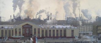
Currently, Yekaterinburg is one of the largest industrial centers. Its enterprises produce industrial goods for heavy engineering and military purposes.
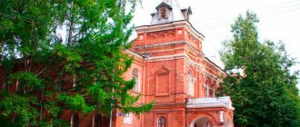
Ekaterinburg is not a very old city, with more than 285 years of history, but it is very unique as the founder of Russian industry, but also due to its geographical location. Unfortunately, very few old buildings have been preserved at present, the oldest (1764) of which is located in the historical park of the city, but it has also been reconstructed.
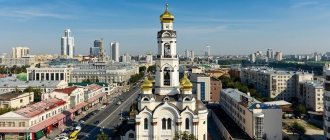
The historical center of Yekaterinburg is a dam on the Iset River, where in the 18th century there was a metallurgical plant, and now in its place there is a museum of the Ural industry and modern art. Not far from the embankment is the Literary Quarter - a quiet romantic place among the noisy streets, where you can stroll past the monuments of wooden architecture of the Urals.
For lovers of theatrical art, on the main street of the city there is the Opera and Ballet Theater, built in the mid-19th century in the classicist style, the Sverdlovsk Philharmonic where you can hear organ music, symphony and jazz orchestras, and many other theaters.
There is also a Circus in the city with a unique roof - a dome in which world-class artists perform. A similar dome by the architect Nemeyer can only be seen in Brazil. Next to the circus there is a magnificent arboretum with a variety of plants from different parts of the world. There is also a Zoo in the city where you can meet polar bears, hippopotamuses and other exotic animals.
The city has preserved a large number of architectural monuments, made in the rare style of the 20s of the industrial age of constructivism (the Big Ural Hotel, Iset, the White Tower, a building on the Boulevard of Culture, a film studio, the Chekist Town, the former building of the Palace of Culture named after. Dzerzhinsky - now the Sverdlovsk Museum of Local Lore and others).
On New Year's holidays, on the main square of the city you can see the Ice Town - this is an entire city within the city, created from ice, inside of which there are attractions and ice sculptures.
During the Great Patriotic War
Sverdlovsk had a deep rear. But the inhabitants of this harsh region also made a worthy contribution to the victory. More than 100 thousand Sverdlovsk residents were called to the front. 62 soldiers became Heroes of the Soviet Union, 13 thousand became holders of orders and medals. More than 500 formations were sent to the front line, including the famous 22nd Army and the Ural Volunteer Tank Corps.
More than 50 large enterprises were evacuated here from territories captured by the Nazis. On their basis, the production of military equipment, weapons and ammunition was launched. Sverdlovsk residents forged victory at the machines.
Residents of Sverdlovsk temporarily forgot ancient Yekaterinburg and why their city was called that.
City information
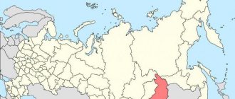
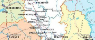
Yekaterinburg is the administrative center of the Sverdlovsk region. Located in the central part of Eurasia. Located on the banks of the Iset River. The economy is characterized by high business activity. There are mechanical engineering, food industry, energy, and metallurgy enterprises.
Important roads pass through the settlement: the federal highway M5 Ural, highways connecting with other cities. There is a large railway junction, consisting of 7 main lines. Koltsovo International Airport is located. There are vocational educational institutions, universities and their branches.
It is the fourth most populous city in the Russian Federation. The population there is about 1.5 million people.