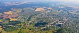
In 2022 city of Verkhniy Tagil turned 300 years old. The ancient city is located on the banks Tagil River And Verkhnetagilsky pond. Thanks to the historical campaign Ermak with the squad in Siberia, in subsequent centuries, throughout Tagil River, many of the first Russian settlements were built along its banks.
Tagil River. Here was the Verkhnetagil plant
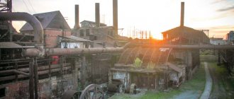
In 1718, in the upper reaches of the Tagil River , Nikita Demidov and his artisans built the Verkhnetagilsky factory . The metallurgical plant was built under the name Verkhny , since Demidov to build the Nizhny Tagil plant . In 1910, the Verkhniy Tagil plant was closed; in 1966, the village of Verkhniy Tagil received city status.
Over the course of 300 years, many events have occurred related to the development of the plant, volost, village and city of Verkhniy Tagil . Interesting and informative events for the press were identified for the city’s anniversary in regional and city archives and presented in this article.
Verkhniy Tagil, Sverdlovsk region
Story
In 1712, in the upper reaches of the Tagil River, factory owner Nikita Demidov founded an iron foundry and ironworks. The Verkhnetagil plant produced the first cast iron in 1718. This date is considered the year of the founding of Verkhniy Tagil.
First, iron ore was delivered from the Shaitansky and Chernoistochinsky mines, and then from Lomovsky. But local ore was refractory, so it was profitable for the owners to transport ore from Mount Vysokaya in Nizhny Tagil, although it required preliminary roasting.
In 1720, the first asbestos deposit in the Urals was found on Mount Shelkovaya, 5 km east of Verkhniy Tagil. Under Akinfiy Demidov, significant mining work was carried out here. A “non-flammable” tablecloth was made from this asbestos, with which Demidov surprised Peter I.
Contrary to his father’s orders, in 1768 Prokopiy Demidov sold the plant to Savva Yakovlev. Until the revolution of 1917, this enterprise was owned by Yakovlev’s heirs.
The Tagil River in its upper reaches is small, so there was not enough water to operate the hammers. In 1774, an auxiliary ironworks was built on the Vogulka River, 2 versts from the Verkhnetagil plant. It worked only in the warm season.
The finished products were sent on barges along the Chusovaya River to Central Russia. To transport iron to the pier, a road was built to the Shaitansky plant (now the village of Chusovoye).
On May 18, 1861, tragedy struck: a severe fire destroyed about 360 households, a wooden church, a dam and factory buildings. Gradually everything was rebuilt.
In the 1880s, under the new manager, Gavriil Aleksandrovich Markov, reconstruction began at the plant, which increased productivity. Later, Markov, beloved by local residents, was transferred to the Verkh-Neivinsky plant.
By the beginning of the 20th century, the population of the factory village was about 4,900 people. There were 2 primary schools, a hospital, 2 churches, and a library. Residents not only worked at the factory, but also engaged in crafts: they produced carts, sleighs, tubs, hats, sheepskin coats, etc. They also worked in gold mines.
It is interesting that in 1903-05, the elder sister of the revolutionary Ivan Mikhailovich Malyshev, Maria Mikhailovna, lived and worked as a teacher in a men’s primary school. She was also close to revolutionary circles.
On January 1, 1910, the Verkhnetagil plant closed. The workers rebelled and demanded that production be resumed. Police from Nevyansk and the Verkh-Neyvinsky plant came to pacify the residents. After the closure of the enterprise, the population began to decline. People went to work.
Later, the Soviet government decided not to restore the plant. The able-bodied population went to work at enterprises in Kirovgrad and Nevyansk.
The new development of Verkhniy Tagil was associated with the construction of the Verkhnetagilskaya State District Power Plant. It began to be built in 1951 to supply electricity to the Ural Electrochemical Plant (Novouralsk). In 1956, the power plant was put into operation, and in December 1964 it reached its design capacity. The station includes 4 power units with an electrical capacity of 1062 MW and a thermal power of 240 Gcal/h. Verkhnetagilskaya GRES operated on imported coal, and later switched to gas. It is a city-forming enterprise.
In the 1950s and 60s, Verkhny Tagil was actively developing and building up. In 1965 it received city status. The population of the city of Verkhniy Tagil is currently 11 thousand people. Quite a lot of Old Believers live here.
Notes
- ↑ 12
www.gks.ru/free_doc/doc_2016/bul_dr/mun_obr2016.rar Population of the Russian Federation by municipalities as of January 1, 2016 - [www.ivtagil.ru/node/19 History of the city of Verkhniy Tagil | Official website of the city administration]
- ↑ 123456789101112
www.MojGorod.ru/sverdlov_obl/verhtagil/index.html People's encyclopedia “My City”. Verkhniy Tagil - [demoscope.ru/weekly/ssp/rus59_reg2.php All-Union Population Census of 1959. The size of the urban population of the RSFSR, its territorial units, urban settlements and urban areas by gender] (Russian). Demoscope Weekly. Retrieved September 25, 2013. [www.webcitation.org/6GDOghWC9 Archived from the original on April 28, 2013].
- [demoscope.ru/weekly/ssp/rus70_reg2.php All-Union Population Census of 1970 The size of the urban population of the RSFSR, its territorial units, urban settlements and urban areas by gender.] (Russian). Demoscope Weekly. Retrieved September 25, 2013. [www.webcitation.org/6GDOiMstp Archived from the original on April 28, 2013].
- [demoscope.ru/weekly/ssp/rus79_reg2.php All-Union Population Census of 1979 The size of the urban population of the RSFSR, its territorial units, urban settlements and urban areas by gender.] (Russian). Demoscope Weekly. Retrieved September 25, 2013. [www.webcitation.org/6GDOjhZ5L Archived from the original on April 28, 2013].
- [demoscope.ru/weekly/ssp/rus89_reg2.php All-Union Population Census of 1989. Urban population]. [www.webcitation.org/617x0o0Pa Archived from the original on August 22, 2011].
- [www.perepis2002.ru/ct/doc/1_TOM_01_04.xls All-Russian Population Census 2002. Volume. 1, table 4. Population of Russia, federal districts, constituent entities of the Russian Federation, districts, urban settlements, rural settlements - regional centers and rural settlements with a population of 3 thousand or more]. [www.webcitation.org/65AdCU0q3 Archived from the original on February 3, 2012].
- [www.gks.ru/bgd/regl/b08_14t/IssWWW.exe/Stg/ur/03-00.htm Administrative-territorial division of the Sverdlovsk region as of January 1, 2008]. Retrieved May 11, 2016. [www.webcitation.org/6hQQf5WLh Archived from the original on May 11, 2016].
- [www.gks.ru/bgd/regl/B09_109/IssWWW.exe/Stg/d01/tabl-21-09.xls Number of permanent population of the Russian Federation by cities, urban-type settlements and districts as of January 1, 2009]. Retrieved January 2, 2014. [www.webcitation.org/6MJmu0z1u Archived from the original on January 2, 2014].
- [sverdl.gks.ru/wps/wcm/connect/rosstat_ts/sverdl/resources/c081bf004cb2e2e8b07efb98f842dd0b/number and distribution of the population of the Sverdlovsk region.rar All-Russian population census 2010. Number and distribution of the population of the Sverdlovsk region]. Retrieved June 1, 2014. [www.webcitation.org/6Q0e0rzaI Archived from the original on June 1, 2014].
- [www.gks.ru/free_doc/doc_2012/bul_dr/mun_obr2012.rar Population of the Russian Federation by municipalities. Table 35. Estimated resident population as of January 1, 2012]. Retrieved May 31, 2014. [www.webcitation.org/6PyOWbdMc Archived from the original on May 31, 2014].
- [www.gks.ru/free_doc/doc_2013/bul_dr/mun_obr2013.rar Population of the Russian Federation by municipalities as of January 1, 2013. - M.: Federal State Statistics Service Rosstat, 2013. - 528 p. (Table 33. Population of urban districts, municipal districts, urban and rural settlements, urban settlements, rural settlements)]. Retrieved November 16, 2013. [www.webcitation.org/6LAdCWSxH Archived from the original on November 16, 2013].
- [www.gks.ru/free_doc/doc_2014/bul_dr/mun_obr2014.rar Table 33. Population of the Russian Federation by municipalities as of January 1, 2014]. Retrieved August 2, 2014. [www.webcitation.org/6RWqP50QK Archived from the original on August 2, 2014].
- [www.gks.ru/free_doc/doc_2015/bul_dr/mun_obr2015.rar Population of the Russian Federation by municipalities as of January 1, 2015]. Retrieved August 6, 2015. [www.webcitation.org/6aaNzOlFO Archived from the original on August 6, 2015].
- taking into account the cities of Crimea
- [www.gks.ru/free_doc/doc_2016/bul_dr/mun_obr2016.rar Population of the Russian Federation by municipalities as of January 1, 2016. Table “31. Population of cities and towns by federal districts and constituent entities of the Russian Federation as of January 1, 2016.” RAR archive (1.0 MB)]
Sights of Verkhniy Tagil
At the entrance to Verkhniy Tagil there is a magnificent panorama of the village, pond and mountains in the surrounding area.
The road leads to the dam of the Verkhnetagilsky pond . Mount Bunar is visible in the distance. On the other bank, the pipes and buildings of the Verkhnetagilskaya State District Power Plant are clearly visible. Warm water from the power plant is discharged into the pond. The average depth of the reservoir is 3.8 m, the maximum is 5 m. There is a lot of fish in the pond, including silver carp, grass carp, channel catfish, bream, roach, bleak, perch, ruffe, pike, crucian carp. There have also been cases of catching exotic piranhas, apparently released from an aquarium by someone. There is a fishery.
In front of the dam on the shore of the pond there is a former factory management building . Now it is occupied by the post office.
Across the road stands an obelisk to participants in the civil war . In the past, there was a Edinoverie church nearby. It was dismantled in 1930, and the building materials were used in the construction of school No. 12.
You can walk along the right bank below the dam and look at it from the side. During the construction of the power plant, the dam was reconstructed and the water level in the pond was raised. The course of the Tagil River was also changed. Part of the shore was razed, exposing limestone rocks. A small rapid formed on the river. Nothing remains of the Verkhnetagil plant itself, which stood below the dam.
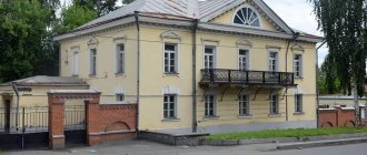
On the high right bank of Tagil, behind a high fence, there is a former manor house . He doesn't make much of an impression these days. Passing by, you won’t even notice him. Meanwhile, this is the most mysterious place in Verkhny Tagil. Legends about underground passages are associated with the house. Popular rumor claimed that the underground passage allegedly went all the way to the Nevyansk Tower.
In the past, the factory owner stayed in this house during visits to the factory. The plant managers also lived here. The house with the garden was surrounded by an openwork fence. There were two outbuildings adjacent to the house. During Soviet times, the building housed a school, a hospital and even a match factory. Now the house is privately owned.
Let's take a look at the book “Tales and Legends of the Urals” (Sverdlovsk, 1991):
“There was a legend that Demidov had moves. Well, we decided to check it out with the carpenter guys, we were still young. We took the lanterns and went. The steps are small. To the right is the move. The walls are brick. There are chambers in the walls. Their doors are massive. He seemed to keep his guilty ones here. How can they breathe in these chambers? Then there is a collapse, the passage is closed, the bricks are still piled up in a heap. We wanted to go further, but where could we go? Let's go back. We also saw a door, and in front of the door there were steps. And someone walled up the door with old bricks. There are holes in the foundation of the chambers. They say money was minted. So we returned. Of course, we need to take care of this matter, unwall the door and find out where the passage led.” (Recorded from B.A. Koryukov, born in 1913).
Even more interesting information is given in the book by V.M. Slukin “Secrets of the Ural Dungeons”:
“...A staircase of several wide steps leads to its deep basement. As soon as we pass the last step, we come across a pipe. We are confidently told that the pipe served to ventilate that very legendary passage to Teplaya Gora... In the basement, two rooms with barrel vaults await us... Not far from the entrance there is a brick block in the wall hiding the doorway. They say that behind this bookmark there was a tunnel towards another old factory building. In the vaulted room you can see another blocked door - here is the beginning of the underground passage to the dam...
Local resident Borozdin not only cleared these basements, but from the second vaulted room, through an iron door at the end of it, entered the third part of the basement, which was already emerging from the contours of the house... He found leg shackles and scattered links of chains. Borozdin guessed that the third room did not close the underground labyrinth, and he was not mistaken. He found a door from it. Where? It was not possible to find out, because when she tried to open the door, something sank behind her and earth fell...
Another hatch right in the basement was found by Vladimir Alekseevich Glinskikh. In the early 30s, he went down the hatch hole, found himself in a section of an underground passage, walked ten meters and saw a solid wall.”
In the vicinity of the house, mysterious failures occurred from time to time, which also proved the existence of dungeons.
Diagram of underground passages from the book by V.M. Slukin “Secrets of the Ural dungeons”
Elena Arapova in her book “Demidov’s Nests” writes about the following incident. In 1993, water began to drain from the pond. They called in specialists from Yekaterinburg, who examined the underground space near the dam, and at the same time near the manor’s house. Using instruments, three passages were identified under the house in different directions: towards the former factory office, towards the factory itself and towards the Edinoverie church that stood nearby.
On the other bank stands the stone Church of the Sign (Sporta St., 46), built in 1859 at the expense of the Stenbock-Fermor factory owners. It was consecrated in honor of the icon of the Most Holy Theotokos “The Sign” on November 22, 1876. Inside, the miraculous icon of the Most Holy Theotokos “The Sign of Verkhnetagil”, revered by believers, is kept, supposedly promoting healing from illnesses. During Soviet times, the church did not close.
Across the road from the church is Ilyinsky Park with a small chapel. However, the park is too strong a name.
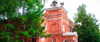
The most beautiful building in Verkhniy Tagil is the former volost administration with an original pointed wooden turret (there is a similar building in the village of Verkh-Neivinsky). The building was built in 1896 according to the design of G.A. Markov, is an architectural monument. In one of the rooms of the former volost government there was a “sizhovka” prison, where during the Civil War, either whites or reds languished in anticipation of the verdict. Also, part of the premises was occupied by firefighters in the past.
Currently, the Verkhnetagil Local History Museum (Lenin St., 30, tel.). It was founded in 1981 thanks to the efforts of Nikolai Ivanovich Ryabov (1918-1993) on the basis of the museum of school No. 12. The museum moved to the building of the volost government in 1990.
The museum has more than 6 thousand exhibits, divided into four departments: history, natural history, geology and art. The exhibition introduces the history of the founding of the city and the construction of the plant. There is also a corner of Mansi life, objects of archeology, mineralogy, and numismatics. There is also a taxidermy collection of Ural fauna.
Nearby is the building of the Pavlenkovsky library (Chapaeva St., 3). The first public library in Verkhny Tagil opened on September 15, 1903. It began with a parcel from St. Petersburg from the executors of the book publisher and educator Florenty Fedorovich Pavlenkov, who bequeathed all his accumulated book capital to free rural reading rooms in the Russian outback. When ural experts visited the city in 2018, the building was in a dilapidated state.
The historical center of Verkhniy Tagil is built up with private houses. Further along the main Lenin Street, the modern city center begins with Soviet buildings and multi-storey buildings.
On Victory Square , the central square of the city, there is a Memorial of Glory dedicated to the Great Patriotic War. It was built in 1984-85. On Victory Day, the “eternal flame” is lit here.
On the other side of the square stands the Palace of Culture (Lenin St., 100), built in 1964. Behind it is a city square.
Nearby, in the western part of the pond, a pedestrian bridge with a length of 300 meters was built from one bank to the other. Also a kind of attraction.
To the west of the city there is another pond - Vogulsky . This is a favorite vacation spot for city residents in the summer. To the north of the Vogulsky pond there is an ash dump of the Verkhnetagilskaya State District Power Plant, which is in no way inferior in area.
The path to Verkhny Tagil passes at the foot of Mount Ezhovaya, popular among skiers. Verkhny Tagil is clearly visible from the Devil's Finger rock - one of the Bunar idols. And 15 km west of the city, the territory of the Visimsky Nature Reserve begins.
Education
In September 1892, Gavriil Aleksandrovich Markov was appointed to the position of manager of the Verkhnetagil plant . He proposed to build a higher primary school building for the children of factory workers. On the initiative of Markov , the building of the volost government was built (currently the local history museum). In September 1903, at the request of G.A. Markov, the Pavlenkov Library was created .
Museum of History and Local Lore
How to get to Verkhniy Tagil?
By car you need to drive along the Serovsky tract, then turn onto Neivo-Rudyanka and, having passed it, move to Verkhniy Tagil. You can also drive through Shurala and Kirovgrad. At the same time you can visit the city of Nevyansk. Distance from Yekaterinburg – 97 km. Regular buses run from Yekaterinburg to Verkhniy Tagil.
Sources:
Arapova Elena. Twice Born // Demidov's Nests. - Yekaterinburg, 2001. Verkhnetagil reservoir - Rivers-Lakes Wikipedia Traditions and legends of the Urals. – Sverdlovsk, 1991. Rundkvist N.A., Zadorina O.V. Sverdlovsk region. Illustrated encyclopedia of local history Slukin V.M. Secrets of the Ural dungeons. – Ekaterinburg, 2005.
Pavel Raspopov
UraloVed. ru
2.2. Relief and geomorphology
In geomorphological terms, the territory of the Verkhniy Tagil urban district is an area of residual mountains of the eastern Ural slope. The relief is hilly and ridged. The maximum elevations of hills, hills, and ridges lie within 300-400 m, and along the border with elevated mountain ranges - up to 500 m or more.
The low foothills, which are a strip of residual mountains, include the orographic units Tagil-Neiva interfluve and the Neiva depression with the Neiva River valley. The hilly and ridged topography of this area is characterized by much less dissection compared to the western part of the territory under consideration. The relief is more leveled, the prevailing heights are 250-280 m, softly defined ridges, ridges, hills, hills alternate with extensive flat depressions.
In the Tagil-Neivinsky interfluve, the maximum heights of hills and ridges are on average 300-350 m, and only along the border with raised ridges they reach higher heights. The height amplitude of the hills and depressions is 40-80 m. In some places on the hills there are rock outcrops. The weathering crusts are more developed than in the elevated area - on the slopes and in depressions the rocks are covered with fine-earth eluvial, deluvial and alluvial deposits, often of Mesozoic and Oligocene age. Basins of reservoirs are associated with tectonic depressions. In the interfluve spaces, the ancient leveling surface is localized in separate spots and stripes.
