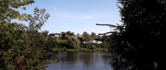
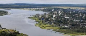
The city of Chita is the capital of the Trans-Baikal Territory. The settlement is surrounded by wooded hills, and in the city itself two rivers, Ingoda and Chita, merge. In the east there is the Chersky ridge, and in the west there is the Yablonogo ridge, along which stretches a whole chain of Ivano-Arakhlei lakes, which are connected by channels.
In Chita itself there is also a small mountain - Titovskaya Sopka. It is believed that it is the remains of a volcanic structure that was formed during the Upper Paleozoic period.
Winter
The climate of Chita in winter is quite harsh; in January the average air temperature is -25.2 degrees. Although in 1892 the temperature was recorded at -49.6 degrees.
Winter lasts about 177 days, starting as early as mid-October and ending by April 10. There is little snow in the city, and thaws occur very rarely. It is in this locality that one can observe a temperature inversion, characterized by an increase in temperature at altitude, as a result of which smog is often observed in the city. February is characterized by strong winds.
Popular message topics
- Decembrists
The Patriotic War of 1812 became a turning point in the history of the Russian Empire, in a sense. As a result of the expulsion of Napoleon from Russia, foreign campaigns were carried out by Russian troops. Many soldiers, officers, - Ekimov’s work
The birthplace of the Russian writer is the city of Igarka, which is located in the Krasnodar region. Boris Ekimov was born in 1938, on November 19, into a family of employees. - Chapaev
Many of us remember Vasily Ivanovich Chapaev only as the hero of jokes, but in fact, the story of his life is much more interesting and multifaceted than we can imagine. Today we will try to refresh our memory and understand
Summer
The summer climate in Chita is characterized as warm. In the second half the rainy season begins. Summer in Chita is 15 days shorter than the calendar season, starting around June 7 and ending on August 22. In July, the average temperature is +18.7 degrees. However, in 1898, a maximum temperature was recorded - +43.2 degrees. By the way, this temperature is an absolute record for all of Siberia.
In recent years (since about 2013), the atmospheric temperature has been constantly recorded at + 30 degrees, but as soon as the sun sets, the temperature drops almost instantly. That’s why it’s cool at night in Chita even in summer.
Train Station
The Chita-II railway station is a station in the Chita region of the Trans-Baikal Railway and the main station in the city of Chita. The railway station is located 60-70 meters from the Chita River at the address: st. Butina, 2. The number of tracks at the station is 8, the number of platforms is 2. The station building is located opposite the Kazan Cathedral. The railway station operates 24 hours a day, seven days a week. The technical break at the ticket office lasts 1 hour (from 1:00 to 2:00).
The most popular long-distance train destinations: Moscow, Vladivostok, Khabarovsk, Beijing, Novosibirsk, Novokuznetsk, Zabaikalsk. In the summer season, trains pass through Chita in the direction Chita-Adler. Suburban trains are also serviced at the Chita-II railway station.
What locals say, reviews
The climate of Chita is not suitable for weather-sensitive people, because the city is located at a fairly high altitude, although in a basin. It is because of this that very large changes in atmospheric temperature occur throughout the day.
Despite the global warming trend, there can be frosts in Chita even in summer. In spring, too, frosts return on a regular basis. Therefore, local residents rarely risk farming.
According to reviews, the city is quite cold in winter, and in February the winds blow endlessly. Summer is very short, although warm, with large amounts of rainfall occurring towards the end of the season.
But there is also a positive point - there are a lot of sunny days in the city, almost like in Sochi. The city has 43% more sunny days than, for example, Moscow.
Religion
In 1776, on the site of a burnt wooden church in the Chita fort, the Archangel Michael Church, also wooden, was built. Until 1727, the parish was under the jurisdiction of the Tobolsk see, then it became part of the newly formed Irkutsk diocese.
In 1862, the Chita Missionary School was opened. On June 3, 1879, the center of the Selenga Vicariate of the Irkutsk Diocese was moved from the Posolky Transfiguration Monastery to Chita. In 1886, the Chita Intercession Monastery was founded. Since 1894, the city became the center of the independent Transbaikal and Nerchinsk diocese. In 1895, the Chita Diocesan Women's School was opened. In 1900, a religious school was transferred to Chita from Nerchinsk. From the same year, the Transbaikal Diocesan Gazette was published.
In 1911, there were 18 Orthodox churches, 4 chapels, a Roman Catholic Church in the name of St. Apostles Peter and Paul (since the 1870s), mosque, synagogue, Buddhist datsan (since 1899, burned down in 1914 under unclear circumstances). In 1913, construction of the Alexander Nevsky Cathedral was completed. In 1917, a Baptist meeting house was built.
On February 16, 1918, the Bolsheviks established themselves in the city and began to pursue their usual policy towards the Church. Having tried to seize the documents of the Ecclesiastical Consistory and having received an unequivocal refusal, they decided that “the local authorities could consider such an attitude of the clergy as the beginning of active actions against the existing government” [6]. The clergy who resisted the robbery of the consistory archive were arrested. On June 19, 1918, seeing no other way to help the imprisoned priests, the laity decided, trusting only in God’s help, to move to the prison with prayer in a procession of the cross. On the street Kamchatskaya had a police chain posted on her way to the prison. After the Orthodox Christians walking with banners and icons refused to stop, they opened fire. Several people were injured, and one of the participants in the procession was killed.
In 1922 - 1929, Chita was the center of the Transbaikal Renovation diocese. By 1924, not a single Orthodox church remained in the city. Subsequently, the department of the Orthodox Transbaikal diocese was located in the Kazan Cathedral, and after it was transferred in the spring of 1929 to supporters of the Gregorian schism, in the Archangel Michael Church. The late 1920s and early 1930s were marked by mass church closures. From March to November 1931, a trial was held in the city in the case of a “counter-revolutionary monarchist organization”, the head of which the OGPU identified Bishop Eusebius (Rozhdestvensky) (who was by that time Archbishop of Shadrinsk). 238 people were involved in the case. Many of them were shot, many were thrown into concentration camps or sent into exile. In 1936, the Alexander Nevsky Cathedral was blown up. Opened in 1945, the Chita Resurrection Church remained the only one operating on the territory of the current Chita diocese until the 1990s.
In the 1960s, the destruction of the Old Chita Cemetery began. In the 1970s, St. Andrew's Bishop's Church was destroyed, and the Archangel Michael Church on Kenon was destroyed.
Since 1994, Chita has been the cathedral city of the Chita and Transbaikal diocese. A significant event was the consecration of the new Kazan Cathedral in 2004.
Since 2002, the Roman Catholic parish of the Holy Apostles Peter and Paul has been operating in the city. In 2010, Chita became the second Russian city after St. Petersburg to open a Buddhist datsan.
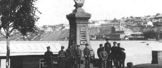
On September 12, 2015, a monument to the Holy Blessed Grand Duke Alexander Nevsky was unveiled on the station square of the city.
Monasteries
- Pokrovsky (inactive)
- Uspensky (male)
Temples
- Alexander Nevsky Cathedral (exploded)
- Alexander Nevsky, chapel on Titovskaya Sopka
- Alexandra the Martyr, at the women's gymnasium (inactive)
- Andrew the First-Called, at the bishop's house (destroyed)
- Antonievsky, at the men's gymnasium (inactive)
- Presentation of the Most Holy Theotokos into the Temple, at the Diocesan Women's School (inactive)
- Resurrection of Christ
- All Saints
- St. George the Victorious, chapel
- Elijah the prophet, cemetery
- Innocent of Moscow
- Innocent of Irkutsk (?), at the missionary school (inactive)
- Kazan Icon of the Mother of God, Cathedral
- Luke Krymsky
- Michael the Archangel
- Michael the Archangel, on Kenon (inactive)
- Nicholas the Wonderworker
- Nicholas the Wonderworker, in Peschanka
- Nicholas the Wonderworker, at the vocational school (inactive)
- Peter and Paul, at the bishop's house (inactive)
- Transfiguration of the Lord
- Transfiguration of the Lord, prison (inactive)
- Nativity of John the Baptist, at st. Chita I
- Sergius of Radonezh
- Our Lady of Sorrows, cemetery (inactive)
- Saint Terenty, camp (inactive)
- Three Saints, at the teachers' seminary (inactive)
- Trinity Life-Giving, on the Island (inactive)
Official portal Zabaykalsky Krai
Date of formation of the region
On March 1, 2008, in accordance with the Federal Constitutional Law of July 21, 2007 No. 5-FKZ “On the formation of a new subject of the Russian Federation within the Russian Federation as a result of the unification of the Chita region and the Aginsky Buryat Autonomous Okrug,” the Trans-Baikal Territory was formed.
The Aginsky Buryat Okrug became part of the region as an administrative-territorial unit with a special status.
Distance from Chita to Moscow - 6074 km Time difference with Moscow - +6 hours
Territory The area of the territory is 431.5 thousand km2 (2.6% of the territory of Russia). The length from west to east is 1000 km and from north to south – 900 km.
Administrative center is the city of Chita
Population (According to the 2010 All-Russian Population Census)
Population – 1,107.1 thousand people.
Population density – 2.6 people.
per 1 km2, Large cities
- Chita (323.9 thousand people)
- Krasnokamensk (55.7 thousand people)
National composition
- Russians – 89.9%;
- Buryats – 6.8%;
- Ukrainians – 0.6%
- other nationalities – 2.7%.
Regional government bodies
Executive body - Government of the Trans-Baikal Territory, Governor of the Trans-Baikal Territory - Osipov A.M.
Legislative (representative) body - Legislative Assembly of the Trans-Baikal Territory, Chairman of the Legislative Assembly - Likhanov I.D.
Historical reference
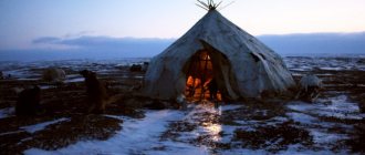
In ancient times, the Transbaikal region was a kind of “corridor” along which the steppe tribes of Mongolia and northern taiga hunters passed. In the 13th century, Transbaikalia became part of the empire of Genghis Khan.
Before joining the Russian state, the region was dependent on the Mongol and Manchu khans. Russian service people appeared on this territory in the middle of the 17th century.
In 1653, they founded a number of settlements: Irgensky, Nerchinsky forts and Ingondinsky winter quarters, which formed Chita.
Industrial development of the territory began in the 18th century. In 1700, the Nerchinsk silver-lead plant was built, and by the end of the 18th century. 9 factories were already operating here, incl. Petrovsky iron foundry and ironworks.
Tin and gold mining were actively developing. In the second half of the 19th century. Nerchinsk factories fell into disrepair.
In the XVIII – XIX centuries. the territory of Transbaikalia is a place of hard labor and exile, including political exile.
After the Amur region was annexed to Russia in 1851, Chita was the center of the Transbaikal region (1851-1920), the capital of the Far Eastern Republic (1920-1922), the province (1923-1926), the Chita district (1926-1930), the Chita region (1937-2008) and Trans-Baikal Territory (since 2008).
Geographical position
The region is located in Transbaikalia. Borders: in the west - with the Republic of Buryatia, in the northwest - with the Irkutsk region, in the northeast - with the Republic of Sakha (Yakutia), in the east - with the Amur region, in the southeast of the region there is the border of the Russian Federation with the People's Republic of China and Mongolia. The total length of the state border is 1920.1 km.
Natural conditions (relief features)
The relief of the territory of the Trans-Baikal Territory is formed by medium-high mountains, in some places reaching 1700-1900 m. The largest ones include the Daursky, Kodar and Yablonovy ridges. The highest point is the BAM peak at 3073 m above sea level.
The Great World Divide passes through the territory of the Trans-Baikal Territory, where the large rivers of Siberia - the Yenisei and Amur Lena - originate.
Natural resources
- Mineral resources
The mineral resource base consists of proven reserves of ferrous, non-ferrous, precious and rare metals, fluorspar, hard and brown coal, semi-precious stones, mineral waters and raw materials for the production of building materials.
The subsoil contains 42% of Russia's proven fluorspar reserves, 31% of zirconium, 21% of copper, 28% of molybdenum, 18% of titanium, 13% of silver, 12% of lead, gold, tungsten, tin, lithium, zinc, coal and iron ores.
The predicted mineral resource potential is: titanium dioxide, nickel, cobalt, lead, antimony, mercury, germanium, synnyrites, fluorite, zeolites. In addition, there are a number of deposits of semiprecious stone raw materials, perlites, graphite, refractory and refractory clays, magnesite, and there are prerequisites for identifying deposits of diamonds and platinum.
- Forest resources
The total area of the forest fund of the Trans-Baikal Territory is 32.6 million hectares, the total reserve of forest wood is 2.7 billion m3. Recreational resources, tourism
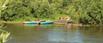
There are 64 unique natural monuments in Transbaikalia, including glaciers of the Kodar ridge, thermal springs, lakes, extinct volcanoes, etc.
The lake is considered a tourist Mecca. Ares at the great watershed. Transbaikalia is rich in sources of mineral waters used for medicinal purposes - the well-known health resorts “Uksakhai” and “Zymka” were created on their basis.
In total, the region has 12 resorts and sanatoriums, including Darasun, Kuka, Molokovka, Yarmarovka.
In the area of the Alkhanai mountain range, the Alkhanai National Park was opened in 1999 - a sacred place of worship for Buddhists.
Culture, museums and theaters of Chita
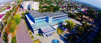
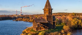
One of the main cultural attractions of Chita are its museums. Trans-Baikal Regional Museum of Local Lore named after. A. Kuznetsov, opened in 1895, is the oldest museum in Siberia. The museum's collections, numbering more than 170 thousand exhibits, tell about the history and nature of the Trans-Baikal region, contain collections of minerals, household items and beliefs of the indigenous population (Evenks and Buryats), and works of fine art. The Chita Art Museum presents exhibitions of paintings, engravings and graphics by Transbaikal artists, works of decorative and applied art of the northern peoples. Separately, it is worth noting the Museum of the Decembrists, which is located in the Archangel Michael Church, better known as the Church of the Decembrists. The exhibition, dedicated to the period of the Decembrists’ stay in Siberia, reveals their significant role in the study of the region, cultural and educational activities. The museum hosts literary and musical meetings, theatrical performances, and “Decembrist Evenings” are held annually. Also of interest: Geological Museum, Art Gallery, Museum of Military Glory of the Siberian Military District, Museum of the Trans-Baikal Railway. The theatrical art of Chita is represented by productions of: the Transbaikal Regional Drama Theatre, which has repeatedly become a laureate and diploma winner of all-Russian and international competitions and festivals, the Puppet Theater “Far Far Away”, the Theater of National Cultures “Transbaikal Patterns”, the Folklore Theater “Zabaikalye”, the Song and Dance Theater “Amar” sain" and others.
Automobile highways
Federal highways pass through Chita:
- P297 “Amur” is a highway that has the status of an object of federal significance. The total length of the route is 2165 km. The road passes through the following regions of the Russian Federation: Amur Region, Trans-Baikal Territory, Jewish Autonomous Okrug, Khabarovsk Territory. The road surface of the route is asphalt.
- P258 “Baikal” is a federal highway, the total length of which is 1113 km. The route originates in Irkutsk and passes through Ulan-Ude. The final point of the route is the city of Chita. The road surface of the Baikal highway is asphalt concrete.
- A350 is a federal highway with a total length of 493 km. It is part of the Asian route AH6. The highway originates in Chita and passes through Zabaikalsk, Aginskoye, Borzya. The final point of the route is the Zabaikalsk checkpoint. The road surface of the route is gravel and asphalt concrete.