| Folk heroes approve of this article. Therefore, they recommend continuing the text in the same spirit |
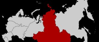
| Lukoyanov on the map | |
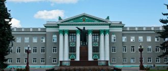
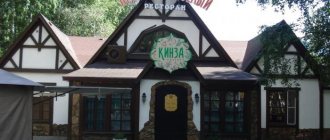
Lukoyanov Church of the Intercession of the Blessed Virgin Mary Retro dumplings in Lukoyanov
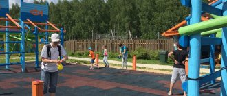
| Dancing. It's City Day in Lukoyanov. | |
Lukoyanov
- a city and administrative center of a large agricultural region of the Nizhny Novgorod region, located on the banks of the Tyoshi River, 173 km southeast of Nizhny Novgorod. This is a small cozy town with over 16 thousand residents.
History of Lukoyanov[edit]
Village Lukoyanovo[edit]
The history of Lukoyanov goes back to the 16th century. According to legend, it was named after the first settler Ivashka Lukoyanov, who set up a “mill, a Russian wheel” in the upper reaches of the Tesha River, thereby laying the foundation of a small village. The village of Lukoyanov was part of the Arzamas district, which was divided into seven camps - Teshsky, Ichalkovsky, Irzhensky, Sobakinsky, Shatkovsky, Zalesny. One camp was with palace and yasash villages. It remained untitled in the inventory book. According to documents of the 17th-18th centuries, this is Utishny camp. Most of the territory of the modern Lukoyanovsky district was part of Zalesye. The camp was located east of Arzamas “behind the Shatkovsky and Sobkinsky gates.” Mostly Mordovians lived here. Until the end of the 16th century, it made up 68% of the population here. Of the 22 villages in Zalesye, 15 were Mordovian. Each village had on average no more than 18 households. All around there was the rustling of centuries-old forests with crop lands in which local residents collected honey from wild bees.
Starting from the 16th century, the kings of the Moscow state distributed land to the boyars in different places. This was also observed in Arzamas district. But over the course of a century, relatively few lands were distributed into patrimonial land ownership and local use in the Middle Volga region; from the beginning of the 17th century, this process took on a wide scope. According to the “tithe list of nobles and boyars’ children,” 85 thousand dessiatines of land were distributed to estates in Arzamas district alone.
Large landowners resettled Russian peasants to these estates. New settlers sometimes displaced the indigenous inhabitants of this region from their homes, and sometimes settled nearby. But there are many facts that show that many Mordovian villages remained Mordovian.
In the first half of the 16th century, the village of Lukoyanova was located in Buturlin’s patrimony, and then was granted by Ivan the Terrible to Fyodor Kireev and Afimya Karpova. In the “separate” and “landmark” books of the estates of Fyodor Kireev and Afimya Karpova for the years 1586-1594, there is an entry in which it is reported that Kireev received in his estate “the patrimony of Lukoyanov according to Ivanov (that is, the royal - M.B.) division Buturlina".
All affairs in the estate were managed by Kireev’s clerk Onokha Ivanov. In a prominent place was his estate with an upper room and a cookhouse, granaries and log stables, an icehouse and other outbuildings. And nearby, on the mountainside, huddled low gray huts of peasants. The miserable picture of the village was complemented by a cemetery, pressed against the hillock of the right bank of the river. Horsetails. The estate was in the possession of Kireyev until 1612, until the war with the Polish lords, when the landowner betrayed his people, going over to the side of the enemy.
By decree of the Tsar, Kireyev was executed, and his sons were deprived of their father's estate. The Tsar ordered the village of Lukoyanov with all the land and peasants to “give the estate to Fyodor Levashov,” an active Nizhny Novgorod militia. But due to the fact that Levashov had by that time received an award elsewhere, she moved to Panov’s estate.
By the middle of the 17th century, as evidenced by documents, the village of Lukoyanova was transferred to the category of economic villages.
The village of Lukoyanovo was a traditional ring settlement of three blocks. One side of the building adjoined the right bank of the Tesha River, and the other went up the mountain. In the center of the square, formed from a ring of buildings, stood a wooden church. Country roads approached the village on both sides.
In the second half of the 17th century, potash trades began to appear in the vicinity of Lukoyanov. Back in the middle of the century, Tsar Alexei Mikhailovich, taking care of palace income, ordered by his decree: “In the Tesh and Alator forests, search for suitable places that would be suitable for him, the great sovereign, for potash and tar mining.” As a consequence of this, numerous potash houses arose in Lukoyanov and its neighboring villages, where peasants worked around the clock. Potash played a huge role in Russia's trade with foreign countries. In terms of the value of exporting individual goods, it occupied one of the first places. The technique for making potash was simple. Oak and alder were mainly burned into ash, and then a liquid dough was made from the ash, pine or spruce logs were coated with it and put into the fire. Each row of logs was covered with a layer of ash and lit. The ash burned and “straightened” in this way was potash.
The production of potash had a detrimental effect on the forests, which were thinning year after year on the right bank of the Volga. Bees died from the smoke. Honey has become expensive.
According to the administrative reform carried out by Catherine II in 1779, p. Lukoyanovo, together with a number of villages in the Nizhny Novgorod province, was transformed into a city. On August 16, 1781, the coat of arms of the city of Lukoyanov was approved: in the upper part of the shield there is the Nizhny Novgorod coat of arms, and in the lower part there are two golden ploughshares on a green field - a sign of the fertility of these places.
The fire of 1817 destroyed the city of Lukoyanov to the ground.
In the middle of the 19th century, there were only four stone buildings in the city: the Intercession Cathedral, the floor church and two public places. The city's population was entirely illiterate; Only on the centenary of the city, in 1879, the laying of the brick two-story building of the city primary school was celebrated as an official event in Lukoyanov. In 1903, in connection with the launch of the Romodanovskaya railway, Lukoyanov became a large railway station with a steam locomotive repair depot. A working class began to form in the city. Lukoyanovsky district had its own branched system of handicrafts. Each village in the district had its own economic “specialization”, its own traditions, and secrets. In a subsistence economy, villages exchanged products from their crafts, which stimulated the development of commodity-money relations. After the abolition of serfdom, the spread of handicrafts increased even more.
The city of Lukoyanov becomes a center of trade in the south of the province. On the Market Square they traded flour, cereals, meat, salt, yarn, canvas, wax, wheels, tubs, etc. The markets contributed to the widespread development of entrepreneurship, which was aimed mainly at serving the trading people. One of the types of entrepreneurship was the maintenance of inns. There were also several hotels in the city. Blacksmithing was greatly developed. Near the Market Square there were six forges that provided services to horse-drawn transport owners. In total, there were about 20 forges in Lukoyanov. The rapid development of trade turned it into the main source of income for the city budget.
Forestry was one of the widespread and varied occupations of the residents: in the first place was weaving matting and sacks, weaving bast shoes, turning wooden spoons, they also made buckets, sleighs, wheels, carts, and sawed boards. In Lukoyanov they got hemp and made ropes. A unique craft in the 19th century was the production of bast, which employed about 10 thousand people throughout the year.
There were also specific crafts in Lukoyanovsky district. So, residents of the village. Kryukovka were highly skilled craftsmen who had no equal in the construction business in the entire district. The production of hams by the Atingey people was quite unusual. The peasants, raising pigs, skillfully brought them to the required condition and delivered the finished hams to the royal table.
Revolution and civil war[edit]
The Civil War (1918-1922) greatly undermined the economy of Lukoyanovsky district. The widespread development of agricultural cooperation played an important role in the further development of agriculture in the county. Peasants saw the practical benefits of agricultural cooperatives and willingly joined them.
The restructuring of agriculture in the region took place simultaneously with the struggle for cultural construction in the city and villages. During the years of the first five-year plan, Lukoyanov’s members occupied one of the first places in the region not only in the organizational and economic strengthening of collective farms, but also in fulfilling obligations to the state, both in terms of agricultural products and financial payments. Lukoyanovsky district was named among the 26 leading agricultural regions of the USSR.
During the war, many enterprises switched to producing military products. The Salmox sewing industry supplied thousands of sets of winter and summer uniforms to the front - sweatshirts, tunics, trousers, and underwear. The local garment workers were tasked with making the first army shoulder straps. The “Red Textile Worker” artel produced camouflage netting, and the “Kustar” produced a metal barrier net against submarines. The Razin timber industry and forestry enterprises produced materials for the aviation industry and made blanks for butts for machine guns and other types of weapons; the glass factory mastered the production of special bottles for flammable mixtures.
Post-war development[edit]
At the end of the 50s, work began on the complete electrification of settlements in the region. In 1958, the Lukoyanovskaya power plant was put into operation. In the fall of 1961, settlements in the Trans-Alatyr zone were electrified, and the region became fully electrified. In 1955, the first paved road was built connecting Lukoyanov with the village. Shaky. The year 1960 should be considered the beginning of thorough construction of roads in the region. The first road to be built was connecting Lukoyanov with the regional center of the neighboring Gaginsky district. In 1960 - 1965, with the participation of Gorky factories, roads were built to Saransk and to the village. Bolshoy Maresyev and r.p. Razino. By the mid-70s, Lukoyanov was connected by roads with all the central villages of the region.
All enterprises gradually mechanized production and built new workshops.
In 1962, a new meat-processing plant (slaughterhouse) came into operation, in 1967 a plant for the production of skimmed milk powder was built, in 1968 a repair and bearing plant began operating, in 1971 - a brick plant, in 1973 - a large-panel house-building plant.
At the end of the 70s, mass housing construction began in villages at the expense of the state budget. In Lukoyanov, the construction of housing and social and cultural facilities was mainly carried out in two microdistricts.
In 1971, the first gas distribution station was built. The network of gas pipelines in the city has been increasing every year since then. At the same time, work was underway on the construction of gas boiler houses, and gasification of populated areas in the region was underway. Currently, the main gas pipelines are laid throughout the region, work is underway to lay gas pipelines from the main highways to each populated area. In 1986, construction of the city sewer began.
Lukoyanov
(Nizhny Novgorod Region)
OKATO code:
22239501
Founded:
16th century.
City since:
1779 City of district subordination (Lukoyanovsky district, Nizhny Novgorod region)
Center:
Lukoyanovsky district
Telephone code (reference phone)
| 83196***** | 21-00-0 |
Deviation from Moscow time, hours:
0
Geographic latitude:
55°02′
Geographic longitude:
44°29′
Altitude above sea level, meters:
170 Sunrise and sunset times in the city of Lukoyanov
Interesting facts[edit]
- In the 17th – 18th centuries, Lukoyanovsky district, by order of the imperial court, actively supplied potash to St. Petersburg. Potash was obtained by burning oak and alder (spruce) firewood. As a chemical, it was used in the production of glass, soap, paints, gunpowder and other products. The government took all measures to encourage the mining of potash and tar, which were one of the most important export items to England and Holland and the receipt of state income.
- It is curious that all the persons who participated in the seizure of Mordovian forests for potash production in the Arzamas district belonged to the court nobility - these were royal relatives and favorites (Morozovs, Cherkasskys and others).
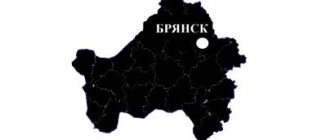
Map
| Lukoyanov: maps |
Lukoyanov: photo from space (Google Maps) Lukoyanov: photo from space (Microsoft Virtual Earth)
| Lukoyanov. Nearest cities. Distances in km. on the map (in brackets along roads) + direction. Using the hyperlink in the distance , you can get the route (information courtesy of the AutoTransInfo website) | |||
| 1 | Shaky | 27 (30) | NW |
| 2 | Gagino | 41 (42) | NE |
| 3 | Pochinki | 44 (54) | SE |
| 4 | Pervomaisk | 47 (56) | Z |
| 5 | Bolshoye Boldino | 53 (77) | IN |
| 6 | Arzamas | 58 (63) | NW |
| 7 | In hell | 58 (89) | WITH |
| 8 | Outcall | 59 (66) | NW |
| 9 | Elniki (Republic of Mordovia) | 60 (88) | SW |
| 10 | Kemlya (Republic of Mordovia) | 61 (193) | SE |
| 11 | Transportation | 63 (109) | WITH |
| 12 | Buturlino | 64 (87) | NE |
| 13 | Bolshoye Ignatovo (Republic of Mordovia) | 69 (237) | IN |
| 14 | Sarov | 75 (87) | Z |
| 15 | Diveevo | 78 (95) | Z |
| 16 | Krasnoslobodsk | 80 (117) | SW |
| 17 | Old Shaigovo (Republic of Mordovia) | 81 () | YU |
| 18 | Urazovka | 82 (96) | NE |
| 19 | Sergach | 83 (87) | NE |
| 20 | Bolshoye Murashkino | 85 (115) | WITH |
| 21 | Romodanovo (Republic of Mordovia) | 88 (159) | SE |
| 22 | Far Konstantinovo | 89 (115) | WITH |
| 23 | Ardatov | 90 (115) | Z |
| 24 | Sechenovo | 92 (116) | IN |
| 25 | Lyambir (Republic of Mordovia) | 92 (146) | SE |
| 26 | Temnikov | 92 (150) | SW |
| 27 | Knyaginino | 93 (130) | WITH |
| 28 | Gremyachevo | 100 (117) | NW |
| 29 | Saransk | 104 (132) | SE |
| 30 | Pilna | 107 (116) | NE |
a brief description of
Located on the bank of the river. Tesha (tributary of the Oka), 173 km southeast of Nizhny Novgorod. Railway station.
Territory (sq. km): 57
Information about the city of Lukoyanov on the Russian Wikipedia site
Historical sketch
In the 16th century a certain Ivashka Lukoyanov built a mill, thus laying the foundation for the village of Lukoyanov. From the middle of the 17th century. economic village.
Since 1779, the district town of Lukoyanov, Nizhny Novgorod governorship (since 1796 - Nizhny Novgorod province).
In 1856, in the district town of Lukoyanov, Nizhny Novgorod province, there were 2 churches, 440 houses, 5 shops.
Economy
Bearing repair and expanded clay plants. House-building plant.
In the Lukoyanovsky district, rye, wheat, barley, oats, sugar beets, and fodder crops are grown. They raise cattle, pigs, and sheep.
Deposits: titanium-zirconium sands, Kurleevskoye rare earth metals, Merlinovskoye expanded clay clay, Razinskoye stone-wattle fence, building stone and sands, as well as peat.
Culture, science, education
Museum of Local Lore (in the former house of the Blokhins, second half of the 19th century, wooden).
Architecture, sights
Magnitsky Grove (founded in 1953). Areas of oak forests are the remains of ancient Murom forests, Morzhovsky sacred groves “Lukash”, “Yavlei”, “Kshekuravai”. The Razin stone, under which, according to legend, the treasures of Stepan Razin are buried.
| Population by year (thousands of inhabitants) | |||||||
| 1856 | 2.9 | 1992 | 12.2 | 2007 | 12.5 | 2016 | 14.2 |
| 1897 | 2.1 | 1996 | 11.8 | 2008 | 12.4 | 2017 | 14.1 |
| 1931 | 7.5 | 1998 | 11.5 | 2010 | 12.3 | 2018 | 14.1 |
| 1939 | 5.5 | 2000 | 11.3 | 2011 | 15.0 | 2019 | 13.9 |
| 1959 | 7.0 | 2001 | 11.2 | 2012 | 14.8 | 2020 | 13.8 |
| 1970 | 10.2 | 2003 | 12.9 | 2013 | 14.5 | 2021 | 13.6 |
| 1979 | 11.4 | 2005 | 12.7 | 2014 | 14.3 | ||
| 1989 | 12.3 | 2006 | 12.6 | 2015 | 14.2 | ||
Links[edit]
Notes[edit]
- ^ abcdefgh Order No. 3-od
- ^ a b Federal State Statistics Service (2011). “All-Russian Population Census 2010. Volume 1" [All-Russian Population Census 2010, vol. 1]. All-Russian Population Census 2010 [All-Russian Population Census 2010]
. Federal State Statistics Service. - "26. The size of the permanent population of the Russian Federation by municipalities as of January 1, 2022". Federal State Statistics Service. Retrieved January 23, 2022.
- ^ abcde Law No. 162-Z
- "On the Calculation of Time". Official Internet portal of legal information
. June 3, 2011. Retrieved January 19, 2022. - Post office. Information and computing center of OASU RPO. ( Post office
).
Search for postal service objects ( postal Search for objects
) (in Russian) - ↑
Federal State Statistics Service of Russia (May 21, 2004).
“The population of Russia, the constituent entities of the Russian Federation as part of federal districts, urban settlements, settlements, settlements of 3 thousand or more people” [Population of Russia, its federal districts, federal districts, districts, urban settlements, rural settlements - administrative centers and rural settlements with a population of more than 3,000 people] (XLS). All-Russian Population Census 2002
. - “All-Union Population Census of 1989. The current population of union and autonomous republics, autonomous regions and districts, territories, effects, urban settlements and rural district centers” [All-Union Population Census of 1989: current population of union and autonomous republics, Autonomous regions and districts, territories, regions, districts, urban settlements and villages performing the functions of district administrative centers. All-Union Population Census of 1989 [All-Union Population Census of 1989]
.
Institute of Demography of the National Research University: Higher School of Economics [Institute of Demography of the National Research University: Higher School of Economics]. 1989 - via Demoscope Weekly
.