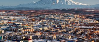
Baltiysk is an unusual city - it is surrounded by water on three sides and is the westernmost city in Russia. The main attractions of Baltiysk are primarily the Baltic Sea, the Baltic Spit, the embankment and the Pillau citadel. The largest naval base, the Baltic Naval Base of the Baltic Fleet, is located here, so you can see many active military ships.
Where to go and what to see in Baltiysk, descriptions, photos and addresses of the most beautiful and interesting places.
A few facts about Baltiysk
- Until 1946, Baltiysk was German, like the entire Kaliningrad region, and was called Pillau.
- Pillau was founded in 1626.
- Until 1986, the city was closed, entry was carried out by passes.
- Baltiysk is a small city - the population is 33 thousand people.
- The city is divided by the Baltic Strait, connecting the Kaliningrad Bay with the Gdansk Bay and the Baltic Sea.
- Every year the city hosts a parade of ships of the Baltic Fleet.
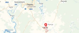
- From Kaliningrad to Baltiysk it is about 43 km.
Climate
Baltiysk has a temperate oceanic climate (Köppen CFB
borders
Dfb
).[13] Winters are cold to mild, summers are warm. In July and August, the warmest season, high temperatures average 21 °C (70 °F) and low temperatures average 15 °C (59 °F). In January and February, the coldest season, high temperatures average 3 °C (37 °F) and low temperatures average -2 °C (28 °F).
| Climate data for Baltiysk | |||||||||||||
| Month | Jan | Feb | Mar | Apr | May | Jun | Jul | Aug | Sep | October | But I | December | Year |
| Record high °C (°F) | 14.5 (58.1) | 17.1 (62.8) | 14.9 (58.8) | 25.0 (77.0) | 27.1 (80.8) | 29.4 (84.9) | 31.7 (89.1) | 31.3 (88.3) | 26.7 (80.1) | 22.6 (72.7) | 17.1 (62.8) | 17.0 (62.6) | 31.7 (89.1) |
| Average high °C (°F) | 2.5 (36.5) | 2.5 (36.5) | 4.6 (40.3) | 9.7 (49.5) | 14.9 (58.8) | 17.8 (64.0) | 20.6 (69.1) | 21.0 (69.8) | 16.8 (62.2) | 12.4 (54.3) | 6.4 (43.5) | 3.5 (38.3) | 11.1 (52.0) |
| Daily average °C (°F) | 0.3 (32.5) | 0.4 (32.7) | 2.5 (36.5) | 7.0 (44.6) | 11.7 (53.1) | 15.0 (59.0) | 17.9 (64.2) | 18.4 (65.1) | 14.4 (57.9) | 10.1 (50.2) | 4.6 (40.3) | 1.4 (34.5) | 8.7 (47.7) |
| Average low °C (°F) | −1.8 (28.8) | −1.6 (29.1) | 0.3 (32.5) | 4.0 (39.2) | 8.2 (46.8) | 11.8 (53.2) | 14.8 (58.6) | 15.6 (60.1) | 12.1 (53.8) | 8.1 (46.6) | 2.9 (37.2) | −0.4 (31.3) | 6.2 (43.2) |
| Record low °C (°F) | −20.8 (−5.4) | −17.6 (0.3) | −12.9 (8.8) | −4.0 (24.8) | −0.2 (31.6) | 1.4 (34.5) | 7.8 (46.0) | 8.1 (46.6) | 4.3 (39.7) | −1.4 (29.5) | −8.8 (16.2) | −14.8 (5.4) | −20.8 (−5.4) |
| Average precipitation mm (inches) | 65 (2.6) | 54 (2.1) | 50 (2.0) | 41 (1.6) | 53 (2.1) | 71 (2.8) | 78 (3.1) | 69 (2.7) | 73 (2.9) | 62 (2.4) | 66 (2.6) | 73 (2.9) | 752 (29.6) |
| Source: Kaliningrad-meteo.ru[14] | |||||||||||||
A little history
The first mention of a settlement called Pillau dates back to the 14th century. The name comes from the Prussian word “pilis” - fortress.
Port of Pillau
From the 16th to the 20th centuries, the city was alternately in the hands of Sweden, the Polish-Lithuanian Commonwealth and Prussia. The city has constantly developed due to its geographical location. It was an intermediate port on the way from Konigsberg to the Atlantic Ocean. Being a well-fortified fortress, Pillau served as reliable protection for passing ships.
During the Great Patriotic War, there were fierce battles in Pillau. It was from here that the civilian population of all East Prussia was evacuated by sea in panic from January 13 to April 25, 1945 - Operation Hannibal.
The Soviet army faced fierce German resistance in Pillau; it was the last stronghold of East Prussia. On April 25, 1945, the city fell under the pressure of the advancing Red Army. After the war, the territory of Pillau passed to the USSR.
Historical reference
The settlement of Pillau was first mentioned in the 14th century. This name has Prussian roots and means fortress in the translation of the word “pilis”. Starting from the 16th century, the city repeatedly came under the rule of the Polish-Lithuanian Commonwealth, Sweden, and Prussia. Due to its geographical features, its constant and active development took place.
The fact is that old Pillau was an intermediate port on the road from Konigsberg to the Atlantic. It acted as a protective, sometimes defensive fortress, protecting passing ships from ill-wishers.
With the onset of the Great Patriotic War, Baltiysk went through difficult times, when there were fierce battles between troops. The Prussian civilian population was evacuated from its territory by sea. This operation, called Operation Hannibal, took place in early 1945.
Approaching Pillau, the Soviet army encountered fierce resistance from the warring troops, which is not surprising, since the city was the last possible stronghold for Prussia. The fall of the village's defense from the actions of the Red Army occurred on April 25. With the onset of peacetime, the designated territory came under the rule of the USSR.
Sights of Baltiysk
View of the Baltic embankment from the Western Fort
The main attractions of Baltiysk are the Pillau fortress and the embankment. It is on the pedestrian embankment, called Morskoy Boulevard, that you can see the Baltic Spit, separated from the city by a strait. And also see the lighthouse and monuments to Peter I, the sailor’s wife and the Russian Empress Elizabeth. The extreme point of the embankment is the Northern Pier, the other point is the pier and the ferry station to the Baltic Spit.
Here, next to the Pillau fortress, there is the CSKA Sports and Fitness Complex (formerly “Priboy”), which has a water park, bowling alley, billiards, a cafe and an observation deck on the roof with panoramic views of the sea. The sports complex was built in 2008.
Pillau Citadel
Pillau Citadel
Entrance ticket cost: 100 rubles, schoolchildren, students, pensioners - 50 rubles, preschoolers - free. Excursion cost (1 hour): 200 rubles, entrance ticket is required, preschoolers are free. Tickets can be purchased at the Baltic Fleet Museum.
The main attraction of Baltiysk is the Pillau citadel. It is built in the shape of a pentagon, each side of which is 80 meters. The shape of the fortress in the form of a pentagonal star is clearly visible on the map. Each corner of the star is a bastion with its own name: König (King), Königin (Queen), Kronprinz (Crown Prince), Albrecht and Prussia.
The citadel is surrounded by a moat with water and is located on the shore of the strait separating Baltiysk and the Baltic Spit.
Construction of the fortress began in 1626 by order of the Swedish king Gustav II Adolf during the Polish-Swedish War. In 1697, Peter I studied bombardment, artillery and fortification art in the fortress.
The Pillau fortress was used by the Germans as a storage facility for artillery ammunition. After 1945, the fortress belonged to the Russian Ministry of Defense. In 1994, the Pillau fortress was classified as a historical and cultural monument; in 1999, part of the fortress was given to the Museum of the Baltic Fleet, a branch of the Central Naval Museum located in St. Petersburg. In 2022, the military completely transferred the citadel to the museum.
The Pillau Citadel is another proposed site that may house the lost, famous Amber Room, stolen by the Germans from Pushkin in 1941, and other valuables taken from the USSR.
“From Pillau to Baltiysk”: the history of the westernmost city in Russia (photo)
Baltiysk is strongly associated among Kaliningrad residents with a military base, wonderful wide beaches and a long pier. Recently opened to “outside” eyes, the seaside city is getting used to its attractiveness and does not hesitate to tell thousands of stories of its existence.
It so happened that many kings and even nature fought for Pillau (that’s what Baltiysk was called until 1945). The sea contributed in every possible way to the emergence and development of the city. Unfortunately, as in many cities of the Kaliningrad region, mostly only stories remain of the previous architecture. But the narrow cobbled streets, monuments and embankments remember everyone who once tried to become the master of this city.
Walking around Baltiysk listening to the stories of the guide, every now and then I wanted to close my eyes and imagine Pillau at all times - from the appearance of the first adventurers in pursuit of amber and ending with the construction of the Northern Pier, which to this day welcomes guests for long walks at sunset. However, first things first.
Mermaids, sturgeon and storm
It is known that Baltiysk was formed from five independent villages. The first mention of a settlement in this area dates back to the 13th century. This village was called Wogram and occupied an area of 17 hectares. It was inhabited by knights and settlers from Europe, who liked the sea rich in fish and forests full of spoils. However, many were also attracted by the desire to get rich - the sand by the sea was “stirred” with expensive amber.
As already mentioned, the struggle for this territory was undertaken not only by people, but also by the elements. Natural phenomena that are abnormal in our understanding happened in this area quite often. Among them are the Northern Lights, a meteorite fall, and snow in June. As for the wind, it played a decisive role in the life of these places. Thus, the first destructive storm hit Wogram in 1690, and the surviving people were forced to move to other settlements.
As for the village with a name similar to Pillau (Pill, Pile), it appeared 166 years later than the emergence of the village of Wogram. Translated from Prussian it meant “mountain”, “castle”, “fortress”. But there is an ancient Prussian legend that the name of the city was given by the mermaid Pilla, who came ashore to dry her hair. It’s up to the reader to believe it or not, but, in my opinion, this beginning of the story for a wonderful seaside town sounds quite natural.
All residents of this village were in one way or another involved in catching and processing sturgeon. The most important building of the village was the Sturgeon Hut on the hill; an Orthodox church now stands in its place. It is worth noting that Baltiysk owes its development to this fish. The first settlement appeared around this hut, and the building itself was something like a treasury - in addition to fish, collected amber was brought here. Back then, up to a thousand sturgeon were caught per year, and its processing was a state monopoly. Sturgeon masters and even their assistants were the most influential residents of the city. However, the significance of this fish did not pass by - its image later began to appear on the coat of arms of Pillau, and now on the coat of arms of Baltiysk. It will most likely come as a surprise to many that such rare fish were once found in our sea. The fact is that the sturgeon loves clean water, and when ships switched to heavy fuel oil, it practically disappeared from the Baltic Sea.
It is unknown how the fate of this territory would have developed if in 1510 a severe storm had not come from the sea, during which a strait was formed, separating the current Baltic Spit from the land. The echoes of this storm were also felt by the residents of Königsberg, many of whom were unable to sleep due to the raging Pregolya. Later, the residents of Pillau began to call the strait “given by God,” because with its emergence, the life of the new settlement changed dramatically for the better.
New Pillau, the Swedes and the first stones of the fortress
After the storm, the residents of Pillau came out of hiding and discovered that their city had taken on a different shape: part of the land had separated, and a strait had formed. After this day, life was no longer the same - people settled on the current spit, and the strait became navigable, bringing colossal development to the economy and history of the city. It was from this moment that Pillau was divided into Old and New.
The strait called Frisch Gaff provided tremendous changes, income and development of the city. Within ten years, braziers with coal for lighting, primitive lanterns, a beer hall and a bakery appeared in Pillau. The city also began to strengthen militarily - a blockhouse appeared, which was later transferred to customs, as well as earthen fortifications and ditches. Customs duties paid by passing ships and the successful trade in sturgeon brought considerable income and ensured the life of the settlement.
Over the course of a century, Pillau became a tasty morsel for conquerors, and during the Prussian-Swedish War in 1623, King Gustav II Adolf of Sweden landed in the peaceful city. Three hours later, his troops completely occupied Pillau, and the king declared that “he needs this bad sandy site temporarily.” Soon he instructed his subordinates to build a fortress and went on a campaign. Four thousand people were gathered for its construction, but a year later the plague claimed a huge number of lives. The construction of the Swedish fortress, known to us, continued only in the year of the king’s death, in 1632. The Dutch engineer Matnal Ventu began the construction of a five-pointed building, which three years later was sold to Prussia in honor of reconciliation. The history and architectural features of this fortress are very interesting, and we will definitely return to them next time.
Frederick William the Great, city status and first Russian traces
A year after the conclusion of a peace agreement between the Prussians and the Swedes, Brandenburg troops entered Pillau. Their life in this territory was not sweet - everything depended on the amount of money received from the sale of amber and customs duties. In winter, navigation almost ceased, and life became almost unbearable. However, this did not kill the morale of the soldiers, and they continued building the fortress.
In 1657, the Polish-Swedish war broke out again, and Pillau was again in danger. For defense, a flotilla of three ships was assembled, which became the basis of the future Prussian fleet. The ships were commanded by the governor of Pillau, Colonel Pierre de la Cava. Three years later, Poland and Sweden again concluded a peace treaty, which returned calm times to the city.
At this time, Frederick William the Great came to power in Pillau, who became one of the key figures in the history of the city. During his reign, residents received the right to trade with the owners of ship cargo, a mill and a small wooden lighthouse were built. Not far from the lighthouse, the first hotel and the first bastion for protection from the storm appeared. By 1660, about 300 people lived in Pillau.
In 1697, three years before the five-pointed fortress was completed, Peter I arrived in Pillau as part of the Great Embassy. His retinue numbered four thousand people. In order to better understand the architecture and strengthen ties, the Russian Tsar visited Pillau twice more - in 1711 and 1716. The Russian ruler enjoyed great respect among the Prussians. King Frederick William I even presented him with a 55 square meter Amber Cabinet and the Amber Room as a gift. The legends about this room are well known to Kaliningrad residents, because the next refuge for treasures after St. Petersburg was Koenigsberg. The further fate of the Amber Room is unknown - no matter how much they search for it. In response to the generous gift, Peter “presented” the Prussians with 55 Russian giants for the royal guard. On the occasion of the 300th anniversary of the Baltic Fleet, a monument to the last Russian Tsar was erected in the city.
All this time, the rapidly developing and attractive settlement for foreigners did not have the status of a city. Pillau acquired it only in 1725. Then the coat of arms known to the Baltic people was introduced with the image of a sturgeon in a golden crown.
The next Russian trace in Pillau was left during the Seven Years' War, in 1758, when the army of Elizabeth I occupied Prussian territories. When the troops of the Russian Empress came ashore at Pillau, many townspeople fled to Königsberg. However, those who remained were not subjected to hardship or torture. On the contrary, the entire population was declared free in faith, trade and the press. The students continued their studies, and the teachers enjoyed special respect from the Russians. Even Prussian peasants engaged in construction were allowed to go home to harvest the harvest, which was used to support them. In turn, the Russian troops ate bread brought from their native fields.
Sooner or later, the Prussians still had to pacify their patriotic feelings - on January 24, the birthday of King Frederick the Great, they all took an oath of allegiance to Russia. However, this was a kind of privilege, because in Russia only nobles had the right to swear allegiance. The great philosopher Immanuel Kant also bowed his knee to Elizabeth.
This state of affairs, for obvious reasons, did not suit the Prussian king, and from the first day of the invasion of his lands he began to hatch a plan of retribution. One of the key roles in this conspiracy was played by the postmaster of Pillau, Ludwig Wagner, who transferred information and money to the king. For several years, the Prussians developed a scheme for the liberation of Pillau from the “usurpers,” but their plans were unsuccessful. The conspiracy was discovered, and its participants, Wagner and other assistants of the king, were exiled to Siberia.
During the reign of Elizabeth in Prussia, the “Russian Dam”, today better known as the Russian Embankment, and an Orthodox Church were built in Pillau. Russian funds were invested in the development of the city, and the Empress's army worked to improve its lands and treat the local population with respect.
The French, the lighthouse, the North Pier and the decline of Pillau
During the Franco-Prussian War in the early 19th century, the French entered Pillau for the first time. Then the army failed to take the fortress, and a month later the states had already concluded the Peace of Tilsit. The second attempt to settle in the seaside city came in 1812. The French who occupied the city did not remain in it for long - in the same year they retreated under the pressure of Russian soldiers.
Soon after these events, in 1816, a new lighthouse was built in Pillau, which to this day is one of the symbols of the city. Its height is more than 30 meters. The author of the building is unknown - different sources suggest different versions. The light, indicating the way for sailors, is visible for 16 nautical miles (about 30 kilometers).
In the 19th century, another attraction appeared in Pillau, which today is the hallmark of Baltiysk. The westernmost point of Russia, the Northern Pier, was built over forty years, from 1840 to 1883. Undertaking such an expensive “project” was necessary to curb sea flows and prevent the strait from shallowing. The pier really fulfilled its function - the depth of the strait increased from three to nine meters, and Pillau did not lose his customs privileges.
In the forties of the 19th century, Pillau began to experience economic difficulties. Trade worsened, and more and more people were left without work. However, work on the development of the city went on continuously - in 1865, Pillau and Königsberg were connected by railway, which greatly facilitated the delivery of goods. Throughout the 19th century and until 1945, planned landscaping was carried out in the city - trees were planted, wide walking roads were built.
In 1817, the first printing house opened in Pillau, thanks to which it was possible to preserve information about the ships that called at the city port. Later, in 1848, the first local newspaper “Ogni Pillau” appeared in the future Baltiysk. The constant work of the residents of Pillau and their strong spirit made it possible to bring the city out of the crisis - in the second half of the 19th century it became the most profitable in East Prussia. For relaxation and to “heal their nerves,” the “cream” of the creative elite came to this city. In 1869, competitions of the Königsberg yacht club "Rhil" were first organized here, which have been held annually in the summer since 1880. With the beginning of perestroika, this tradition was resumed, and the regatta, as a rule, is held on Navy Day.
Despite the success of the townspeople, progress did its insidious work - in 1901 the Königsberg Canal was opened, which allowed ships to enter the city without going through Pillau. This event gradually began to lead the lives of the townspeople into decline.
Since then, the city has begun trying to take it “to another level.” The authorities intended to “repurpose” Pillau into a tourist attraction, and for this it needed changes. In addition, industrial development began at this time. “In 1914, the First World War began. The Russian fleet mined the sea coast. According to O. Schlicht, the mines were of very good quality, but poorly installed. There was real panic when they started washing up on the coast. Not only ships and fishing boats at sea were blown up, but also people on the coast. Specialists walked along the shore and neutralized mines. When Russian troops almost approached Königsberg, many fled from the city. The residents were greatly impressed by the sight of a convoy of ships escorted by an airship,” writes Lydia Dovydenko in her book “Secrets of Pillau.”
Hard times have come for the residents of the city: food is rationed, the main food product is rutabaga. People were obliged to give up metal, and the state bought up valuables. After the end of the war, Pillau became the only way to get from East Prussia to Germany without Polish control. Hundreds of ships carrying those wishing to come to or leave Prussia passed through the sea gates of the city. In 1921, Pillau became a closed city and was declared a base for the German fleet, which, however, did not interfere with the further development of the city's infrastructure. So, in 1927, water supply appeared in the city, and the first water tower has survived to this day. And the wastewater treatment plant built that same year remained virtually untouched and is used by the Baltic people today. In addition, in the thirties, hotels, boarding houses and small cafes began to be built on a large scale in Pillau, and in 1934 the construction of an airfield began. Tourists continued to arrive in the city, and transport links to Königsberg and around the city were established.
The Second World War interrupted all beginnings and construction and the city again plunged into poverty. From the memoirs of Erwin Friedrich Kafke, who worked in the Pillau administration.
“The sturgeon above the town hall sparkled with a joyful, hospitable crown. He saw endless misery, death and destitution as a stream of East Prussian refugees poured into the city on January 18, 1945, hurrying to the port.”
Despite the entry of Soviet troops into the city, about 250 indigenous residents chose to remain in Pillau. However, in 1948 they were forcibly deported. On November 27, 1946, Pillau was renamed Baltiysk.
Memories of a Pillau resident
People from Pillau now mainly live in the German town of Eckenförde. Every year they gather at the monument to the Great Elector, built in 1913 in their native Pillau. He accidentally survived the war and was found in Hamburg, from where he was taken to the new place of residence of these people.
Some of them were able to visit their homeland and tell today's Baltic people what it was like to live in a wonderful seaside city. Lidia Dovydenko kindly provided Kaliningrad.Ru journalists with a story from one of them.
From the memoirs of Joachim Ruge, who lives with his wife Vera near Dresden:
“We loved to gather around the big tiled stove, especially in the fall and winter and when the power went out due to a storm. My father was often absent from home because he worked as a pilot and escorted visiting ships along the sea canal to Königsberg or Elbing (Elblag). And mom was always with us. We really enjoyed spending time at dusk, saving electricity, sitting near our stove. We sang songs, for example, “Do you know how many stars are there in the sky,” ate apple pie, or mom talked about her childhood. Her parents' house was so tiny that there was barely room for a table with chairs around it. But that didn’t stop him from being sweet and cozy.”
“On April 4, 1937, I was enrolled in first grade. According to the old tradition, I received a gift. There was such a cardboard package in the form of a long cone, about 80 centimeters long, which was filled with sweets and small items needed at school. The public school I went to was located on modern Golovko Street; this building has not survived. For physical education classes we walked through the schoolyard to the sports hall, which belonged to the boys' high school (now the building of the sailors' club), where I began to study after Easter 1941. My journey to school was very short, unlike my older brother and sister, who studied in Pillau-2 (today it is Lyceum No. 1). English was the first foreign language, and from the 3rd grade I started learning Latin.”
“Today the center of Baltiysk is Pillau-2, but in my time the main life of the city was concentrated in Pillau-1. It seems like a small space - but there were 21 streets and two squares. The houses were mostly one-story. The central square (today the final stop for minibuses on Kronstadt) had a triangular shape. On it stood the town hall with a turret, on the spire of which a metal sturgeon spun and showed the direction of the wind. There was also a pharmacy, an ice cream parlor, a Kaiser cafe-shop, numerous shopping shops and our favorite cinema. There was a fountain in the center of the square. The most important buildings were the lighthouse and pilot tower, the monument to the great elector (on the site of the monument to Peter I), the magnificent post office building (not preserved), the Golden Anchor, the courthouse (BF museum), the reformist church (today Orthodox), the old fortress and barracks (base headquarters building). Among cafes and canteens, the townspeople’s favorite place was the Ilske-Falle cafe (not preserved). It was decorated in a nautical style, with paintings on the walls related to the theme of the sea and marine life.”
“Behind the treatment plant, between the fortress and the canal, there was a meadow, and there was a so-called bleaching plant. Here housewives dried white bed linen, white towels and tablecloths in the sun. In winter, in this place, one resident of Pillau (I don’t remember his name) filled a skating rink here, and we skated there as much as we wanted, for 10 pfennigs. The skating rink was very popular.”
“During the war, the famous liner Robert Ley stood in Pillau just opposite the monument to the Elector. His cabins became apartments for many submarine sailors. We, the children of pilots, completely explored and studied this ship, learned Morse code, and put on gas masks. Once I was splashed with acid, and holes appeared in the place of these splashes. It was a disaster, and my mother spent a long time sewing on many patches, since I had no other suit. In August 1944, British aircraft began bombing Koenigsberg. My brother and I climbed into the attic and from the window we saw the blood-red sky in the east. It was Koenigsberg that was burning."
Kaliningrad.Ru thanks Lidia Dovydenko, a scientist and journalist who has already republished her book “The Secrets of Pillau” three times, for her assistance in preparing the material. The editors also express gratitude to Fedor Muntyan for the tour and old photographs of the city.
Interesting facts about the city
In 1585, the inhabitants of Pillau observed the Northern Lights.
In 1642, a decree was issued in Pillau providing for heavy fines for women who were seen in quarrels and gossip.
The famous composer Richard Wagner fled from creditors to London through Pillau.
In 1769, a meteorite fell on the territory of Pillau.
The first train with passengers from Königsberg reached Pillau in 78 minutes.
In June 1871, snow fell in Pillau.
Text - Elizaveta Shafer, photo - Kirill Novikov
The author's opinion may not coincide with the position of the editors of Kaliningrad.Ru
Museum of the Baltic Fleet
Website : navalmuseum.ru. Address: st. Kronstadtskaya, 1. Opening hours: from 10.00 to 18.00 - Wednesday-Sunday. Ticket price: 200 rubles, schoolchildren, students, pensioners - 100 rubles, free for preschoolers.
The Baltic Fleet Museum was opened in 1959. Since then, he has changed his location several times. Today it is located in the building where the court of the city of Pillau was located before the war. The building is interesting for its architecture: pseudo-Gothic style, built in 1903.
But the main asset of the museum is its exhibitions. Here are models of ships, weapons, ammunition, documents, awards for sailors from the First and Second World Wars, and portraits of Baltic heroes. The museum preserves the history of the Baltic Fleet, including the development of naval aviation, the submarine fleet, as well as the history of the city of Pillau-Baltiysk.
Economy and population of Baltiysk
The life of modern Baltiysk is closely connected with the military base and seaport. Most of the city's residents are, one way or another, involved in servicing these two facilities.
As of 2022, just over 33 thousand people live in Baltiysk. The average age of its residents is 36 years. Despite the low birth rate, the city's population is growing due to the influx of migrants from the CIS countries. Compared to other settlements in the Kaliningrad region, Baltiysk is a fairly “advanced” city. One fact eloquently testifies to this. In 2009, residents of one of the multi-storey buildings, in which the elevator did not work for many years, brought this case all the way to the Strasbourg court!
Key sectors of the local economy are the ship repair and food industries. Tourism has been actively developing over the past ten years. The largest industrial enterprise in Baltiysk is ship repair plant No. 33, which serves both military and civilian ships (including foreign ones). An oil transshipment company also operates in the city.
The seaport has played a vital role in the development of the city since its foundation in the 16th century. It developed especially rapidly in the 19th century. Today, work is actively underway to modernize it. Every year at least one million tons of various cargo passes through the seaport of Baltiysk.
Naval Cathedral
Address: st. Admirala Kuznetsov, 3
The Cathedral of St. George's Naval Cathedral is located in the church building next to the Baltic Fleet Museum. The church was built in 1866 in the neo-Gothic style from red burnt brick. In Soviet times, a sailor's club was located here, then military warehouses.
In May 1991, the building was transferred to the Russian Orthodox Church, and now there is a functioning Orthodox church in the former church, which is common in the Kaliningrad region.
Visit to the citadel
Baltiysk is proud of this architectural monument. It has a rectangular shape, each edge reaching 80 m. If you look at the map, you can clearly see the fortress, made in the form of a five-pointed star. Each of the edges is made in the form of bastions, which are called:
- Prussia;
- The King, or Koenig;
- Albrecht;
- Kronprinz, which translates to crown prince;
- Queen, or Koenigin.
Around the fortress, which is located on the coast of the strait, a moat filled with water was created. Construction took place in 1626, which was ordered by King Gustav II Adolf. It is known from history that Peter I mastered fortification and bombardment skills in this citadel in 1697.
For the Germans, the fortress provided a spacious storage facility for ammunition and related equipment. But when the building came under the control of the Russian Ministry of Defense, it began to be called a cultural monument. A little later, part of the citadel was allocated to the Museum of the Baltic Fleet. More recently, in 2022, the fortress completely moved away from military control to museum control.
Some sources indicate that the Pillau citadel may be the place where the mysterious Amber Room is hidden, which disappeared in 1941 from Pushkin not without the intervention of the Germans. Along with it, it may contain other valuables dating back to the USSR era.
Monument to Empress Elizabeth
In 2004, a monument to the Russian Empress Elizaveta Petrovna was erected in Baltiysk, sculptor Georgy Frangulyan. In honor of the events of the Seven Years' War, when East Prussia became Russian (1758-1762), and its entire population swore allegiance to Elizabeth Petrovna.
The weight of the bronze monument is 12 tons, height is 14 meters. The Empress sits on a horse in the uniform of a colonel of the Preobrazhensky Life Guards Regiment. The monument is installed on a powerful pedestal on the embankment.
International burials
Those killed in the first months of 1945 are buried on this territory. It was during this period that East Prussia experienced fierce fighting. The cemetery is monitored by the People's Union of Germany, the graves are provided with proper care , as determined by the German-Russian Agreement of 1992. The international burial site on the territory of Baltiysk appeared in 1996, construction work was completed in 2000.
Officers and soldiers of the German army, as well as civilians, are buried in the cemetery. Among them are refugees (204 people) from the ship "Wilhelm Gustloff", which was sunk by a submarine of the Soviet command under the control of A. Marinesko in early 1945. Here you can see the graves of citizens from different countries who did not survive the war.
The burial is marked by a unique monument consisting of an Orthodox cross and its two Latin analogues. There are memorial plaques on the territory that display the names of identified individuals.
Sculpture of a sailor's wife
If we talk about sculptural monuments, the most touching and symbolic is the sculpture of a woman with a child, “The Sailor’s Wife.” Once it was located in a city park, now it is on the shore of the Kaliningrad Bay.
The sculpture symbolizes the value of the family hearth, the importance of which increases greatly in the conditions of a long separation of sailors from their home base. This landmark of Baltiysk immediately after its installation fell in love with the city residents.
Lighthouse
The red and white lighthouse is a symbol and landmark of Baltiysk. The technology of its construction is interesting. At the entrance to the Baltic Strait, concrete piles are driven into the seabed and connected to each other by chains. Large field stones were placed in the spaces between the piles. This is how the foundation of the lighthouse is formed.
The Baltiysk lighthouse has the shape of a truncated cone 31.4 meters high. Initially, the glow was achieved by burning vegetable oil, then - kerosene. Nowadays electricity is used for this purpose. The visibility range of the fire in clear weather reaches 16 nautical miles (about 30 kilometers).
Walk through amazing places
In 1959, a museum entirely dedicated to the Baltic Fleet began operating and changed its location several times. It currently resides in a building that was occupied by the city court before the war. The house is made in pseudo-Gothic style. The main asset of the institution is considered to be its unusual exhibitions, containing:
- ammunition;
- models of various ships;
- documentation;
- weapons;
- awards given to sailors for their services in the First and Second World Wars;
- portraits of Baltic heroes.
The museum conveys in detail the history of the formation and development of the city, tells interesting facts about the submarine fleet, as well as naval aviation of Baltiysk.
Excursion routes always pass through St. George's Cathedral. It is located in the church building, adjacent to the museum. The neo-Gothic style church, in turn, was created in 1866, for which burnt red brick was used. Under Soviet rule, a sailor's club functioned in the building, and later military warehouses were set up here. The house came into the hands of the Russian Orthodox Church in 1991. Currently, the church has been converted into an Orthodox church, which is typical for the border zone of Russia.
The real pride of Baltiysk in the Kaliningrad region is the lighthouse, which is distinguished by its unique construction technology. Directly at the entrance to the Baltic Strait, concrete piles connected to each other by strong chains are fixed underwater in the bottom. Huge wild stones are laid between the pillars. Together, this structure forms the basis for the lighthouse. It is made in the shape of a truncated cone, which rises to a height of 31 m.
Previously, lighting was provided by burning vegetable oil, later kerosene began to be used. Currently, electricity is used for this purpose. In clear weather, the fire can be seen at a distance of 30 km, which is equal to 16 nautical miles.
Monument to Peter I
Address: Morskoy Boulevard
In 1998, the Baltic Fleet celebrated its three hundredth anniversary. By this date, a monument to Peter I by I. Minin and V. Bartenev was erected in Baltiysk. The height of the monument with a pedestal is 6.4 meters, weight is 2.5 tons. Emperor Peter is depicted in full growth, in his right hand he holds a telescope, with his left he leans on a scroll lying on a music stand.
It is noteworthy that the Russian emperor visited Pillau three times, which Peter liked for some reason, and he gave this city the name “little Amsterdam”.
Inspection of monuments
A monument to Elizaveta Petrovna, Empress of Russia, appeared in the city in 2004; its creator is Georgy Frangulyan. It was restored as a result of the end of the Seven Years' War, which ended with the conquest of East Prussia. The population of this region swore allegiance to the empress. The monument reaches a height of 14 m and weighs 12 tons; it is placed on a massive pedestal on the embankment. The woman is dressed in the military uniform of a colonel of the Preobrazhensky Regiment.
The popular sculpture called “The Sailor’s Wife,” depicting a woman and child, looks symbolic and touching for Baltiysk. Previously, it decorated the city park, but has now been moved to the coast of the Kaliningrad Bay. This monument is a symbol of family values and unity. Its significance is especially relevant under conditions of long stay of seafarers far from their native lands.
The tercentenary anniversary of the Baltic Fleet occurred in 1998. In honor of this event, a monument dedicated to Peter I appeared in the city. V. Bartenev and I. Minin worked on its creation. The height of the monument is 6.4 m, weight - 2.5 tons. The emperor is presented in full height, his right hand is occupied with a telescope, his left is resting on a scroll located on the music stand. It is known that Peter I visited his beloved Pillau several times, calling it “little Amsterdam.”
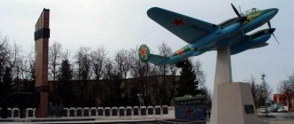
torpedo boat
Address: between St. George's Naval Cathedral and Baltic Glory Square.
The Torpedo Boat monument was erected in 1973 in honor of the sailors of the First Red Banner Torpedo Boat Brigade. It is a real combat boat "Komsomolets" model 1944 with hull number 36 on the pedestal.
Infantry barracks
Address: Lenin Avenue, building 1
The Baltiysk infantry barracks were built in 1904 to house the military garrison of Pillau. The headquarters, Northern and Southern barracks, a 30-meter-high water tower, warehouses and other outbuildings were located here. Before the First World War, an artillery barracks was built. After the war, the buildings first housed warehouses, and then various units of the German army.
During World War II, there was a submarine school here, where the elite troops of the German Navy were trained. After the war, the barracks were heavily damaged and restored in the 50s of the last century.
International Memorial Cemetery
Victims of the Second World War are buried in the cemetery, mainly in the first months (January-April) of 1945, when fighting took place in East Prussia. The burials are carried out by the German People's Union for the Care of War Graves in accordance with the German-Russian Agreement of December 16, 1992.
Construction of the memorial burial ground in Baltiysk began in 1996, and it was completed in 2000. Previously, the territory of military Baltiysk was closed to everyone, which made it impossible for the German organization to work here.
The cemetery contains not only the graves of German soldiers and officers, but also civilians, including 204 refugees from the ship Wilhelm Gustloff, sunk by a Soviet submarine under the command of Alexander Marinesko on January 30, 1945. Citizens of the USSR and other countries who died in the war are also buried here.
At the cemetery there is a monument in the form of three crosses: one Orthodox, two Latin. The crosses on the graves are grouped in groups of three throughout the memorial. There are memorial plaques with the names of identified people, their dates of birth and death.
The defeat of the Zemland group. Assault on Pillau
The defeat of the Koenigsberg group created favorable conditions for the final destruction of the remnants of the East Prussian group - the Semland group. On April 13, almost without a pause, troops of the 3rd Belorussian Front under the command of A. M. Vasilevsky went on the offensive against German troops entrenched on the Zemland Peninsula and the Pillau naval base. On April 26, the port and fortress of Pillau were captured. The East Prussian operation ended with the destruction of the Nazi group on the Zemland Peninsula. Position and strength of the parties
THE USSR. In order to immediately break the enemy’s strong defenses and not prolong the fighting, Marshal Vasilevsky decided to involve five combined arms armies in the operation. The 2nd Guards, 5th, 39th and 43rd Armies were in the first echelon, the 11th Guards Army in the second. To achieve this, a regrouping of forces was carried out: the front, which was previously occupied by the 2nd Guards and 5th Armies, was reinforced by the 39th Army, the 43rd Army was deployed on the southern coast of Friches Huff Bay, and the 11th Guards Army was transferred to the front reserve . The troops of the 3rd Belorussian Front numbered more than 111 thousand people, more than 3 thousand guns and mortars, 824 tanks and self-propelled guns. As a result, at the beginning of the operation, Soviet troops outnumbered the enemy almost twice in manpower, in artillery by 2.5 times, in tanks and self-propelled guns by almost 5 times.
Taking into account the short length of the front and the small number of units and formations, the armies received narrow zones for the offensive. The largest zone was the 2nd Guards Army - 20 km, but it had an advantage; Chanchibadze’s army occupied these positions for two weeks and managed to thoroughly study the terrain, the enemy’s defenses and prepare for the attack. The remaining armies had offensive zones of 7-8 km. The main blow was delivered by the 5th and 39th armies, directed towards Fischhausen, in order to cut the enemy group into two parts and then eliminate it. The 11th Guards Army was supposed to build on the success of the two armies. The 2nd Guards and 43rd armies supported the general offensive on the flanks, advancing along the northern and southern coasts of the Zemland Peninsula.
The Baltic Fleet was supposed to cover the coastal flanks of the troops of the 3rd Belorussian Front; cover sea communications with light forces and submarines and carry out patrol duty; land tactical troops behind enemy lines; support the landing forces with artillery fire and prevent the evacuation of the enemy by sea. Fleet aviation was supposed to launch massive attacks on enemy sea communications and support landing forces.
Germany. The western part of the Zemland Peninsula was defended by the 9th and 26th Army Corps, which consisted of 7-8 infantry and one tank divisions. Taking into account combat groups and other units, enemy forces reached 10 divisions. The Soviet troops were opposed by more than 65 thousand soldiers and officers, 1,200 guns and mortars, 166 tanks and assault guns.
In addition, on the Pillaus Peninsula, the 55th Army Corps (three or four divisions and a number of special units) was located in the second echelon; on the Frische-Nerung Spit, the 6th Army Corps was hastily restored from the remnants of the defeated Heilsberg group. All German troops were united into the 2nd Army, and from April 7 into the Army of East Prussia. The army was created on the basis of the headquarters and some units of the 2nd Army and the remnants of the 4th Army units located in East and West Prussia. The commander of the German 4th Army, General Müller, was removed from his post and replaced by General Dietrich von Saucken.
The German command expected the main attack in the central and southern directions, so the densest battle formations were located here: the 93rd, 58th, 1st, 21st, 561st and 28th infantry and 5th tank divisions, i.e., about 70-80% of the first echelon troops. The Germans had a well-developed defense with a dense network of trenches, strong points and resistance centers. Strong defensive lines were located on the Pilau Peninsula. The city of Pillau was a strong fortress.
First stage of the offensive
On the morning of April 13, heavy artillery preparation began. At the same time, the 1st and 3rd air armies attacked enemy positions. After an hour-long artillery barrage, the troops of the 3rd Belorussian Front went on the offensive. The Soviet armies broke through the enemy's defenses. True, the offensive began to develop not according to the original plan.
In the afternoon, German resistance intensified. The Germans launched a series of counterattacks at the junction of the 5th and 39th armies of Krylov and Lyudnikov. By the end of the day, Soviet troops advanced 3-4 km, capturing about 4 thousand Germans. The next day the battle continued with great ferocity. The German command, having unraveled the plan of the command of the 3rd Belorussian Front, strengthened the defense in the direction of advance of the 5th and 39th armies. At the same time, in order to save the northern part of the group, the Germans began to quickly withdraw troops in front of the front of the 2nd Guards Army. As a result, in three days of fighting, our troops in the main direction advanced only 9-10 km, and the right flank of Chanchibadze’s 2nd Guards Army advanced 25 km and reached the coast.
The 2nd Division of Armored Boats of the Baltic Fleet provided great assistance to the Soviet troops. Baltic sailors broke into the Frisches Huff Bay and the Königsberg Sea Canal and launched surprise attacks, suppressing enemy firing points that were hindering the advance of ground forces. Naval aviation and a group of naval railway artillery launched massive attacks on the enemy. On April 15 and 16, 1945, a successful tactical landing of the 24th Guards Rifle Division took place on the Königsberg Canal dam in the Pais-Zimmerbud area. Landing and fire support from armored boats allowed the troops of the 43rd Army to clear the strongholds of Pais and Zimmerbude and the canal dam from the Nazis. This created favorable conditions for the Red Army's advance along the gulf coast.
The loss of defensive lines and heavy losses forced the German command on April 15 to abolish the command of the Semland task force and subordinate the remnants of its troops to the command of the East Prussian army. The German command, trying to save as many troops as possible, made desperate efforts to evacuate people. Marine transport worked around the clock. All available watercraft from the Baltic Sea coast and the lower reaches of navigable rivers remaining in the hands of the Germans were mobilized. The ships were pulled into Danzig Bay. However, here they were subjected to massive attacks by Soviet aircraft and suffered significant losses.
The movement of the 2nd Guards Army along the Baltic Sea coast in a southern direction and the offensive of the 39th and 5th armies in the general direction of Fischhausen forced the Germans to pull troops into the southwestern part of the peninsula and organize defense on a narrow front. On the night of April 17, our troops took the strong enemy resistance center of Fischhausen. The remnants of the German Zemland group (about 20 thousand soldiers) retreated to the Pillau area and secured a position in a previously prepared position. The Soviet offensive was stopped.
Thus, in five days of offensive, our troops cleared the Zemland Peninsula from enemy troops, and reached the first line of defense of the Pilau Peninsula, the front of which was 2-3 km. Here the enemy had the opportunity to compact the battle formations as much as possible, and it was impossible to bypass him. The front's advance stopped. On the one hand, our troops won, reached the coast and liberated the territory. On the other hand, it was not possible to fragment and encircle the enemy troops. The German command removed the northern part of the Zemland group from attack and withdrew the troops to previously prepared positions on the Pillaus Peninsula. The German troops retained their combat effectiveness and still fought stubbornly and skillfully, although they suffered serious losses. The current situation threatened to delay the operation. It was necessary to bring fresh forces into battle.
Broken equipment of the German army on the Samland Peninsula
Mortar crew of the 11th Guards Army at a firing position on the outskirts of Pilau
Second stage of the operation. Assault on Pillau
The Soviet command decided to bring Galitsky's 11th Guards Army into the battle. On April 16, Vasilevsky ordered the 11th Army to replace the troops of the 2nd Guards Army and on April 18 to launch an attack on Pillau and the Frische-Nerung Spit. The 5th, 39th and 43rd armies were also transferred to the front reserve.
The command of the 11th Guards Army decided to strike at the enemy’s outer flanks, break through his defenses and develop an offensive with second echelons of corps. By the end of the second day, with the support of amphibious landings, they planned to take Pillau. On the night of April 17, the divisions of the 16th and 36th Guards Rifle Corps began moving to their original positions.
The Pillaus peninsula was about 15 km long and varied from 2 km at the base to 5 km at the southern tip. German troops erected six defensive positions here, which were located 1-2 km from each other. There were also pillboxes with armored caps. On the northern outskirts of Pillau there were four forts and a sea fortress, on the northern shore of the Frische-Nerung spit there were two forts. Having found out that the enemy had a serious defense, the start of a new offensive was postponed to April 20. On April 18, Soviet troops conducted reconnaissance in force. On April 19, reconnaissance continued. It turned out that in front of us were units of three or four divisions, which supported about 60 artillery and mortar batteries, up to 50-60 tanks and self-propelled guns, several warships from the Pillau roadstead and the sea.
At 11 o'clock On April 20, 1945, the 11th Guards Army went on the offensive. However, despite strong artillery preparation (600 guns) and air support (more than 1,500 sorties), it was not possible to immediately break the enemy’s defenses. Our troops advanced only 1 km, capturing 2-3 lines of trenches. On the second day of surgery the situation did not improve. The enemy positions were hidden by forest, which made it difficult for artillery to operate, and fire on areas had little effect. The Germans defended the last stronghold in East Prussia with particular tenacity, launching counterattacks with up to an infantry battalion supported by tanks and assault guns. On the second day the weather worsened, which reduced the activity of our aviation. In addition, they underestimated the strength of the German group, believing that after the defeat of the Zemland group, victory was already assured.
On April 22, the 8th Guards Corps was brought into battle on the left flank of the army. On the third day of fierce fighting, the Germans were pushed back 3 km. The German command threw into battle the remnants of previously defeated divisions, all the units and subunits available at hand. The narrow line of defense was extremely saturated with firepower, which made it difficult for our troops to advance. For every 100 meters there were on average 4 machine guns and 200 soldiers with automatic weapons. Here the Germans had reinforced concrete and armored pillboxes, concrete platforms for heavy guns, including 210 mm caliber. The German defense had to be literally “gnawed through”, meter by meter. And the closer the Soviet troops approached Pillau, the more permanent structures became available. All the stone buildings of Pillau and its suburbs, where there were almost no wooden buildings, were adapted for defense. Other large buildings were so well prepared for defense that they were almost indistinguishable from forts. Guns and anti-tank grenade launcher positions were installed on the lower floors, and machine gun nests on the top. The fortress had a three-month reserve and could remain under siege for a long time. The Germans constantly counterattacked, all buildings had to be taken by storm. The balance of forces, especially in bad weather when aviation was inactive, was almost equal.
Therefore, the battles were extremely fierce and stubborn. On April 22, 1945, on the approaches to Pillau, the hero of the assault on Koenigsberg, the brave commander of the 16th Guards Rifle Corps, Major General Stepan Savelyevich Guryev, died. S.S. Guryev began serving as a Red Army soldier during the Civil War, already as a regiment commander he participated in battles with Japanese troops in the area of the Khalkhin Gol River. He fought since the beginning of the Great Patriotic War. He was the commander of the 10th Airborne Brigade, then commanded the 5th Airborne Corps, distinguishing himself in the battles near Moscow. Bravely and skillfully led the 39th Guards Division in the Battle of Stalingrad. Then he commanded the 28th and 16th Guards Corps. For his skillful leadership of troops and personal courage during the storming of Königsberg, he was awarded the title of Hero of the Soviet Union. In 1946, in the Kaliningrad region, the city of Neuhausen was renamed in honor of the deceased hero to Guryevsk and the Guryevsky district was formed.
Monument at the grave of Hero of the Soviet Union S.S. Guryev at the memorial to 1200 guardsmen in Kaliningrad
It must be said that Marshal Vasilevsky himself almost died in this operation. He went to the army observation post in Fischhausen, the area of which was regularly shelled by enemy artillery, and came under fire. Vasilevsky's car was wrecked and he himself, by a lucky chance, survived.
German soldiers in an anti-tank ditch near the Lochsted Forest. One of the many lines of defense in front of the sea fortress of Pillau
German soldiers in shelters dug into the slopes of an anti-tank ditch near the Lochsted Forest
Soviet soldiers at Fort Vostochny in Pillau
On April 24, our troops, despite the desperate resistance of the enemy, who threw the most combat-ready units into battle, including the marines supported by tanks, took Neuhozer. The stubborn battle for this stronghold, which covered the approaches to Pillau, lasted almost a day. On the night of April 25, our troops bypassed the sea fortress from the east and started a battle on the right flank on the near approaches to Pillau. On April 25, Soviet troops began their assault on Pillau. The German command understood that the fortress was doomed, but tried to gain time to evacuate as many troops as possible by sea or to the Frische-Nerung spit. In addition, with the stubborn defense of Pillau they wanted to somehow influence the development of the situation in the Berlin direction. The garrison of the fortress itself was small, but a significant number of field troops and various headquarters retreated to the city. The Pillau garrison was supported by fortress and field artillery from the northern part of the Frische-Nerung spit and artillery by 8-10 warships and naval boats.
Commander Galitsky ordered the 16th Guards Corps to take the fortress on the southwestern tip of the peninsula, immediately cross the Zeetif Strait and take a bridgehead on the Frische-Nerung spit; The 36th Corps will occupy the south-eastern area of the city and also cross the strait; 8th Corps - liberate the eastern harbor and, having crossed the strait, capture the Neutif stronghold (a German air base was located there).
On April 25, Soviet troops, who had extensive experience in urban battles and especially the assault on Königsberg, cleared the outskirts and broke through to the city center. The assault groups took buildings, punched holes in the walls, blew up especially fortified houses and took Pillau step by step. The Germans retained only the coastal part in the southwestern region of the city and the fortress. On April 26, the Pillau fortress was also taken. A modernized old fortress that had 1,000 inhabitants. garrison, did not succumb to medium-caliber artillery. Multi-meter brick walls and arched ceilings withstood hits from medium and even large caliber shells. The gates were blocked with bricks and concrete blocks. The shape of the fortress in the form of a multi-beam star made it possible to conduct flanking fire. The Germans pushed back our troops with strong artillery and machine gun fire from numerous embrasures. The garrison rejected the ultimatum to surrender. Only by bringing up dozens of heavy-caliber guns were the tanks of the 213th brigade and heavy self-propelled guns with 152-mm guns and concentrated fire able to weaken the enemy defenses. Gates and barricades were swept away. With the onset of darkness, the soldiers of the 1st Guards Rifle Division launched a decisive assault. The guardsmen, having filled the 3-meter ditch with fascines, boards and various improvised means, went to the walls and began to climb the walls using ladders and burst into the gaps. Inside the fortress, close combat began with the use of grenades, bombs and flamethrowers. After a fierce battle, the destroyed German garrison began to surrender.
Pillau FortressCompleting the operation. Fighting on the Frische-Nerung Spit
Already on April 25, our troops crossed the Zeetif Strait on the move. Under the cover of artillery barrage fire and a powerful strike from heavy bombers, as well as a smoke screen, the amphibians of Captain Gumedov with the guardsmen of the 2nd battalion of the 17th rifle regiment under the command of Captain Panarin were the first to cross the strait. The guards quickly captured the enemy's first trench and withstood a counterattack by German troops who tried to throw the first echelon into the water. The infantry platoon of junior lieutenant Lazarev was the first to land. He captured a bridgehead and fought to the death; even the wounded refused to leave, continuing to shoot. Lieutenant Lazarev was wounded twice during the crossing, and received a third wound in a battle with the Germans. However, the hero refused to leave and continued to fire from a machine gun, the crew of which died, destroying up to 50 Germans. Only when Lazarev lost consciousness was he taken away. The first guardsmen who captured the bridgehead on the spit - Egor Ignatievich Aristov, Saveliy Ivanovich Boyko, Mikhail Ivanovich Gavrilov, Stepan Pavlovich Dadaev, Nikolai Nikolaevich Demin and the battalion Komsomol organizer junior sergeant Vasily Aleksandrovich Eremushkin were awarded the title of Hero of the Soviet Union.
Behind the first echelon on boats, cutters, barges and other watercraft, the second echelon moved - the main forces of the 17th regiment, led by its commander, Lieutenant Colonel A.I. Bankuzov. At night, units of the 5th Guards Division crossed the strait and expanded the bridgehead. By 11 o'clock. On April 26, the Neutif stronghold was taken. The troops of the 84th and 31st divisions also crossed the strait and captured bridgeheads. This made it possible to organize the transfer of heavy weapons in the morning and begin construction of a pontoon crossing, which was ready by the morning of April 27.
To speed up the operation, two troops were successfully landed on the spit. The Western detachment led by Colonel L. T. Bely (units of the 83rd Guards Division - about 650 soldiers) - from the open sea and the Eastern detachment of Rear Admiral N. E. Feldman (regiment of the 360th Marine Brigade and combined rifle Regiment of the 43rd Army) - from the side of Friches Huff Bay. The Western landing force landed in the area southwest of Lemberg (3 km south of the Zeetif Strait). The eastern detachment landed in the area of Cape Caddich Haken in two echelons.
Using several fast barges armed with 88-mm guns, the enemy attempted to disrupt the Soviet landing operation. The Germans were able to damage two minesweeper boats. But the attack of our armored boats forced them to retreat. Our landing party was not expected to attack, and the paratroopers quickly captured the bridgehead. However, then significantly superior enemy forces attacked the guards, and they had to fight a difficult battle. Bely's guards repelled 8-10 attacks by German troops in the first half of the day. Only after the landing of the first echelon of the Eastern Detachment and the arrival of troops of the 5th and 31st Guards Divisions did it become easier for the paratroopers. In general, the landings, although taking into account a number of mistakes, coped with their task. They distracted the enemy, disorganizing his defense.
In liberated Pillau
German prisoners march in a column along the road in the area of the Frische-Nerung Spit
The Frische-Nerung Spit (the modern Baltic Spit), separating the sea from the Frisches Huff Bay, is about 60 km long. Its width ranges from 300 meters to 2 km. It was impossible to maneuver on it, so the Germans were able to create a dense defense and stubbornly fought back. Units of the 83rd, 58th, 50th, 14th and 28th infantry divisions, as well as numerous individual units and subunits, defended on the spit. They were supported by about 15 tanks and self-propelled guns, more than 40 batteries of field, coastal and anti-aircraft artillery.
Due to the narrowness of the spit, Soviet troops advanced with 1-2 divisions, regularly replacing them with fresh ones. During April 26, troops of the 8th Guards Corps and landing detachments captured the northern coast of the Frische-Nerung spit, surrounded part of the German group, capturing about 4.5 thousand people. However, the Germans continued to actively resist, taking advantage of the convenience of the terrain. The German defense, as on the Pilaus Peninsula, had to be literally “gnawed through”. Individual enemy defense units continued to resist for some time even in our rear. They were surrounded and were in no hurry to attack; in most cases, the Germans surrendered after a certain period of time.
The German command, still hoping for a “miracle,” continued to demand that they fight to the death. Heavy fighting continued for several more days. The 11th Guards Army fought heavy offensive battles for five days and advanced along the Frische-Nerung spit about 40 km. After this, units of the 11th Guards Army were replaced by troops of the 48th Army. The battles to destroy the German group on the Frische-Nerung spit and at the mouth of the Vistula (up to 50 thousand Nazis were located there) continued until May 8, when the remnants of the German army (about 30 thousand people) finally capitulated.
Soldiers of the Moscow Proletarian Division fire at the enemy on the Frisch Nerung Spit. 1945. An artillery crew of the 11th Guards Army is fighting on the Frisch Nerung Spit. Soviet guardsmen on the Frisch Nerung Bay after defeating the enemy. April 1945
Results
During the fighting on the Zemland Peninsula, the troops of the 3rd Belorussian Front destroyed about 50 thousand German soldiers and officers, and captured about 30 thousand people. On the Pillaus Peninsula and the Frische-Nerung Spit, only from April 20 to 30, the remnants of 5 infantry divisions were destroyed, 7 divisions were destroyed (including tank and motorized), not counting individual and special units and units. About 1,750 guns and mortars, about 5 thousand machine guns, about 100 aircraft, more than 300 warehouses with various military equipment, etc. were captured as trophies. With the capture of Pillau, the Baltic Fleet received a first-class naval base. The liberated armies of the 3rd Belorussian Front could participate in the final battles of the Great Patriotic War.
East Prussia was completely liberated from the Nazis. The victory of the Red Army in East Prussia was of enormous moral and military-strategic significance. Soviet troops captured Königsberg, the second most important military-political and historical center of Germany. With the loss of East Prussia, the Third Reich lost one of its most important economic regions. Germany lost the most important base of the German Navy and Air Force. The Soviet Baltic Fleet improved its position and basing conditions, receiving such first-class bases, ports and harbors as Königsberg, Pillau, Elbing, Brandenburg, Kranz, Rauschen and Rosenberg. After the war, Pillau will become the main base of the Baltic Fleet.
German troops suffered a heavy defeat: more than 25 divisions were destroyed, 12 divisions were defeated, losing 50-75% of manpower and equipment. German troops lost about 500 thousand people (of which 220 thousand were captured). The militia (Volkssturm), the police, the Todt organization, and the Imperial Railway Service Hitler Youth suffered high losses (their numbers were quite comparable to the Wehrmacht - about 500-700 thousand people). The exact number of losses of the German militia and militarized organizations is unknown. The losses of the 3rd Belorussian Front in the East Prussian operation were more than 584 thousand people (of which more than 126 thousand were killed).
The battle in East Prussia lasted three and a half months (105 days). During the first stage, the enemy’s powerful defenses were broken and the East Prussian group was divided into three parts: the Heilsberg, Königsberg and Semland groups. Then the Red Army successively crushed large pockets of enemy resistance: the destruction of the Heilsberg group, the assault on Königsberg and the defeat of the Semland group.
The Soviet Army avenged the Imperial Russian Army, which suffered a heavy defeat in the forests and swamps of East Prussia in 1914. Historic retribution has taken place. After the end of the war, the city of Königsberg and the surrounding areas forever became part of Russia-USSR. Koenigsberg became Kaliningrad. Part of East Prussia was nobly transferred to Poland. Unfortunately, modern Polish authorities have already forgotten about the good deeds of Moscow towards the Polish people.
Soviet soldiers on the shores of the Baltic Sea. East Prussia
Soviet soldiers raise a toast to victory. Koenigsberg. May 1945
Sources: Balyazin V.N. Storm of Koenigsberg. M., 1964 // https://may1945pobeda.narod.ru/shturm-m02-0.htm. Vasilevsky A.M. Life's work. M., 1978 // https://militera.lib.ru/memo/russian/vasilevsky/index.html. Galitsky K.N. In the battles for East Prussia. M., 1970 // https://militera.lib.ru/memo/russian/galitsky_kn/index.html. Isaev A.V. Defeat 1945. Battle for Germany. M., 2010. History of the Great Patriotic War of the Soviet Union 1941-1945. (in 6 volumes). M, 1960-1965 // https://militera.lib.ru/h/6/index.html. Lyash O. So Koenigsberg fell. M, 1991 // https://militera.lib.ru/memo/german/lasch/index.html. https://waralbum.ru/.
City Park named after Golovko
Residents of Baltiysk love to relax in the city park named after Admiral A.G. Golovko, located on the shore of the Gulf of Gdansk. The park was laid out at the beginning of the 19th century as protection from sand and was first called Primorsky.
Here lovers retire in the shade of trees. There is a summer stage where local and visiting performers perform. There are cafes and ice cream is sold.
In the nineties of the last century, the park fell into disrepair. But in subsequent years, restoration work was carried out by military builders. and now he has again begun to delight the townspeople.
Recommendations
Notes
- ^ a b c d f g gram hour
Resolution # 640 - ^ a b
Federal State Statistics Service of Russia (2011).
“All-Russian Population Census 2010. Volume 1" [All-Russian Population Census 2010, vol. 1]. All-Russian Population Census 2010 [All-Russian Population Census 2010]
(in Russian). Federal State Statistics Service. - "26. The size of the permanent population of the Russian Federation by municipalities as of January 1, 2022.” Federal State Statistics Service. Retrieved January 23, 2022.
- ^ a b c d f
Law No. 274 - "On the calculation of time." Official Internet portal of legal information
(in Russian). June 3, 2011. Retrieved January 19, 2022. - Post office. Information and computing center of OASU RPO. ( Post office
).
Search for postal facilities ( Search for postal facilities
) (in Russian) - Kemmerer, Margaret (2004). Ortsnamenverzeichnis der Ortschaften jenseits von Oder u.
Neiße (in German). paragraph 125. ISBN 3-7921-0368-0. - פּילאַווע, Yiddishland https://www.yivo.org/yiddishland-topo
- Federal State Statistics Service of Russia (May 21, 2004). “The population of Russia, the constituent entities of the Russian Federation as part of federal districts, urban settlements, urban settlements, settlements, settlements of 3 thousand or more people.” [Population of Russia, its federal districts, federal subjects, districts, urban settlements, rural settlements - administrative centers, rural settlements with a population of more than 3000 people] (XLS). All-Russian Population Census of 2002 [All-Russian Population Census of 2002]
(in Russian). - “All-Union Population Census of 1989. The actual population of the union and autonomous republics, autonomous regions and districts, territories, regions, urban settlements and villages of Elbląg - Podstrony / Partner Municipalities.” Elblonski Dziennik Internetowy
(in Polish). Archived from the original on March 15, 2011. Retrieved August 1, 2013. - "Elbląg - Partner Municipalities". Elbląg.net
(in Polish). Retrieved August 1, 2013.
Sources
- Government of the Kaliningrad region. Resolution No. 640 of August 30, 2011 “On approval of the register of administrative-territorial divisions of the Kaliningrad region,” as amended. Resolution No. 877 of November 21, 2011 “On amendments to the Resolution of the Government of the Kaliningrad Region of August 30, 2011 No. 640.” Came into force on the date of official publication. Published: “Kaliningradskaya Pravda” (insert “Officially”), No. 170, September 15, 2011 (Government of the Kaliningrad Region. Resolution No. 640 of August 30, 2011 On approval of the Register of objects of the administrative-territorial division of the Kaliningrad Region
As amended by Resolution No. 877 dated November 21, 2011.
On amendments to the Decree of the Government of the Kaliningrad Region No. 640 dated August 30, 2011.
Valid from the date of official publication.). - Kaliningrad Regional Duma. Law No. 274 of July 3, 2008 “On the organization of local self-government in the territory of the municipal formation “Baltic City District”,” as amended. Law No. 370 of July 1, 2009 “On the territories of municipalities of the Kaliningrad region.” Came into force on the date of official publication. Published: “Kaliningradskaya Pravda”, No. 124, July 11, 2008 (Kaliningrad Regional Duma. Law No. 274 of July 3, 2008 On the organization of local government in the territory of the municipal formation “Baltiysky Urban Okrug”
As amended by Law No. 370 of July 1 2009.
On the composition of the territories of municipalities of the Kaliningrad region
... Valid from the date of official publication.). - Baedeker, Karl, Northern Germany
, 14th revised (English) edition, Leipzig, London and New York, 1904.
Baltic Naval Base
The Baltic naval base is the main base of the Russian fleet. It is especially interesting here on Russian Navy Day. You can watch a parade of ships and a theatrical performance of the amphibious landing. An exhibition of weapons and equipment is being organized in the city.
Being on the deck of a warship is every boy’s secret dream. And to walk through its premises: pilothouses, cockpits, go down the ladders, eat sailor's borscht in the galley - this is generally the ultimate dream. On Navy Day (the last Sunday in July) this dream becomes a reality. On this day, organized excursions are conducted under the guidance of military officers, who will show and tell how weapons work, and even allow you to touch them.
North and south breakwaters
Northern pier
The northern and southern breakwaters of Baltiysk are the sea gates of the city. They were built to protect the strait from sand and waves. The North Breakwater was built in 1883, and the South Breakwater in 1887. There is a tower with a red light on the Northern pier, and a green one on the Southern pier.
Southern Pier
The southern breakwater is located on the Baltic Spit across the Baltic Strait, at a distance of 361 meters.
Extreme points of Russia
The names of the extreme points of continental Russia are known to everyone from school - these are:
- Cape Chelyuskin (northern).
- Mount Bazarzyugo (southern).
- Baltic Spit (western).
- Cape Dezhnev (eastern).
The list of the most extreme cities in Russia (their location is marked on the map below) is as follows:
- Pevek (northernmost).
- Derbent (the southernmost).
- Baltiysk (the westernmost).
- Anadyr (easternmost).
It is curious that the northernmost and easternmost cities of Russia are located within the same federal subject - the Chukotka Autonomous Okrug.
The distance between them is relatively small - about 600 km. Anadyr and Pevek are harsh northern cities whose population is forced to live in extreme climatic conditions. But the extreme southern city of the country is radically different from them. Frosts are a huge rarity here. Summer in Derbent lasts 250 days, and the streets of the ancient city are decorated with evergreen subtropical vegetation.
Next, we will tell you in as much detail as possible about the westernmost city of Russia. Where is Baltiysk located, what is the climate there, and how many people live there? Let's figure it out together.
Baltic Spit
Baltic Spit
The southern part of the city of Baltiysk is located on the Baltic Spit - these are the villages of Kosa and Rybachy. You can get to the spit by crossing the Baltic Strait (by ferry or boat). Here you can enjoy a wild holiday: sandy beaches, fishing and beautiful nature.
the Neutif airfield, built by the Germans in 1939, with two concrete runways and a hydraulic harbour. After the war, the airport was used by the Russian military. Currently abandoned by everyone, plundered and destroyed by time.
Fort Zapadny is a monument of fortification architecture of the mid-19th century. Destroyed by the sea, people and time. The authorities are not taking any measures to preserve the Western Fort.
Baltiysk is a very beautiful and unique sea city in Russia. The sights of Baltiysk reflect the rich history and culture of the ancient city.
Architecture and districts
The architecture of Baltiysk is dominated by late Soviet buildings in the form of standard panel houses. There are also two-story brick houses built by the Germans. New buildings are rare and located mainly on the outskirts of the city.
In addition to the tiny center, several other districts stand out in Baltiysk: Mechnikovo, Baltic Spit, and the village of Sevastopolsky. Mechnikovo is located four kilometers from the city center and adjacent to the Kaliningrad Highway. During Soviet times, this territory was closed. The Baltic Spit is an area located south of the strait, on the sand spit of the same name. It is connected to the central part of Baltiysk by ferry. Kamsigal (or the village of Sevastopol) is located on the shore of Primorskaya Bay. The housing stock of this microdistrict is represented by old German houses on one floor and (fragmentarily) new buildings.
Transport in Baltiysk is represented by regular and fixed-route taxis. The city is connected with Kaliningrad and other areas of the region by regular bus routes.