You may have heard about a Russian city like Novy Urengoy: someone was passing through there, and some still live permanently today. However, if you ask a person to tell about this settlement and even show its location on the map, most will fall into a stupor. To prevent this from happening, in this article we will tell you everything about Novy Urengoy: what region it belongs to, where it is located, what its history is and what both visiting tourists and indigenous residents can pay attention to here.
Geography and climate
New Urengoy is located in the Yamalo-Nenets district of the Tyumen region. The area of the city is 221 square meters. km. The gas capital is located 2,350 km from Moscow and 450 km from Salekhard. The city is located just 60 km from the Arctic Circle and lies on the left bank of the Pur River, at its confluence with the Evo-Yahu River. The settlement is located on a flat coast. The Tamchara-Yakha and Sede-Yakha rivers flow through its territory, dividing the city into northern and southern parts. The lands around Urengoy are very swampy, and expanding the city’s borders is difficult, but it still continues to gradually reclaim pieces of land from nature.
The population of New Urengoy lives in places with a harsh climate. Two climatic zones converge here: temperate and subarctic. The average annual temperature in the city is minus 4.7 degrees. The long, 9-month winter is very severe. The thermometer can drop to minus 45. In winter there are often storms and snowstorms. The average winter temperature is around minus 20 degrees. Summer lasts only 35 days, while the air warms up to an average of +15 degrees. The city is located in a permafrost zone; in summer the soil thaws only to a depth of 1.5-2 meters. The shortest daylight hours in Novy Urengoy last just over an hour.
Transport
There is a regional airport 4 kilometers from the city, from which there are air connections with major Russian cities.
There are three railway stations in Novy Urengoy, connecting the city with Yamburg, Salekhard, Noyabrsky, Kogalym, Surgut, Nefteyugansk.
Public transport is represented by 9 bus routes.
Buses regularly depart from the city bus station to Nadym, Surgut, Ufa,
Half a century ago, when the Yamal fields were just being discovered, the entire population of the current Yamalo-Nenets Autonomous Okrug was less than 30 thousand people, half of them were local peoples: Nenets, Khanty, Komi. Since then, the number of inhabitants has increased 18 times, and the share of indigenous peoples has dropped below 10%. Yamal is a territory of migrants: researchers, romantics, seekers of quick money, who came here for a couple of years and have been living here for decades. Much in the appearance of the cities and towns of Yamal indicates that people came here for a short time: if we build a house, it will last for five years, and we don’t need more. This is how temporary buildings stand, even if they are not the first generation to use them. This is in the nature of both settlers and indigenous people, who have been wandering after their herds for many centuries. Nature also does not advise building to last. Permafrost, the top layer of which melts in a short summer, can destroy any foundation. The earth “walks”, moves in waves, and even piles do not always save.
Structures that definitely need to last a long time are everything that relates to the fuel and energy complex. Thanks to him, Yamal became rich by Russian standards and filled with people (at least in its southern part). And the fuel and energy sector does not tolerate negligence: this is an area of high pressure and flammable substances. Everything here must be reliable: buildings, cars, people. The entire Yamal from south to north is crossed by a grandiose infrastructure, which seems unshakable against the backdrop of the short-lived villages of the peninsula. Now this entire industry has a single axis around which it is built - the Polar Region - Purpe, the northernmost oil pipeline in Russia. From the village of Purpe, oil goes further - to the southwest and southeast. And going up the pipeline, as if along a river, passing by Novy Urengoy, you find yourself in the very north of Yamal - to distant and rich deposits.
Story
New Urengoy, whose population lives in such difficult climatic conditions, appeared on the map in 1973. But before that, the village of Urengoy existed here, not far from which a gas field was discovered in 1966. The settlement existed since 1949, where the builders of the railway from Salekhard to Igarka lived. However, with the death of Stalin, this project died out, and for some time the houses stood uninhabited. Then geologists moved into the dilapidated barracks. And only with the beginning of the development of the field, the population begins to increase.
The first inhabitants of the new city were its builders, who set up a camp 100 km from the village of Urengoy and called it “New Urengoy”. First of all, the workers installed gas heating, and then began to erect the first multi-story buildings. Then a power plant and a bakery appeared, an airport was built within a year, and two years later a railway line reached from Surgut. In 1978, industrial gas production began. Large volumes of “blue fuel” extraction ensured the rapid development of Novy Urengoy.
Already in 1980, the settlement received official city status. In 1981, the city was awarded the title of All-Union Komsomol construction site; many young people from all over the country came here. In 1983, the Urengoy - Pomary - Uzhgorod gas pipeline was launched, which opened the way for Russian gas to Western Europe. In the 90s, private capital began to invest in the region, and this had a positive impact on the development of the city. In 2004, the city “absorbed” the villages of Korotchaevo and Limbayakha. Since that time, Novy Urengoy has become the longest city in the world - its length is more than 80 km.
Train Monument
Guests of the city who reach it by rail will certainly enjoy the monument to the locomotive. It stands on Privokzalnaya Street, not far from the central station.
It was on this diesel locomotive, donated to the city for the thirty-year anniversary of the station, that many years ago materials for the construction of the city were delivered. For people looking at the train, it reminds them of the development of the region and its history.
Location: Privokzalnaya street (in the park).
Administrative division
The official division of the city was carried out according to a simple geographical principle, the city includes such areas as the Northern Residential, Northern Industrial Zone, Southern Residential, Western Industrial Zone and Eastern Industrial Zone. The population of Novy Urengoy conventionally divides the city into two parts: the “south” and the “north”. The districts are distinguished by such components as Student, Optimists, Creators, Zvezdny, Olympic, Raduzhny, Nadezhda, Druzhba, Yagelny microdistricts. In total, today there are 32 microdistricts in the city, as well as 5 villages.
Fountain "Sailboat"
It is difficult to imagine a sailboat in a cold city far from the seas and oceans. And he is here! The impressive metal structure installed in Friendship Park really resembles a sailboat - it has both a mast and sails. In summer, water splashes here, and in winter, the structure turns into a beautiful light composition. The Sailboat fountain is one of the main attractions of New Urengoy and a certain symbol of this city.
City infrastructure
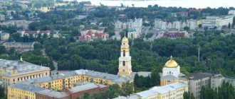
The city of Novy Urengoy was built according to modern standards, there are wide avenues and good roads. The population of Novy Urengoy is fully provided with the service enterprises and cultural institutions necessary for life. There are 7 branches of higher educational institutions and 23 secondary educational institutions operating here. The cultural needs of the population are satisfied by an art museum and several cinemas. Transport links are well developed here; this is a city in which there are almost no traffic jams. The airport, railway and river transport provide good connections between the region and other parts of the country. The population of Novy Urengoy is fully provided with medical care; there are 11 medical institutions in the city with a good level of qualifications of doctors. Sports and physical education are held in high esteem by city residents; 17 sports-oriented institutions allow 25 thousand people to regularly engage in various types of physical activity.
Cafe "Octopus"
An excellent place for a family holiday. A clean, cozy cafe, a relaxing place for couples, business partners, and young people. A large abundance of dishes of various tastes and price categories.
Large, spacious hall, comfortable tables, quality service, entertainment programs, karaoke, celebrations and banquets, New Year's and corporate parties.
Location: Sovetsky microdistrict - 6.
Population dynamics
Systematic observations of the number of residents in the city have been carried out since 1979. In general, Novy Urengoy, whose population is almost always growing, shows good development. Over the entire observation period, three points of population decline were noted. This is the time from 1996 to 2000, when negative population dynamics were recorded throughout the country. The second noticeable decline occurred in 2010, when the number of city residents decreased by 14 thousand people. The third period with negative dynamics is observed today; it began in 2014, and so far the authorities have not been able to change the situation. At the beginning of 2016, the number of residents of New Urengoy was 111,163 people. Due to the large extent of the urban area, the population density here is quite low - 470 people per 1 sq. km.
Memory Square
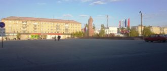
In the very center of the Northern residential zone there is Memory Square with a unique memorial to three wars. It was opened in 2005 in memory of those killed in three terrible armed conflicts of the 20th century - the Great Patriotic War, the Afghan and the Chechen War.
Of all the proposed projects, a sketch by the Moscow sculptor A. Frangulyan was chosen. The monument consists of three monolithic columns of different heights. Nearby burns the Eternal Flame, lit at one of the local gas fields. On the square, during the opening of the monument, a time capsule was laid, which should be opened in 2025 (for the 50th anniversary of the city).
Ethnic composition and language
Novy Urengoy is a multinational city. Due to the fact that the settlement was formed by newcomers from different parts of the country, a slightly different ethnic situation developed here than in many regions of Russia. Thus, the population of Novy Urengoy who consider themselves Russian is 64%. Almost 11% called themselves Ukrainians during the census. 5% of the total population are Tatars, 2.6% are Nogais, 2% each are Kumyks and Azerbaijanis, 1.7% are Bashkirs. The remaining ethnic groups account for less than 1% each. Despite such ethnic diversity, the main, if not the only, language of communication in the region is Russian.
Serious measures
An interesting fact is that in 2012 the city actually became closed, given that there was no actual legal basis for this. Entry into the city could only be done with a special pass. Such drastic measures were needed because the crime level in this territory was approaching a critically high level. Various terrorist organizations were active here, and therefore the situation had to be resolved on an emergency basis. There is also an unconfirmed hypothesis that this practice of a permit system was introduced to regulate population migration and limit the internal and external “turnover” of residents. Be that as it may, such a system in Urengoy, whose name translated from one of the local Nenets dialects means “lost place,” lasted about six months and then was abolished.
Sex and age characteristics of the population
In Russia, on average, the number of men everywhere is inferior to the number of women. Novy Urengoy, whose population has specific characteristics, fits into this trend, but the average preponderance is approximately 1.02 (49.3% of men and 50.7% of women), while in the country the proportion of women to men is 1.2 -1.4.
In terms of age characteristics, the region also differs from the overall Russian situation. This is a city with a large number of minors, 23% of the population are children under 15 years of age. 19% of the population are residents over working age. Thus, the dependency ratio for each working-age resident of the city is 1.4, which is lower than in many regions of the country.
Interesting modern objects
Novy Urengoy (whose attractions are mainly modern buildings) is one of the few Russian regional cities that are superior to the administrative center of its federal subject called Salekhard. It is ahead of it in terms of population and economic and industrial development.
Monument to the borehole and people
The monument is located at a distance of 2 km from the city on its eastern side. It is installed on a historical site where the first discovered well was once located.
The monument is dedicated to the workers who worked on gas production. The monument depicts 2 male figures standing near a gas pipe. One of the men stands with his hand raised to the top, the other is holding on to the valve.
KSC Gas producer
KSC Gas Dobytchik is a cultural and sports center that opened at the beginning of the 21st century.
The complex has several separate halls that offer entertainment for every taste:
- Gym;
- theater Club;
- concert hall;
- art exhibition;
- cafeteria and bar.
Demographics of New Urengoy
Fertility and mortality are the most important demographic indicators of the socio-economic development of the region. In Novy Urengoy the birth rate is 15.4 for every thousand people. And the mortality rate today remains at 3.8 per thousand people. The average age of a city resident is 36 years. Thus, the population of the city of Novy Urengoy shows a natural increase, and this allows us to classify it as a growing, rejuvenating type of settlement, while throughout the country, for the most part, mortality is outpacing the birth rate. However, in terms of life expectancy, the region is not prosperous; on average, residents of Novy Urengoy live 2-3 years less than other Russians.
Education
There are many universities operating on the territory of New Urengoy, including:
- branch of the Moscow State Open University;
- branch of Tyumen Oil and Gas University;
- branch of the Tobolsk State Pedagogical Institute named after. DI. Mendeleev;
- branch of Tomsk State University of Radioelectronics and Control Systems;
- branch of the Moscow Open Social University (Institute) and others.
As you can see, here, in one of the cities of the Tyumen region, you can not only live, but do it successfully: study, work and make plans for the future.
Socio-economic development of Novy Urengoy
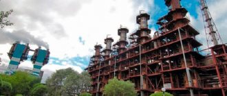
The region has a high level of development, which is facilitated by stable work on extracting gas from the bowels of the Earth. The main occupation of the population of Novy Urengoy is work in the gas production and gas transportation industries. The region accounts for about 75% of all gas produced in the country. There are about a thousand different enterprises in the fuel and energy industry of New Urengoy.
Also, the city’s economy is developing steadily due to the service sector. Novy Urengoy has its own enterprises for the production of dairy, confectionery and meat products. Service companies also constitute a well-growing segment of the local market. Retail trade provides the greatest profits and high employment. Novy Urengoy is well supplied with socially significant enterprises and has fairly high average wages. All this makes the city an attractive place to live and have children.
Employment
The unemployment situation is monitored by the Novy Urengoy Employment Center. The organization has been recording an extremely low unemployment rate for many years in a row; it is 0.5-0.6%, with the national average being 4.5%. The Employment Center (Novy Urengoy) notes that the need for workers in the city is never fully satisfied; there are always at least 15 thousand vacancies. It is difficult for people with rare specialties to find work, for example, winemakers, and women over 35 years of age with one or two higher educations also experience some difficulty in finding work in their specialty.
Korotchaevo
New Urengoy is truly new. This name was registered only in 1975, and then it was still a small village. It’s just that Urengoy is a little older—ten years. This is a village located to the east, not far from Korotchaevo - an important industrial and transport point, where there is a very busy crossing over the Pur River. In the summer, when there is no winter road, this is the most important link in the Yamal transport system. The pontoon bridge is always filled with cars and people - an endless stream, going alternately to one side and then to the other. It is interesting that Korotchaevo is formally a microdistrict of Novy Urengoy, although it is located 70 kilometers from the city (this is if you count in a straight line), which says a lot about the scale of Yamal and the distances that people travel.
Tazovsky is located 200 kilometers north of Urengoy. But it seems much further. You need to drive there all day: the road gets lost, makes a big detour, and it’s impossible to accelerate on it: fogs and sudden changes in the height of the roadway interfere, on which a careless driver can take off and make a hard landing. This is the peculiarity of the polar routes - the biggest problem here is not the potholes. In such places, roads are built with a large margin of safety - so that under normal conditions they would last 10 or 20 years without repair. But the road inevitably moves in waves due to the constantly unsettled permafrost.
Special report Tazovsky village: at the edge of the Earth
Along the way, you manage to see the gradual transformation of the forest-tundra into tundra: when the trees practically disappear, but more and more often you see the shiny surface of the water as you approach the Tazovskaya Bay - a bay of the Kara Sea, which is surrounded by countless lakes accumulated in the deltas of the Taz and Pur rivers. If you drive at night, the lights of the fields are constantly flashing either to the right or to the left of the road - searchlights and torches of associated gas. And during the day you can see that the Zapolyarye-Purpe pipeline runs along the road - the only main pipeline in Russia, most sections of which are laid above ground. Otherwise, the permafrost will be distorted and pushed out of the ground. They say that when the pipeline was being built and the fields were being developed, cars walked here in a continuous line. At night there was no need to worry about visibility: the road was two stripes of light moving in opposite directions. Nowadays you can drive for an hour at night and not meet anyone. Only rare lights from the deposits indicate that there are still other people somewhere in the world.
