Recently, for various reasons, the interest of Russians in domestic tourism has been growing. One of the most popular destinations is small towns located in the European part of the country. Novy Oskol, located 110 km east of Belgorod, belongs to this large group of objects that travelers interested in the Russian province enjoy visiting.
What is interesting about Novy Oskol?
In 1637, a permanent fort was founded on the left bank of the Oskol River. Since 1647, the settlement, which served to protect the roads leading to Moscow from the attacks of the Crimean Tatars, began to be called Tsarev-Alekseev. Later, in 1655, the future city was renamed Novy Oskol. Gradually this place lost its important fortification significance. In the 18th–19th centuries the city developed as a center for bread production. Now Novy Oskol and its surroundings attract tourists with several features:
- protected areas, rich springs, forests and groves;
- ancient sacred buildings;
- recreation opportunities among the natural landscapes of Central Russia;
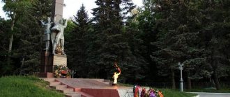
- monuments telling about different stages of the history of the city and region, starting from the era of the fight against the Crimean Tatars and ending with events related to the liberation of Belgorod land from the Nazi invaders.
In 2022, in Novy Oskol, located 720.5 km south of Moscow, there are 5 large industrial enterprises, 4 secondary schools, Oskol - a center for cultural development - and an agricultural college. There are 13 sculptural compositions and historical monuments erected in the city.
Geographical names (toponyms)
According to the Slavic version, the name of the Oskol River is associated with numerous exposed steep banks: oskolin and oskolin cretaceous sedimentary rocks located along the entire length of the river.
The evidentiary basis for the infallibility of this version lies in the existence of the names:
1. “Oskolets” is a tributary of Oskol.
2. “Oskolishche” is the name of the settlement.
The name of the settlement, Oskolishche, is extremely interesting, strongly reminiscent of the fact that the toponym came, apparently, from the steep coastal slopes - “oskalin”. Moreover, in former times the village was called Oskolishchi - fragments of cliffs.
This kind of hypothesis for the origin of the hydronym “Oskol” was developed on real grounds.
Economy
| : Incorrect or missing image | This section is missing references to information sources. Information must be verifiable, otherwise it may be questioned and deleted. You may edit this article to include links to authoritative sources. This mark is set April 27, 2016 . |
K:Wikipedia:Articles without sources (type: not specified)
- Poultry farm "Prioskolye".
- Furniture factory.
- Bread factory.
- Electrode plant.
- Compound feed plant.
- sale of agricultural machinery "Don".
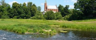
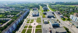
Photo gallery. Photos of the city of Novy Oskol
© “Department of Culture of the Novooskol District Administration” · All rights reserved · E-Mail Use of materials from the site kultura-novosk.ru is permitted only with a link to the original source Development and support of the site: ROMCNOVOSK by Aleksey Evseevkultura-novosk.ru
Photo gallery photographs of the city of Novy Oskol
Weather in Novy Oskol
[td]Gismeteo 2 week forecast
- culture News
- About the management of cultural institutions cultural and leisure activities
- Libraries
- Museum of the First Cavalry Army
- Novooskol School of Arts
- Velikomikhailovskaya School of Arts
- Landmarks Buildings
- Regulations on the Department of Culture
- Events
- Photo gallery Events
- About the city
Official website Department of Culture of the Administration of the Municipal District "Novooskolsky District" of the Belgorod Region
kultura-novosk.ru
Geography
The Oskol River covers three regions of the largest area: Kursk and Belgorod, located on the territory of Russia, and Kharkov in the neighboring country - Ukraine.
Due to the fact that Oskol mostly flows through central Russia, it is subject to freezing in winter. If the river originates in Russia, then its mouth is in Ukraine.
Tributaries
Along its entire length, the Oskol River has 33 tributaries.
The most significant of them account for 7 left banks and 6 right banks.
On the map
It turns out that not everything has a description. Important parameters for a map are the name and coordinates.
On the interactive map you can see the location of the Oskol River and obtain detailed information of interest.
We recommend reading: Where the Setun River flows: map, description, fishing
mass media
Internet
- "Domolink"
Press
- Since 1921, the regional newspaper “Forward” has been published.
TV broadcasting
- First channel
- Russia 1
- NTV
- World of Belogorye
- Teleradio
- Terrestrial digital TV (package of 10 channels
Broadcasting
- Radio Russia - 71.08 MHz
- Mayak - 68.33 MHz
- Capital FM / Radio 88 - 88.0 MHz
- Radio 31 - 102 MHz
- Radio 7 - 105.2 MHz
- Radio "Radio" - 106.5 MHz
- Road Radio - 91.1 MHz
Notes
- ↑ 123
www.gks.ru/free_doc/doc_2016/bul_dr/mun_obr2016.rar Population of the Russian Federation by municipalities as of January 1, 2016 - ↑ 12
THE USSR. Administrative-territorial division of the union republics on January 1, 1980 / Compiled by V. A. Dudarev, N. A. Evseeva. - M.: Publishing house "Izvestia of the Soviets of People's Deputies of the USSR", 1980. - 702 p. — P. 101. - ↑ 12
Directory "Liberation of Cities: A Guide to the Liberation of Cities during the Great Patriotic War of 1941-1945." M. L. Dudarenko, Yu. G. Perechnev, V. T. Eliseev and others. M.: Voenizdat, 1985. 598 p. - Red Army website. rkka.ru.
- dlib.rsl.ru/viewer/01003542943#page2?page=2 Static tables of the Russian Empire
- ↑ 12345678910111213
[www.MojGorod.ru/belgorod_obl/novyjoskol/index.html People's encyclopedia “My City”. Novy Oskol]. Retrieved November 5, 2013. [www.webcitation.org/6Ku0gM6iH Archived from the original on November 5, 2013]. - [demoscope.ru/weekly/ssp/rus59_reg2.php All-Union Population Census of 1959. The size of the urban population of the RSFSR, its territorial units, urban settlements and urban areas by gender] (Russian). Demoscope Weekly. Retrieved September 25, 2013. [www.webcitation.org/6GDOghWC9 Archived from the original on April 28, 2013].
- [demoscope.ru/weekly/ssp/rus70_reg2.php All-Union Population Census of 1970 The size of the urban population of the RSFSR, its territorial units, urban settlements and urban areas by gender.] (Russian). Demoscope Weekly. Retrieved September 25, 2013. [www.webcitation.org/6GDOiMstp Archived from the original on April 28, 2013].
- [demoscope.ru/weekly/ssp/rus79_reg2.php All-Union Population Census of 1979 The size of the urban population of the RSFSR, its territorial units, urban settlements and urban areas by gender.] (Russian). Demoscope Weekly. Retrieved September 25, 2013. [www.webcitation.org/6GDOjhZ5L Archived from the original on April 28, 2013].
- [demoscope.ru/weekly/ssp/rus89_reg2.php All-Union Population Census of 1989. Urban population]. [www.webcitation.org/617x0o0Pa Archived from the original on August 22, 2011].
- std.gmcrosstata.ru/webapi/opendatabase?id=vpn2002 All-Russian Population Census 2002
- [www.gks.ru/bgd/regl/b07_14t/IssWWW.exe/Stg/z/01.htm Cities of the Belgorod region (number of inhabitants - estimate as of January 1, 2007, thousand people)]. Retrieved May 26, 2016. [www.webcitation.org/6hnE0VK3q Archived from the original on May 26, 2016].
- [www.gks.ru/bgd/regl/b08_14t/IssWWW.exe/Stg/z/01.htm Cities of the Belgorod region (number of inhabitants - estimate as of January 1, 2008, thousand people)]. Retrieved May 22, 2016. [www.webcitation.org/6hh6UGShi Archived from the original on May 22, 2016].
- [www.gks.ru/bgd/regl/B09_109/IssWWW.exe/Stg/d01/tabl-21-09.xls Number of permanent population of the Russian Federation by cities, urban-type settlements and districts as of January 1, 2009]. Retrieved January 2, 2014. [www.webcitation.org/6MJmu0z1u Archived from the original on January 2, 2014].
- [belg.gks.ru/wps/wcm/connect/rosstat_ts/belg/resources/eab54e804ff0fbbca305efd8c740ec4f/pub-01-15.pdf All-Russian Population Census 2010. Belgorod region. 15. Number of non-population in urban and rural settlements]. Retrieved August 15, 2013. [www.webcitation.org/6ItkEdvFz Archived from the original on August 15, 2013].
- [www.gks.ru/free_doc/doc_2012/bul_dr/mun_obr2012.rar Population of the Russian Federation by municipalities. Table 35. Estimated resident population as of January 1, 2012]. Retrieved May 31, 2014. [www.webcitation.org/6PyOWbdMc Archived from the original on May 31, 2014].
- [www.gks.ru/free_doc/doc_2013/bul_dr/mun_obr2013.rar Population of the Russian Federation by municipalities as of January 1, 2013. - M.: Federal State Statistics Service Rosstat, 2013. - 528 p. (Table 33. Population of urban districts, municipal districts, urban and rural settlements, urban settlements, rural settlements)]. Retrieved November 16, 2013. [www.webcitation.org/6LAdCWSxH Archived from the original on November 16, 2013].
- [www.gks.ru/free_doc/doc_2014/bul_dr/mun_obr2014.rar Table 33. Population of the Russian Federation by municipalities as of January 1, 2014]. Retrieved August 2, 2014. [www.webcitation.org/6RWqP50QK Archived from the original on August 2, 2014].
- [www.gks.ru/free_doc/doc_2015/bul_dr/mun_obr2015.rar Population of the Russian Federation by municipalities as of January 1, 2015]. Retrieved August 6, 2015. [www.webcitation.org/6aaNzOlFO Archived from the original on August 6, 2015].
- taking into account the cities of Crimea
- [www.gks.ru/free_doc/doc_2016/bul_dr/mun_obr2016.rar Population of the Russian Federation by municipalities as of January 1, 2016. Table “31. Population of cities and towns by federal districts and constituent entities of the Russian Federation as of January 1, 2016.” RAR archive (1.0 MB)]
