I have a rather cool attitude towards Crimea, but at the same time I really love Balaklava. This is partly due to childhood memories: I remember well walking with my parents around the Chembalo fortress in the summer of 1992. On the other hand, this city has three conditions necessary to be included in my secret list of places where I agree to settle in my old age: a warm sea, a nice bay and an ancient European fortress (this list also includes Kyrenia, Lagos, Nafplio and Chania) . In addition, Balaklava has a rather interesting historical background (for example, Lamos, the capital of the Laestrygonians, mentioned in Homer’s Odyssey, is identified with the local harbor) and an extremely unusual set of attractions, the most exciting of which is, of course, an underground complex from the Cold War. And it’s just very beautiful here: the city is surrounded by mountains, leisurely strolling along them is a pleasure!
The naturalist and traveler Peter Simon Pallas, who visited Balaklava in 1794, wrote:
The city lies on the shore of the harbor itself along the foot of the mountain, but does not have good drinking water. The harbor is deep, and since it is protected by high mountains and little exposed to the sea, it is as quiet as a pond, and fishing can be done at any time. The entrance to it is very deep, but between the steep rocks it is so narrow that two ships can hardly pass each other.
The old fortress is located, like all the Genoese and Greek fortifications of this peninsula, on inaccessible cliffs, at the very entrance to the harbor, on a mountain lying to the east and is protected by high walls and towers.
A drawing (source: - Author's note) gives a better idea than a detailed description.
Of course, over the past two hundred-odd years, Balaclava has changed a lot. Moreover, if you believe the engraving presented above, for the worse. But even in our difficult times, she has plenty of charm.
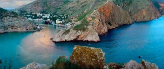
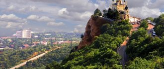
I really wanted to look at Balaklava Bay from different angles, so I decided to visit all the iconic peaks in its vicinity one by one. The task turned out to be quite simple: all of them in the past were turned into well-fortified defense units, and each of them can now be driven by car.
Geography and climate
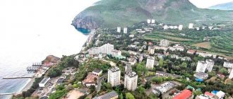
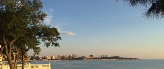
Balaklava is located in the southwestern part of the Crimean Peninsula in the bay of the same name on the Black Sea coast. This convenient natural harbor is approximately 1.5 km long. At the same time, it is quite narrow (200-400 m) and deep (17 m), and there are no storms here. Balaklava has a Mediterranean climate with warm summers and mild winters.
Balaclava
Lookout under the lighthouse
Not the most obvious place, but here the chances of being alone are much higher. To get here, at the fork on the way to the previous site near the fortress, you need to turn right and move along the fence with barbed wire. The trail will take you to the lighthouse and then to the observation deck. This is the closest observation point to Cape Balaklava, from which you can observe ships entering the bay.
Path to the lookout under the lighthouse, Balaklava
The map is loading. Please wait.
Viewpoint to Balaklava under the lighthouse
This is the closest observation point to Cape Balaklava, from which you can observe ships entering the bay.
Lookout to Balaklava under the lighthouse 44.493792, 33.596493 This is the closest lookout point to Cape Balaklava, from which you can watch ships entering the bay.