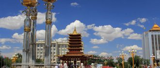
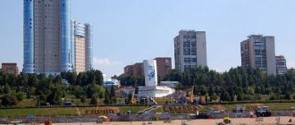
Tomsk region
| Coat of arms of the Tomsk region | ||
| Flag of Tomsk region | Coat of arms of the Tomsk region | |
— Total — % aq. turn 16
314,391 km² 0.4Population
— Total — Density 51st
approx. 1,045,541 (2010) approx. 3.33/km² Federal DistrictSiberianEconomic regionWest SiberianGovernorSergey ZhvachkinChairman of the Regional DumaOksana KozlovskayaVehicle code70TimezoneMSK+3 (UTC+6, summer UTC+7)
Tomsk region
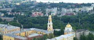
- a subject of the Russian Federation, located in the southeast of the West Siberian Plain, in the southwestern part of the Siberian Federal District. The administrative center of the region is the city of Tomsk.
History[edit | edit code]
The development of the region's territory began at the end of the 16th - beginning of the 17th centuries. The oldest settlement in the region is the village (formerly city) Narym, founded in 1596. The administrative center of the region, Tomsk, was founded in 1604. In 1804, the Tomsk province was formed, which existed until 1925, when it became part of the Siberian region. The Tomsk region was formed on August 13, 1944 by separating part of the districts and the former Narym district from the Novosibirsk region.
Population[edit | edit code]
Population 1045.5 thousand people (2010)[1], 51st in terms of population among the constituent entities of the Russian Federation (0.7% of the Russian population), of which 70.2% are urban (2009), population density: 3.3 people/km² (2009)[2].
Before the annexation of the region's territory to Russia in the 17th century, the main population was Siberian Tatars, Selkups and Khanty. According to the results of the 2002 All-Russian Population Census, Russians make up about 91% of the total population (about 951 thousand people). Of the other peoples, the largest share (from 2.0 to 0.1%) of the population is made by Tatars, Ukrainians, Germans, Chuvashs, Belarusians, Bashkirs and Jews.
National composition
The lion's share of local residents, according to the 2010 census, are Russian - more than 92%, or 922,723 people. The next largest nation is sharply inferior - only 1.7% of Tatars live here.
In third place, also noticeably behind, are the Ukrainians. At the time of the last census, just over 11 thousand Ukrainians lived here, or 1.12%.
There are also Germans here, and not so few of them - approximately 0.87%, or 8687 people.
Azerbaijanis close the top five peoples most common in the Tomsk region. In 2010, a little more than 2 thousand representatives of this people lived here, which is 0.4% of the total population.
In general, here you can see representatives of dozens of peoples, both local (Chulym, Yakut, Khanty) and very exotic for these places (Vietnamese, Yezidis, Jews, Greeks). Of course, the number of most of them is extremely limited and mostly amounts to only a few hundred people - less than 0.01%.
Such a varied composition is easy to explain. During Soviet times, industry actively developed here - both mining, manufacturing, and agriculture. Therefore, people came here from all over the Soviet Union - teachers, builders, geologists, doctors, drivers, workers and many, many others.
In post-Soviet times, the region began to concentrate on the extractive industry - primarily oil. Serious salaries attract many residents from other areas.
In recent years, the number of Chinese has increased sharply. Immigrants from China receive the right to logging or simply begin logging on their own. Of course, as a more understandable and cheaper labor force, influential and richer loggers prefer to use their compatriots, many of whom come without paperwork.
Alas, the area of the Tomsk region in km2 is about 314,000, and it is very difficult to control it. Therefore, it is unknown when the situation here will change and whether it will change at all.
Geography[edit | edit code]
The area of the region is 316.9 thousand km², the 16th largest among the constituent entities of the Russian Federation, which is 1.9% of the total territory of Russia. The length from north to south is about 600 km, from west to east – 780 km. Thus, the Tomsk region is approximately 1.5% larger in area than Poland (and almost 40 times smaller than Poland in population). The Tomsk region borders in the north with the Tyumen region and the Khanty-Mansi Autonomous Okrug, in the south with the Kemerovo and Novosibirsk regions, in the west with the Omsk region, and in the east with the Krasnoyarsk Territory[2].
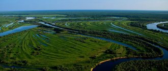
Most of the region's territory is inaccessible, as it consists of taiga (forests occupy 63% of the area) and swamps (28.9%, in particular the largest Vasyugan swamp in the world). The highest point of the region is 274 m above sea level, the lowest is 34 m above sea level. The largest lake is Mirnoe (Parabelsky district), the surface area is 18.3 km². The region borders on the Krasnoyarsk Territory, Tyumen, Omsk, Novosibirsk and Kemerovo regions. The climate is continental. The main river, the Ob, crosses the region diagonally from southeast to northwest, dividing the region into two almost equal parts.
Interesting Facts
Now you know the area of the Tomsk region in hectares and square kilometers, you have an idea of its population, industry and history. You can cite several not so important, but quite interesting facts that will reveal this area and its center from a completely new, unexpected side.
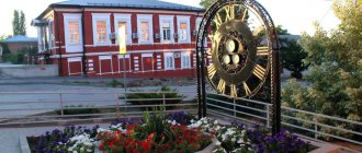
Tomsk can boast of a large number of monuments, many of which are distinguished by their originality. So, while walking along the streets of the city, you can come across monuments to the ruble, cabbage, slippers, and beaver. But perhaps all of them are overshadowed by the monument depicting a wolf from the famous Soviet cartoon “Once upon a time there was a dog,” where the now catchphrase was uttered: “I’ll sing now!”
From the eighteenth century until the October Revolution, the Tomsk region was a place where political prisoners were sent. For example, in the first half of the nineteenth century, every fifth resident of these places was an exile.
Tomsk universities, which are the hallmark of the city, have produced such famous instructors as M. Mil (creator of the Mi series helicopters), N. Kamov (helicopter developer), N. Nikitin (architect who designed the Ostankino TV tower).
Mikhail Andreev, who composed the song “Poplar fluff, heat, July,” which was a real hit for several years, played on radio and television, was inspired by the landscapes of this particular glorious city. In addition, he wrote the song “Tram Pyaterochka”. True, this text had to be edited a little later. The fact is that it featured a rather unusual name for the local district - Cheremoshniki. The toponym is unusual, so it was replaced with Cheryomushki - such areas exist in many cities of the country, so preference was given to the popular option. But from Cheremoshniki it was really possible to get to the city center by tram route No. 5, until it was abolished.
Time zone[edit | edit code]
The Tomsk region is located in the time zone designated by international standard as Omsk Time Zone (OMST/OMSST). The UTC offset is +6:00 (OMST, winter time) / +7:00 (OMSST, summer time) due to daylight saving time in that time zone. Relative to Moscow time, the time zone has a constant offset of +3 hours and is designated in Russia accordingly as MSK+3. Omsk time differs from standard time by one hour, since maternity time is in effect in Russia.
Administrative-territorial division[edit | edit code]
4 urban districts, 16 municipal districts, 3 urban and 117 rural settlements, 576 rural settlements.
| Districts of the Tomsk region | |
| Alexandrovsky | Asinovsky | Bakcharsky | Verkhneketsky | Zyryansky | Kargasoksky | Kozhevnikovsky | Kolpashevsky | Krivosheinsky | Molchanovsky | Parabelsky | Pervomaisky | Teguldetskiy | Tomsk | Chainsky | Shegarsky | |
| Districts of the Tomsk region | |
| Alexandrovsky | Asinovsky | Bakcharsky | Verkhneketsky | Zyryansky | Kargasoksky | Kozhevnikovsky | Kolpashevsky | Krivosheinsky | Molchanovsky | Parabelsky | Pervomaisky | Teguldetskiy | Tomsk | Chainsky | Shegarsky | |
| Settlements with a population of more than 5 thousand as of January 1, 2005 | |||||||||||||||||||||||||||||||||||||||||||
| |||||||||||||||||||||||||||||||||||||||||||
Administrative structure
As you know, the area of the Tomsk region in sq. km exceeds 314 thousand. Of course, for easier administration, the entire territory is divided into several administrative units. Moreover, it is divided quite unevenly – we’ll talk about this a little later.
In total, the region consists of twenty urban districts and districts. The largest regional center in terms of population is the city of Tomsk. Almost 595 thousand people live here. According to this indicator, he is in first place. But in area it is much smaller than most other administrative units. Despite the impressive total area of the Tomsk region, the territory of the regional center is only 295 square kilometers.
The largest administrative unit in these parts by area is the Kargasok district. Its area is close to 87 thousand square kilometers. But the population is surprisingly small - less than 20 thousand people.
The Verkhneketsky district with an area of 43,349 square kilometers is almost twice as large as the leader. Very few people live here – less than 16 thousand people.
The smallest district is Kozhevnikovsky. Its area is only 3,908 square kilometers, but in terms of population it is not inferior to, or even surpasses, the largest districts of the region: more than 20 thousand people.
The Zyryansky district is only slightly ahead of it. Its area is slightly larger - 3966 square kilometers, but its population is almost half as much - 11 thousand people. And this is on a territory almost twice the size of such a prosperous state as Luxembourg, whose population is almost 600 thousand people.
As you can see, the population and areas of the districts of the Tomsk region are distributed very unevenly. This is influenced by the size of areas suitable for living, the availability of jobs and simply historical factors.
Rivers[edit | edit code]
In the Tomsk region there are 18.1 thousand rivers, streams and other watercourses, with a total length of about 95 thousand km, including 1620 rivers with a length of more than 10 km (the total length of these rivers is 57.2 thousand km). The main water artery is the Ob River. The length of the Ob within the region is 1065 km. The main tributaries of the Ob, flowing into it in the Tomsk region: Tom, Chulym, Chaya, Ket, Parabel, Vasyugan, Tym.[3] The duration of the navigation period is 170-180 days.
Water resources
It is not surprising that, given the low altitude and abundance of forests, these places are rich in water resources. The total number of streams and rivers exceeds 18 thousand. Of course, not all of them are large, but still there are more than one and a half thousand rivers more than 10 kilometers long. Well, the main water artery of the region was and remains the Ob, connecting it with many other regions - starting with Altai at the source and ending with the Yamalo-Nenets Autonomous Okrug at the mouth, where the river flows into the Ob Bay, which is part of the Kara Sea. The Ob has many tributaries, each of which flows into the river in the Tomsk region. The largest ones include: Ket, Chaya, Tom, Vasyugan, Chulym, Tym, Parabel. The navigation period here is quite long - about six months, which gives all navigable rivers strategic importance.
There are also many lakes here. For many fishermen, Lake Glukhoe is of particular interest, where pike, crucian carp, perch and other fish are found. The area of Lake Glukhoye in the Tomsk region is about 10 square kilometers.
Natural resources[edit | edit code]
The Tomsk region is rich in natural resources such as oil (82 fields, 1449 million tons), natural gas (632 billion m³), ferrous and non-ferrous metals, brown coal - 74.7 billion tons (first place in terms of reserves in Russia), peat ( second place in terms of reserves in Russia) and groundwater. In the region there is the Bakcharskoye iron ore deposit, which is one of the largest in the world (57% of all iron ore in Russia), the total reserves are 90 billion tons. In the Tomsk region there are many deposits of raw materials for building materials: clay, sand, limestone, shale, gravel The Middle Ob region has mineralized groundwater at a depth of 1100-2250 m. In the area of the city of Tomsk there are outlets of radon water. In addition, there are proven reserves of kaolin, refractory clays, glass and ilmenite-zircon sands (ilmenite - 3.4 million tons, zircon - 1380 thousand tons), leucoxene and rutile (600 thousand tons), bauxite, brown coal, zinc , gold, platinum and titanium[4].
Forests are one of the most significant assets of the region: about 20% (more than 26.7 million hectares) of forest resources in Western Siberia are located in the Tomsk region. The region is home to 28 species of wild animals, more than 40 species of birds and 15 species of fish of commercial importance; pine nuts, mushrooms and berries are harvested[5]. In the Tomsk region there are 15 zoological reserves (Tomsky, Verkhne-Sorovsky, Ilovsky, Kaltaisky, Karegodsky, Ket-Kassky, Malo-Yuksinsky, Oktyabrsky, Osetrovo-nelmovy, Paninsky, Pershinsky, Poskoevsky, Tongulsky, Oglatsky, Chichka-Yulsky), 2 landscape (Larinsky and Pol-To) and 1 botanical (South Taiga)[6]. 145 natural monuments have been identified in the region, of which 69 are located in the Tomsk region, in particular, the Talovskie Bowls, Blue Cliff, Dyzvezdny Klyuch, Peschanoe Lake, etc.
Number and density of population
The total number of residents here, according to the 2022 census, is only 1 million 78 thousand people. Of course, given the huge area of the Tomsk region in hectares (about 26.7 million), this is surprisingly small - only 3.4 people per square kilometer.
Of course, the population is distributed extremely unevenly. In cities, the density increases significantly, for example, in Tomsk the density is 1947 people per square kilometer. In smaller settlements it is measured in hundreds of people. But around these tiny spots on the map lie thousands of square kilometers of swamps and forests, where people either do not visit at all or visit only temporarily, traveling from one city to another.
By the way, many people would be interested in what the residents of the city of Tomsk are called - the name formed according to standard templates sounds very unusual. In fact, their name is Tomsk.
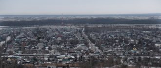
The percentage of urbanization in the region is quite high. More than 72% of the population lives in cities. The highest density was recorded in settlements located along the banks of the Ob and its tributaries. This is not an accident at all - getting out of many populated areas in the spring thaw, as well as in the winter snowstorm, can be very difficult. But rivers do an excellent job of serving as roads, allowing you to travel almost all year round without fear of getting stuck in the mud.
Industry[edit | edit code]
According to the Russian Ministry of Economic Development, in 2004 the Tomsk region was classified as a region with an above-average level of development (18th place in the country). At the same time, the region ranked 14th in terms of the average monthly salary (9,640 rubles), the volume of paid services per capita (18.8 thousand rubles), and tax revenues to the budget per capita (60.4 thousand rubles). ). The main priorities of economic development are fuel and energy, scientific and educational complexes and small business.[7].
In 2004, industry contributed 45.5% of regional GDP, agriculture - 19% and construction - 13%. Of the industrial sectors, the most developed in the region are fuel (52.8%), including oil production (48.5%) and mechanical engineering (12.6%). chemical and petrochemical industry. The large share of non-ferrous metallurgy (8.9% in 2004, 20.3% in 2001) is explained by the fact that the products of the Siberian Chemical Plant traditionally belong to this industry[8]. Main exported products: oil (62.1%), methanol (30.2%), machinery and equipment (4.8%). Joint ventures in the region are primarily involved in oil production and logging. The main branches of agriculture are meat and dairy farming, animal husbandry and crop farming.
Industry
The entire industry of the region is based on such main sectors as oil production, mechanical engineering, and non-ferrous metallurgy.
Today, almost half of the GDP from all industry comes from oil production - about 49%. Mechanical engineering accounts for 13%, which is also a serious indicator showing that the region not only uses natural gifts, but also produces high-quality equipment that is in stable demand.
The Siberian Chemical Plant, although it is one of the largest in Russia, specializing in working with radioactive materials, is gradually losing its importance. Thus, in 2004 it brought only 9% of GDP, while in 2001 this figure exceeded 20%. However, management is not going to give up and is actively using innovative technologies, introducing new projects. For example, it is planned to begin production of titanium dioxide, lithium tetrafluoroborate, sodium fluoride and a number of stable isotopes - all these raw materials are in stable demand both in Russia and abroad, which will provide a large sales market.
Agriculture is represented by both crop production and meat and dairy farming, and breeding of fur-bearing animals, which are of particular value.
Also in the region you can see many large joint ventures involved in oil production and logging.
Notes[edit | edit code]
- Population of districts and urban settlements of the constituent entities of the Russian Federation as of October 25, 2010
- ↑ a b Rosstat. Estimation of the permanent population of the constituent entities of the Russian Federation
- Study of the water quality of two rivers of the Tomsk region, Tom and Ushaika
- Tomsk region. Geological certificate, minerals
- Tomsk region on the tourist map of Russia
- Specially protected natural areas of the Tomsk region
- Report on the results of the implementation of the Program for the socio-economic development of the Tomsk region until 2005 (.doc)
- Social atlas of Russian regions / Tomsk region
- United Russia faction in the State Duma of the Tomsk region on the website of the regional branch of United Russia