Valdai is a treasure trove of natural and historical attractions. This is a land of stunning mountains and unique lakes, water streams full of fish, and rich fresh air. The city itself in the Novgorod region is one of the oldest in Russia and dates back about five centuries, according to historians. This is a place of bells and lakes, natural areas and mountain rivers. Tourists are attracted by the various attractions of Valdai. Some of them are not so famous, but that does not prevent them from being unique and amazing.
Lake Veljo
Valdai Lake is not the only water attraction in the region. One of the largest reservoirs in the region with an area of more than 25 kilometers is a real natural pearl. Its basin contains many large and small islands, and the depths are a paradise for anglers. The pike pools and abundance of bream deserve special attention. The water of the lake is clean and suitable for drinking, because there is not a single industrial enterprise in the vicinity. Small villages in the north-west make up the entire civilization of these regions. The southeastern coast of the lake is wild and deserted.
Useful information about the eco-trail
What's the easiest way to get there?
The Valdai National Park is located in the Novgorod region, 445 km from Moscow and 388 km from St. Petersburg. The easiest and most convenient option for getting to the designated place is a personal car. Another option is the train, the road from Moscow will take 5-8 hours, from St. Petersburg on the Lastochka to Veliky Novgorod 4-5 + 1-2 hours by bus or car to the start of the route.
If you plan to travel by Lastochka, it is better to buy tickets in advance. It is also worth taking care of bus tickets to Valdai - tickets from Veliky Novgorod in the summer sell out quickly. For a distance of 140 kilometers, the price of a bus is not cheap, depending on the departure time, it will be 250-430 rubles. From Valdai to Novgorod the price is fixed - 250 rubles. It is more profitable to take advantage of BlaBlaCar upon arrival in Novgorod and book a trip with a private driver, getting to Valdai for 250 rubles, but in comfort.
Entrance to the trail
The exact start coordinates from Valdai: 57.953554, 33.269257. Finish: Burakovo village, Dorozhnaya, 11.
Yandex.MapsThe Great Valdai Trail — Yandex.Maps
The beginning of the trail is located at the exit from the M10 Moscow - St. Petersburg highway, not far from the Podvorye hotel and restaurant complex. If you arrive by car, there is also a car park there. Many leave their cars there, take a bus in Valdai and go to Dunaevshchina to start the route from there.
The start of the trail is absolutely unremarkable. After leaving the track you will not see any information boards or stone tours, just a dusty road and a field. It may seem that you might have mixed up the coordinates, but after walking for about ten minutes along a country road and not missing the left turn, you will see a sign reading “Great Valdai Trail”. You can breathe out.
The best time to take the eco route is in the summer, when the weather allows you to enjoy the hike to the fullest.Ticket price
The cost of visiting the national park is 200 rubles (children of preschool and school age, pensioners, parents with many children are exempt from paying the ticket).
The cost of an excursion tour for adults is 500 rubles, children 7-14 years old are 250 rubles, children under 7 years old do not need to pay for the tour.
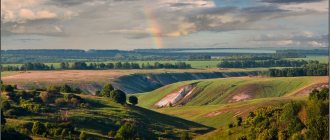
Natural landscapes will delight the traveler's eye.
Tickets can be purchased online on the official website of Valdai Park: valdaypark.ru. Save them in your phone or print them out before your visit. No one asked me, like the tourists we met along the way, about their availability.
The famous suspension rope bridge over the Polomet River.
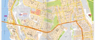
Route map
According to recommendations, the length of a day's trek is 12 kilometers. Thus, the entire route takes approximately 5 days for guests of the national park. On the official website of the park you can download a map diagram, which you can then use to organize your movement.
Map of the Great Valdai Trail route with coordinates.
You can also download an offline map to the maps.mi application or simply follow the signs that are installed at every kilometer of the Valdai Trail.
Where to organize a camping
Along the entire route there are several equipped base camps for tents, as well as stopover sites between them. The most picturesque places in my opinion:
- 11 km - Lake Nakhodno;
- 23 km - Lake Russkoe;
- 39 km - Myslovichi (TOP).
Comfortable living conditions will allow you to have a good time with your family.
In 2022, the Russian Ministry of Natural Resources allocated funds for the development of BVT infrastructure - 15 million rubles for the construction of glamping sites.
Rest stops.
At all sites you can make a fire and set up a small tent camp. Each of them has all the amenities for a hiker: a fire pit, a woodshed, wide tables and benches, rain shelters, toilets, and garbage bins. Almost glamping!
The exact parking locations can be found on the map available on the park’s official website, or you can follow the signs.
Cost of parking in the camp: adults – 100 rubles/day, children from 7 to 14 years old – 50 rubles/day. Most likely, in this case no one will take payment from you.
However, I never stopped at any base camp. Next to them there are no less convenient, clean and picturesque places for a tent, but without tourist groups.
Nature reserves "Polistovsky" and "Rdeisky"
The Valdai Hills are a unique natural place. The marsh systems on hand Polist and Lovat within the Novgorod and Pskov regions are included in the list of UNESCO-protected natural wonders. These places are equipped into two reserves. Tourists mainly pay attention to the large national parks of Valdai, but the value of the reserves is no less significant: there are rare species of birds listed in the Red Book, more than 30 species of mammals, unique flora and pristine beauty of wild nature.
Recommendations for tourists
- Fill out the traveler registration form on the official website of the national park and pay for a ticket to visit.
- Register on the Ministry of Emergency Situations website: forms.mchs.ru/registration_tourist_groups/form
- Download the GPS track of the route.
- Take essentials with you: food and water supplies, charged gadgets, a change of clothes, a raincoat, basic camping equipment, a first aid kit, a burner in case there is no firewood in the camp.
- To fully enjoy the hike, it is better to follow the recommended driving schedule - 12 kilometers per day.
- Treat nature with care. Leave the place behind you cleaner than it was before you arrived.
- When visiting the park, the main thing is to follow safety rules. Light fires only in areas where it is permitted.
- Think about parking spots in advance.
- Look at the weather forecast for the selected trip dates and, in accordance with it, select equipment and clothing.
Ant Island
Tourists often ignore this island, focusing on the nearby Iversky Monastery. But this natural attraction is worth a look. Ant Island is a body of water within a body of water. On the island there is Lake Glukhoe, the depth of which exceeds Valdai. The island is named so because of the tall anthills that are visible from afar. Legends say that Ant was once called the Dark Island, and a black sorcerer lived on its territory.
FAQ
Can wild animals attack tourists?
- The probability that a wild animal will attack is very small, but not zero. You are unlikely to meet a predator, but on the information boards you will learn that these places are inhabited by: moose, hares, foxes, beavers, wild boars, squirrels and other mammals and birds. Be prepared for the fact that at night someone will rustle or flounder in the water next to your tent.
What time of year is best to travel?
- The most popular season is summer. The weather is dry at this time. In autumn and spring there is a high probability of rain and cool nights. If anyone has gone or is planning a hike in winter, then write a review in the comments.
What should you take with you for a hike on the trail?
- It depends on how many days you are going to devote to completing the route. But everyone must have with them: water, food, comfortable change of clothes and shoes, a first aid kit, and be sure to spray against mosquitoes and ticks.
About water separately. What the trail really lacks are springs. From kilometer 11 to ~45 I did not come across a single source of clean water. At about 35 kilometers, in a village near Mount Ryzhokha, I replenished my balance by contacting a local resident. There are no wells in the villages; everyone brings water from the city.
Is it safe for an elderly person to take the route?
- If you have no health problems, yes, but if you are not confident in yourself, it is better not to go on your own and find a travel companion. Tourists do not meet often, and there are interruptions in cellular communications.
Is Internet available on the trail?
- It’s better to forget about fast Internet during your hike. The best place to catch it is the observation tower on Mount Ryzhokha, there is 4G there.
Lake Linen
The reservoir, located on the northern slope of the Valdai Ridge, is a natural monument of regional significance, and also has cultural and historical value. This glacial lake is covered with mosses and is located in a remote area, preserving pristine natural beauty. Linen is remarkable in that L.N. Tolstoy and I.I. Levitan lived here for some time.
A trip to ancient Valdai is an acquaintance with the history, culture and amazing nature of the region, which can bring many unexpected impressions.
Valday Ultra Trail
On August 15, 2022, trail running took place along the Valdai Trail at distances of 105 km, 55 km, 30 km, 15 km, 5 km and a children's race. People of all ages and with different physical fitness took part. The winners of the longest distance among men and women were Petr Sedov and Evgenia Kretova.
The route was laid through local attractions - the suspension bridge over Polomet, the Ryzhokha observation tower and the beaver dam. It is expected that such a race will be held annually during the summer months.

