Geography
Geographically, the Arkhangelsk region is located in the north of the Russian Plain, which has a large number of hills. For example, Nyandomskaya. There are four natural zones in the region: ice, taiga, forest-tundra and tundra. Some of the settlements in the Arkhangelsk region are located beyond the Arctic Circle. The largest river flowing through the region is the Northern Dvina. Also in the region there are rivers such as Onega, Mezen and Pechora. The largest lake is Kenozero.
The region's territory is washed by several seas: the White, Kara and Barents. The beaches of the White Sea are a favorite vacation spot for Arkhangelsk residents. The Arkhangelsk region borders the Republic of Karelia, the Vologda and Kirov regions, as well as the Komi Republic. The region also includes the Nenets Autonomous Okrug.
see also
- Arhangelsk region
- Symbols and landmarks of the Arkhangelsk region
- Cities of Russia
| [ + ] Cities by regions of Russia | |
| Cities of the North-West (NWFD) | St. Petersburg (and its cities) • Leningrad region (historical Staraya Ladoga) • Arkhangelsk region • Vologda region • Kaliningrad region • Karelia • Komi • Murmansk region • Nenets Autonomous Okrug • Pskov region |
| Cities of the Volga region (Volga Federal District) | Bashkortostan • Volgograd region • Kalmykia • Kirov region • Mari El • Mordovia • Nizhny Novgorod region • Orenburg region • Penza region • Perm region • Samara region • Saratov region • Tatarstan • Udmurtia • Ulyanovsk region • Chuvashia |
| Cities of Southern Russia (SFD) | Sevastopol (including Inkerman) • Republic of Crimea • Adygea • Astrakhan region • Krasnodar region • Rostov region |
| Cities of the North Caucasus (NCFD) | Dagestan • Ingushetia • Kabardino-Balkaria • Karachay-Cherkessia • North Ossetia - Alania • Stavropol Territory • Chechen Republic |
| Cities of the Urals (Ural Federal District) | Kurgan region • Sverdlovsk region • Tyumen region • Khanty-Mansi Autonomous Okrug - Yugra • Chelyabinsk region • Yamalo-Nenets Autonomous Okrug |
| Cities of Siberia (Siberian Federal District) | Altai Republic • Altai Territory • Irkutsk Region • Kemerovo Region • Krasnoyarsk Region • Novgorod Region • Novosibirsk Region • Omsk Region • Tomsk Region • Tyva • Khakassia |
| Cities of the Far East (FEFD) | Amur Region • Buryatia • Jewish Autonomous Region • Trans-Baikal Territory • Kamchatka Territory • Magadan Region • Primorsky Territory • Sakha (Yakutia) • Sakhalin Region • Khabarovsk Territory • Chukotka Autonomous Region |
| see also | Cities of the DPR, LPR, Transnistria, South Ossetia • Regions of Russia • Cities of Russia |
Districts of the Arkhangelsk region
The region is located on a vast territory, larger than even the area of France.
It is divided into 20 municipal districts and 6 urban districts. The latter are the capital of the region, Arkhangelsk, as well as Severodvinsk, Mirny, Koryazhma, Kotlas, Novodvinsk.
Districts of the Arkhangelsk region: Primorsky, Plesetsk, Kholmogorsky, Nyandoma, Konoshsky and others. Each of them has its own characteristic features. The Nenets Autonomous Okrug, included in the Arkhangelsk region, includes the urban district of Naryan-Mar, as well as the Zapolyarny region. These are regions with a very harsh climate and a specific culture.
Ustyansky district of the Arkhangelsk region is located in the southern part of the region. Occupies more than 10,000 square meters. In the Arkhangelsk region, the Ustyansky district has a population of less than 20,000 people; it is equated to the regions of the Far North. It includes more than 200 settlements, such as the village of Bereznik, the village of Dubrovskaya, the village of Loyga and others.
The administrative center of the Kholmogory district of the Arkhangelsk region is the village of Kholmogory. The area of the occupied territory reaches more than 16 thousand square meters. It is also a region of the Far North. It is possible to get from Kholmogory to Arkhangelsk both by personal transport and by public transport. Travel time is about 2 hours.
Urban settlements
- Vychegodsky
Population 12,314 (2020).
- Konosha
Population 10,683 (2020).
- Plesetsk
Population 9,789 (2020).
- October
Population 9,016 people (2020).
- Savinsky
Population 6,508 (2020).
- Bereznik
Population 5,292 (2020).
- Kuloy
Population 5,056 people (2020).
- Severonezhsk
Population 4,688 (2020).
- Urdoma
Population 4,116 people (2020).
- Shipitsyno
Population 3,377 (2020).
- Obozersky
Population 3,049 (2020).
- Privodino
Population 3,009 (2020).
- Belushya Guba (Novaya Zemlya)
Population 2,708 (2020).
- Maloshuika
Population 2,320 (2020).
- Kamenka
Population 1,903 (2020).
The largest cities in the Arkhangelsk region
It’s worth starting with the administrative center of the region. The capital of the region is Arkhangelsk, founded in 1584 by Ivan the Terrible. Until 1613 it was called Novokholmogory. The occupied area is almost 300 square meters. 350 thousand people live in Arkhangelsk. Many residents of Russia do not know how to correctly call the residents of the city. The correct option is Arkhangelsk residents. This question is very often included in various quizzes and olympiads for schoolchildren and students. In 2009, Arkhangelsk was awarded the title of City of Military Glory. The city is also depicted on the five-hundred-ruble banknote issued by the Bank of Russia.
In 1936, the second most recognizable city in the Arkhangelsk region, Severodvinsk, was founded. In the mid-20th century, the plant located on the territory of the city was transferred to the construction of nuclear submarines. This plant is the main Russian enterprise where strategic submarines are produced. Previously, the city had other names: Molotovsk, as well as the village of Sudostroy. No more than 200 thousand people live there; the settlement is the second most populous in the Arkhangelsk region. In the statistics of all cities, Severodvinsk ranks 103rd in terms of the number of inhabitants.
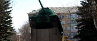
The city of Mirny in the Arkhangelsk region has the status of a closed administrative-territorial entity. The status was assigned to the city in 1993. This is where the Plesetsk cosmodrome is located. More than 30 thousand people live in the city, however, the number of residents decreases every year. There are a lot of different monuments on the space-military theme in the city.
Content
- 1 Large cities 250-500 thousand people 1.1 Arkhangelsk
- 2.1 Severodvinsk
- 3.1 Kotlas
- 4.1 Kargopol
Protected areas
On the territory of the Arkhangelsk region there are such protected parks as Vodlozersky and Kenozersky. As well as the Pinezhsky, Nenets and Bolshezemsky nature reserves. The region also contains the Franz Josef Land state nature reserve, consisting of 192 islands. The total area of the territory is more than 16 thousand square kilometers. The reserve is inhabited by a large number of polar bears, and Arctic foxes are also found among mammals. The waters of the Arctic Ocean are home to sea hares, walruses, seals and others.
Government departments
System of government bodies authorities are determined by the Charter of the Arkhangelsk Region. (1995). State power in A. o. carried out by the Arkhangelsk Regional Assembly of Deputies, the head of the administration and the regional administration, and other state bodies. authorities formed in accordance with the Charter of the region.
The Arkhangelsk Regional Assembly of Deputies is the highest legislative (representative) body of the state. regional authorities; consists of 62 deputies elected for 4 years. The number of deputies of the regional Assembly carrying out their activities on the prof. on a permanent basis, established by the regional Assembly. The regional administration is the highest executive. state body regional authorities. It is formed and headed by the head of the administration, vested with powers by the regional Assembly on the proposal of the President of the Russian Federation.
Weather
The weather in the Arkhangelsk region is not a strong point of the region. A temperate continental climate prevails over most of the territory. The northwestern part of the region has a maritime climate. Subarctic air masses predominate in the northeast. Winter in the Arkhangelsk region is long and moderately cold. Summer, on the contrary, is short and cool. In January, the average temperature is -12°C in the western part of the region, -18°C in the eastern part. In July, the average temperature varies from +8°C to +16°C.
There have been cases when residents of the regions of the Arkhangelsk region could observe snow in the summer months.
Music
The basis of music cultures make up the oral traditions of the North. groups of Russians (including Pomors), in the Nenets Autonomous Okrug. - Nenets. The first records of Russian folklore was carried out in the end. 19th century F. M. Istomin and G. O. Dyutsh, later on the territory of the A. o. folklorists E.V. Gippius, A.M. Mekhnetsov, Yu.I. Marchenko and others worked. In 1869, the Circle of Music Lovers was organized in Arkhangelsk, and in 1894 the first concert of lovers of choral singing took place. In 1906 the first music school was formed. school. In 1913, the Arkhangelsk branch of the Russian Musical Society was opened. Among prof. composers - P. F. Koltsov, D. V. Ivanov, V. L. Vakhrushev; in the 1960s A.V. Mosolov lived in Arkhangelsk. In Arkhangelsk there are: Northern Russian Folk Choir (1926), State. chamber orchestra (1993), as part of the Pomeranian Philharmonic (1937) – string quartet (2002); Military Orchestra of the Belomorsk Naval Base North. fleet. The arts festival “Zimushka-Winter” (since 1979), the chamber music festival “White Nights” (since 1980), the organ music festival “Praise of the Organ” (since 1991), and “Jazz Days in Arkhangelsk” (since 1982) are held annually. Museum of wood architecture and people open-air art-va "Malye Karely" with con. 1980s – one of the centers of the revival of bell ringing.
Kitchen
The large number of reservoirs located in the region also influenced the cuisine: Arkhangelsk residents prepare a large number of fish dishes. Cod is considered a traditional fish on the Pomeranian table. It is difficult to meet a resident of the Arkhangelsk region who has never tried cod. Also on the table of Arkhangelsk residents you can find pies with cabbage and berries. Residents of the region love to prepare fruit drinks and jelly from cloudberries and lingonberries.
They also bake special gingerbreads here, called kozuli. They got their name from the Pomeranian word for “snake”. Previously, roe deer were considered a delicacy; they were baked only for Christmas. They decorated the Christmas tree and only then ate it. Nowadays, roe deer are often given to children as part of New Year's gifts, and children can also enjoy roe deer on other holidays throughout the year.
One of the famous dishes of the Russian North is Pomeranian fish soup. The traditional recipe states that only freshly caught fish is suitable for classic fish soup.
Historical sketch
Stone ax-hammer with a bear's head on the butt. 2nd millennium BC e. Historical Museum (Moscow).
The most ancient monuments on the territory of A. o. are represented by individual Paleolithic finds in the North. Dvina (Stupino, Ichkovo) and sites in the Pechora basin, near the Arctic Circle. The Mesolithic era (9th–4th millennium BC) includes sites (Yavronga 1, Nizhneye Veretye 1, etc.) and a ground burial ground (Popovo). During the Neolithic, Bronze and Early Iron Ages (4th millennium BC – 1st millennium AD), hunters and fishermen continued to live here, and marine fishing was developed on the sea coast (White Sea culture). The Neolithic is represented by the Kargopol culture in the south of the Autonomous Region, and the Pechora-Dvina culture in the north. At the sites, molded ceramics with comb, pit-comb, and comb-toothed ornamentation, flint and bone tools were found, stone axes (Fig.), flint figurines of animals and people, clay figurines of birds, etc.; Burials face down are known at burial grounds (Kubenino, Nizhneye Veretye, Orletsy, Nizhnyaya Zolotitsa, etc.). There are finds of bronze celtic axes (Petrominsk). Some of the monuments of the Early Iron Age belong to the White Sea variant of the Ananino culture. The complex of sanctuaries of the Solovetsky Islands is associated with the ancestors of the Sami.
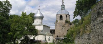
Solovetsky Monastery. Photo by A. I. Nagaev
In the river basin Vaga is known for burial grounds of the 10th–13th centuries. Vym culture, on Vaga and Koksheng - refuge settlements, probably of the same time. By the time the Slavs conquered the territory of A. o. include slav. burial mounds with burials according to the ritual of corpse burning (10th–12th centuries). At the mouth of the North. An 11th-century treasure containing Arabic (Kufic) and Western European treasures was found in Dvina. coins. In the 12th–13th centuries. territory of modern A. o. became part of the Novgorod Republic, the Rostov Principality and the Belozersky Principality. By the 12th century refers to the foundation of the Mikhailo-Arkhangelsk monastery. in the lower reaches of the North. Dvina. In the 14th–15th centuries. to the North In the Dvina and Vaga rivers there were fortified estates of the Novgorod boyars (Orletsy, Pinezhsky town, etc.), forts with settlements arose (Kargopol, Shenkursk), and the Solovetsky Monastery was founded. After entering the territory of modern A. o. at the end of the 15th century. Pustozersk, Kholmogory, etc. were built into the Russian state, and the Anthony-Siysky Monastery was founded.
Farms played an important role in the development of the region. the activities of the Solovetsky Monastery, which was its spiritual, cultural and economic. center, and in the 16th–18th centuries. - a key link in the defense of all Rus. North. Thanks to the Pomors, marine fishing became widespread. In the 1550s, after the “discovery” of English. merchant sailors (R. Chancellor and others) on the way from the West. Europe to the mouth of the river. North Dvina, founded by English. and gol. trading posts moved in the 1580s. to New Port (now Arkhangelsk). During the Time of Troubles on the territory of modern A. o. individual Swedes acted. and Polish-Lithuanian. squads. In the 17th century the region was a major transshipment center for trade. An important event in the history of the region was the Solovetsky Uprising of 1667–76, caused by a split in the Russian Orthodox Church. In 1708–80 and 1784–1929 the territory of modern. A. o. was part of the Arkhangelsk province (until 1780 Arkhangelsk), in 1780–84 – the Vologda governorate (under the name Arkhangelsk region), in 1929–36 – the Northern Territory, in 1936–37 – the Northern region. On September 23, 1937, when the latter was divided, the Arkhangelsk region was formed.
Education
Arkhangelsk is home to one of several Russian federal universities - the Northern Arctic Federal University. NArFU included several Arkhangelsk educational institutions, such as the Technical University and Pomeranian University. There is also the Northern State Medical University, which is one of the best medical institutes in the region. There are many foreigners among the university students.
The region also has award-winning secondary education institutions. For example, the Arkhangelsk City Lyceum named after M.V. Lomonosov. Students annually bring prizes from the All-Russian School Olympiad in subjects such as mathematics, social studies, physics, literature, and chemistry. Many teachers of the lyceum are Honored Teachers of Russia.
Farm
A. o. - one of the industrial regions of the Northern economic. district; industrial volume The cost of production is almost 14 times higher than the volume of agricultural production. products. In the country's economy, it stands out for its developed forestry complex (about 33% of Russian pulp production, 26% of cardboard, 9.7% of lumber, 9% of commercial timber and paper each), shipbuilding and the fishing industry. In the structure of GRP (%, 2003): industry - 39.4, trade - 12.3, transport - 11.4, construction - 10.1, p. x-in – 2.1, communication – 1.3. The ratio of enterprises by type of ownership (by number of organizations;%): private – 66.5, state. and municipal – 17.1, societies. and religious organizations (associations) – 9.8, other forms of ownership – 6.5%.
Economically active us. 763 thousand people, 82% are employed in the economy. Sectoral structure of employment (%): industry 26.7, trade and society. food 14.5, education 10.6, transport 9.4, healthcare 7.8, housing and communal services 6.0, p. agriculture 5.2, construction 4.9, etc. The unemployment rate is 9.9%. Cash income per capita of A. o. – 6.01 thousand rubles. per month (approx. 95% of the Russian average); OK. 30% of us. has income below the subsistence level.
Industry. Industrial volume products 106185 million rubles. (2004). Industry structure of industry production (%): forestry, woodworking and pulp and paper industries 39, fuel - 25, mechanical engineering and metalworking - 19.3, electric power - 8.5, food - 4.8.
Deposits of bauxite (Iksinskoye in the Plesetsk region, etc.), diamonds (named after Lomonosov, 90 km north of Arkhangelsk), oil and gas (Prirazlomnoye) have been explored and exploited. A. o. energy deficient. More than 90% of primary energy resources are imported from other regions, approx. 8% comes from local fuels: firewood, pulp and paper and forest chemical waste. industry, peat (peat briquette plants in Solvychegodsk and Shenkursk). The largest thermal power plants operate in Arkhangelsk, Severodvinsk and Kotlas. In a number of areas of decentralized power supply (mainly in the north), electricity is generated by diesel power plants.
Forest skidding. Photo by M. V. Glazov
A. o. – one of the largest suppliers of timber industry products in the Russian Federation (has a completed production cycle, including logging, woodworking, pulp and paper industries and plywood production). Among the constituent entities of the Russian Federation, the region occupies one of the leading places in the production of lumber, industrial wood, cellulose, cardboard, and paper (Table 1). Basic a timber industry region is an area that gravitates towards the railway. d. Arkhangelsk - Vologda. The largest wood processing enterprises are located in the tundra zone, at the confluence of rivers into the sea, next to the ports for the export of timber. The largest timber processing centers: Arkhangelsk, Novodvinsk, Kotlas and Koryazhma. Chemical Wood processing is carried out by the Arkhangelsk, Kotlas, Solombala pulp and paper mills, as well as the Arkhangelsk and Onega hydrolysis plants. The second largest branch of specialization of the A. o. industry. – shipbuilding (including nuclear submarines, icebreakers). Basic centers for the production and repair of large ships - Severodvinsk (including military ones), Arkhangelsk and Kotlas. On the territory of the region there are State. grew up nuclear shipbuilding center (Severodvinsk; includes the enterprises Sevmash, Zvezdochka, etc.) and the State. will be tested Cosmodrome "Plesetsk" (Mirny). Production of road machines (Sevdormash, Severodvinsk) and equipment for the forestry industry (Solombala Machine-Building Plant, Arkhangelsk). The fishing industry also stands out (over 50% of all food industry products in the region). The annual fish catch is approx. 200 thousand tons (fishing for cod, halibut, haddock, perch, navaga, herring and salmon); More than 120 thousand tons of food fish products and canned food are produced. The number of enterprises in the industry is concentrated in Arkhangelsk; the largest of them is the Arkhangelsk Trawling Fleet Base (75–80% of the catch, about 70% of food fish products). Algae fishing is carried out mainly. in the area of the Solovetsky Islands and about. Zhizhginsky (up to 2000 tons of algae per year; “Arkhangelsk Experimental Algae Plant”). Diamond cutting enterprises (in Koryazhma and Severodvinsk), clothing factories, manufacturing of shoes from natural leather and fur. Ch. prom. centers: Arkhangelsk, Severodvinsk, Novodvinsk, Koryazhma, Onega.
Table 1. Production of the most important types of industrial products
| Products | 1985 | 1990 | 1995 | 2000 | 2003 |
| Electricity, billion kWh | 7 | 7,9 | 5,9 | 5,7 | 6,6 |
| Oil, including gas condensate, million tons | 0 | 1,2 | 2,7 | 4,5 | 7,4 |
| Commercial timber, million dense m3 | 22,8 | 21,6 | 8,3 | 9,1 | 8,4 |
| Lumber, million m3 | 5,8 | 5 | 1,8 | 2 | 1,9 |
| Glued plywood, thousand m3 | 50,3 | 50,4 | 25,4 | 47,1 | 72,3 |
| Fiberboards, million conventional m2 | 20,3 | 22,4 | 13,5 | 18,1 | 18,8 |
| Cellulose (by cooking), million tons | 2,1 | 2,2 | 1,3 | 1,7 | 1,9 |
| Paper, thousand tons | 374 | 397 | 211 | 297 | 333,4 |
| Cardboard, thousand tons | 602 | 628 | 400 | 620 | 705,3 |
| Fish catch and production of other seafood, thousand tons | 336 | 261 | 133 | 198 | 120 |
The products of the timber industry (cellulose, lumber, cardboard, paper) provide approx. 3/4 of the export volume of A. o.; They also export crude oil and shipbuilding products. Imports are dominated by mechanical engineering products (forestry equipment, equipment for the electric power industry, etc.).
Agriculture. Cost of gross output c. holdings 5867.1 million rubles. (2004). In value terms, crop production predominates (56%). Agricultural area land 583.4 thousand hectares (including 46% arable land). A. o. located in a risky farming zone. All in. basic conditions agricultural crops are potatoes and vegetables. Crop production is focused on producing products to meet the needs of the region (Table 2). Ch. agricultural The district is located in the south of the region.
Table 2. Production of main agricultural crops, thousand tons
| 1985 | 1990 | 1995 | 2000 | 2003 | |
| Corn | 105,4 | 98,7 | 42 | 10,6 | 4,5* |
| Potato | 209 | 167 | 434,5 | 460 | 325,7 |
| Vegetables | 32,6 | 27,4 | 72 | 89,6 | 93,6 |
* 2004.
Photo by I. G. Nagaev Grazing near Kholmogory.
The leading branch of livestock farming is dairy and beef cattle breeding (highly productive Kholmogory breed); They also raise pigs, sheep and goats (Table 3), poultry, and deer (in the north). Livestock breeding. Fur farming (Arctic fox, mink); marine hunting.
Table 3. Livestock, thousand heads
| 1985 | 1990 | 1995 | 2000 | 2004 | |
| Cattle | 356,4 | 354,7 | 232,5 | 128,2 | 79,3 |
| Pigs | 133,1 | 176,2 | 77,5 | 26,6 | 23,8 |
| Sheep and goats | — | 92 | 91,5 | 58,3 | 41,2 |
94.5% agricultural land refers to agricultural lands. organizations that provide 62.2% of grain production, 55.3% of livestock and poultry meat. The population's farms produce approx. 94% potatoes, 92% vegetables, approx. 40% livestock and poultry meat and approx. 50% milk (Table 4).
Table 4. Livestock products
| 1985 | 1990 | 1995 | 2000 | 2004 | |
| Livestock and poultry for slaughter, thousand tons | 53,2 | 62,3 | 32,1 | 17,1 | 25,3 |
| Milk, thousand tons | 372,9 | 391,6 | 229,4 | 173,1 | 143,3 |
| Eggs, million pieces | — | 467,4 | 285,3 | 154,8 | 180,3 |
Transport. Transport development of the territory is low. Road transport accounts for approx. 1/2 of the total volume of transported cargo and 95% of all transported passengers. The length of paved roads is 7.23 thousand km. Basic highway - federal highway Arkhangelsk - Vologda. Sea and river transportation are developed. The total length of navigable river routes is 3.8 thousand km, rafting routes - more than 9 thousand km. The most important water transport system is the North. Dvina with tributaries. Sea and river ports: the main ones are Arkhangelsk (provides connections with remote areas of the Nenets Autonomous Okrug and the polar islands), Onega, Mezen, Kotlas (river). The length of the railways is 1.76 thousand km. Ch. railway highway – Arkhangelsk – Moscow. Other important railways: Kotlas - Vologda, Arkhangelsk - Murmansk, Kotlas - Kirov, Arkhangelsk - Karpogory. Airports in Arkhangelsk (international) and Kotlas. By southeast Parts of the region pass through the main gas pipeline Punga - Ukhta - Gryazovets and an oil pipeline from the fields of the Komi Republic. The Nyuksenitsa – Arkhangelsk gas pipeline is under construction (2005), which will supply gas to the region from the territory of the Nenets Autonomous Okrug.
Souvenirs
Traditional souvenirs that tourists should definitely buy are birch bark crafts. As well as various linen products. There are also bone carving traditions in some areas. Jewelry, toys, and various memorable trinkets are made using this technique. In the Kargopol region there is a tradition of producing special clay toys.
Tourists also like to bring special roe gingerbread from the Arkhangelsk region. They are baked only in this region of Russia.
Fine arts and architecture
Interior of the Church of the Intercession in the village of Lyadiny, near Kargopol. 2nd half 18th century Photo by P. S. Pavlinov
Art from the Neolithic, Bronze Age, Early Iron Age (4th millennium BC - 1st millennium AD) is represented by finds of animal figurines (elk, seal, bear, arctic fox) and humans made of flint and horns, clay figurines of birds, ceramics, decorated with stamps, petroglyphs in a limestone grotto near the village. Kurga on the river Pinega (late 1st millennium BC), stone labyrinths of the complex of sanctuaries of the Solovetsky archipelago. Middle-century Finnish art is represented by bronze jewelry (noisy pendants, etc.).
From the 12th century monasteries are being built - Mikhailo-Arkhangelsky (founded in the 12th century), Nikolo-Karelsky (known since the 15th century), Solovetsky Monastery (from 1429), Anthony-Siysky Monastery (from 1520), Artemiev-Verkolsky (founded in 1645), Godfather on Kiy Island (founded in 1656 by Patriarch Nikon), Sursky Ioanno-Bogoslovsky (founded by John of Kronstadt in 1899), etc.
Sretenskaya Church in the village of Rikasovo. 1683–88. Photo by P. S. Pavlinov
Church of the Nativity of the Virgin in Kargopol. 17th century Photo by I. G. Nagaev
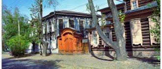
The oldest stone cathedrals: Nativity of Christ (1552–62, carved 5-tier iconostasis of the 18th century) in Kargopol; 5-domed Annunciation (1560–64, frescoes 1600, iconostasis with icons of the Stroganov school of the 17th century) and Vvedensky in the Naryshkin Baroque style (1689) in Solvychegodsk; 5-domed, 6-pillar Spaso-Preobrazhensky with a hipped bell tower (1683–91) and the Bishop's Chambers (1688–89) in the village. Kholmogory, c. Nativity of the Virgin Mary (17th century; bell tower - 19th century) in Kargopol. Monuments of secular architecture have been preserved. arr. in Arkhangelsk. Numerous monuments of wooden architecture: temples of the ancient type (kletsky), single-domed tented, multi-domed, also bridges, wind and water mills, residential buildings, wells, barns, lined up in the form of streets (all 17th - early 20th centuries). Wooden votive and worship crosses are common. In the interiors of churches there are sculptures made of wood, as well as special paintings on the top (the so-called heavens). In icon painting, the influence of the Novgorod school is noticeable - the compositions are small-figured and decorative.
Chip bird. Tree. Photo by A. I. Nagaev
Kargopol toy. 1960s (From the collection of I. G. Nagaev.) Photo by A. I. Nagaev
Nar. crafts: wood painting (Uftyug, Mezen, Pinega, Rakul, Severodvinsk), Kholmogory carved bone (masters N. D. Butorin, P. P. Chernikovich, etc.), wood carving (M. V. Varvarsky, E. M. Shishkin and others) and birch bark (A. I. and V. I. Petukhov, N. A. Sidorov, M. F. and L. V. Fatyanov), weaving from birch bark, creating chipped birds, molded Kargopol toy from clay (U.I. Babkina, I.V., S.E. and E.A. Druzhinin, A.V. Zavyalova, S.I. Ryabov, V.D., K.P. and A.P Shevelyovs and others, also S.S. Klykov from Arkhangelsk), pottery (A.I. and P.I. Zhitnukhins and others), embroidery, embossing, filigree, painted Usolsk enamel (Solvychegodsk region). People's enterprise artist crafts "White Sea Patterns" in Arkhangelsk. In Kenozersky national park (approx. 140 thousand hectares) ensembles of trees. architectures are preserved in nature. landscape, there is a program for the revival of traditions. habitats (including workshops of ancient technologies for making household items). Modern prof. art is represented by graphics (V. S. Vezhlivtsev, S. G. Grigoriev, G. A. and L. V. Elfimov, B. S. Lukoshkov, G. A. Ryabokon, S. N. Syukhin), painting ( I. S. Kotov, D. K. Sveshnikov, D. K. Shiryaev), jewelry works (A. V. Lazurko).
Interesting facts about Arkhangelsk
In the 12th century, the territory that now belongs to the Arkhangelsk region was part of the Novgorod land.
Every year the Margaritin Fair is held in Arkhangelsk; it was the first international fair held in Russia. The first mentions of it date back to the 14th century.
Surprisingly, in the Arkhangelsk region, unlike the rest of Russia, there was never serfdom.
The Russian tricolor was first flown on the sea ship “St. Paul” in Arkhangelsk in 1694, so we can say that the city is the birthplace of the Russian flag. Moreover, it was in Arkhangelsk that the first nautical school in Russia was opened. The opening decree was signed by Catherine the Great. Nowadays it is the Arkhangelsk Naval School.
S. Yu. Witte is an honorary citizen of the city. The Prime Minister of Russia under Nicholas II received the title for insisting on the construction of a railway from Arkhangelsk to Vologda.
Joseph Brodsky served exile in the Arkhangelsk region, Inessa Armand, Alexander Green, Boris Rosing also received exile to the region.
The White Sea used to have other names. For example, at one time it was called Solovetsky, Snake Bay, Studeny, Russian. The Solovetsky Islands, located on the territory of the Arkhangelsk region, are UNESCO World Heritage Sites.
Ioann Kronstadsky Street, located in the center of Arkhangelsk, changed its name several times. At one time it was called Teatralnaya, Shenkurskaya, Pravda Street, and also Khlebny Lane.
The region is home to Russia's largest diamond mining platform.
The railway bridge located in Arkhangelsk is recognized as the northernmost in the world.
Arkhangelsk region: cities and districts, general information on News4Auto.ru.
Our life consists of everyday little things that in one way or another affect our well-being, mood and productivity. I didn’t get enough sleep - my head hurts; I drank coffee to improve the situation and cheer myself up - I became irritable. I really want to foresee everything, but I just can’t. Moreover, everyone around, as usual, gives advice: gluten in bread - don’t go near it, it will kill you; A chocolate bar in your pocket is a direct path to tooth loss. We collect the most popular questions about health, nutrition, diseases and give answers to them that will allow you to better understand what is good for your health.
Transport and roads
The transport network of the Arkhangelsk region cannot be called developed, which is explained by the large size of the territory and the concentration of most of the population in cities. Road transport accounts for more than 50% of all transported goods and more than 90% of passengers (buses).
The main road in the region is the M8 highway "Kholmogory" (Moscow - Severodvinsk). This is a federal highway; there are also three regional highways in the region. There is a project to build a new federal highway St. Petersburg - Arkhangelsk. There are a large number of dirt roads in the Arkhangelsk region.
The total length of railway tracks is 1,760 kilometers. The main railway line is Moscow – Arkhangelsk. All belong to the Northern Railway. In addition to wide-gauge railways, there are also narrow-gauge ones. During the Soviet era, the Arkhangelsk region was among the leaders in the number and length of narrow-gauge railways.
Narrow gauge railway By Leg29 (Own work), via Wikimedia Commons
River and sea transportation are sufficiently developed, the total length of navigable river routes is 3850 kilometers. The main water transport artery is the Northern Dvina. Seaports – Arkhangelsk. Mezen, Onega, river port - Kotlas. However, along river and sea routes, mainly only cargo is transported; passengers are transported in a number of settlements and are of local importance. During the Soviet era, the passenger fleet in the Arkhangelsk region was much better developed.
There are two airports in the Arkhangelsk region: in Arkhangelsk and in Kotlas. There are also small airfields with short runways on the Solovetsky Islands, Onega, Leshukonsky and Mezen.
Map
| Arkhangelsk: maps |
Arkhangelsk: photo from space (Google Maps) Arkhangelsk: photo from space (Microsoft Virtual Earth)
| Arkhangelsk. Nearest cities. Distances in km. on the map (in brackets along roads) + direction. Using the hyperlink in the distance , you can get the route (information courtesy of the AutoTransInfo website) | |||
| 1 | Novodvinsk | 20 (17) | SE |
| 2 | Severodvinsk | 34 (45) | Z |
| 3 | Kholmogory | 65 (69) | SE |
| 4 | Onega | 137 (235) | SW |
| 5 | Savinsky | 180 (294) | YU |
| 6 | Peaceful | 198 (320) | YU |
| 7 | Karpogory | 198 (326) | IN |
| 8 | Plesetsk | 205 (324) | YU |
| 9 | Bereznik | 216 (274) | SE |
| 10 | Severonezhsk | 220 () | YU |
| 11 | Mezen | 225 (494) | NE |
| 12 | Solovetsky | 234 () | Z |
| 13 | Leshukonskoe | 251 (363) | IN |
| 14 | Belomorsk | 275 (1069) | Z |
a brief description of
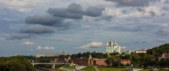
Located on the banks of the Northern Dvina and the islands of its delta, forming the Dvina Bay of the White Sea. Sea and river port. Railway node
In 1970, Arkhangelsk was included in the list of historical cities of Russia. The urban planning value of its heritage is assessed at the regional level. In 2010, it was excluded from the list of historical cities.
The climate is subarctic, maritime. Average temperatures in January are -13, July are +17. Precipitation is about 500 mm per year.
Territory (sq. km): 294
Information about the city of Arkhangelsk on the Russian Wikipedia site
Historical sketch
In a deserted place on the shores of the White Sea at the beginning of the 15th century. A monastery arose in the name of Archangel Michael, but in 1419 all the monks of the monastery were killed and the monastery itself was burned by the Norwegians. Subsequently, the monastery was rebuilt for a long time and with difficulty. Around 1440, the Solovetsky monks began to build their ships in the vicinity of Arkhangelsk for sailing along the White Sea and the Northern Dvina. In 1548 they had their own shipyards here. Apparently, already at that time there was a settlement around the monastery.
After the loss of Narva as a result of defeat in the Livonian War of 1558-1583. it was decided to make the mouth of the Northern Dvina the center of maritime trade relations with other states.
Founded in 1583 by decree of Ivan the Terrible (letter dated March 4, 1583) on the right bank of the Northern Dvina, on Cape Pur-Navolok as a wooden fortress near the St. Michael the Archangel Monastery (founded by the Novgorodians at the end of the 14th century). The official founding date is considered to be 1584, when the city was “established in one year” (according to the “report” of the governor).
In the first decades of the city’s existence, it was called the New City, New Kholmogory, New Kholmogory City. The names were associated with the fact that the role of the main port on the Northern Dvina was transferred to this city from the village of Kholmogory. However, the residents called it Arkhangelsk City after the monastery. Since 1613, the city was officially called Arkhangelsk. Over time, the name is fixed in the form Arkhangelsk.
The first major seaport of the Russian state, and according to the decree of 1585, it was the only city where foreigners were allowed to purchase goods from the interior regions of Russia. In the 17th century its heyday was due to the development of White Sea trade with England and other Western European countries. Since the 1620s there was a foreign colony.
Arkhangelsk was heavily damaged by a fire in 1667 and was rebuilt, mainly with wooden buildings: the house of the governor and commandant, executive chambers, residential estates, and the complex of the St. Michael the Archangel Monastery. One of the first stone buildings is the Gostiny Dvor, both a fortress and a trade building (1668-84, architect D. Startsev).
At the turn of the 17th and 18th centuries, it played an important role in the history of the development of the Russian naval and merchant fleet. Peter I came three times and lived for a long time in Arkhangelsk.
In 1693, Peter I founded a shipyard on the nearby island of Solombala and founded the Admiralty. In connection with the military actions of the Swedish fleet in 1701-05. near Arkhangelsk, Peter I built the first Russian regular Novodvinsk fortress at the Korabelny estuary (now within the city). The fortress is square in plan, with 4 corner bastions. The walls and white stone gates with Baroque decor have been preserved. The city experienced its greatest prosperity in 1700-22. The center of the Arkhangelsk province since 1708, since 1719 the center of the province. Since 1784 the center of the Arkhangelsk governorship (since 1796 Arkhangelsk province).
The decree of 1722 on the transfer of all foreign trade from the Northern Dvina to the Neva temporarily reduced the economic activity of Arkhangelsk. But the city continued to remain the main trading center of the Russian North.
In 1784, the Novodvinskaya fortress was listed as a district-free city of the Arkhangelsk governorship.
In 1762 it was equalized in trade rights with St. Petersburg. In the mid-18th - early 19th centuries. The city's importance increased again, especially in the period 1807-1813, when, due to the Napoleonic wars and the economic, continental blockade of Great Britain, Arkhangelsk became the only port in Russia where foreign goods arrived.
In 1856, in the provincial city of Arkhangelsk, Arkhangelsk province, there were 17 churches, 1950 houses, 440 shops.
At the end of the 19th - beginning of the 20th centuries. the largest timber industry and timber export center in Russia.
In 1918-19 was occupied by British, American and French troops. Liberated in 1920 by units of the Red Army.
Arkhangelsk played a big role in the development of the Arctic and the Northern Sea Route. From here the expeditions of V.Ya. Chichagova, A.M. Sibiryakova, F.P. Litke, V.A. Rusanova, G.Ya. Sedova. On the icebreaking steamer "A. Sibiryak" made the first voyage along the Northern Sea Route in one navigation (1932).
Since 1929 - the center of the Northern Territory, since 1936 - the Northern Region, since 1937 - the Arkhangelsk Region.
In 1932, the village of Solombala (9.0 thousand inhabitants, 1897) was included within the boundaries of Arkhangelsk and the Solombala urban district was formed.
Arkhangelsk included the town of Zenkovichi on Bakaritsa (town from December 27, 1927, 7.0 thousand inhabitants, 1931), Isakogorka (town from December 27, 1927, 5.4 thousand inhabitants, 1931), Tsiglomen (town from December 27, 1927, 7.0 thousand inhabitants, 1931).
Municipal indicators
| Index | 1990 | 1999 | 2001 | 2003 | 2005 |
| Demography | |||||
| Number of births, per 1000 population | 12.1 | 7.9 | 9.4 | 10.7 | 10.3 |
| Number of deaths, per 1000 population | 9.6 | 15.6 | 15.1 | 16 | 14.9 |
| Natural increase (decrease), per 1000 population | 2.5 | -7.7 | -5.7 | -5.3 | -4.6 |
| Standard of living of the population and social sphere | |||||
| Average monthly nominal accrued wages, rub. | 0.336 | 2003 | 4084 | 6783 | 11018.6 |
| Average housing area per inhabitant (at the end of the year), sq.m. | 16 | 20.4 | 20.9 | 21.1 | 21.5 |
| Number of preschool institutions, pcs. | 193 | 84 | 77 | 75 | 74 |
| Number of children in preschool institutions, thousand people | 31 | 13.4 | 14 | 14.3 | 14.8 |
| Enrollment of children in preschool educational institutions (at the end of the year), as a percentage of the number of children of the corresponding age, % | 77.4 | 73.3 | |||
| Number of daytime educational institutions (at the beginning of the school year), pcs. | 69 | 79 | 79 | 74 | 74 |
| Number of students in daytime educational institutions, thousand people | 54.1 | 51.5 | 46 | 39.9 | 34.4 |
| Number of doctors, people. | 2342 | 3629 | 3761 | 3727 | 3732 |
| Number of nursing staff, people. | 6694 | 6480 | 6476 | 6759 | 6879 |
| Number of hospital institutions, pcs. | 25 | 26 | 25 | 26 | 27 |
| Number of hospital beds, thousand units | 7.6 | 6.8 | 6.7 | 6.8 | 6.9 |
| Number of medical outpatient clinics, pcs. | 39 | 39 | 46 | 41 | 43 |
| Capacity of medical outpatient clinics, visits per shift, thousand units. | 12.1 | 15.4 | 15.4 | 15.2 | 16.1 |
| Number of registered crimes, pcs. | 10336 | 8418 | 7983 | 13873 | |
| Persons who committed crimes were identified, persons. | 5207 | 4020 | 2300 | 3218 | |
| Economy, industry | |||||
| Number of enterprises and organizations (at the end of the year), pcs. | 8070 | 9252 | 10432 | 12019 | |
| Number of operating enterprises by type of activity: mining (at the end of the year), pcs. | 6 | ||||
| Number of operating enterprises by type of activity: manufacturing (at the end of the year), pcs. | 172 | ||||
| Number of operating enterprises by type of activity production and distribution of electricity, gas and water (at the end of the year), pcs. | 71 | ||||
| Volume of shipped goods of own production by type of mining (in actual prices), million rubles. | 956.3 | ||||
| Volume of shipped goods of own production by type of manufacturing (in actual prices), million rubles. | 10648.2 | ||||
| Volume of shipped goods of own production by type of production and distribution of electricity, gas and water (in actual current prices), million rubles. | 8828.9 | ||||
| Construction | |||||
| Volume of work performed by type of activity “Construction” (until 2004 - volume of work performed under construction contracts), million rubles. | 0.206 | 571.5 | 858.5 | 2138.5 | 5473.1 |
| Commissioning of residential buildings, thousand sq.m. of total area | 194.2 | 45.4 | 32 | 25 | 29.4 |
| Commissioning of residential buildings, apartments | 695 | 370 | 196 | 425 | |
| Commissioning of preschool institutions, places | 564 | 0 | 0 | 0 | 0 |
| Commissioning of educational institutions, places | 1616 | 0 | 0 | 0 | 0 |
| Commissioning of hospital facilities, beds | 120 | 0 | 0 | 0 | 268 |
| Commissioning of outpatient clinics, visits per shift | 0 | 0 | |||
| Transport | |||||
| Number of bus routes (in intracity traffic), pcs. | 24 | 25 | 22 | 23 | 17 |
| Number of tram routes, pcs. | 5 | 5 | 5 | 1 | 0 |
| Length of operational tram tracks (at the end of the year), km | 23.5 | 33.5 | 21.5 | ||
| Number of trolleybus routes, pcs. | 6 | 4 | 5 | 2 | 3 |
| Length of operational trolleybus lines (at the end of the year), km | 32.4 | 32.6 | 22.2 | ||
| Number of passengers transported by buses per year (in intracity traffic), million people. | 98.1 | 90.1 | 38.4 | 29.2 | 17.6 |
| Number of passengers transported by trams per year, million people. | 46.7 | 77.9 | 23.4 | 9.3 | 0 |
| Number of passengers transported by trolleybuses per year, million people. | 24.2 | 74.1 | 17 | 14.5 | 7.1 |
| Connection | |||||
| Number of telephone sets of the city public telephone network, thousand units. | 53.7 | 60.3 | 60.8 | 119.1 | |
| Number of residential telephone sets of the city public telephone network, thousand units. | 31.1 | 42.3 | 44.4 | 95.5 | |
| Number of payphones of the city telephone network (including universal ones), pcs. | 369 | ||||
| Trade and services to the population | |||||
| Retail trade turnover (in actual prices), million rubles. | 4602.9 | 9504.4 | 14766.5 | 23503.4 | |
| Retail trade turnover (in actual prices), per capita, rub. | 12393 | 26118 | 40916 | 65873 | |
| Index of physical volume of retail trade turnover, % compared to the previous year | 114 | 113 | |||
| Index of physical volume of public catering turnover, % compared to the previous year | 100.7 | 99 | |||
| Number of stores, pavilions (at the end of the year), pcs. | 207 | 310 | |||
| Sales area of shops, pavilions (at the end of the year), sq.m. | 26277.2 | 32425.3 | |||
| Volume of paid services to the population (in actual prices), million rubles. | 0.106 | 1454 | 2926.4 | 5280 | 11358.2 |
| Volume of paid services to the population (in actual prices), per capita, rub. | 0.3 | 3914.9 | 8041.7 | 14630.1 | 31833.5 |
| Volume of household services to the population (in actual prices), million rubles. | 0.033 | 102.3 | 253.9 | 637.1 | 832 |
| Volume of household services to the population (in actual prices), per capita, rub. | 0.083 | 275.4 | 697.7 | 1765.2 | 2331.8 |
| Investments | |||||
| Investments in fixed assets (in actual prices), million rubles. | 0.425 | 1164.9 | 1783.4 | 4279.4 | 5526.1 |
| Share of investments in fixed assets financed from budgetary funds in the total volume of investments, % | 18.4 | 41.8 | 21.3 | 26.3 | |
Data sources:
- Regions of Russia. Main characteristics of the constituent entities of the Russian Federation: statistical collection. Goskomstat of Russia. - M:, 2003.
- Regions of Russia. Basic socio-economic indicators of cities. Statistical collection. Rosstat. - M:, 2005. p. 111
- Transport in Russia: Statistical collection. Goskomstat. - M:, 2003. pp. 110, 112, 120, 122
- Transport in Russia: Statistical collection. Rosstat. - M:, 2005. pp. 117, 119, 127, 129
- Regions of Russia. Basic socio-economic indicators of cities. 2006. Statistical collection. Rosstat. - M:, 2006. p. 111
Culture, science, education
Arkhangelsk State Technical University, Pomor State University named after M.V. Lomonosov, Northern State Medical University. Branch of the State Maritime Academy, etc.
Theaters: Drama named after. M.V. Lomonosov, youth, dolls. Circus (under renovation). Philharmonic.
Museums: local history (founded in 1859), fine arts, State Northern Maritime Museum.
Museums, galleries, exhibition halls
Arkhangelsk Literary Museum 163061, Arkhangelsk, st.
Volodarskogo, 10 Telephone(s): (8182) 43-3426 Arkhangelsk Regional Museum of Local Lore 163061, Arkhangelsk, sq. Lenina, 2 Phone(s) Website: https://www.aokm.ru/
Museum of Aviation of the North 163053, Arkhangelsk, Airport
Museum of Wooden Architecture "Malye Korely" 163000, Arkhangelsk, st. John of Kronstadt, 15 Phone(s): (8182) 20-4164 Website: https://www.korely.ru/
Museum of the ship repair shipyard "Red Forge" 163020, Arkhangelsk, Nikolsky Ave., 15 Telephone(s): 23-1790
Northern Maritime Museum 163061, Arkhangelsk, emb. Northern Dvina, 80 Phone(s): (88182) 20-5516 Website: https://www.sevmormuseum.ru/
Artistic culture of the Russian North 163000, Arkhangelsk, sq. Lenina, 2 Phone(s): (8182) 65-3534 Website: https://www.arhmuseum.ru/
Architecture, sights
The city stretches along the Northern Dvina embankment. From 1794, the city began to be built up according to a regular plan, which included previously constructed stone buildings in the system of a new urban space with wide streets parallel to the embankment. Modern Arkhangelsk, a port city rebuilt according to the 1950 project, retained the basic network of streets, but increased the length along the Northern Dvina to 40 km.
The Gostiny Dvor, the Customs Castle, the tower and the exchange building (late 18th century) have survived. In the northern part of the city, a former garrison settlement, there is the Baroque Trinity Church (1745). A number of surviving wooden houses from the late 19th and early 20th centuries. now moved and reassembled on one of the old streets, which has become a pedestrian conservation area. In the city center there are monuments to M.V. Lomonosov (installed in 1832, sculptor I.P. Martos, 1826-29) and Peter I (installed in 1914, sculptor M.M. Antokolsky, 1872).
Within the city limits of Arkhangelsk there is the island of Solombala - the former naval center of Arkhangelsk, now one of the industrial areas in which old wooden buildings (early 18th century) and the Admiralty building (1820) have been preserved. Stone buildings from the 18th and 19th centuries have been partially preserved.
An important role is played by the reinforced concrete suspension bridge across the river. Kuznechikha (1956), railway bridge (1964), connecting the center of Arkhangelsk with new areas of the left bank, automobile bridge (1990).
In the delta of the Northern Dvina, in the vicinity of Arkhangelsk, there is the old Pomeranian settlement of Konetsdvorie: wooden residential buildings, the tented church of St. Michael the Archangel with a bell tower (1769).
25 km south of Arkhangelsk, upstream of the Northern Dvina, near the villages of Big and Small Karely, there is the Arkhangelsk Museum of Wooden Architecture (collected numerous monuments of the 16th - early 20th centuries from different regions of the Russian North).
75 km from Arkhangelsk is the village of Kholmogory (known since the 14th century). Since 1707, Kolmogory has been a settlement assigned to Arkhangelsk; since 1770, it has been a district town in the Arkhangelsk province. On its southern outskirts is the oldest surviving stone structure of the Lower Dvina - the monumental five-domed Spaso-Preobrazhensky Cathedral with a low hipped bell tower (1683-91) and two-story Bishop's Chambers (1688-89).
| Population by year (thousands of inhabitants) | |||||||
| 1811 | 11.0 | 1956 | 238 | 1995 | 381.9 | 2011 | 348.8 |
| 1840 | 9.6 | 1959 | 256.3 | 1996 | 372.1 | 2012 | 349.5 |
| 1856 | 15.2 | 1962 | 276 | 1997 | 378.2 | 2013 | 351.0 |
| 1863 | 20.2 | 1967 | 310 | 1998 | 367.9 | 2014 | 350.4 |
| 1897 | 20.9 | 1970 | 342.6 | 2000 | 361.8 | 2015 | 351.0 |
| 1913 | 35.4 | 1973 | 362 | 2001 | 357.5 | 2016 | 351.2 |
| 1914 | 36.9 | 1976 | 371 | 2003 | 356.1 | 2017 | 351.5 |
| 1923 | 53.3 | 1979 | 385.0 | 2005 | 351.6 | 2018 | 349.7 |
| 1926 | 75.2 | 1982 | 395 | 2006 | 349.8 | 2019 | 348.3 |
| 1931 | 128.9 | 1986 | 412 | 2007 | 348.6 | 2020 | 347.0 |
| 1934 | 199.0 | 1989 | 415.9 | 2008 | 348.7 | 2021 | 344.9 |
| 1939 | 284.6 | 1992 | 413.6 | 2010 | 348.4 | ||
Literature
- Krogius V.R.
Historical cities of Russia as a phenomenon of its cultural heritage. M.: Progress-Tradition, 2009. p. 198 - Boguslavsky V.V.
Slavic encyclopedia. Kievan Rus - Muscovy: in 2 volumes. T. 1. M.: Olma-Press, 2005. p. 48 - Pospelov E.M.
Geographical names of the world: Toponymic dictionary: About 5000 units. M.: Russian dictionaries, Astrel Publishing House LLC, AST Publishing House LLC, 2001. p. 45 - Ch.
ed. Gorkin A.P. Geography of Russia: encyclopedic dictionary. M.: Great Russian Encyclopedia, 1998. pp. 40-41 - Ch.
ed. Lappo G.M. Cities of Russia: encyclopedia. M.: Great Russian Encyclopedia, 1994. pp. 25-28