Ulyanovsk region
includes 35
urban settlements
, including[1][2]:
- 6 cities, among which the following stand out: 3 cities of regional significance (highlighted in orange in the list) - within the framework of the organization of local self-government they form urban districts;
- 3 cities of district significance - included in districts - within the framework of the organization of local self-government, included in municipal districts;
see also
- Ulyanovsk region
- Cities of Russia
| [ + ] Cities by regions of Russia | |
| Cities of the North-West (NWFD) | St. Petersburg (and its cities) • Leningrad region (historical Staraya Ladoga) • Arkhangelsk region • Vologda region • Kaliningrad region • Karelia • Komi • Murmansk region • Nenets Autonomous Okrug • Pskov region |
| Cities of the Volga region (Volga Federal District) | Bashkortostan • Volgograd region • Kalmykia • Kirov region • Mari El • Mordovia • Nizhny Novgorod region • Orenburg region • Penza region • Perm region • Samara region • Saratov region • Tatarstan • Udmurtia • Ulyanovsk region • Chuvashia |
| Cities of Southern Russia (SFD) | Sevastopol (including Inkerman) • Republic of Crimea • Adygea • Astrakhan region • Krasnodar region • Rostov region |
| Cities of the North Caucasus (NCFD) | Dagestan • Ingushetia • Kabardino-Balkaria • Karachay-Cherkessia • North Ossetia - Alania • Stavropol Territory • Chechen Republic |
| Cities of the Urals (Ural Federal District) | Kurgan region • Sverdlovsk region • Tyumen region • Khanty-Mansi Autonomous Okrug - Yugra • Chelyabinsk region • Yamalo-Nenets Autonomous Okrug |
| Cities of Siberia (Siberian Federal District) | Altai Republic • Altai Territory • Irkutsk Region • Kemerovo Region • Krasnoyarsk Region • Novgorod Region • Novosibirsk Region • Omsk Region • Tomsk Region • Tyva • Khakassia |
| Cities of the Far East (FEFD) | Amur Region • Buryatia • Jewish Autonomous Region • Trans-Baikal Territory • Kamchatka Territory • Magadan Region • Primorsky Territory • Sakha (Yakutia) • Sakhalin Region • Khabarovsk Territory • Chukotka Autonomous Region |
| see also | Cities of the DPR, LPR, Transnistria, South Ossetia • Regions of Russia • Cities of Russia |
General information about the Ulyanovsk region
Distinctive features . The Ulyanovsk region is officially (at the trademark level) considered the “Aviation Capital of Russia”. Indeed, here is the largest aviation enterprise, Aviastar-SP, which produces Tu-204 passenger aircraft, and is preparing to produce Ruslan transport aircraft. If we talk about mechanical engineering in general, it occupies 15% of the region’s gross structure. In addition to aircraft, the Ulyanovsk region produces world-famous air defense systems (Shilka, Tunguska-M, etc.) and no less famous UAZ SUVs. The nuclear innovation cluster is developed in Dimitrovgrad, the second largest city in the region.
Aircraft production at Avistar-SP. Photo by Andrey Pozdeev
Despite its small area, the Ulyanovsk region has given Russia and the world many celebrities. This is the leader of the revolution Vladimir Ulyanov (Lenin), Russian historian Karamzin, hero of the Patriotic War of 1812, poet, hussar and partisan Denis Davydov, writer Ivan Goncharov... And this is not a complete list! Moreover, the Ulyanovsk region is considered the birthplace of the hero of the Russian fairy tale - Kolobok.
Geographical location . The Ulyanovsk region is located in the center of the middle Volga region. It borders on the Samara, Saratov, Penza regions, as well as the republics of Mordovia, Chuvashia and Tatarstan. The Ulyanovsk region is part of the Volga Federal District.
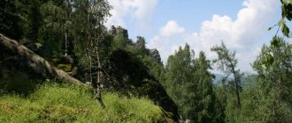
The main river of the region is the Volga, which passes through the Kuibyshev Reservoir - the largest for this river. The Volga divides the territory of the region into two parts - the Right Bank and the Left Bank. On the right bank there is the Volga Upland, and the left bank (Trans-Volga region) is a lowland. Forests occupy about 25% of the territory of the Ulyanovsk region.
Bridge over the Volga. Photo by Ekaterina Kuleshova (https://fotki.yandex.ru/users/ekaterinacooleshova/)
Population. Once upon a time, the lands of the Ulyanovsk region were part of Volga Bulgaria. Turkic nomads and Finno-Ugric tribes lived here side by side. Now the national composition is as follows: 70% of the population are Russians, and then come the peoples of the Volga region: Tatars (11.59%), Chuvash (7.52%), Mordovians (3%).
Dimitrovgrad - the cultural capital of small nations of Russia
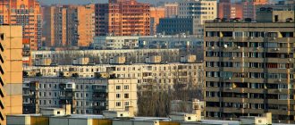
Currently, 1,274,487 people live in the Ulyanovsk region. 74% of them live in cities. Unfortunately, the natural population decline (-2.8 people per 1000 inhabitants) leads to the gradual extinction of the region. Over the past 20 years, the population has been steadily declining. But life expectancy is increasing every year: in 2012 it was 68.5 years.
Crime . The 66th place of the Ulyanovsk region in the ranking of regions by the number of crimes committed eloquently indicates that the criminal situation in the region is calm. Not many criminal offenses are recorded here, but high-profile corruption scandals occasionally appear.
The unemployment rate in the Ulyanovsk region almost exactly coincides with the average for the Russian Federation - 5.57%. The average salary in the region is 16.5 thousand rubles, and the highest salaries are for those involved in the extraction of fuel and energy minerals (34 thousand rubles)
Property value. The average cost of one square meter in Ulyanovsk is 44.5 thousand rubles. According to this indicator, it is comparable to Omsk, Krasnodar or Saratov. Prices for one-room apartments in Ulyanovsk start from 1.4 million rubles. Two-room apartments are much more expensive, around 2 million rubles.
On the streets of Ulyanovsk. Photo by koartemvl (https://fotki.yandex.ru/users/koartemvl/)
The climate of the Ulyanovsk region is temperate continental. The average temperature of the warmest month of July is +21°С, the average temperature of January is −7°С. In winter, Arctic and Atlantic air masses alternate here, so temperature changes are not uncommon. The average annual precipitation is 350-500 mm, depending on the area.
Urban settlements[ | ]
| № | Name | district[4] | population (persons) |
| 1 | Bazarny Syzgan | Bazarnosyzgansky district | ↘4672[3] |
| 2 | Veshkaima | Veshkaimsky district | ↘5459[3] |
| 3 | Gultovka | Inzensky district | ↘1815[3] |
| 4 | Zhadovka | Baryshsky district | ↘1543[3] |
| 5 | Ignatovka | Mainsky district | ↘1805[3] |
| 6 | Izmailovo | Baryshsky district | ↘1900[3] |
| 7 | named after V.I. Lenin | Baryshsky district | ↘2045[3] |
| 8 | Isheevka | Ulyanovsk district | ↘10 857[3] |
| 9 | Karsun | Karsun district | ↘7212[3] |
| 10 | Red Gulyai | Sengileevsky district | ↘2691[3] |
| 11 | Kuzovatovo | Kuzovatovsky district | ↘7388[3] |
| 12 | Maina | Mainsky district | ↘5821[3] |
| 13 | Mullovka | Melekessky district | ↘5346[3] |
| 14 | Nikolaevka | Nikolaevsky district | ↘5728[3] |
| 15 | New Maina | Melekessky district | ↘5272[3] |
| 16 | Novospasskoe | Novospassky district | ↘10 583[3] |
| 17 | Pavlovka | Pavlovsky district | ↘5023[3] |
| 18 | Radishchevo | Radishchevsky district | ↘3959[3] |
| 19 | Silicate | Sengileevsky district | ↘2632[3] |
| 20 | Staraya Kulatka | Starokulatkinsky district | ↘4565[3] |
| 21 | Old Maina | Staromainsky district | ↘5922[3] |
| 22 | Starotimoshkino | Baryshsky district | ↘3305[3] |
| 23 | Surskoye | Sursky district | ↘6008[3] |
| 24 | Terenga | Terengulsky district | ↘4715[3] |
| 25 | Tsemzavod | Sengileevsky district | ↘960[3] |
| 26 | Tsilna | Tsilninsky district | ↘3613[3] |
| 27 | Attics | Cherdaklinsky district | ↘11 132[3] |
| 28 | Chufarovo | Veshkaimsky district | ↘1695[3] |
| 29 | Linguistically | Karsun district | ↘3365[3] |
Former town[ | ]
- Barysh has been a town since 1938. Incorporated into a city in 1954.
- Guryevka has been a town since 1938. Incorporated into the city of Barysh in 1954.
- Inza has been a town since 1928. Incorporated into a city in 1946.
- Canaday has been a town since 1974. Transformed into a rural settlement in 2003[6].
- Melovaya has been a town since 1994. Converted to a rural settlement in 1995.
- Nikolskoye-on-Cheremshan has been a town since 1968. Transformed into a rural settlement in 2003[6].
- Novoulyanovsk has been a town since 1961. Incorporated into a city in 1967.
- Novocheremshansk has been a town since 1940. Until 1962 it was called Old Salavan. Transformed into a rural settlement in 2003[7].
- Oktyabrsky has been a town since 1971. Converted to a rural settlement in 2009.
- Sengilei has been a town since 1936. Incorporated into a city in 1943.
Map
| Ulyanovsk: maps |
Ulyanovsk: photo from space (Google Maps) Ulyanovsk: photo from space (Microsoft Virtual Earth)
| Ulyanovsk Nearest cities. Distances in km. on the map (in brackets along roads) + direction. Using the hyperlink in the distance , you can get the route (information courtesy of the AutoTransInfo website) | |||
| 1 | Isheevka | 15 (19) | NW |
| 2 | Novoulyanovsk | 18 (25) | IN |
| 3 | October | 20 (13) | IN |
| 4 | Attics | 30 (31) | IN |
| 5 | Bolshoye Nagatkino | 34 (40) | NW |
| 6 | Old Maina | 46 (61) | NE |
| 7 | Sengilei | 47 (67) | SE |
| 8 | Maina | 54 (106) | SW |
| 9 | Terenga | 66 (68) | YU |
| 10 | Mullovka | 67 (69) | IN |
| 11 | Staroe Drozhzhanoe (Republic of Tatarstan) | 70 (86) | NW |
| 12 | Buinsk | 72 (94) | WITH |
| 13 | Tetyushi | 74 (99) | NE |
| 14 | Dimitrovgrad | 79 (85) | IN |
| 15 | Bulgarian | 83 (124) | NE |
| 16 | Shemursha (Chuvash Republic - Chuvashia) | 84 (91) | NW |
| 17 | Starotimoshkino | 86 () | SW |
| 18 | Veshkaima | 86 (108) | Z |
| 19 | Karsun | 91 (85) | Z |
| 20 | New Maina | 91 (97) | IN |
| 21 | Batyrevo (Chuvash Republic - Chuvashia) | 96 (111) | NW |
| 22 | Shygyrdan (Chuvash Republic - Chuvashia) | 97 () | NW |
| 23 | Kuzovatovo | 97 (107) | SW |
| 24 | Yalchiki (Chuvash Republic - Chuvashia) | 97 (124) | WITH |
| 25 | Apastovo (Republic of Tatarstan) | 99 (128) | WITH |
| 26 | New Malykla | 101 (109) | IN |
| 27 | Shigony (Samara region) | 105 (165) | YU |
| 28 | Surskoye | 109 (120) | Z |
| 29 | Barysh | 111 (142) | SW |
| 30 | Tolyatti | 111 (184) | SE |
a brief description of
Located on the Volga Upland, on the banks of the Volga (Kuibyshev Reservoir) and Sviyaga rivers, 893 km east of Moscow. River port. Railway junction lines and highways.
The climate is moderate continental. The average temperature in January is -14, July is +20. Precipitation is over 400 mm per year.
Territory (sq. km): 622
Information about the city of Ulyanovsk on the Russian Wikipedia site
Historical sketch
In 1648, during the construction of the Sinbirsk abatis line, the city of Sinbirsk was founded as its starting point. The name of the feature and the city is based on its location in the Sinbir Mountains area, which received its name from the Sinbir settlement (20 km to the south on the left bank of the Volga). Its name is based on the name of the Tatar prince Sinbar from the times of the Golden Horde or the Kazan Khanate. But the use of the suffix -sk allows us to more likely see the formation from a common noun, possibly from an ethnonym.
The fortress was founded on the steep bank of the Volga, called Venets (height more than 120 m), by okolnichy and governor B.M. Khitrovo and clerk G. Kunakov.
In 1670 it was besieged by the troops of Stepan Razin. In 1773 and 1774, Emelyan Pugachev was kept in custody in the Sinbirsky prison.
The name Sinbirsk was used in charters and acts until the end of the 18th century, and in popular usage it remained until the end of the 19th century. From the end of the 18th century. The Simbirsk uniform receives official recognition.
In 1708 it was assigned to the Kazan province, from 1717 - in the Astrakhan province, in 1728 again in the Kazan province, the center of the Sinbir province. Since 1780, the center of the Simbirsk governorship (since 1796 - Simbirsk province).
In the 19th century one of the major centers of trade in bread, fish, livestock, and timber in the Volga region.
In the 1790s. The first public theater was opened in Simbirsk in the 1840s. a theater school was built.
In 1856, in the provincial city of Simbirsk, Simbirsk province, there were 26 churches, 2613 houses, 677 shops.
In 1898 it was connected by railway with Inza, at the beginning of the 20th century. - with Bugulma.
In 1924, it was renamed Ulyanovsk after the name of local native V.I. Ulyanov-Lenin (1870-1924).
Since 1928 it was part of the Middle Volga region (then the region), since 1936 - into the Kuibyshev region. Since 1943, the center of the Ulyanovsk region.
During the Great Patriotic War of 1941-45, a number of industrial enterprises were evacuated to Ulyanovsk.
Municipal indicators
| Index | 1990 | 1999 | 2001 | 2003 | 2005 |
| Demography | |||||
| Number of births, per 1000 population | 14.8 | 7.2 | 8 | 9.1 | 8.8 |
| Number of deaths, per 1000 population | 8.4 | 11.3 | 12.5 | 13.9 | 13.6 |
| Natural increase (decrease), per 1000 population | 6.4 | -4.1 | -4.5 | -4.8 | -4.8 |
| Standard of living of the population and social sphere | |||||
| Average monthly nominal accrued wages, rub. | 0.27 | 1153.9 | 2410 | 4345.8 | 6702.8 |
| Average housing area per inhabitant (at the end of the year), sq.m. | 15.7 | 18.7 | 19.1 | 20.3 | 20.8 |
| Number of preschool institutions, pcs. | 254 | 153 | 140 | 133 | 129 |
| Number of children in preschool institutions, thousand people | 44.4 | 18.2 | 17.4 | 17 | 18.1 |
| Enrollment of children in preschool educational institutions (at the end of the year), as a percentage of the number of children of the corresponding age, % | 60.8 | 59.7 | |||
| Number of daytime educational institutions (at the beginning of the school year), pcs. | 91 | 107 | 108 | 108 | 109 |
| Number of students in daytime educational institutions, thousand people | 85 | 97.3 | 87.6 | 74.8 | 61.7 |
| Number of doctors, people. | 3144 | 3588 | 3540 | 3415 | 3252 |
| Number of nursing staff, people. | 9295 | 11137 | 10784 | 11259 | 10418 |
| Number of hospital institutions, pcs. | 26 | 31 | 30 | 28 | 31 |
| Number of hospital beds, thousand units | 9.3 | 9.8 | 9.2 | 8.7 | 8.4 |
| Number of medical outpatient clinics, pcs. | 48 | 56 | 60 | 62 | 67 |
| Capacity of medical outpatient clinics, visits per shift, thousand units. | 16.6 | 18.2 | 18.4 | 18.3 | 19.6 |
| Number of registered crimes, pcs. | 7403 | 9710 | 10349 | 8380 | 13698 |
| Persons who committed crimes were identified, persons. | 6402 | 5919 | 3891 | 4770 | |
| Economy, industry | |||||
| Number of enterprises and organizations (at the end of the year), pcs. | 10286 | 12338 | 14637 | 17136 | |
| Number of operating enterprises by type of activity: mining (at the end of the year), pcs. | 6 | ||||
| Number of operating enterprises by type of activity: manufacturing (at the end of the year), pcs. | 572 | ||||
| Number of operating enterprises by type of activity production and distribution of electricity, gas and water (at the end of the year), pcs. | 112 | ||||
| Volume of shipped goods of own production by type of mining (in actual prices), million rubles. | 3.5 | ||||
| Volume of shipped goods of own production by type of manufacturing (in actual prices), million rubles. | 34230.3 | ||||
| Volume of shipped goods of own production by type of production and distribution of electricity, gas and water (in actual current prices), million rubles. | 8847.4 | ||||
| Construction | |||||
| Volume of work performed by type of activity “Construction” (until 2004 - volume of work performed under construction contracts), million rubles. | 0.4 | 1790.1 | 2917.4 | 2906.9 | 3594.8 |
| Commissioning of residential buildings, thousand sq.m. of total area | 345.8 | 139.5 | 124.4 | 112.7 | 202.7 |
| Commissioning of residential buildings, apartments | 1963 | 1556 | 1528 | 2652 | |
| Commissioning of preschool institutions, places | 2938 | 0 | 0 | 0 | 0 |
| Commissioning of educational institutions, places | 4322 | 0 | 0 | 0 | 0 |
| Commissioning of hospital facilities, beds | 300 | 0 | 0 | 0 | 0 |
| Commissioning of outpatient clinics, visits per shift | 0 | 30 | 0 | 40 | |
| Transport | |||||
| Number of bus routes (in intracity traffic), pcs. | 58 | 47 | 45 | 28 | 23 |
| Number of tram routes, pcs. | 9 | 17 | 17 | 16 | 14 |
| Length of operational tram tracks (at the end of the year), km | 53.1 | 59.3 | 59.3 | ||
| Number of trolleybus routes, pcs. | 7 | 9 | 9 | 7 | 7 |
| Length of operational trolleybus lines (at the end of the year), km | 26 | 27.3 | 27.3 | ||
| Number of passengers transported by buses per year (in intracity traffic), million people. | 116.5 | 60.1 | 42.5 | 14.2 | 8.3 |
| Number of passengers transported by trams per year, million people. | 122.9 | 178 | 180.4 | 132.1 | 70.8 |
| Number of passengers transported by trolleybuses per year, million people. | 14.9 | 29.2 | 29 | 29.3 | 13.5 |
| Connection | |||||
| Number of telephone sets of the city public telephone network, thousand units. | 79.7 | 130.7 | 146.2 | 200 | 234.4 |
| Number of residential telephone sets of the city public telephone network, thousand units. | 39.9 | 92.6 | 100.8 | 154.7 | 193.9 |
| Number of payphones of the city telephone network (including universal ones), pcs. | 1292 | 1162 | |||
| Trade and services to the population | |||||
| Retail trade turnover (in actual prices), million rubles. | 1 | 7159.8 | 12398 | 21141 | 27784 |
| Retail trade turnover (in actual prices), per capita, rub. | 1.6 | 10342 | 18134 | 32390 | 43317.8 |
| Index of physical volume of retail trade turnover, % compared to the previous year | 110 | 101.4 | |||
| Index of physical volume of public catering turnover, % compared to the previous year | 82.3 | 91.4 | |||
| Number of stores, pavilions (at the end of the year), pcs. | 526 | 532 | |||
| Sales area of shops, pavilions (at the end of the year), sq.m. | 32007.1 | 39610 | |||
| Volume of paid services to the population (in actual prices), million rubles. | 0.186 | 1472.1 | 3409.7 | 6130.5 | 9992.3 |
| Volume of paid services to the population (in actual prices), per capita, rub. | 0.3 | 2126 | 4987 | 9393 | 15579 |
| Volume of household services to the population (in actual prices), million rubles. | 0.043 | 318.9 | 634.4 | 684.1 | 833.9 |
| Volume of household services to the population (in actual prices), per capita, rub. | 0.067 | 460.7 | 928 | 1048 | 1300 |
| Investments | |||||
| Investments in fixed assets (in actual prices), million rubles. | 0.648 | 1141 | 2051.4 | 3925.1 | 4713.4 |
| Share of investments in fixed assets financed from budgetary funds in the total volume of investments, % | 9.6 | 10.9 | 11.9 | 17 | |
Data sources:
- Regions of Russia. Main characteristics of the constituent entities of the Russian Federation: statistical collection. Goskomstat of Russia. - M:, 2003.
- Regions of Russia. Basic socio-economic indicators of cities. Statistical collection. Rosstat. - M:, 2005.
- Transport in Russia: Statistical collection. Goskomstat. - M:, 2003. pp. 110, 112, 120, 122
- Transport in Russia: Statistical collection. Rosstat. - M:, 2005. pp. 117, 119, 127, 129
- Regions of Russia. Basic socio-economic indicators of cities. 2006. Statistical collection. Rosstat. - M:, 2006. p. 255
Culture, science, education
Institutes: pedagogical, polytechnic, agricultural.
Higher Aviation School of Civil Aviation. Branches of Moscow State University and Samara Economic Institute.
Theatres: drama, puppet theaters.
Museums: local history (founded in 1895), art, history of civil aviation.
The poet N.M. was born in the city. Yazykov, writers D.V. Grigorovich, A.I. Goncharov.
Monument to N.M. Karamzin (1845, sculptor S.I. Galberg) - a native of the Simbirsk province. Monuments: “M.A. Ulyanov with his son Volodya”, to Karl Marx (1921), V.I. Lenin (1940), V. Ulyanov - high school student (1954), I.N. Ulyanov (1957), N. Narimanov (1973).
Architecture, sights
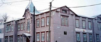
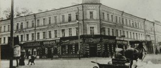
Buildings: public places (1807, architect A.D. Zakharov), Assembly of the Nobility (1838-47, architect I.A. Benzeman), Yazykov House (early 19th century), military gymnasium (1877, architect Zalessky) , Public Assembly (1910), Peasant Land Bank (1911, architect F.O. Livchak), house of I.A. Goncharova (1916, architect A.A. Shode), etc.
In the 1960-70s. The central part of Ulyanovsk was reconstructed, where the Lenin Memorial Zone was created (1967-70), including elements of old Simbirsk (mainly houses associated with the life of the Ulyanov family in the city) and the ensemble of the Lenin Memorial Center.
River station (1965), railway station (1970)
| Population by year (thousands of inhabitants) | |||||||
| 1811 | 13.3 | 1956 | 183 | 1992 | 656.4 | 2011 | 614.8 |
| 1840 | 17.7 | 1959 | 205.9 | 1996 | 680.2 | 2012 | 614.4 |
| 1856 | 26.5 | 1962 | 239 | 1998 | 675.6 | 2013 | 615.3 |
| 1863 | 24.9 | 1967 | 294 | 2000 | 667.4 | 2014 | 616.7 |
| 1897 | 41.7 | 1970 | 351.1 | 2001 | 663.6 | 2015 | 619.5 |
| 1913 | 54.7 | 1973 | 395 | 2003 | 635.9 | 2016 | 621.5 |
| 1914 | 55.2 | 1976 | 429 | 2005 | 623.1 | 2017 | 624.5 |
| 1923 | 68.7 | 1979 | 464.0 | 2006 | 617.2 | 2018 | 626.5 |
| 1926 | 70.6 | 1982 | 497 | 2007 | 611.7 | 2019 | 627.9 |
| 1931 | 68.9 | 1986 | 566 | 2008 | 607.0 | 2020 | 627.7 |
| 1939 | 103.8 | 1989 | 625.2 | 2010 | 602.8 | 2021 | 625.5 |
How many people live in the Ulyanovsk region, census
| Year | Growth/decrease population Ulyanovsk region |
| 2017 | ↘1,252,887 people |
| 2018 | ↘1,246,618 people |
| 2019 | ↘1,238,416 people |
| 2020 | ↘1,229,824 people |
| 2021 | ↘1,218,319 people |
| 2022 |
Tarot card forecast by Angela Pearl for 2022, all zodiac signs
Flower grower's lunar calendar 2022, the best days to plant flowers
Health calendar 2022 lunar, favorable days for well-being
More accurate information on the population census of the Ulyanovsk region as of January 1, 2022, what is the number of people living in cities, villages and towns (urban settlements) according to statistics, will appear later, after which we will present it to you, but for now, use what is currently available , with the figures available in official sources, which we offer you.
Cities
| № | Name | district[4] / city of regional significance[5] | population (persons) | founding/first mention | city status | coat of arms | former names |
| 1 | Barysh | Baryshsky district | ↘15 408[3] | 17th century | 1954 | ||
| 2 | Dimitrovgrad | Dimitrovgrad (GO) | ↘112 388[3] | 1698 | 1926 | until 1972 - Melekess | |
| 3 | Inza | Inzensky district | ↘17 016[3] | 1897 | 1946 | ||
| 4 | Novoulyanovsk | Novoulyanovsk (GO) | ↘13 588[3] | 1957 | 1967 | Kremenki | |
| 5 | Sengilei | Sengileevsky district | ↘6182[3] | 1666 | 1943 | until 1780 - Pokrovskoye | |
| 6 | Ulyanovsk | Ulyanovsk (GO) | ↘625 462[3] | 1648 | 1648 | until 1780 - Sinbirsk until 1924 - Simbirsk |
Residents of the Ulyanovsk region, how many live in cities, towns, villages
With the official population of cities, towns (towns) and villages of the Ulyanovsk region on January 1, 2022, how many people live in this territory, people in each settlement of this territorial unit of the Russian Federation, that’s what we figured out here, made our contribution to the satisfaction requests from those interested in this statistical information.
Gardener's lunar calendar for 2022, sowing table
Calendar of church holidays 2022, what are they today, tomorrow
Cities[ | ]
| № | Name | district[4] / city of regional significance[5] | population (persons) | founding/first mention | city status | coat of arms | former names |
| 1 | Barysh | Baryshsky district | ↘15 408[3] | 17th century | 1954 | ||
| 2 | Dimitrovgrad | Dimitrovgrad (GO) | ↘112 388[3] | 1698 | 1926 | until 1972 - Melekess | |
| 3 | Inza | Inzensky district | ↘17 016[3] | 1897 | 1946 | ||
| 4 | Novoulyanovsk | Novoulyanovsk (GO) | ↘13 588[3] | 1957 | 1967 | Kremenki | |
| 5 | Sengilei | Sengileevsky district | ↘6182[3] | 1666 | 1943 | until 1780 - Pokrovskoye | |
| 6 | Ulyanovsk | Ulyanovsk (GO) | ↘625 462[3] | 1648 | 1648 | until 1780 - Sinbirsk until 1924 - Simbirsk |
Ulyanovsk
(Ulyanovsk region)
OKATO code:
73401
Founded:
1648
City since:
1648 City of regional subordination
Center:
Ulyanovsk region
Urban areas, population as of 01/1/2021
| Railway | 83.8 | Zasviyazhsky | 225.4 |
| Zavolzhsky | 223.7 | Leninist | 114.9 |
| The city was formerly called: | ||
| Simbirsk | 1924 | |
| Telephone code (reference phone) | |
| 8422****** | 64-98-10 |
Deviation from Moscow time, hours:
1
Geographic latitude:
54°19′
Geographic longitude:
48°23′
Altitude above sea level, meters:
140 Sunrise and sunset times in the city of Ulyanovsk