Population[ | ]
| Population | |||||||||
| 1959[3] | 1970[4] | 1979[5] | 1987[6] | 1989[7] | 1990[8] | 1991[8] | 1992[8] | 1993[8] | 1994[8] |
| 1 036 387 | ↗1 144 918 | ↗1 233 435 | ↗1 361 000 | ↗1 377 975 | ↘1 320 562 | ↘1 317 948 | ↘1 307 810 | ↘1 283 764 | ↘1 269 690 |
| 1995[8] | 1996[8] | 1997[8] | 1998[8] | 1999[8] | 2000[8] | 2001[8] | 2002[9] | 2003[8] | 2004[8] |
| ↘1 256 389 | ↘1 247 668 | ↘1 234 397 | ↘1 219 795 | ↘1 207 030 | ↘1 192 819 | ↘1 178 824 | ↘1 155 346 | ↘1 152 596 | ↘1 143 876 |
| 2005[8] | 2006[8] | 2007[8] | 2008[8] | 2009[8] | 2010[10] | 2011[8] | 2012[11] | 2013[12] | 2014[13] |
| ↘1 135 721 | ↘1 128 238 | ↘1 122 104 | ↘1 118 931 | ↘1 117 030 | ↘1 107 107 | ↘1 106 155 | ↘1 099 396 | ↘1 095 169 | ↘1 090 344 |
| 2015[14] | 2016[15] | 2017[16] | 2018[17] | 2019[18] | 2020[2] | 2021[19] | 2022[1] | ||
| ↘1 087 452 | ↘1 083 012 | ↘1 078 983 | ↘1 072 806 | ↘1 065 785 | ↘1 059 700 | ↘1 053 485 | ↘1 042 993 | ||
Ratio of men and women (data from Rosstat[20])
| Year | Number of women per 1000 men |
| 2005 | 1092 |
| 2010 | 1091 |
| 2011 | 1091 |
| 2012 | 1090 |
| 2013 | 1089 |
| 2014 | 1088 |
| 2015 | 1087 |
| 2016 | 1087 |
| 2017 | 1087 |
Climate
The climate of the region, like most of Eastern Siberia, is sharply continental with insufficient precipitation.
Winters are long and harsh, summers are short and warm, dry in the first half and wet in the second. Fluctuations in daily and annual temperatures are large, in some areas the annual range is 94°C or more. The transition seasons spring and autumn are short. The average January temperature is -20°C in the south and -37°C in the north. The average July temperature is +13°C in the north to +21°C in the south. The frost-free period averages 80-140 days. Also a characteristic feature of the climate is the significant duration of sunshine per year, up to 2600 hours, while, for example, in Sochi the average annual number of hours of sunshine is 2154 hours.
Demographics[ | ]
| Fertility (number of births per 1000 population) | ||||||||
| 1970[21] | 1975[21] | 1980[21] | 1985[21] | 1990[21] | 1995[21] | 1996[21] | 1997[21] | 1998[21] |
| 18 | ↗21,2 | ↗21,3 | ↘20,5 | ↘16,7 | ↘12,2 | ↘11,3 | ↘11 | ↗11,7 |
| 1999[21] | 2000[21] | 2001[21] | 2002[21] | 2003[22] | 2004[22] | 2005[22] | 2006[22] | 2007[23] |
| ↘10,9 | ↗11,1 | ↗11,7 | ↗12,3 | ↗13,5 | ↗13,8 | ↘13,5 | ↗13,9 | ↗14,9 |
| 2008[23] | 2009[23] | 2010[23] | 2011[24] | 2012[25] | 2013[26] | 2014[27] | ||
| ↗15,9 | →15,9 | →15,9 | ↘15,4 | ↗16,1 | ↘15,9 | ↗16 | ||
| Mortality rate (number of deaths per 1000 population) | ||||||||
| 1970[28] | 1975[28] | 1980[28] | 1985[28] | 1990[28] | 1995[28] | 1996[28] | 1997[28] | 1998[28] |
| 7,4 | ↗8,4 | ↗9,5 | ↘9,2 | ↘8,7 | ↗12,8 | ↘12,4 | ↘12 | ↘11,6 |
| 1999[28] | 2000[28] | 2001[28] | 2002[28] | 2003[29] | 2004[29] | 2005[29] | 2006[29] | 2007[30] |
| ↗13,6 | ↗13,7 | ↗14,4 | ↗15,2 | ↗16,8 | ↗17,1 | ↗17,2 | ↘15,5 | ↘14,4 |
| 2008[30] | 2009[30] | 2010[30] | 2011[31] | 2012[32] | 2013[33] | 2014[34] | ||
| ↘14,3 | ↘13,7 | ↗13,8 | ↘13,2 | ↘13 | ↘12,5 | ↘12,4 | ||
| Natural population growth (per 1000 population, sign (-) means natural population decline) | ||||||||
| 1970[35] | 1975[36] | 1980[37] | 1985[38] | 1990[39] | 1995[40] | 1996[41] | 1997[42] | 1998[43] |
| 10,6 | ↗12,8 | ↘11,8 | ↘11,3 | ↘8 | ↘−0,6 | ↘−1,1 | ↗−1 | ↗0,1 |
| 1999[44] | 2000[45] | 2001[46] | 2002[47] | 2003[48] | 2004[48] | 2005[48] | 2006[48] | 2007[49] |
| ↘−2,7 | ↗−2,6 | ↘−2,7 | ↘−2,9 | ↘−3,3 | →−3,3 | ↘−3,7 | ↗−1,6 | ↗0,5 |
| 2008[49] | 2009[49] | 2010[49] | 2011[50] | 2012[51] | 2013[52] | 2014[53] | ||
| ↗1,6 | ↗2,2 | ↘2,1 | ↗2,2 | ↗3,1 | ↗3,4 | ↗3,6 | ||
| Life expectancy at birth (number of years) | ||||||||
| 1990[54] | 1991[54] | 1992[54] | 1993[54] | 1994[54] | 1995[54] | 1996[54] | 1997[54] | 1998[54] |
| 66,8 | ↗67 | ↘65,5 | ↘61,5 | ↘59,7 | ↗61,5 | ↗62,3 | ↗63,3 | ↗64,2 |
| 1999[54] | 2000[54] | 2001[54] | 2002[54] | 2003[54] | 2004[54] | 2005[54] | 2006[54] | 2007[54] |
| ↘61,7 | ↘61,5 | ↘60,3 | ↘59,8 | ↘59,7 | ↘59,3 | →59,3 | ↗61,4 | ↗63 |
| 2008[54] | 2009[54] | 2010[54] | 2011[55] | 2012[55] | 2013[55] | |||
| ↗63,8 | ↗64,7 | ↗64,8 | ↗65,8 | ↗66,2 | ↗67,1 | |||
Religion
On the territory of the Transbaikal region there are traditional beliefs of the indigenous peoples of Transbaikalia (from generalized Shamanism to Totemism, Animism, Animalism and Fetishism).
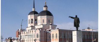
From the 13th century, under Kublai Khan, Buddhism began to spread among the Mongolian tribes. The mass adoption of Buddhism begins after the publication in 1577 of the religious manifesto “The Laws of the Teachings of the Buddha, Possessing Ten Virtues” (Bur. Arban buyany tsaaz). In 1741, Empress Elizabeth Petrovna issued a decree approving the staffing table. The lamas were sworn to allegiance to Russia, and Buddhism thus became one of the official religions of the Russian Empire. The first datsan in the region was Tsugolsky, built in the village of Tsugol in 1801.
Since the 17th century, Orthodoxy came to the region with the penetration of the Russian-speaking population. During these times, after the Church Schism, mainly Old Believers and Old Believers settled in Transbaikalia. The first Orthodox Church, Mikhailo-Arkhangelskaya, was built in 1776 in the Chita fortress. The independent Transbaikal diocese was formed in 1894.
Protestantism, Lutheranism and other Christian religions appeared in Transbaikalia with the beginning of construction of the Trans-Siberian Railway here. Judaism and Islam also take place in the region.
Urban and rural population[ | ]
| Years | Whole population | Including rural | % urban population |
| 1939+ | 963,2 | 565,1 | 41 |
| 1970+ | 1144,9 | 487,1 | 57 |
| 1990 | 1320,6 | 477,3 | 64 |
| 1995 | 1256,4 | 457,7 | 63,1 |
| 2000 | 1192,8 | 434,2 | 63,6 |
| 2002+ | 1155,3 | 416,8 | 63,9 |
| 2005 | 1135,7 | 415,1 | 63,5 |
| 2006 | 1128,2 | 413,5 | 63,3 |
| 2007 | 1122,1 | 410,2 | 63,5 |
| 2010+ | 1107,1 | 385,6 | 65,2 |
| 2019 | 1066,0 | 336,4 | 68,4 |
| 2020 | 1059,7 | 337,0 | 68,2 |
Plus (+) denotes census years.
Borders
External boundaries.
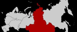
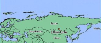
In the north, the Trans-Baikal Territory borders with the Irkutsk region (border length 520 km) and the Republic of Sakha (Yakutia) (200 km), in the west with the Republic of Buryatia (the longest border of the region is 1700 km), in the east with the Amur region (700 km), in the south there is a state border with Mongolia (863 km) and China (more than 1000 km). The total length of the borders of the region is about 5000 km.
Internal boundaries.
In addition to external borders, the Trans-Baikal Territory also has an internal border with the Aginsky Buryat Autonomous Okrug, the length of which is about 850 km.
Age composition[ | ]
| Population groups | 1990 | 1995 | 2000 | 2005 | 2007 |
| Total population (thousand people) | 1320,6 | 1256,7 | 1192,8 | 1135,7 | 1122,1 |
| Younger than working age | 30,8 | 28,4 | 24,6 | 21,4 | 20,5 |
| Able-bodied | 56,2 | 56,8 | 60,2 | 63,7 | 64,3 |
| Over working age | 13,0 | 14,8 | 15,2 | 14,9 | 15,2 |
Official portal Zabaykalsky Krai
Date of formation of the region
On March 1, 2008, in accordance with the Federal Constitutional Law of July 21, 2007 No. 5-FKZ “On the formation of a new subject of the Russian Federation within the Russian Federation as a result of the unification of the Chita region and the Aginsky Buryat Autonomous Okrug,” the Trans-Baikal Territory was formed.
The Aginsky Buryat Okrug became part of the region as an administrative-territorial unit with a special status.
Population (According to the 2010 All-Russian Population Census)
Population – 1,107.1 thousand people.
Population density – 2.6 people. per 1 km2,
Regional government bodies
Executive body - Government of the Trans-Baikal Territory, Governor of the Trans-Baikal Territory - Osipov A.M.
Historical reference
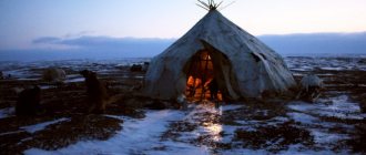
In ancient times, the Transbaikal region was a kind of “corridor” along which the steppe tribes of Mongolia and northern taiga hunters passed. In the 13th century, Transbaikalia became part of the empire of Genghis Khan.
Before joining the Russian state, the region was dependent on the Mongol and Manchu khans. Russian service people appeared on this territory in the middle of the 17th century.
In 1653, they founded a number of settlements: Irgensky, Nerchinsky forts and Ingondinsky winter quarters, which formed Chita.
Industrial development of the territory began in the 18th century. In 1700, the Nerchinsk silver-lead plant was built, and by the end of the 18th century. 9 factories were already operating here, incl. Petrovsky iron foundry and ironworks.
Tin and gold mining were actively developing. In the second half of the 19th century. Nerchinsk factories fell into disrepair.
Geographical position
The region is located in Transbaikalia. Borders: in the west - with the Republic of Buryatia, in the northwest - with the Irkutsk region, in the northeast - with the Republic of Sakha (Yakutia), in the east - with the Amur region, in the southeast of the region there is the border of the Russian Federation with the People's Republic of China and Mongolia. The total length of the state border is 1920.1 km.
Natural conditions (relief features)
The relief of the territory of the Trans-Baikal Territory is formed by medium-high mountains, in some places reaching 1700-1900 m. The largest ones include the Daursky, Kodar and Yablonovy ridges. The highest point is the BAM peak at 3073 m above sea level.
Natural resources
The mineral resource base consists of proven reserves of ferrous, non-ferrous, precious and rare metals, fluorspar, hard and brown coal, semi-precious stones, mineral waters and raw materials for the production of building materials.
The subsoil contains 42% of Russia's proven fluorspar reserves, 31% of zirconium, 21% of copper, 28% of molybdenum, 18% of titanium, 13% of silver, 12% of lead, gold, tungsten, tin, lithium, zinc, coal and iron ores.
The predicted mineral resource potential is: titanium dioxide, nickel, cobalt, lead, antimony, mercury, germanium, synnyrites, fluorite, zeolites. In addition, there are a number of deposits of semiprecious stone raw materials, perlites, graphite, refractory and refractory clays, magnesite, and there are prerequisites for identifying deposits of diamonds and platinum.
There are 64 unique natural monuments in Transbaikalia, including glaciers of the Kodar ridge, thermal springs, lakes, extinct volcanoes, etc.
In the area of the Alkhanai mountain range, the Alkhanai National Park was opened in 1999 - a sacred place of worship for Buddhists.
Source
Settlements[ | ]
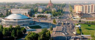
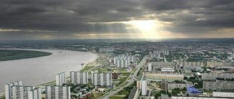
Settlements with a population of more than 5 thousand people Chita
| ↘350 861[56] | |
| Krasnokamensk | ↗51 451[56] |
| Borzya | ↗29 387[56] |
| Aginskoe | ↗18 335[56] |
| Petrovsk-Zabaikalsky | ↘15 626[56] |
| Nerchinsk | ↘14 648[56] |
| Mogocha | ↗12 992[56] |
| Zabaikalsk | ↗13 293[56] |
| Chernyshevsk | ↗12 834[56] |
| Karymskoe | ↘12 771[56] |
| Shilka | ↘12 339[56] |
| ↘11 592[56] | |
| Balei | ↘10 630[56] |
| Mountain | ↘9979[56] |
| Pervomaisky | ↗11 343[56] |
| Mogoituy | ↘10 738[56] |
| Khilok | ↗10 320[56] |
| Atamanovka | ↘10 148[56] |
| Novokruchinsky | ↘10 075[56] |
| Clear | ↘7650[56] |
| Tin | ↘7099[56] |
| Priargunsk | ↘7056[56] |
| ↘6979[56] | |
| Yasnogorsk | ↘6495[56] |
| Kokuy | ↘6847[56] |
| Darasun | ↘6488[56] |
| Blast furnace | ↘6309[56] |
| Sretensk | ↘6353[56] |
| Duldurga | ↗6557[56] |
| Fly away | ↗6134[57] |
| Vershino-Darasunsky | ↘5136[56] |
Geographical position
A number of negative and positive features can be identified in the geographical location of the Trans-Baikal Territory.
The Transbaikal region occupies an inland position and is located at unequal distances from the oceans. The Seas of Okhotsk and the Yellow Sea of the Pacific Ocean are closest to the edge; the closest distance to them is 850 and 1000 km, respectively. Of the seas of the Arctic Ocean, the Laptev Sea is the closest, the distance to which is about 1700 km. The seas of the Atlantic Ocean closest to Eastern Transbaikalia are the Baltic, Azov and Black, which are more than 5000 km away. All three oceans influence the climate of the region, but to varying degrees. The region also has a remote location from the capital of Russia and the most developed regions (Center, Volga region, Ural).
The positive features include the following. First of all, this is the position of the region on the way from Europe and from some Asian countries to Japan, China, and Korea. Here passes the Trans-Siberian Railway, BAM and railways to Mongolia and China, as well as the waterway along the Shilka and Argun through the Amur with access to the Pacific Ocean. In addition, air routes of domestic and international importance pass through the region.
National composition[ | ]
National composition of the region's population according to the 2002 and 2010 censuses[58][59]
| 2002 | % from everything | % of those who indicated nationality | 2010 | % from everything | % of those who indicated nationality | |
| Whole population | 1155346 | 100,00 % | 1107107 | 100,00 % | ||
| Russians | 1037502 | 89,80 % | 90,01 % | 977400 | 88,28 % | 89,91 % |
| Buryats | 70457 | 6,10 % | 6,11 % | 73941 | 6,68 % | 6,80 % |
| Ukrainians | 11843 | 1,03 % | 1,03 % | 6743 | 0,61 % | 0,62 % |
| Tatars | 8159 | 0,71 % | 0,71 % | 5857 | 0,53 % | 0,54 % |
| Armenians | 3594 | 0,31 % | 0,31 % | 3943 | 0,36 % | 0,36 % |
| Azerbaijanis | 2129 | 0,18 % | 0,18 % | 2045 | 0,18 % | 0,19 % |
| Kyrgyz | 532 | 0,05 % | 0,05 % | 1634 | 0,15 % | 0,15 % |
| Belarusians | 2973 | 0,26 % | 0,26 % | 1544 | 0,14 % | 0,14 % |
| Uzbeks | 655 | 0,06 % | 0,06 % | 1515 | 0,14 % | 0,14 % |
| Evenks | 1492 | 0,13 % | 0,13 % | 1387 | 0,13 % | 0,13 % |
| Bashkirs | 1228 | 0,11 % | 0,11 % | 968 | 0,09 % | 0,09 % |
| Tajiks | 375 | 0,03 % | 0,03 % | 964 | 0,09 % | 0,09 % |
| Chuvash | 1271 | 0,11 % | 0,11 % | 792 | 0,07 % | 0,07 % |
| Germans | 1294 | 0,11 % | 0,11 % | 750 | 0,07 % | 0,07 % |
| Chinese | 295 | 0,03 % | 0,03 % | 632 | 0,06 % | 0,06 % |
| Moldovans | 827 | 0,07 % | 0,07 % | 613 | 0,06 % | 0,06 % |
| Kazakhs | 535 | 0,05 % | 0,05 % | 570 | 0,05 % | 0,05 % |
| Dargins | 589 | 0,05 % | 0,05 % | 527 | 0,05 % | 0,05 % |
| Mordva | 749 | 0,06 % | 0,06 % | 429 | 0,04 % | 0,04 % |
| Mari | 496 | 0,04 % | 0,04 % | 349 | 0,03 % | 0,03 % |
| Udmurts | 498 | 0,04 % | 0,04 % | 336 | 0,03 % | 0,03 % |
| Georgians | 366 | 0,03 % | 0,03 % | 304 | 0,03 % | 0,03 % |
| Koreans | 365 | 0,03 % | 0,03 % | 256 | 0,02 % | 0,02 % |
| Gypsies | 313 | 0,03 % | 0,03 % | 243 | 0,02 % | 0,02 % |
| Avars | 249 | 0,02 % | 0,02 % | 214 | 0,02 % | 0,02 % |
| Tuvans | 274 | 0,02 % | 0,02 % | 214 | 0,02 % | 0,02 % |
| Lezgins | 296 | 0,03 % | 0,03 % | 206 | 0,02 % | 0,02 % |
| Jews | 334 | 0,03 % | 0,03 % | 199 | 0,02 % | 0,02 % |
| Poles | 307 | 0,03 % | 0,03 % | 182 | 0,02 % | 0,02 % |
| Chechens | 226 | 0,02 % | 0,02 % | 177 | 0,02 % | 0,02 % |
| Yakuts | 206 | 0,02 % | 0,02 % | 163 | 0,01 % | 0,01 % |
| Altaians | 129 | 0,01 % | 0,01 % | 160 | 0,01 % | 0,01 % |
| Ossetians | 196 | 0,02 % | 0,02 % | 159 | 0,01 % | 0,01 % |
| Vietnamese | 13 | 0,00 % | 0,00 % | 153 | 0,01 % | 0,01 % |
| Lithuanians | 190 | 0,02 % | 0,02 % | 130 | 0,01 % | 0,01 % |
| Ingush | 131 | 0,01 % | 0,01 % | 117 | 0,01 % | 0,01 % |
| Kumyks | 127 | 0,01 % | 0,01 % | 116 | 0,01 % | 0,01 % |
| Khakassians | 92 | 0,01 % | 0,01 % | 106 | 0,01 % | 0,01 % |
| Mongols | 58 | 0,01 % | 0,01 % | 84 | 0,01 % | 0,01 % |
| Gagauz | 65 | 0,01 % | 0,01 % | 60 | 0,01 % | 0,01 % |
| Bulgarians | 101 | 0,01 % | 0,01 % | 55 | 0,00 % | 0,01 % |
| other | 1122 | 0,10 % | 0,10 % | 889 | 0,08 % | 0,08 % |
| total indicated | 1152653 | 99,77 % | 100,00 % | 1087126 | 98,20 % | 100,00 % |
| not specified | 2693 | 0,23 % | 19981 | 1,80 % |
Economy
The region has developed non-ferrous and ferrous metallurgy, mechanical engineering (car assembly plant, mining equipment plant), electric power (Chita and Kharanorskaya state district power plants), coal, light (worsted and cloth mill).
The region is a large agricultural region east of Lake Baikal, specialized in fine-fleece sheep farming. Meat and dairy and meat livestock farming, partly pig farming, and poultry farming are also developed. Crop production takes place, the main sown areas are concentrated in the central, southern and south-eastern regions. Hunting is developed in the mountain taiga and northern regions.
Transbaikalia is significantly removed from the western part of the country, at the same time it is close to the Russian Far East and occupies a key position on the way to the Pacific Ocean and the countries of Southeast Asia. The distance by rail from Chita to Moscow is 6074 km, Ekaterinburg - 4386, Novosibirsk - 2861, Khabarovsk - 3327, Irkutsk - 1013 km.
The region is rich in natural resources, such as non-ferrous and precious metals, iron ore, coal, fluorspar, and various construction raw materials. The most famous deposits: polymetallic ores - Novoshirokinskoye; copper ores - Udokan; titanium-magnetite ores - Kruchininskoe; coal - Kharanorskoe.