Story
Kingisepp district was formed in 1927. In 1931, its territory expanded due to the abolished Kotelsky district. During the Second World War it was under occupation and suffered greatly. At the end of the war, in 1945, he received part of the territories of the Estonian SSR, on which the village of Ivangorod was located.
In 1963, the Kingisepp rural swarm was created, which also included the territories of the abolished Slantsevsky and Volosovsky districts. However, in 1965, the territory of the Volosovsky district was again separated. In the same year, but a little later, the Slantsevsky district was separated. It is worth noting that such transformations are typical for the Leningrad region; this happened everywhere.
In 1996 it received the status of a municipal entity. In 2006 it was finally formed in its modern form.
The history of the formation of Kingisepp
Since ancient times, these lands have been located at the intersection of water and land routes. The first settlers were small Finno-Ugric tribes - Vod, Izhora, Chud. Around the 5th century, the territory was occupied by the Slavs. During the expansion of Novgorod, these lands became part of it, and already in 1384 the Yam fortress on the Luga River was mentioned for the first time. A city of great strategic importance was formed on the basis of the fortress. But during the Livonian War, in 1583, Yam was handed over to the Swedes, the fortress was destroyed, and Russia lost access to the sea. Yam was returned to Russia thanks to the efforts of Peter I in 1703, and renamed Yamburg. Being under the patronage of St. Petersburg, the city began to actively develop, the first plants, manufactories and factories appeared. In 1922, Yamburg was renamed Kingisepp, in honor of the Estonian communist Victor Kingisepp.
At the moment, the Kingisepp district is inhabited by approximately eighty thousand people.
Population and administrative structure
The population of the Kingisepp district is 78.8 thousand people. 72.5% of the population lives in urban areas. The national composition is dominated by Russians. The population is decreasing; the maximum was recorded in 2014 – 79.6 thousand people.
Kingisepp district consists of 2 urban and 9 rural settlements, which include 190 settlements. The urban settlements are: Ivangorodskoye with the administrative center of the city of Ivangorod (total population 10,460) and Kingiseppskoye with the administrative center of the city of Kingisepp (total population of 46,750).
Table. Rural settlements of the Kingisepp district.
| Name | Center | Population | Settlements included |
| Bolshelutskoe | Village Kingiseppsky | 4700 | 22 |
| Vistinskoe | Vistino village | 1750 | 19 |
| Kotelskoe | Kotelsky village | 3600 | 44 |
| Kuzemkinskoe | Village Bolshoye Kuzemkino | 1400 | 18 |
| Nezhnovskoe | Village Nezhnovo | 900 | 21 |
| Opolevskoe | Village of Opole | 2800 | 22 |
| Pustomerzhskoe | Tree Big Hollow | 2300 | 18 |
| Ust-Luga | Ust-Luga village | 3100 | 12 |
| Falileevskoe | Village of Falileevo | 1100 | 9 |
Kingisepp district in wartime.
The fascist invaders occupied Kingisepp on August 12, 1941. During the occupation, according to available data, about a thousand civilians were killed, 18 thousand people were driven to Germany. Labor and concentration camps were created. During the war, the number of residents in the area decreased from 57 to 8.5 thousand people. The Germans destroyed plants and factories, destroyed many cultural objects, literally turning the city into ruins. In 1943, the Nazis completely burned the village of Zagorye. On February 1, 1944, during the offensive operation NEVA-2, Kingisepp was liberated from the Nazi army. As soon as the city was liberated, work began on organizing war graves.
Geography, relief and climate
The area of the Kingisepp district is 2907 square kilometers. It borders with Estonia, as well as with the Volosovsky, Lomonosovsky and Slantsevsky districts. In the north-west it is washed by the Gulf of Finland, the length of the coast is 105 kilometers.
The terrain is mostly flat, in some places there are hills with heights of up to 150 meters. Most of the territory of the Kingisepp district is covered with forest, dominated by birch and aspen. Pine and spruce, characteristic of most areas of the Leningrad region, are rare here. The share of agricultural land is also large.
There are several large lakes, in particular Babinskoye, Glubokoye, Sudachye, Khabolovo, Kopapskoye. In the southwest, on Russian territory, the Narva Reservoir is partially located. It is also worth noting that this part of the Kingisepp district is swampy. In general, the number of lakes is small. There are rivers, the largest of which are Narva and Luga.
It is worth noting that part of the Kingisepp district is officially recognized as affected by the accident at the Chernobyl nuclear power plant. It is not recommended to pick berries and mushrooms here, as they contain a high content of cesium-137. Of course, local residents are not particularly concerned about this, but we still do not recommend buying or picking mushrooms and berries here.
The climate is temperate continental, which distinguishes it from other areas of the Leningrad region. However, the average annual air temperature does not differ from the regional average. However, the average annual precipitation is lower - 625 millimeters. The weather is changeable, with frequent pressure changes.
Kingisepp municipal district
Kingiseppsky district is located in the southwest of the Leningrad region. It borders by land with Estonia, Slantsevsky, Volosovsky and Lomonosovsky districts of the Leningrad region.
Distance to St. Petersburg : 110 km
Administrative center : Kingisepp
Area : 2907.1 km2
Population : 74,881 people (urban population - 73.1%, rural population - 26.9%)
Infrastructure : Kingisepp municipal district has a well-developed network of roads. The framework of public roads is being built around the main federal roads Kerstovo - Luzhitsa, A180/E20 "Narva" and its duplicating direction Petrodvorets - Keikino.
The main regional roads serve as connecting links between the directions of federal highways and serve interdistrict and interregional transport links. The traffic intensity on them varies between 1,000-3,000 cars per day. The total length of roads is 600 km.
Through the Mga railway station, transport and economic connections are provided between enterprises of the Leningrad region, the republics of Karelia and Komi, the Urals, Siberia and Central Asian states, both with St. Petersburg and the ports of the Gulf of Finland, and with neighboring states - Estonia, Lithuania, Latvia, Finland.
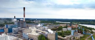
Economics : analysis of the development of the industrial complex over the past 5 years and long-term plans of the main industrial enterprises indicate an increase in industrial production volumes. The dynamics of changes in the volumes of shipped products over the past five years has a positive trend.
The average number of employees at large and medium-sized industrial enterprises as of January 1, 2020 was 5,143 people, the average salary in the industry was 64.6 thousand rubles.
Industry in the region is represented mainly by the following types of economic activities:
- chemical production;
- glass industry;
- production of components for automobiles;
- production of building materials.
Large enterprises:
- LLC PG Phosphorit – chemical production (mineral fertilizers, sulfuric acid)
- Plant – production of equipment for vehicles (electrical cables for Hyundai cars)
- CJSC "Kingisepp Glass Factory" - production of premium glass containers
- Poliplast North-West LLC – chemical additives for the construction industry (concrete additives)
- MV Kingisepp LLC – production of finished metal products (steel wheels)
- Branch of the Central Committee of the IS FPG "ROSSTRO" OJSC "ROSSTRO" - "ROSSTRO-VELOX" - wood processing and production of wood products (slabs and slab products, metal ties)
- Kingisepp House Construction Company LLC (KDSK) – production of building materials (permanent formwork made of polystyrene concrete for construction, reinforced concrete structures)
- LLC Novatek - Ust-Luga - production of petroleum products (naphtha, kerosene, diesel fraction, fuel oil)
- JSC EuroChem North-West – chemical production (commercial ammonia)
Official website of the district
Investment passport of the district
Passport of the district's labor resources
| Name of municipality | Official site | Urban planning documentation |
| Ivangorod urban settlement | ivangorod.ru |
|
| Kingisepp urban settlement | kingisepp-mo.ru |
|
| Bolshelutskoe rural settlement | bolshelutsk.ru |
|
| Vistinskoe rural settlement | amo-vistino.rf |
|
| Kotelskoe rural settlement | kotelskoe-adm.ru |
|
| Kuzyomkinskoye rural settlement | kuzemkinskoe.rf |
|
| Nezhnovskoe rural settlement | nezhnovo.ru |
|
| Opolyevskoe rural settlement | opolye.ru |
|
| Pustomerzhskoye rural settlement | mo-pustomerzhskoe.rf |
|
| Ust-Luga rural settlement | Ust-Luga.rf |
|
| Falileevskoe rural settlement | falileevo.ru | Master plan/rules of land use and development |
Top
Economics and transport
The economy of the Kingisepp district focuses on industry, where three areas are distinguished:
- Chemical industry;
- Food;
- Glass
Agriculture specializes mainly in dairy farming. It is also worth noting the developed trade, which is facilitated by transit through the area.
There are four railway lines, one to St. Petersburg. The Narva highway also passes through the area. The port in Ust-Luga is one of the most developing in Russia. Its cargo turnover is steadily growing, and there are plans for further development, which will have a beneficial effect on the economy of the Kingisepp region.
Attractions
There are many attractions in the Kingisepp district, most of which are architectural monuments or the Great Patriotic War. There are also several museums, some of which are of great interest.
Of the sights and interesting places in the Kingisepp district that are worth visiting, we can note:
- Yam fortress, city of Kingisepp;
- Fortress in Ivangorod;
- Ethnographic Museum in the village of Vistino.
There are also natural attractions, for example, the Kurgalsky and Kotelsky nature reserves. There are a large number of churches and estates that are in different states.
Recreation and fishing
Most of the tourists in the Kingisepp region pass through here in transit, although in the summer you can meet many vacationers on the banks of the largest rivers and lakes, as well as the Gulf of Finland, where in some places there are good sandy beaches. For those who like to camp with tents, there are a fairly large number of interesting places.
Fishermen prefer the largest lakes, the Luga River or the coast of the Gulf of Finland, in particular the Luga and Koporskaya bays, where fishing enthusiasts can be found at any time of the year. But in general, the Kingisepp region does not look very attractive for fishing, or even for recreation. There are more interesting destinations in the Leningrad region.
In addition, it is worth noting that some interesting places are located in the border zone and access there without permission is prohibited, which imposes additional inconvenience.
