The Karachay-Cherkess Republic is located in the North Caucasus Federal District. This region of the country is surrounded by mountain ranges and high mountains. On the territory of the republic there is Mount Elbrus, the peaks of which are the highest in Europe. If you use a satellite map of the Karachay-Cherkess Republic, you can study its reliefs, find the main cities and small foothill villages, and examine the borders.
The region is limited from different sides by:
- Stavropol region;
- Krasnodar region;
- Abkhazia;
- Georgia;
- Kabardino-Balkaria.
Most of the republic is a mountainous area, from which more than 130 rivers and streams flow to the Black Sea. They form beautiful waterfalls that attract many tourists here. Moving along the map of the Karachay-Cherkess Republic with a diagram, you can consider the main rivers, such as:
- Laba;
- Kuban;
- Bolshoy Zelenchuk;
- Urup.
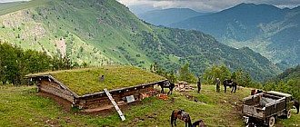
On the territory of the republic there are the Kuban Reservoir and the Great Stavropol Canal, which are important for the region and the neighboring Stavropol Territory. One of the famous natural sites is the Teberda Nature Reserve. This is a nature-protected zone, which can be found on a map of the Karachay-Cherkess Republic by region, and has unique flora and fauna.
see also
- Karachay-Cherkessia
- Cities of Russia
| [ + ] Cities by regions of Russia | |
| Cities of the North-West (NWFD) | St. Petersburg (and its cities) • Leningrad region (historical Staraya Ladoga) • Arkhangelsk region • Vologda region • Kaliningrad region • Karelia • Komi • Murmansk region • Nenets Autonomous Okrug • Pskov region |
| Cities of the Volga region (Volga Federal District) | Bashkortostan • Volgograd region • Kalmykia • Kirov region • Mari El • Mordovia • Nizhny Novgorod region • Orenburg region • Penza region • Perm region • Samara region • Saratov region • Tatarstan • Udmurtia • Ulyanovsk region • Chuvashia |
| Cities of Southern Russia (SFD) | Sevastopol (including Inkerman) • Republic of Crimea • Adygea • Astrakhan region • Krasnodar region • Rostov region |
| Cities of the North Caucasus (NCFD) | Dagestan • Ingushetia • Kabardino-Balkaria • Karachay-Cherkessia • North Ossetia - Alania • Stavropol Territory • Chechen Republic |
| Cities of the Urals (Ural Federal District) | Kurgan region • Sverdlovsk region • Tyumen region • Khanty-Mansi Autonomous Okrug - Yugra • Chelyabinsk region • Yamalo-Nenets Autonomous Okrug |
| Cities of Siberia (Siberian Federal District) | Altai Republic • Altai Territory • Irkutsk Region • Kemerovo Region • Krasnoyarsk Region • Novgorod Region • Novosibirsk Region • Omsk Region • Tomsk Region • Tyva • Khakassia |
| Cities of the Far East (FEFD) | Amur Region • Buryatia • Jewish Autonomous Region • Trans-Baikal Territory • Kamchatka Territory • Magadan Region • Primorsky Territory • Sakha (Yakutia) • Sakhalin Region • Khabarovsk Territory • Chukotka Autonomous Region |
| see also | Cities of the DPR, LPR, Transnistria, South Ossetia • Regions of Russia • Cities of Russia |
Districts of the Karachay-Cherkess Republic on the map
The region is divided into 10 districts. The most significant in terms of population size is Cherkessk, and the least number of people live in the Adygea-Khablsky region. The northern territories are well suited for the development of industrial production, wood processing and livestock farming. And if you take a closer look at the southern regions on the map of the Karachay-Cherkess Republic, you can find such famous resorts as:
- Teberda;
- Arkhyz;
- Dombay;
Among other resort areas in Europe, the Karachay-Cherkess Republic poses serious competition. There are many tourist routes, cable cars built, and complexes for skiers and climbers equipped. It is better to travel around this amazing land using a map of the Karachay-Cherkess Republic with settlements. A convenient online service will help you quickly navigate difficult mountainous terrain, find cities and villages, resort areas, and highways.
You can get to any area of the region by road transport. As a rule, tourists arrive in the region through Mineralnye Vody if they travel by plane, and by bus or car they move to the desired area of the mountain region. When getting ready to travel, take with you a detailed map of the roads of the Karachay-Cherkess Republic, which will show the direction of the main highways and secondary roads.
CITIES OF KARACHAY-CHERKESSIA
Karachay-Cherkessia is far from the largest region within the Russian Federation, but rather one of the smallest. A distinctive feature of this republic is its settlements. Surely everyone now thought that they were very large and important. In fact, this is not true. There are only four cities in the republic, the rest of the settlements have the status of villages, towns, and hamlets. But the Karachay-Cherkessian cities are very modern, and as a result, spending your holidays here is a pleasure!
CHERKESSK - the capital of the republic
Railway station: - address: Station Square, 1; — phone: +7 (87822) 4-28-87. Bus station: — address: Privokzalnaya street, 1; - telephones;
Cherkessk is the largest city in the republic both in terms of area and population; it is also the administrative center. center of Karachay-Cherkessia. The largest settlement is located in the foothills, the landscapes here are amazing. Cherkessk is a relatively young city, it was built in 1825 and was originally the village of Batalpashinskaya. It arose at the location of the redoubt of the same name, which was named after the Russian troops over the army of the Turkish commander Batal Pasha in 1790. It’s a paradox, but the village is named after the vanquished. The settlement of the town did not take place immediately; over the course of several years, Cossacks from neighboring regions (soldiers of the Kuban and Khoper regiments) moved here. Initially, Batalpashinskaya was considered a military settlement, but over time it began to play a significant role in establishing cultural and trade ties with the highlanders. In the second half of the 19th century, the village became a district town in the Kuban province, where two schools and a hospital functioned. It developed through the livestock trade, grain trade, and lumber industry. The beginning of the 20th century turned out to be a turning point. With the start of the Civil War, the city was in the hands of white troops until 1920. And in 1922, the village received the status of an administrative center, first of the Karachay-Cherkess Autonomous Okrug, then of the Circassian National. district, and then the Circassian Autonomous Okrug. The status of a city and the name Batalpashinsk were assigned to the village in 1931. In 1934, it began to be called Sulimov in honor of the head of the Council of People's Commissars of the RSFSR D.E. Sulimova. However, after the arrest of the said party leader, the city was renamed again - it became Yezhovo-Cherkessk, again in honor of the political associate of those years - N.I. Yezhova. When the leader was shot in 1939, the city began to be called Cherkessk. In 1957, it became the main settlement of the Karachay-Cherkess Autonomous Okrug, and since 1991 - the newly formed republic. Today Cherkessk is not such a prominent settlement; the basis of the economy here is small trade and several light and food industry enterprises. Cherkessk is an unusually beautiful city. And although there are not many attractions in the traditional sense of the word, there are still interesting places to visit. First of all, one cannot help but notice the amazing nature: the city is located in the foothills of the Caucasus on the Kuban River, whose banks are also distinguished by their extraordinary beauty and picturesqueness. You can admire the hills almost anywhere in the capital, but it’s better to travel beyond its borders. 18 km from Cherkessk are the Batalpashinsky lakes, now a reservoir called the Circassian Sea. It is also very, very beautiful here. Inspired by the beautiful nature, you can explore the local attractions. First of all, you need to go to the central square of V.I. Lenina, she is the oldest in the city, she has been the main one for many years. It is famous for the fact that the first monument to the leader of the revolution, V.I., was erected here. Lenin. At first the sculpture was wooden, but now it is bronze - it was erected in 1969. Then you can go to the square named after. Kirov and look at the monument to Ya.V. Balakhonov (a WWII participant) and the eternal flame. You should definitely visit the Green Island recreation park; it is one of the largest in Russia, but it opened only in 2013. Before that time, it was in ruins, and the vast territory was simply empty. Now it’s very cozy here: the trees create a pleasant shade, the benches invite you to relax, and the cheerfully murmuring fountains create an atmosphere of happiness and well-being. But fountains are not the only bodies of water here; there are several ponds and artificial canals in the park. There is even a beach area on the “Green Island” - clean and comfortable. In general, both adults and children will like it here. Everyone will like Cherkessk mainly due to the local nature. But the traditional national flavor also plays an important role in the charm of visiting tourists!
KARACHAYEVSK - the city of three rivers
How to get there: — by bus: direct or transit (to Teberda) flights; — by car: in a south-west direction 58 km (1 hour on the road). Karachaevsk is one of the most interesting cities not only in Karachay-Cherkessia, but throughout Russia. Firstly, it stands on three rivers - Kuban, Teberda and Mara. Secondly, from a bird's eye view it looks like a horseshoe, since it is located in the valleys of two out of three rivers. Well, the importance of the city is the transport hub of the republic, since it is located in the center of the high mountain regions. Karachaevsk is a young city, it was founded only in 1927, and was originally called the village of Georgievskoye. A year later it was renamed Mikoyan-Shahar in honor of A.I. Mikoyan. In 1944, it changed its name again, became known as Klukhori and became part of the Georgian Autonomous Soviet Socialist Republic (at the time of the deportation of the Karachais). It received its modern name only in 1957. Today Karachaevsk is a provincial town with a fairly developed industry, mainly light and food industry. At first glance, it may seem that the settlement is boring and uninteresting. But this opinion is fundamentally wrong. Tourists are usually recommended to start exploring Karachaevsk from the Cathedral Mosque. This building is quite young, it was erected in 2007, but it quickly became one of the iconic attractions. Externally, the Muslim temple is very light and elegant, it has two minarets and a golden dome in the middle: traditional and at the same time colorful. The mosque fits very well into the appearance of the entire city. Next you can visit an Orthodox church - the Church of the Holy Trinity (the only one in Karachaevsk). Then it is advisable to simply walk along the streets of the city and look at two iconic monuments: one is the monument to Kurman-Ali Kurdzhiev (the founder of the city), the second is the “Mountain Woman” memorial sign. “Goryanka” is perhaps the main monument of the city. Initially, it was erected as a monument welcoming guests, but over time it became the “heart” of Karachaevsk.
After exploring the city, you can go beyond its borders. Why? Because it is amazingly beautiful there and you can visit natural monuments and more! First of all, you need to find two temples - Shaoninsky and Sentinsky. They were built in the 10th century and belonged to Christians. Now the buildings, of course, are in a rather deplorable state, but the charming atmosphere of the place still remains. Both temple complexes are located high in the mountains, getting to them is problematic, but it’s worth it. Local residents will definitely recommend visiting the Devil's Wells. The name is alarming, but there is nothing scary there. “Devil's Wells” are located in the Karachaevsky district near the village of Kamennomostsky, they are a unique natural structure: the Kuban River made its way into the rock, and over time, depressions were formed here from the washing out of the rock - they are called wells. In some places there are tiers of such washed out areas. On the one hand, the spectacle is creepy, on the other - exciting! Where else can you see such an amazing natural structure? In general, absolutely everyone will like Karachaevsk: rivers and mountains always create amazingly beautiful and unusual combinations!
TEBERDA - resort city of Karachay-Cherkessia
How to get there: — by bus: direct flights; — by car: in a south-west direction 102 km (2 hours on the road). Few people know about a city like Teberda, but this is one of the health resorts in Russia and is considered a resort city. Teberda is also a relatively young city, like Cherkessk. But it arose a little earlier, in 1868, as a Karachai village. At first it was called by the name of the family that settled here, but when other families began to come here, they decided to change the name. Well, Teberda received the status of a city very late, already in the 20th century, in 1971. Outwardly, the city does not fit with traditional ideas about this type of settlement. Teberda more closely resembles a large village: the houses are mostly one-story, rarely two. But it is very cozy and calm here, the healing air is very good for health. The settlement lives mainly on income from tourism: mountaineering trips and hiking tours are organized here. Ski lovers will also be happy to be in this place; excellent ski slopes are equipped for them. There are also a balneological hospital and several sanatoriums. The cultural and educational component is also present in Teberda. There is a small local history museum here, if you want, you can go. But it’s still better to go on an exciting trip around the area. The first thing you will encounter on the way is the Sentinsky Temple, which is very ancient, but the date of its construction is not known for certain. However, the wall frescoes are dated by researchers to the 11th century, so it is quite possible to attribute the construction of the sacred structure to this time. The temple is comfortably located on the spur of a mountain range; outwardly it repeats the shape of the first Christian cross-domed churches and cathedrals. There used to be a monastery here, and even a mausoleum has been preserved on the territory. Although to say “even” is somewhat insulting to this building, it is very well preserved, happily welcoming its guests. Next, you should definitely visit the ruins of the Meuse - this city was for a long time the capital of the Alanian state, destroyed by the Mongols. It was located nearby on the right bank of the Bolshoy Zelenchuk River; this position was extremely convenient in conditions of turbulent times. Well, now it enhances the effect of the picturesque ruins; against the backdrop of water and lush vegetation they look simply breathtaking. Many people will like Teberda! Firstly, the atmosphere of the resort town cannot but charge you with positive emotions. Secondly, clean air and pristine nature untouched by man are the best way to heal people exhausted by city life.
ZELENCHUKSKAYA STANISH - small, but very interesting!
How to get there: — by bus: direct or transit (to Maykop, Pregradnaya, Moscow) flights; — by car: in a south-west direction 68 km (1 hour on the road). Zelenchukskaya is not a city, but a village, despite this, it is the regional center of Zelenchuksky district. This settlement was founded in 1859; it included the land of Storozhovaya and Kardonikskaya villages. It was needed to protect the surrounding territories from attacks by unfriendly Circassians. Any outstanding events in the life of the locality during the 19th-20th centuries. didn't happen. The only thing is that it was periodically transferred to different administrative-territorial units, but for the longest time it was part of the Kuban region. Now few people know about the village of Zelenchukskaya, but you can spend a useful holiday here. Not far from it is the Nizhne-Arkhyz settlement - a monument of Alan culture of the 10th-12th centuries. Nowadays the Karachay-Cherkessian Historical, Cultural and Natural Museum-Reserve is located on this territory.
Its area is slightly more than 90 hectares. There are several interesting places within the walls of the complex. Perhaps the most valuable exhibits of the attraction can be called the Zelenchuk temples; there are only three of them - Northern, Middle and Southern. All of them were built around the 9th-10th centuries. and are amazing examples of cross-domed architecture. The northern temple was erected in honor of St. Nicholas the Wonderworker, it was preserved rather poorly, the frescoes and paintings were not preserved at all, but the layout can be traced. The middle one was restored at the end of the 19th century by the monks of the Alexander Nevsky Monastery formed on the territory of the ancient settlement. Divine services were held in the restored sacred building. The southern temple is the only one now functioning, consecrated in 1991, called Ilyinsky. In addition to the temple complexes, the remains of fortress walls, watch bastions and destroyed buildings for utility purposes have been preserved on the territory of the settlement. Another significant object of the Zelenchuk village is the RATAN-600 radio telescope. It is considered the world's largest telescope with a reflecting mirror, the diameter of which reaches 600 m, thanks to which it can distinguish even the smallest space objects. If, after all, local attractions do not impress picky tourists, then Zelenchukskaya can offer a trip to the local natural beauties, and they certainly will not leave anyone indifferent!
UCHKEKEN - “three bushes”
How to get there: — by bus: with a change in Mineralnye Vody or in Pyatigorsk; — by car: in a southeast direction 74 km (1 hour 15 minutes on the way). Uchkeken is a small village located approximately 74 km from the administrative center; its name translates as “three bushes”. The first settlement was formed here immediately after the establishment of Soviet power: peasants from surrounding villages received permission to populate these lands. Over the course of two years, the settlement has expanded significantly geographically, and accordingly, the number of residents has also increased. A school opened here, then a club, then the first telephone line was installed - in general, life got better. Naturally, there can be no talk of industry in the village, but the agricultural component played an important role. Even during the Second World War and immediately after its end, the local population managed to reap good harvests. The village flourished in the 70s and 80s. XX century, but now Uchkeken, although it has slowed down production, still continues to develop steadily. People come to Uchkeken to see unique natural monuments. First of all, visitors are interested in Honey Falls. There are 5 of them in total - Zhemchuzhny, Hidden, Noisy (Devil's Mill), Bolshoy Medovy and Maly Medovy. These wonderful natural sculptures were called honey because in ancient times bees lived in the rocks. Today, the waterfalls are one of the most popular tourist places; all conditions for a comfortable stay have been created here - a restaurant, a tourist center and even an ethnographic museum. You should definitely visit Mount Rome, which looks more like a high hill with a cut off top. In fact, it is really a hill consisting of rocks. But in ancient times there was a settlement on it; in the Middle Ages, a large Alan city was located here, which was located on the Trans-Caucasian Silk Road and played an important trade and economic importance. Now, the remains of buildings and fortifications, for example, steps on one side of the mountain leading to its top, will help you understand that there was a fortress here. In addition, from the top there is a stunning view of the surrounding areas.
Karachay-Cherkessia is, first of all, a unique nature, unusually beautiful picturesque natural monuments. You need to come here precisely for the beauty of the surrounding world, and along the way, acquire some knowledge about the history and culture of the region as a whole!
Map of the Karachay-Cherkess Republic with cities and villages
Half of the total population of the republic lives in 4 large cities:
- Cherkessk;
- Ust-Dzheguta;
- Teberda;
- Karachaevsk.
Industrial enterprises are concentrated in these settlements and social infrastructure is developed. Using a map of the Karachay-Cherkess Republic with cities and villages, you can study in detail the location of the streets, find the desired object, house or landmark for which the mountainous region is famous.
Coming to the republic, tourists strive to visit the most famous interesting places, which are located in different localities:
- temple on Mount Shoana in the village named after. Kosta Khetagurova;
- astrophysical observatory in Zelenchkaya;
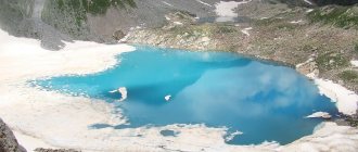
- “Lake of Love” in the village of Arkhyz;
- the ruins of an ancient watchtower in the village of Krasnogorskaya;
- Khumarin settlement in the village of Kalezh.
On the map of the Karachay-Cherkess Republic with villages, everyone can find popular health resorts, next to which there are sources of carbon dioxide mineral waters. Using 15 types of different water, restorative procedures are carried out, complex diseases of the musculoskeletal system and gastrointestinal tract are cured.
Economy and industry of the Karachay-Cherkess Republic
The region has mining, processing, and engineering enterprises, most of which are concentrated in the northern regions. On Yandex maps of the Karachay-Cherkess Republic, you can see that most of the industrial facilities are located in Cherkessk. Livestock farming also plays a large role in the region's economy. There are more than 30 collective farms in the region, which specialize in horse breeding, breeding pigs, sheep and cows.
Medical resorts and the development of tourism are of key importance for the republic’s economy. Sanatoriums, ski resorts and mountaineering trails are available to people who come here all year round. Maps of the Karachay-Cherkess Republic allow you to examine in detail the resort infrastructure, the location of sanatoriums and tourist centers.
