Geographical location and climatic conditions of Mordovia
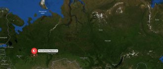
Mordovia lies on a plain with a double name - Russian or East European.
More than 13 rivers flow through the territory. But the location itself is in the Volga River basin, between Oka and Sura. The online map of the region allows you to see the borders and areas of Mordovia, the length of which from north to south is 100 km, from west to east – 300. It borders on different regions:
- North – Nizhny Novgorod;
- South – Penza;
- Northeast – Chuvashia;
- South-east - Ulyanovsk;
- West – Ryazan region.
The climate is conducive to the cultivation of agricultural crops and is temperate continental. Given the flat nature of the landscape on which the republic is located, it is exposed to winds from different directions. Therefore, the temperature regime is not constant and can vary:
- In winter – from -1 to -20 degrees;
- In summer – from +15 to +27.
This climate is favorable for growing crops, raising livestock and poultry. Therefore, the region has developed livestock farming, poultry farming, planting of grains, corn, etc., and many agricultural enterprises.
Mordovia by region. Topographic atlas of the Republic of Mordovia by region
Map of Russia with cities. Map of Russia by region. Maps of Russia with cities and regions
| Lipetsk region. Cities and districts of the Lipetsk region. Atlas of Lipetsk region | Moscow. Detailed map of Moscow. Administrative districts of Moscow. Map of Moscow with streets and house numbers |
Mordovia by region. Atlas of regions of the Republic of Mordovia
- Districts of the Republic of Mordovia in alphabetical order. Complete list of administrative districts of Mordovia
Ardatovsky district topographic map. Detailed map of the Ardatovsky district of the Republic of Mordovia
- Atyuryevsky district road map. Detailed road map of Atyuryevsky district of Mordovia
- Atyashevsky district general geographical map. Detailed large-scale map of the Atyashevsky district of the Republic of Mordovia
- Bolshebereznikovsky district geographical map. Detailed map of the Bolshebereznikovsky district on a scale of 1 cm: 2 km
- Bolsheignatovsky district topographic map. Large detailed map of Bolsheignatovsky district, Republic of Mordovia
- Dubensky district map. Detailed large-scale map of the Dubensky district of Mordovia
- Elnikovsky district road map. Detailed map of Elnikovsky district of Mordovia
- Zubovo-Polyansky district on the map. Large large-scale map of Zubovo-Polyansky district of Mordovia
- Insar district map is free. Detailed topographic map of the Insarsky district of Mordovia
- Ichalkovsky district topographic map scale 1cm:2km. Large detailed map of the Ichalkovsky district of the Republic of Mordovia
- Kadoshkinsky district topographic map. Detailed map of the Kadoshkinsky district of Mordovia
- Kovylkinsky district map. Detailed geographical map of the Kovylkinsky district of the Republic of Mordovia
- Kochkurovsky district topographic map scale 1cm:2km. Detailed map of Kochkurovsky district with roads and settlements
- Krasnoslobodsky district map. Detailed topographic map of Krasnoslobodsky district of Mordovia
- Lyambirsky district map. Large-scale map of Lyambirsky district with roads and settlements
- Romodanovsky district topographic map. Detailed map of the Romodanovsky district of the Republic of Mordovia
- Ruzaevsky district geographical map. Large-scale map of Ruzaevsky district with roads and settlements
- Staroshaigovsky district map. Detailed topographic map of Staroshaigovsky district on a scale of 1cm:2km
- Temnikovsky district geographical map. Detailed map of Temnikovsky district on a scale of 1cm:2km
- Tengushevsky district map. Large-scale map of the Tengushevsky district of the Republic of Mordovia
- Torbeevsky district automobile map. Detailed map of the Torbeevsky district of the Republic of Mordovia, scale 1 cm: 2 km
- Chamzinsky district topographic map. Detailed map of the Chamza district of Mordovia, scale 1cm:2km
Transport of the region
A satellite map of the region allows you to track all transport and logistics hubs of the republic over an area of more than 26 thousand square kilometers. The most important railways for the country pass through this territory, connecting the European part with the Urals and the north of the country with the Volga region. Communications are maintained with Kazakhstan, Siberia, Central Asia, and the Far East. The road infrastructure is also actively developed. They have a length of more than 6 thousand km.
Of these, more than 400 are federal highways, more than 4 thousand are republican ones. The map of Russia shows numerous pipelines, such as Urengoy - Pomary - Uzhgorod, Urengoy - Center-1, Urengoy - Center-2, Yamburg - Yelets-1, Yamburg - Yelets-2. They have a length of more than 13 thousand km. The air transport infrastructure is represented by the airport in Saransk.
The railway in Mordovia is 550 km long. The logistics centers are Saransk, Krasny Uzel and Ruzaevka.
Districts of the Republic of Mordovia in alphabetical order. Complete list of administrative districts of Mordovia
Map of Russia with cities. Map of Russia by region. Maps of Russia with cities and regions / Mordovia by region. Topographic atlas of the Republic of Mordovia by region
Districts of the Republic of Mordovia in alphabetical order. Complete list of administrative districts of Mordovia
- Ardatovsky district topographic map. Detailed map of the Ardatovsky district of the Republic of Mordovia
- Atyuryevsky district road map. Detailed road map of Atyuryevsky district of Mordovia
- Atyashevsky district general geographical map. Detailed large-scale map of the Atyashevsky district of the Republic of Mordovia
- Bolshebereznikovsky district geographical map. Detailed map of the Bolshebereznikovsky district on a scale of 1 cm: 2 km
- Bolsheignatovsky district topographic map. Large detailed map of Bolsheignatovsky district, Republic of Mordovia
- Dubensky district map. Detailed large-scale map of the Dubensky district of Mordovia
- Elnikovsky district road map. Detailed map of Elnikovsky district of Mordovia
- Zubovo-Polyansky district on the map. Large large-scale map of Zubovo-Polyansky district of Mordovia
- Insar district map is free. Detailed topographic map of the Insarsky district of Mordovia
- Ichalkovsky district topographic map scale 1cm:2km. Large detailed map of the Ichalkovsky district of the Republic of Mordovia
- Kadoshkinsky district topographic map. Detailed map of the Kadoshkinsky district of Mordovia
- Kovylkinsky district map. Detailed geographical map of the Kovylkinsky district of the Republic of Mordovia
- Kochkurovsky district topographic map scale 1cm:2km. Detailed map of Kochkurovsky district with roads and settlements
- Krasnoslobodsky district map. Detailed topographic map of Krasnoslobodsky district of Mordovia
- Lyambirsky district map. Large-scale map of Lyambirsky district with roads and settlements
- Romodanovsky district topographic map. Detailed map of the Romodanovsky district of the Republic of Mordovia
- Ruzaevsky district geographical map. Large-scale map of Ruzaevsky district with roads and settlements
- Staroshaigovsky district map. Detailed topographic map of Staroshaigovsky district on a scale of 1cm:2km
- Temnikovsky district geographical map. Detailed map of Temnikovsky district on a scale of 1cm:2km
- Tengushevsky district map. Large-scale map of the Tengushevsky district of the Republic of Mordovia
- Torbeevsky district automobile map. Detailed map of the Torbeevsky district of the Republic of Mordovia, scale 1 cm: 2 km
- Chamzinsky district topographic map. Detailed map of the Chamza district of Mordovia, scale 1cm:2km
Map of Mordovia with cities and villages
A map of the republic with regions allows you to see that two varieties of the same people of Mordovia live in different regions of the republic:
- Erzyan - in Kochkurovsky, Atyashevsky, Dubensky, Ardatovsky, Bolsheignatovsky districts.
- Mokshane - in Zubovo-Polyansky, Atyuryevsky, Staroshaigovsky, Torbeevsky districts.
The capital of the region has a predominantly Russian population.
According to statistics, the majority of the population lives in cities - 62% of the total number living in the region. The remaining residents of Mordovia live in 22 rural districts of the region.
Map of Mordovia with cities, regions and villages
| 1. Saransk | 8. Chamzinka district (Chamzinsky district) | 15. Atyashevo rp (Atyashevsky district) | 22. Yavas town (Zubovo-Polyansky district) |
| 2. Romodanovo rp (Romodanovsky district) | 9. Komsomolsky town (Chamzinsky district) | 16. Bolshie Berezniki village. (Bolshebereznikovsky district) | 23. Umet town (Zubovo-Polyansky district) |
| 3. Lyambir village (Lyambirsky district) | 10. Torbeevo town (Torbeevsky district) | 17. Atyurevo village (Atyuryevsky district) | 24. Potma town (Zubovo-Polyansky district) |
| 4. Kovylkino city (Kovylkinsky district) | 11. Tengushevo village (Tengushevsky district) | 18. Turgenevo town (Ardatovsky district) | 25. Elniki village (Elnikovsky district) |
| 5. Ruzaevka city (Ruzaevsky district) | 12. Temnikov city (Temnikovsky district) | 19. Ardatov city (Ardatovsky district) | 26. Kemlya village (Ichalkovsky district) |
| 6. Krasnoslobodsk city (Krasnoslobodsky district) | 13. Kadoshkino district (Kadoshkinsky district) | 20. Bolshoye Ignatovo village. (Bolsheignatovsky district) | |
| 7. Staroe Shaygovo village (Staroshaigovsky district) | 14. Insar city (Insarsky district) | 21. Dubenki village (Dubensky district) |
Satellite map of Mordovia
Switching between the satellite map of Mordovia and the schematic map is done in the lower left corner of the interactive map.
Republic of Mordovia - Wikipedia:
Date of formation of Mordovia:
January 10, 1930
Population of Mordovia:
778,965 people.
(January 1, 2022) Telephone code of Mordovia:
834
Area of Mordovia:
26,128 km²
Vehicle code of Mordovia:
13, 113
Regions of Mordovia:
Ardatovsky, Atyuryevsky, Atyashevsky, Bolshebereznikovsky, Bolsheignatovsky, Dubensky, Elnikovsky, Zubovo-Polyansky, Insarsky, Ichalkovsky, Kadoshkinsky, Kovylkinsky, Kochkurovsky, Krasnoslobodsky, Lyambirsky, Romodanovsky, Ruzaevsky, Staroshaigovsky, Temnikovsky, Tengushevsky, Torbeevsky, Chamzinsky.
Cities of Mordovia - list of cities in alphabetical order:
Population of cities in Mordovia in 2022.
City of Ardatov
founded in 1671.
The population of the city is 8734 people. The city of Insar
was founded in 1648.
The population of the city is 8169 people. The city of Kovylkino
was founded in 1892.
The population of the city is 20,072 people. The city of Krasnoslobodsk
was founded in 1571.
The population of the city is 9556 people. The city of Ruzaevka
was founded in 1631.
The population of the city is 45988 people. The city of Saransk
was founded in 1641.
The population of the city is 314,789 people. The city of Temnikov
was founded in 1536. The population of the city is 6291 people.
The Republic of Mordovia
- a region of Russia, which is located in the very center of the East European Plain. Although the Republic of Mordovia is located in the Volga Federal District of Russia, the Volga River does not actually flow through the republic. Mordovia is located between the Nizhny Novgorod, Ulyanovsk, Penza and Ryazan regions and the Republic of Chuvashia.
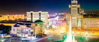
The capital of the republic is the city of Saransk, which was chosen as one of the venues for the 2018 FIFA World Cup. The city also boasts the largest collection of works by the sculptor Stepan Erzya, the Erzya Mordvin himself.
What to see in Mordovia
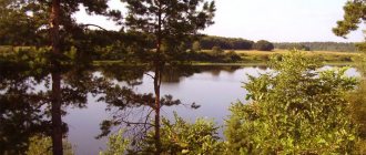
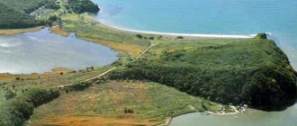
There are so many attractions in the Republic of Mordovia that it is impossible to list them all - these are both architectural and historical monuments. The most picturesque natural attraction of Mordovia is Lake Inerka, which is 2 km long and 11 meters deep.
Once upon a time, Saransk had many churches and other religious buildings from the 16th and 17th centuries. Most of the churches were destroyed, and only one survived - the Church of St. John the Theologian, one of the largest in Russia.
Sights of Mordovia
Museum of Local Lore named after. I.D. Voronin, Musical Theater named after I.M. Yaushev, Spaso-Preobrazhensky Monastery, Museum of Mordovian Folk Culture, Mordovian Republican Museum of Fine Arts named after S. D. Erzya, Puppet Theater of the Republic of Mordovia, Museum of Military and Labor Feat, Museum of the Locomotive Depot, Drama Theater, Cathedral of the Holy Righteous Warrior Theodore Ushakov, Church John the Theologian, Paraskeva-Voznesensky Convent, Sanaksarsky Monastery, Mordovian Nature Reserve, Lake Inerka, Monument to Emelyan Pugachev.
