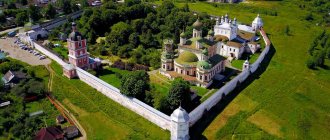
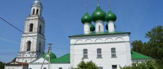
Pereslavl-Zalessky is one of the most interesting cities of the Golden Ring, and on our website you

1K 4 min. Pavla Tapashidi presented plans for the development of 300 hectares on the
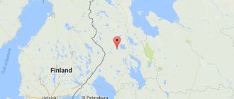
The Republic of Karelia is located in the north-west of our country. This region is culturally unique,
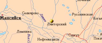
Lyantor (Khanty-Mansiysk Autonomous Okrug - Yugra) OKATO code: 71126605 Founded: 1967 Urban-type settlement
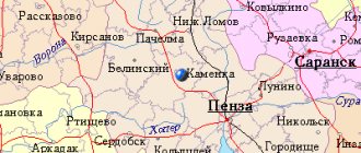
Kamenka (Penza region) OKATO code: 56229501 Founded: 18th century. Urban settlement since: 1944
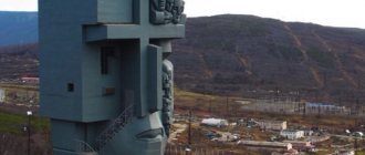
The city, located on the shores of the Sea of Okhotsk, was founded in 1929. Land development has begun

The Voronezh region is geographically located in the central zone of Russia. Map of the Voronezh region from a satellite visually
Poshekhonye: TOP-3 things to see in one day To see all the sights, you need to stay in
History of the emergence and development of the city of Kirov The location of modern Kirov is the southern slopes of the Smolensk-Moscow Upland.

If we consider the Central Federal District, then in its southwestern part you can see a small area